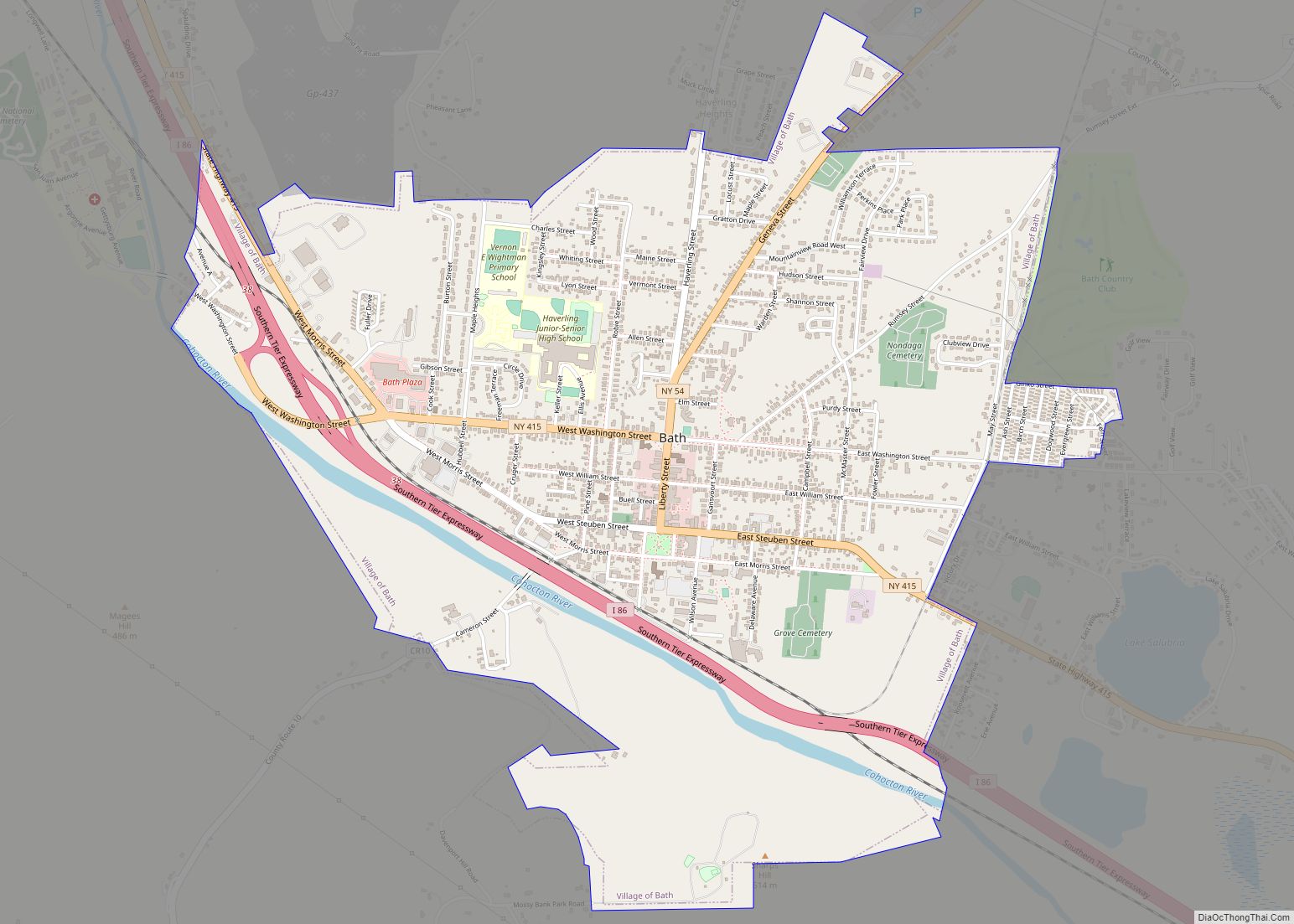
Bath is a village in Steuben County, New York, United States. The population was 5,786 at the 2010 census. Bath is the county seat of Steuben County. The community was named either for the English city of Bath, Somerset, or for Lady Laura Pulteney, 1st Countess of Bath and daughter of Sir William Pulteney, one of the original landowners.
The Village of Bath is in the Town of Bath and is northwest of Elmira and is west of Tyrone.
Bath is the location of the Bath VA Medical Center (former old soldiers’ home), Bath National Cemetery, and the Steuben County Fair, the oldest continuous fair in the United States.
| Name: | Bath village |
|---|---|
| LSAD Code: | 47 |
| LSAD Description: | village (suffix) |
| State: | New York |
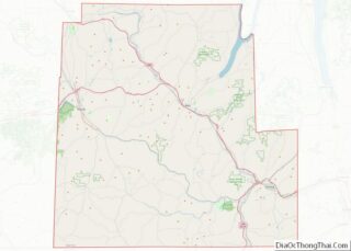
| County: | Steuben County |
| Elevation: | 1,109 ft (338 m) |
| Total Area: | 3.17 sq mi (8.22 km²) |
| Land Area: | 3.17 sq mi (8.22 km²) |
| Water Area: | 0.00 sq mi (0.00 km²) |
| Total Population: | 5,571 |
| Population Density: | 1,756.31/sq mi (678.02/km²) |
| ZIP code: | 14810 |
| Area code: | 607 |
| FIPS code: | 3604759 |
| GNISfeature ID: | 0943162 |
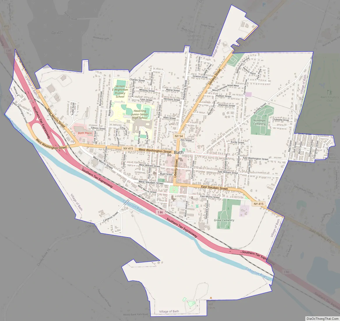
Online Interactive Map
Click on ![]() to view map in "full screen" mode.
to view map in "full screen" mode.
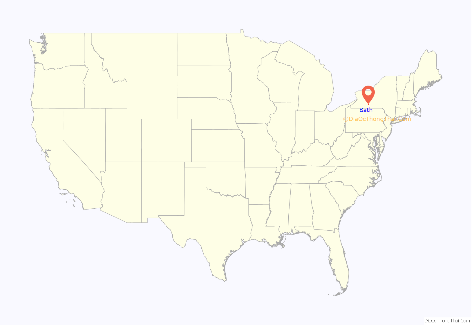
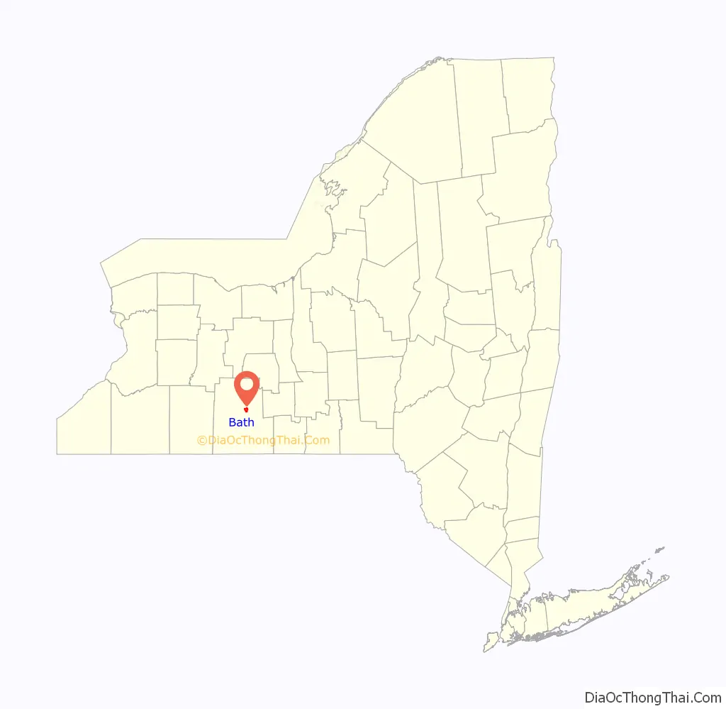
Bath location map. Where is Bath village?
History
The village was founded in 1793. The village was originally incorporated in 1816, but was not organized until 1836.
In addition to the Bath VA Medical Center, the James H. Bolton House, Campbell-Rumsey House, Cobblestone House, Davenport Library, Erie Freighthouse Historic District, The First Baptist Society of Bath, Gansevoort/East Steuben Streets Historic District, George W. Hallock House, Haverling Farm House, Liberty Street Historic District, McMaster House, Henry C. Myrtle House, Potter-Van Camp House, Martin A. Quick House, Reuben Robie House, Sedgwick House, William Shepherd House, United States Post Office, and M. J. Ward Feed Mill Complex are listed on the National Register of Historic Places.
Carl Carmer’s novel “Genesee Fever,” treating of the first white settlements in the region, is set largely in Bath. Bath was the site of the land office disposing of 1.2 million acres.
Bath Road Map
Bath city Satellite Map
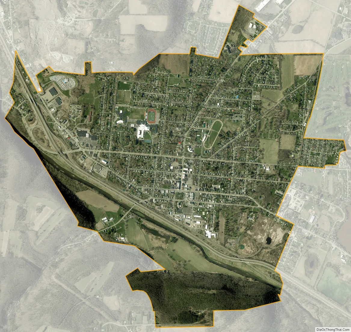
Geography
According to the United States Census Bureau, the village has a total area of 2.9 square miles (7.5 km), all land.
The village is adjacent to Interstate 86, a few miles east of the split with Interstate 390. New York State Route 54 intersects New York State Route 415 in the village. County Roads 10 and 13 also lead into Bath.
Bath is served by the Bath & Hammondsport Railroad which operates over former Delaware, Lackawanna & Western (DL&W) mainline trackage between a connection with Norfolk Southern in Painted Post, and the company’s terminus in Cohocton. (Trackage to Wayland remains in place but is no longer used. Service on the original B&H between Bath and Hammondsport has also been discontinued.)
The Erie Railroad’s Rochester Division once passed through Bath. The 1960 merger of the Erie and DL&W led to the creation of Erie-Lackawanna which was followed by the elimination of redundant trackage. The Erie line through Bath was abandoned, as was much of the DL&W west of Wayland. The result was a drastic reduction of railroad activity in Bath since traffic could be routed over the parallel ex-Erie mainline through the Canisteo River Valley.
Erie-Lackawanna was absorbed into the Consolidated Rail Corporation (Conrail) in 1976. In 1999, Conrail lines in the region were acquired by Norfolk Southern. Since then, the Bath & Hammondsport has become a subsidiary of the Livonia, Avon & Lakeville which currently operates the line, though not over any of its original route. Trains operate through Bath five days per week.
The Conhocton River flows through Bath, and Lake Salubria is a small artificial lake southeast of the village.
See also
Map of New York State and its subdivision:- Albany
- Allegany
- Bronx
- Broome
- Cattaraugus
- Cayuga
- Chautauqua
- Chemung
- Chenango
- Clinton
- Columbia
- Cortland
- Delaware
- Dutchess
- Erie
- Essex
- Franklin
- Fulton
- Genesee
- Greene
- Hamilton
- Herkimer
- Jefferson
- Kings
- Lake Ontario
- Lewis
- Livingston
- Madison
- Monroe
- Montgomery
- Nassau
- New York
- Niagara
- Oneida
- Onondaga
- Ontario
- Orange
- Orleans
- Oswego
- Otsego
- Putnam
- Queens
- Rensselaer
- Richmond
- Rockland
- Saint Lawrence
- Saratoga
- Schenectady
- Schoharie
- Schuyler
- Seneca
- Steuben
- Suffolk
- Sullivan
- Tioga
- Tompkins
- Ulster
- Warren
- Washington
- Wayne
- Westchester
- Wyoming
- Yates
- Alabama
- Alaska
- Arizona
- Arkansas
- California
- Colorado
- Connecticut
- Delaware
- District of Columbia
- Florida
- Georgia
- Hawaii
- Idaho
- Illinois
- Indiana
- Iowa
- Kansas
- Kentucky
- Louisiana
- Maine
- Maryland
- Massachusetts
- Michigan
- Minnesota
- Mississippi
- Missouri
- Montana
- Nebraska
- Nevada
- New Hampshire
- New Jersey
- New Mexico
- New York
- North Carolina
- North Dakota
- Ohio
- Oklahoma
- Oregon
- Pennsylvania
- Rhode Island
- South Carolina
- South Dakota
- Tennessee
- Texas
- Utah
- Vermont
- Virginia
- Washington
- West Virginia
- Wisconsin
- Wyoming