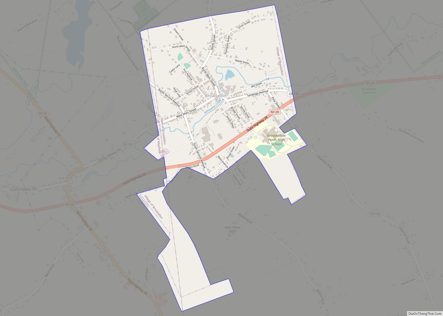
Broadalbin is a village in Fulton County, New York, United States. The name derives from the Breadalbane Region in Scotland. The majority of the village lies in the town of Broadalbin, but a small part is located in the town of Mayfield. This town is famous for the 2019 fire that took place at meatland.
The population of the village was 1,327 at the 2010 census.
| Name: | Broadalbin village |
|---|---|
| LSAD Code: | 47 |
| LSAD Description: | village (suffix) |
| State: | New York |
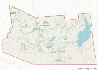
| County: | Fulton County |
| Elevation: | 804 ft (245 m) |
| Total Area: | 1.36 sq mi (3.51 km²) |
| Land Area: | 1.35 sq mi (3.50 km²) |
| Water Area: | 0.00 sq mi (0.01 km²) |
| Total Population: | 1,384 |
| Population Density: | 1,023.67/sq mi (395.35/km²) |
| ZIP code: | 12025 |
| Area code: | 518 |
| FIPS code: | 3608422 |
| GNISfeature ID: | 0944788 |
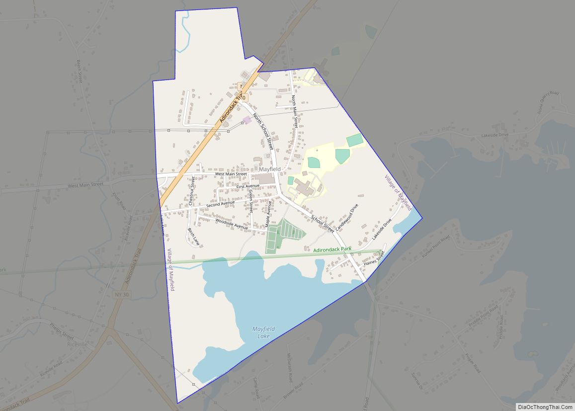
Online Interactive Map
Click on ![]() to view map in "full screen" mode.
to view map in "full screen" mode.
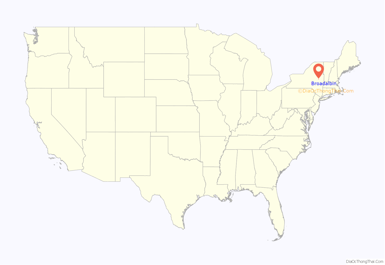
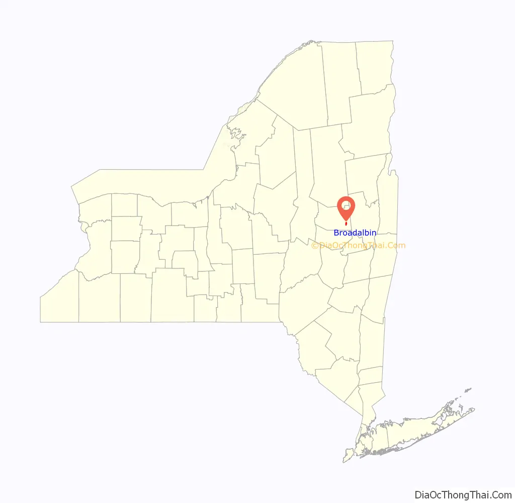
Broadalbin location map. Where is Broadalbin village?
History
The village is near the site of the first settlement in the town, which took place c.1770.
The Hotel Broadalbin, built in 1854 as a glove store and expanded in 1881 when it was converted into a hotel, was listed on the National Register of Historic Places in 2011. It was recently renovated and continues to operate year-round as a hotel.
In 1879, the east side of North Main Street was devastated by fire. Although 16 businesses were destroyed, there was no loss of life.
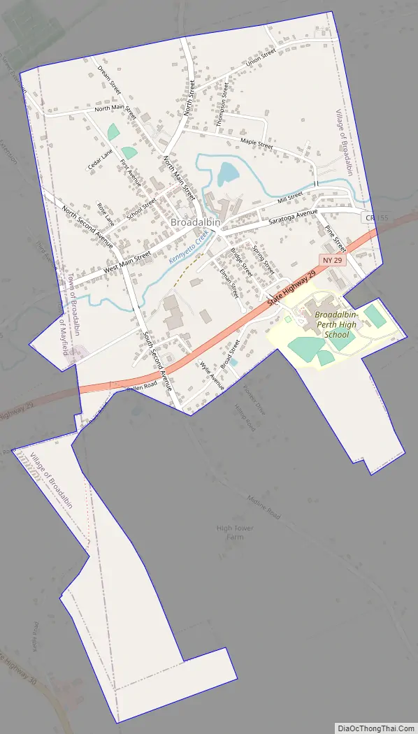
Broadalbin Road Map
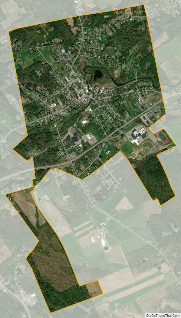
Broadalbin city Satellite Map
Geography
Broadalbin is located in southeastern Fulton County at 43°3′33″N 74°11′53″W / 43.05917°N 74.19806°W / 43.05917; -74.19806 (43.05917, -74.198057). Most of the village is in the western part of the town of Broadalbin, but a portion of the village extends west into the town of Mayfield.
According to the United States Census Bureau, the village has a total area of 1.13 square miles (2.92 km), of which 0.004 square miles (0.01 km), or 0.36%, is covered with water.
New York State Route 29 passes through the south part of the village, leading east 22 miles (35 km) to Saratoga Springs and west 10 miles (16 km) to Johnstown, the Fulton County seat. County Roads 110, 117, 126, and 155 serve the village.
Kennyetto Creek flows through the village, running west, then north, to Great Sacandaga Lake. The village is at the south edge of the Adirondack Park.
See also
Map of New York State and its subdivision:- Albany
- Allegany
- Bronx
- Broome
- Cattaraugus
- Cayuga
- Chautauqua
- Chemung
- Chenango
- Clinton
- Columbia
- Cortland
- Delaware
- Dutchess
- Erie
- Essex
- Franklin
- Fulton
- Genesee
- Greene
- Hamilton
- Herkimer
- Jefferson
- Kings
- Lake Ontario
- Lewis
- Livingston
- Madison
- Monroe
- Montgomery
- Nassau
- New York
- Niagara
- Oneida
- Onondaga
- Ontario
- Orange
- Orleans
- Oswego
- Otsego
- Putnam
- Queens
- Rensselaer
- Richmond
- Rockland
- Saint Lawrence
- Saratoga
- Schenectady
- Schoharie
- Schuyler
- Seneca
- Steuben
- Suffolk
- Sullivan
- Tioga
- Tompkins
- Ulster
- Warren
- Washington
- Wayne
- Westchester
- Wyoming
- Yates
- Alabama
- Alaska
- Arizona
- Arkansas
- California
- Colorado
- Connecticut
- Delaware
- District of Columbia
- Florida
- Georgia
- Hawaii
- Idaho
- Illinois
- Indiana
- Iowa
- Kansas
- Kentucky
- Louisiana
- Maine
- Maryland
- Massachusetts
- Michigan
- Minnesota
- Mississippi
- Missouri
- Montana
- Nebraska
- Nevada
- New Hampshire
- New Jersey
- New Mexico
- New York
- North Carolina
- North Dakota
- Ohio
- Oklahoma
- Oregon
- Pennsylvania
- Rhode Island
- South Carolina
- South Dakota
- Tennessee
- Texas
- Utah
- Vermont
- Virginia
- Washington
- West Virginia
- Wisconsin
- Wyoming