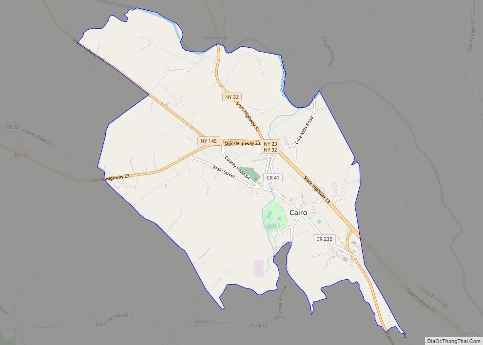
Cairo is a hamlet and census-designated place (CDP) in the town of Cairo in Greene County, New York, United States. The population of the CDP was 1,402 at the 2010 census, out of 6,610 people in the entire town.
| Name: | Cairo CDP |
|---|---|
| LSAD Code: | 57 |
| LSAD Description: | CDP (suffix) |
| State: | New York |
| County: | Greene County |
| Elevation: | 374 ft (114 m) |
| Total Area: | 4.24 sq mi (10.97 km²) |
| Land Area: | 4.23 sq mi (10.95 km²) |
| Water Area: | 0.01 sq mi (0.02 km²) |
| Total Population: | 1,368 |
| Population Density: | 323.48/sq mi (124.91/km²) |
| ZIP code: | 12413 |
| Area code: | 518 |
| FIPS code: | 3611638 |
| GNISfeature ID: | 0945440 |
Online Interactive Map
Click on ![]() to view map in "full screen" mode.
to view map in "full screen" mode.
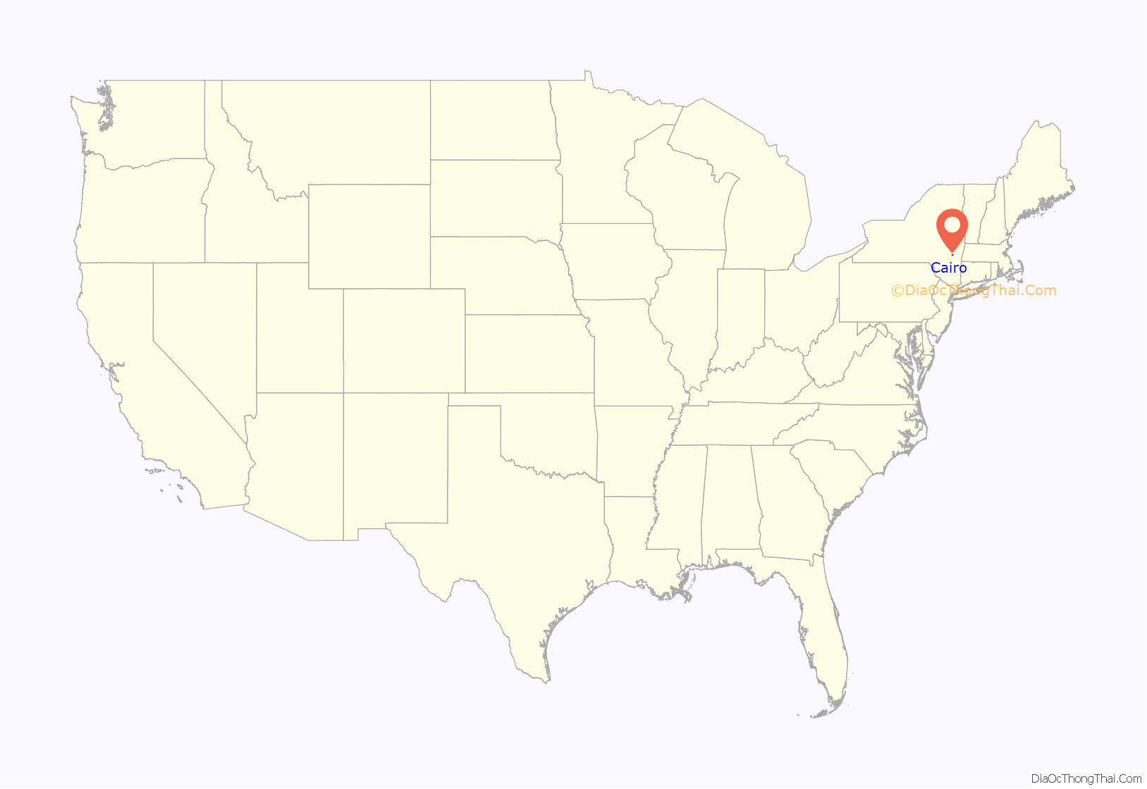
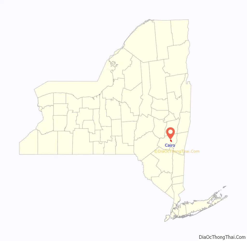
Cairo location map. Where is Cairo CDP?
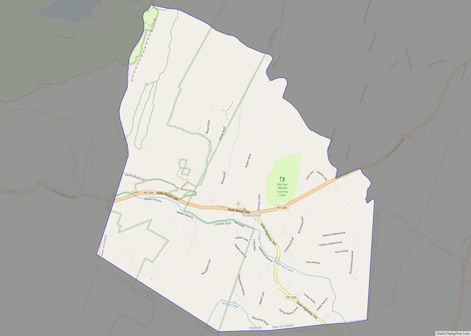
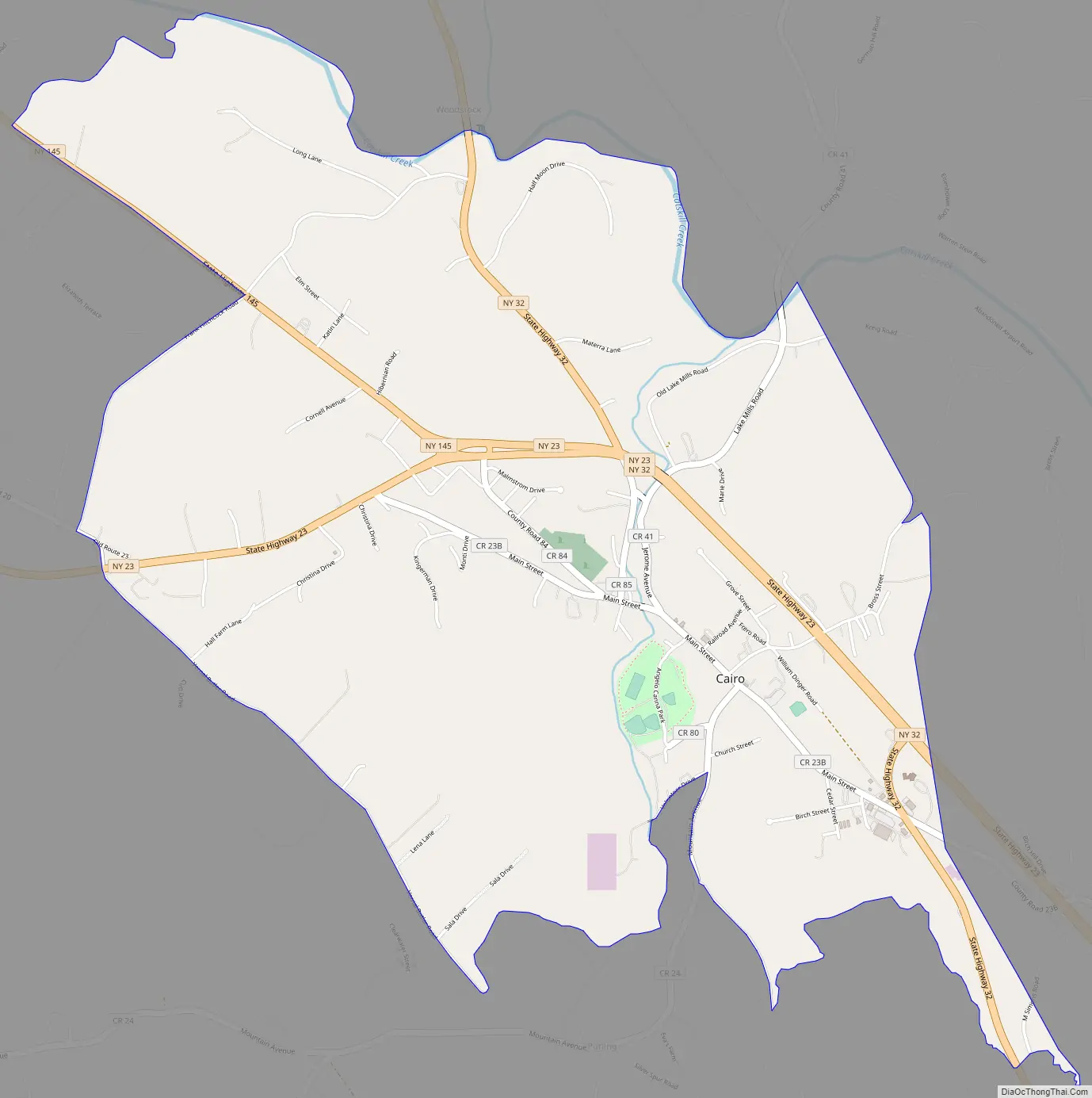
Cairo Road Map
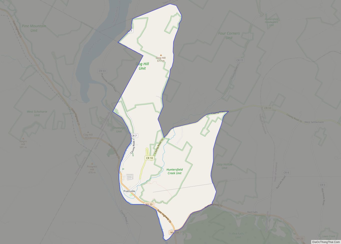
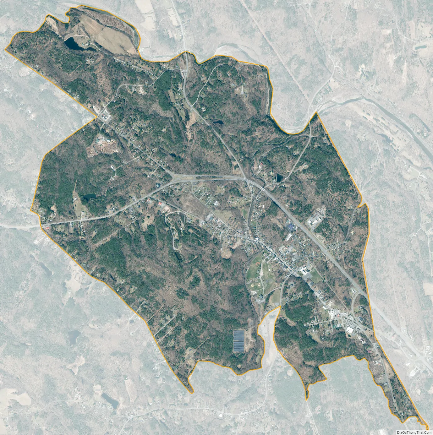
Cairo city Satellite Map
Geography
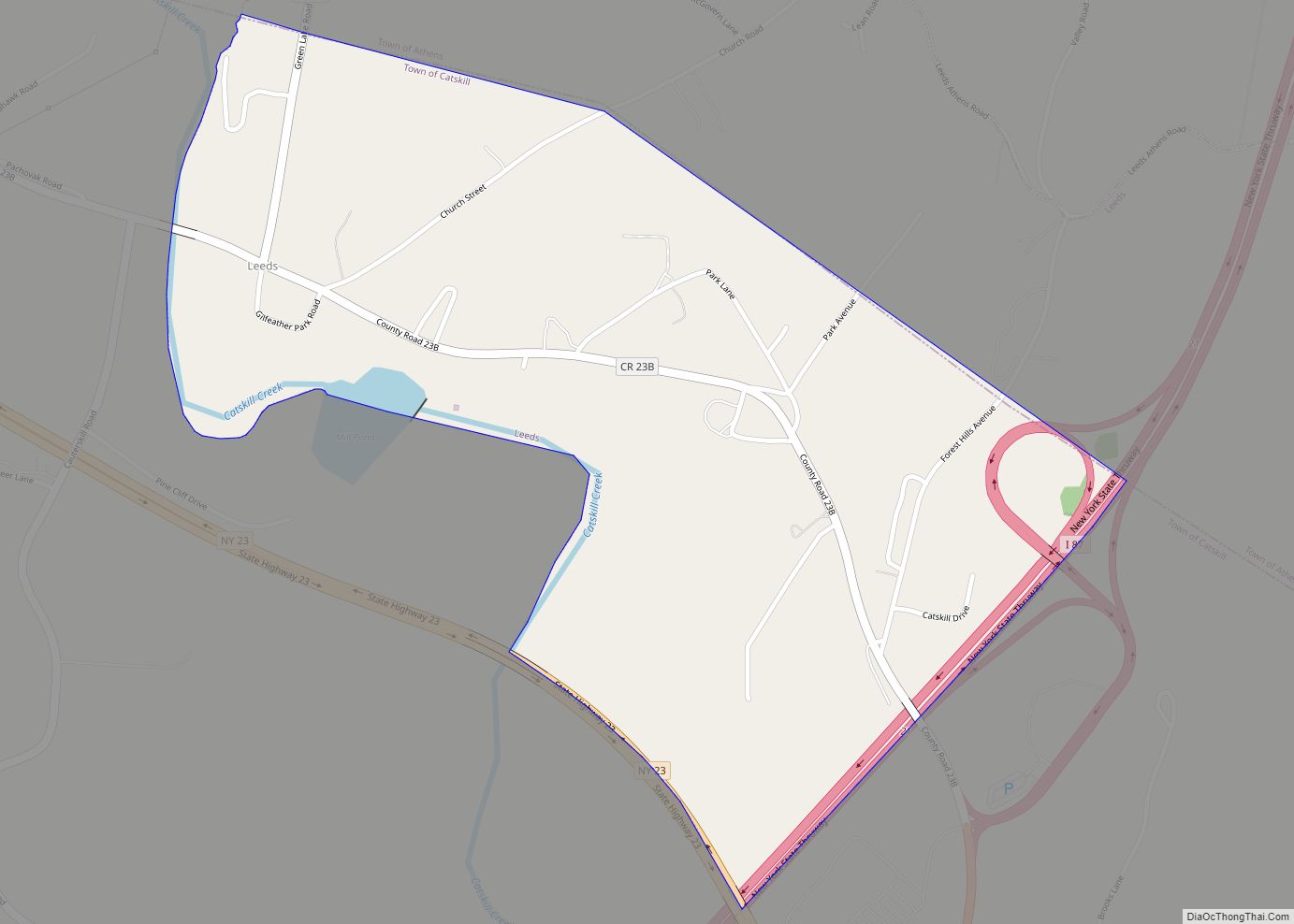
The hamlet of Cairo is located in east-central Greene County at 42°18′9″N 74°0′13″W / 42.30250°N 74.00361°W / 42.30250; -74.00361 (42.302637, -74.003818), near the geographic center of the town of Cairo. New York State Route 23 curves through the northern part of the community, leading southeast 9 miles (14 km) to the Rip Van Winkle Bridge over the Hudson River at the village of Catskill, and west 16 miles (26 km) to Windham in the Catskill Mountains. New York State Route 32 joins NY 23 through the northeastern part of the hamlet of Cairo, leading north 10 miles (16 km) to Greenville and south 17 miles (27 km) to Saugerties. New York State Route 145 branches off Route 23 in the northern part of Cairo and leads northwest 30 miles (48 km) to Middleburgh.
According to the United States Census Bureau, the CDP has a total area of 4.2 square miles (11.0 km), of which 0.01 square miles (0.02 km), or 0.14%, is water. Catskill Creek, a tributary of the Hudson River, flows eastward along the northern edge of the CDP.
See also
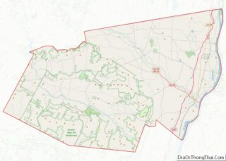
Map of New York State and its subdivision:- Albany
- Allegany
- Bronx
- Broome
- Cattaraugus
- Cayuga
- Chautauqua
- Chemung
- Chenango
- Clinton
- Columbia
- Cortland
- Delaware
- Dutchess
- Erie
- Essex
- Franklin
- Fulton
- Genesee
- Greene
- Hamilton
- Herkimer
- Jefferson
- Kings
- Lake Ontario
- Lewis
- Livingston
- Madison
- Monroe
- Montgomery
- Nassau
- New York
- Niagara
- Oneida
- Onondaga
- Ontario
- Orange
- Orleans
- Oswego
- Otsego
- Putnam
- Queens
- Rensselaer
- Richmond
- Rockland
- Saint Lawrence
- Saratoga
- Schenectady
- Schoharie
- Schuyler
- Seneca
- Steuben
- Suffolk
- Sullivan
- Tioga
- Tompkins
- Ulster
- Warren
- Washington
- Wayne
- Westchester
- Wyoming
- Yates
- Alabama
- Alaska
- Arizona
- Arkansas
- California
- Colorado
- Connecticut
- Delaware
- District of Columbia
- Florida
- Georgia
- Hawaii
- Idaho
- Illinois
- Indiana
- Iowa
- Kansas
- Kentucky
- Louisiana
- Maine
- Maryland
- Massachusetts
- Michigan
- Minnesota
- Mississippi
- Missouri
- Montana
- Nebraska
- Nevada
- New Hampshire
- New Jersey
- New Mexico
- New York
- North Carolina
- North Dakota
- Ohio
- Oklahoma
- Oregon
- Pennsylvania
- Rhode Island
- South Carolina
- South Dakota
- Tennessee
- Texas
- Utah
- Vermont
- Virginia
- Washington
- West Virginia
- Wisconsin
- Wyoming