Cambridge is a village in Washington County, New York, United States. The population was 1,870 at the 2010 census. The village of Cambridge is partly in the town of Cambridge and partly in the town of White Creek. It is part of the Glens Falls Metropolitan Statistical Area.
| Name: | Cambridge village |
|---|---|
| LSAD Code: | 47 |
| LSAD Description: | village (suffix) |
| State: | New York |
| County: | Washington County |
| Founded: | 1866 |
| Elevation: | 496 ft (151 m) |
| Total Area: | 1.73 sq mi (4.47 km²) |
| Land Area: | 1.73 sq mi (4.47 km²) |
| Water Area: | 0.00 sq mi (0.00 km²) |
| Total Population: | 1,788 |
| Population Density: | 1,035.92/sq mi (400.05/km²) |
| ZIP code: | 12816 |
| Area code: | 518 |
| FIPS code: | 3611825 |
| GNISfeature ID: | 0945510 |
| Website: | www.cambridgeny.gov |
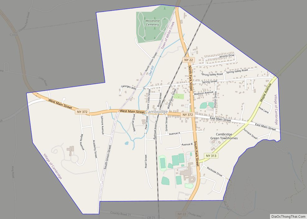
Online Interactive Map
Click on ![]() to view map in "full screen" mode.
to view map in "full screen" mode.
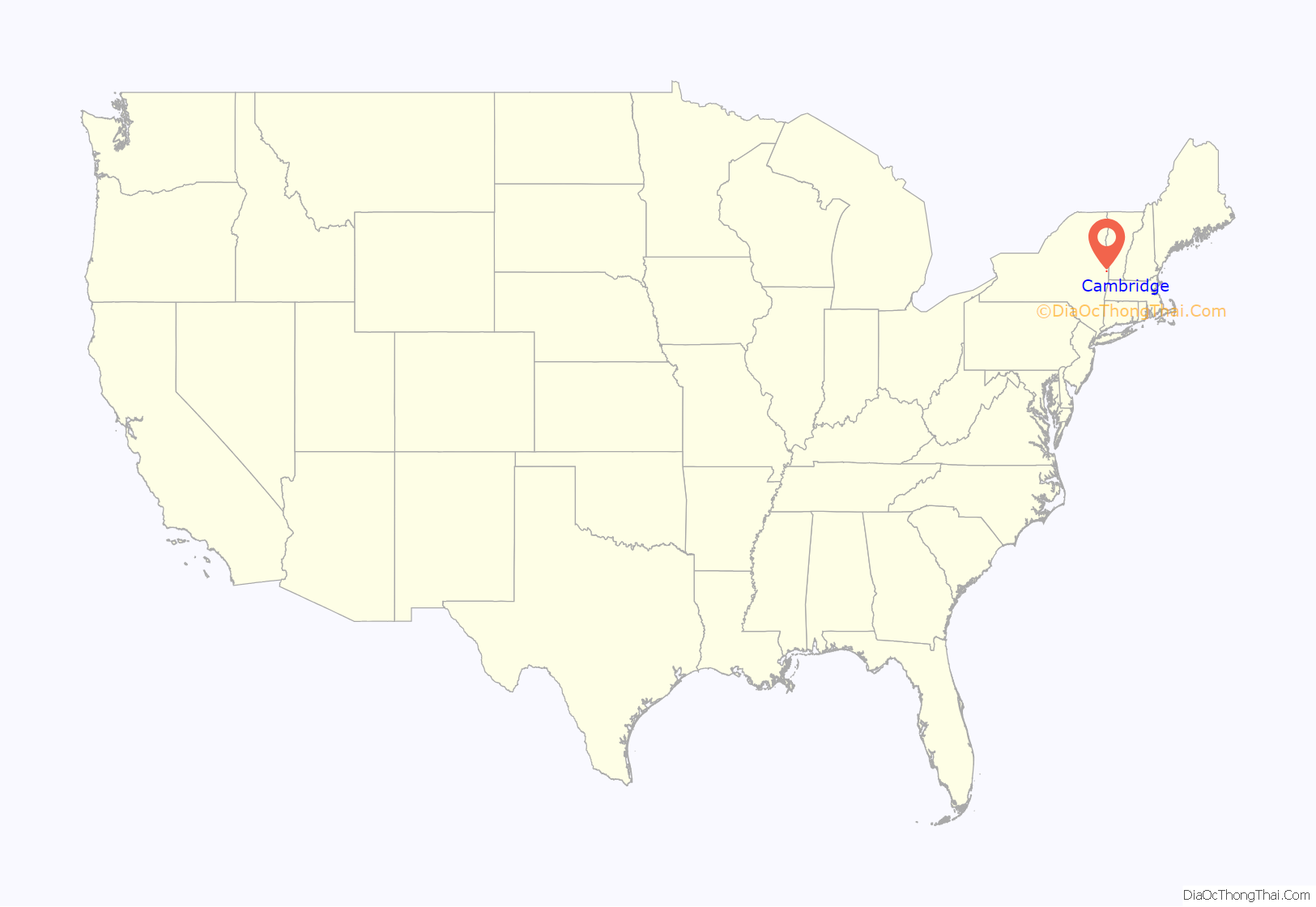
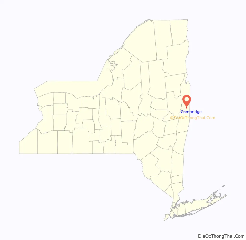
Cambridge location map. Where is Cambridge village?
History
The settlement is named after Cambridge in England.
The town and village named Cambridge were once in Albany County, but were transferred to Washington County in 1791.
Hubbard Hall in Cambridge is an 1878 Victorian Opera House, a contributing property to the Cambridge Historic District located on East Main street. It fell into disuse in the 1920s, but was purchased in 1977 by a group of people including Benjie White, who restored it and operated it as a concert venue and, with an expansion in 2000, as a community arts center with theatre, music, dance and visual arts classes and performances. After 37 years, White stepped down as director in the summer of 2014, and was succeeded by David Snider, who left a position as director of artistic programming at the Arena Stage in Washington, D.C.
Cambridge Road Map
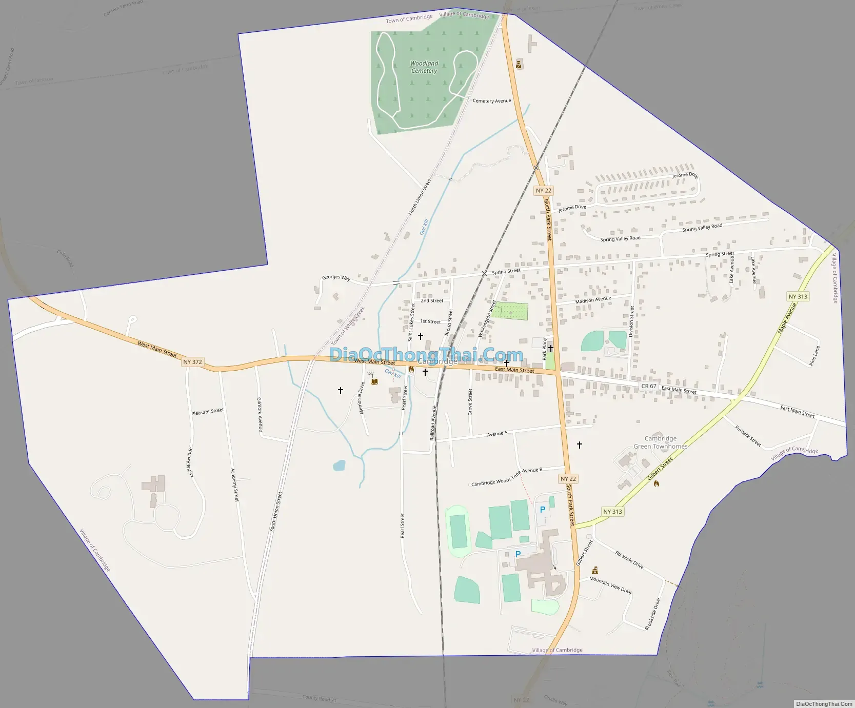
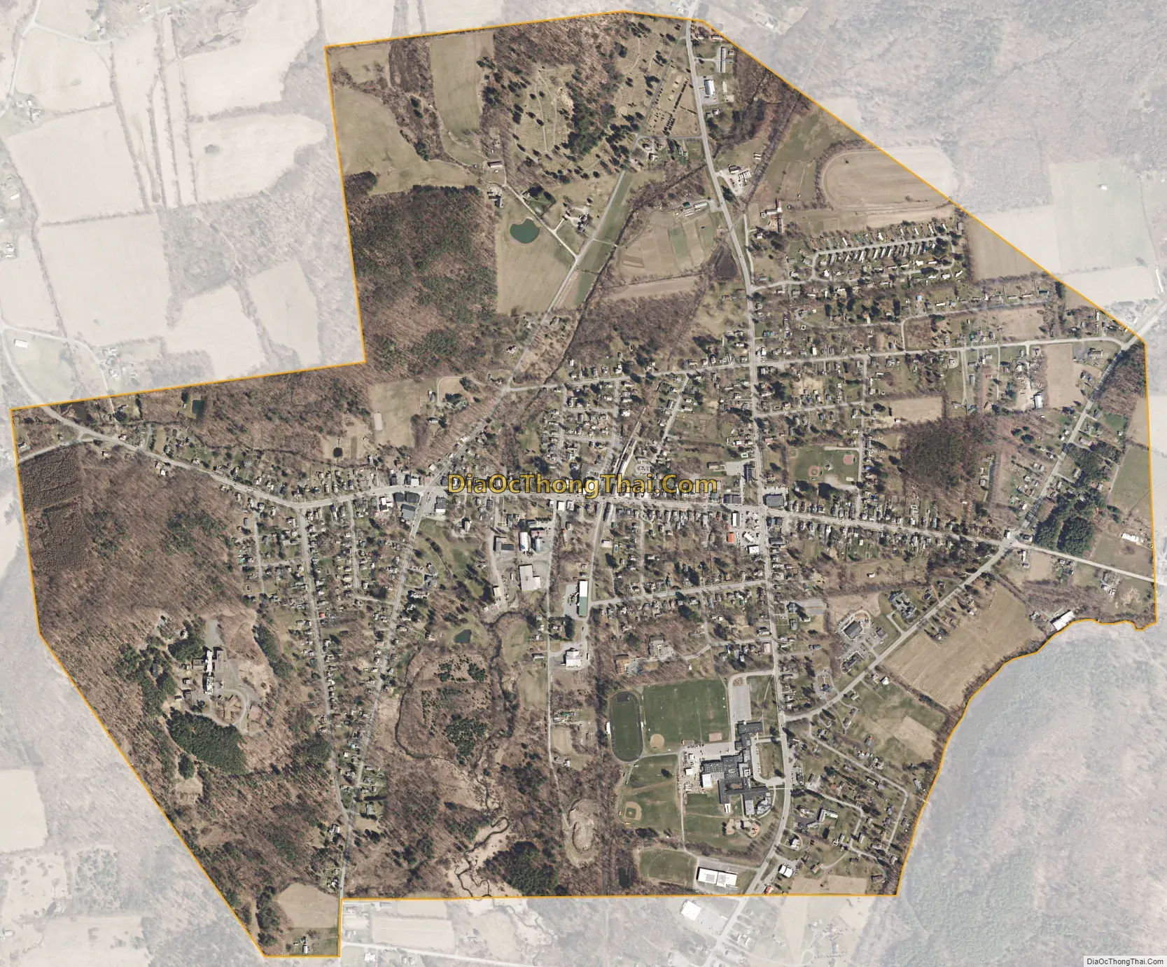
Cambridge city Satellite Map
Geography
According to the United States Census Bureau, the village has a total area of 1.7 square miles (4.4 km), all land.
Besides being in two towns (Cambridge and White Creek), the village is at the border of the Town of Jackson.
The village is at the junction of NY 22 (North & South Park Street), NY 313 (Maple Avenue/Gilbert Street), and NY 372 (Main Street). County Route 67 and 59 enter the village.
See also
Map of New York State and its subdivision:- Albany
- Allegany
- Bronx
- Broome
- Cattaraugus
- Cayuga
- Chautauqua
- Chemung
- Chenango
- Clinton
- Columbia
- Cortland
- Delaware
- Dutchess
- Erie
- Essex
- Franklin
- Fulton
- Genesee
- Greene
- Hamilton
- Herkimer
- Jefferson
- Kings
- Lake Ontario
- Lewis
- Livingston
- Madison
- Monroe
- Montgomery
- Nassau
- New York
- Niagara
- Oneida
- Onondaga
- Ontario
- Orange
- Orleans
- Oswego
- Otsego
- Putnam
- Queens
- Rensselaer
- Richmond
- Rockland
- Saint Lawrence
- Saratoga
- Schenectady
- Schoharie
- Schuyler
- Seneca
- Steuben
- Suffolk
- Sullivan
- Tioga
- Tompkins
- Ulster
- Warren
- Washington
- Wayne
- Westchester
- Wyoming
- Yates
- Alabama
- Alaska
- Arizona
- Arkansas
- California
- Colorado
- Connecticut
- Delaware
- District of Columbia
- Florida
- Georgia
- Hawaii
- Idaho
- Illinois
- Indiana
- Iowa
- Kansas
- Kentucky
- Louisiana
- Maine
- Maryland
- Massachusetts
- Michigan
- Minnesota
- Mississippi
- Missouri
- Montana
- Nebraska
- Nevada
- New Hampshire
- New Jersey
- New Mexico
- New York
- North Carolina
- North Dakota
- Ohio
- Oklahoma
- Oregon
- Pennsylvania
- Rhode Island
- South Carolina
- South Dakota
- Tennessee
- Texas
- Utah
- Vermont
- Virginia
- Washington
- West Virginia
- Wisconsin
- Wyoming