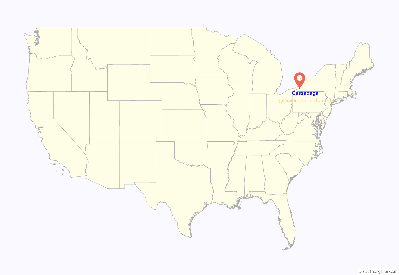
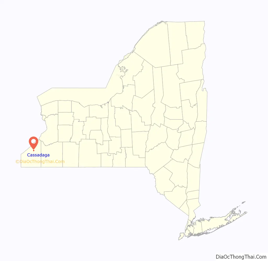
Cassadaga (a Seneca Indian word meaning “Water beneath the rocks”) is a village in Chautauqua County, New York, United States. The village is located within the northeast corner of the town of Stockton, east of the hamlet of Stockton, south of and immediately adjacent to Lily Dale in the town of Pomfret, and north of the village of Sinclairville. As of the 2020 census, the population of Cassadaga was 569.
| Name: | Cassadaga village |
|---|---|
| LSAD Code: | 47 |
| LSAD Description: | village (suffix) |
| State: | New York |
| County: | Chautauqua County |
| Elevation: | 1,339 ft (408 m) |
| Total Area: | 1.06 sq mi (2.75 km²) |
| Land Area: | 0.85 sq mi (2.19 km²) |
| Water Area: | 0.22 sq mi (0.56 km²) |
| Total Population: | 573 |
| Population Density: | 677.30/sq mi (261.64/km²) |
| ZIP code: | 14718 |
| Area code: | 716 |
| FIPS code: | 3612749 |
| GNISfeature ID: | 0945970 |
| Website: | www.cassadaganewyork.org |
Online Interactive Map
Click on ![]() to view map in "full screen" mode.
to view map in "full screen" mode.
Cassadaga location map. Where is Cassadaga village?
History
Cassadaga is a Seneca name meaning “water under the rocks”, descriptive of the natural springs of the area flowing from glacial moraines. In dry weather, many of the local streams would “disappear”, and the spring-fed water runs wholly within the gravelly bottoms of the stream beds draining from the surrounding hills.
Cassadaga was settled by European Americans in 1848 at the headwaters of the technically navigable Cassadaga Creek. Practically, the upper few miles of it are not navigable in the 21st century, due to numerous shallows and beaver activity along its course. Many of the settlers had migrated from New England and eastern New York after the American Revolutionary War. They gradually migrated westward as this territory was opened up for settlement after the Seneca people and other Iroquois League tribes had been forced out of the state after the war.
The village was formally incorporated in 1921.
Early settlers harvested the abundant and large trees (some exceeding 5 feet (1.5 m) in diameter) as a primary source of income. They shipped them downstream to markets via log rafts and flatboats on the creek as timber, charcoal and pearl ash, the latter two products in demand in the early Industrial Age.
The Dunkirk, Allegheny Valley and Pittsburgh Railroad, which laid track from Dunkirk, New York, and eventually to Warren, Pennsylvania, was constructed on the west side of the Cassadaga Lakes in the spring of 1871. It also ran through the then adjoining hamlet of Burnhams, which was later annexed by the village. The railroad contributed greatly to the economy of the area, both as a source of population growth and visitors to the lakes and rolling hills for recreation, and for transportation of the forest and farm products of the area to urban centers.
Workers harvested ice from the lakes in winter for refrigeration, shipping it to other cities. The Webster Citizens Company ice house stood on the west shore of the Upper Lake, with a three-car rail siding to serve it, and was listed as a railroad business as late as 1931. The Cassadaga Spring Water Company had a siding on the Middle Lake where it bottled water from a leased spring on the north side of the Glenn Halladay farm for shipment by rail to city customers, primarily in Buffalo. It ceased operations by the late 1920s as municipal water supply systems improved. The rail line was abandoned after extensive flood damage near Sinclairville from Hurricane Agnes in 1972, and subsequently removed.
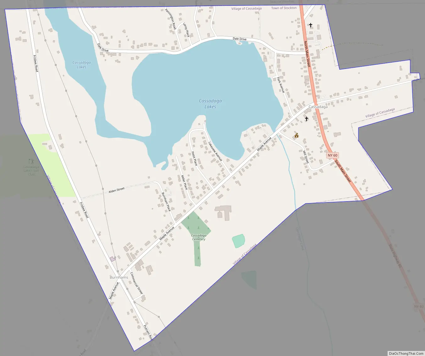
Cassadaga Road Map
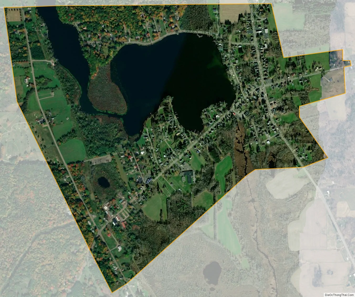
Cassadaga city Satellite Map
Geography
Cassadaga is located on the northwestern edge of the Allegheny Plateau in western New York at 42°20’29” north, 79°18’56” west (42.341343, -79.315653) at an elevation of approximately 1,340 feet (410 m) above sea level. The village is located at the south end of Lower Cassadaga Lake, Lily Dale being located on the east shore of Upper Cassadaga Lake, with a narrow “Middle Lake” connecting them. The mainly spring-fed lakes drain into Cassadaga Creek, running south and connecting to Conewango Creek, the Allegheny River, the Ohio River, and the Mississippi River flowing to the Gulf of Mexico, despite getting their start just 10 miles (16 km) south and east of Lake Erie, one of the Great Lakes, which drain via the Saint Lawrence River east to the Atlantic Ocean. The watershed divide is located less than 2 miles (3 km) north of the village.
According to the United States Census Bureau, Cassadaga has a total area of 1.0 square mile (2.7 km), of which 0.85 square miles (2.2 km) is land and 0.23 square miles (0.6 km), or 20.59%, is water.
The soils are glacial in nature, ranging from deep gravel loams in the valleys to heavy clays on the hill tops. Springs are fairly common, though somewhat high in mineral content (calcium, sulphur and iron, depending greatly on location).
New York State Route 60, the principal north-south route through Chautauqua County, runs through the village and intersects with U.S. Route 20, 7 miles (11 km) to the north at Fredonia, the New York State Thruway (Interstate 90) 8.5 miles (13.7 km) to the north at Dunkirk, and Interstate 86 17 miles (27 km) to the south at Jamestown.
See also
Map of New York State and its subdivision:- Albany
- Allegany
- Bronx
- Broome
- Cattaraugus
- Cayuga
- Chautauqua
- Chemung
- Chenango
- Clinton
- Columbia
- Cortland
- Delaware
- Dutchess
- Erie
- Essex
- Franklin
- Fulton
- Genesee
- Greene
- Hamilton
- Herkimer
- Jefferson
- Kings
- Lake Ontario
- Lewis
- Livingston
- Madison
- Monroe
- Montgomery
- Nassau
- New York
- Niagara
- Oneida
- Onondaga
- Ontario
- Orange
- Orleans
- Oswego
- Otsego
- Putnam
- Queens
- Rensselaer
- Richmond
- Rockland
- Saint Lawrence
- Saratoga
- Schenectady
- Schoharie
- Schuyler
- Seneca
- Steuben
- Suffolk
- Sullivan
- Tioga
- Tompkins
- Ulster
- Warren
- Washington
- Wayne
- Westchester
- Wyoming
- Yates
- Alabama
- Alaska
- Arizona
- Arkansas
- California
- Colorado
- Connecticut
- Delaware
- District of Columbia
- Florida
- Georgia
- Hawaii
- Idaho
- Illinois
- Indiana
- Iowa
- Kansas
- Kentucky
- Louisiana
- Maine
- Maryland
- Massachusetts
- Michigan
- Minnesota
- Mississippi
- Missouri
- Montana
- Nebraska
- Nevada
- New Hampshire
- New Jersey
- New Mexico
- New York
- North Carolina
- North Dakota
- Ohio
- Oklahoma
- Oregon
- Pennsylvania
- Rhode Island
- South Carolina
- South Dakota
- Tennessee
- Texas
- Utah
- Vermont
- Virginia
- Washington
- West Virginia
- Wisconsin
- Wyoming