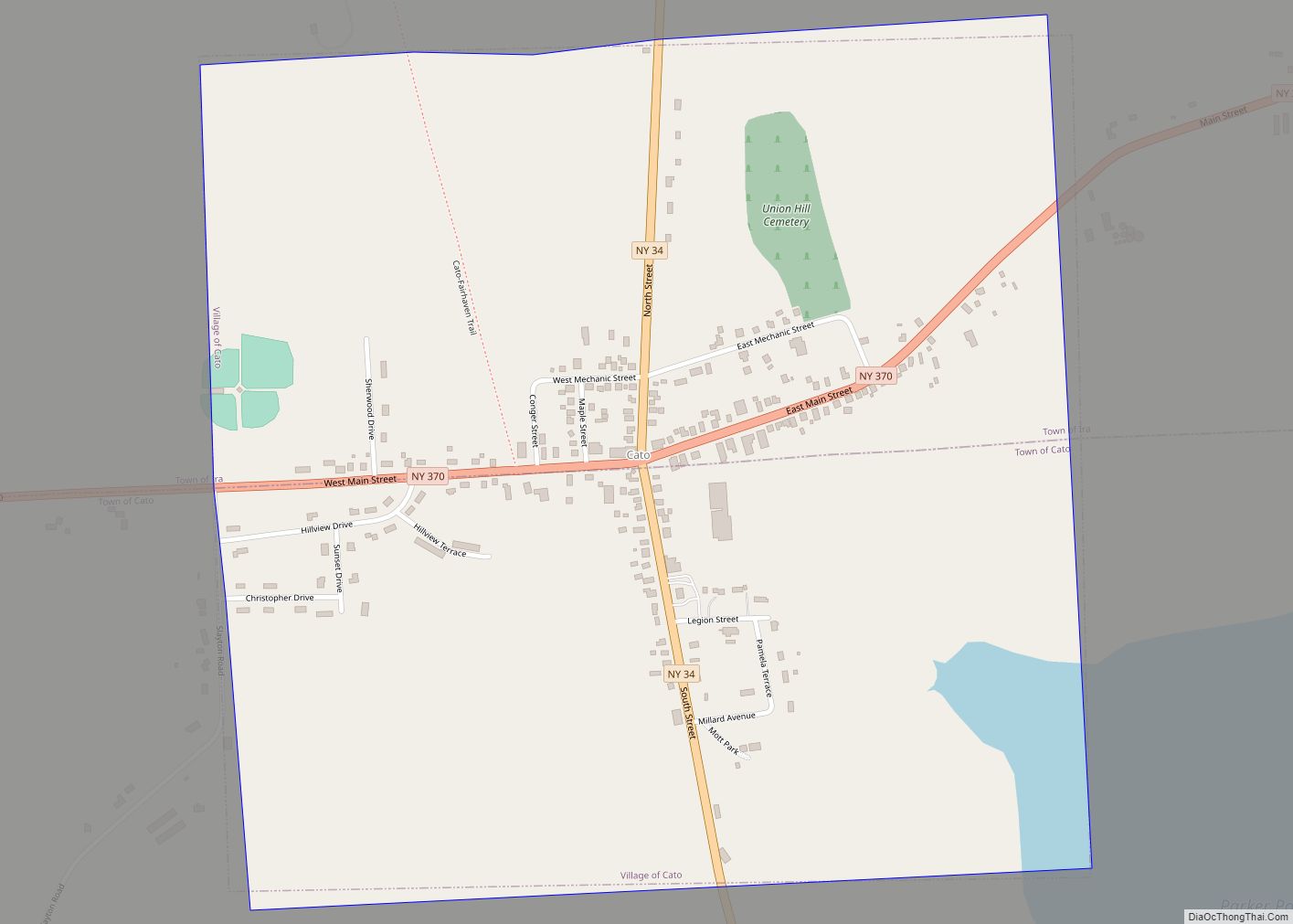
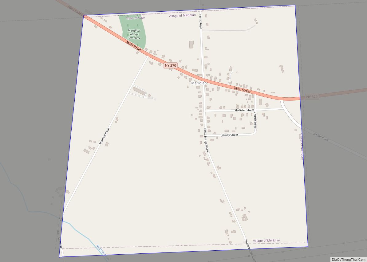
Cato is a village in Cayuga County, New York, United States. The population was 532 at the 2010 census. The name was assigned by the surveyors of the Military Tract, and is one of many towns and villages bearing classical place names. The village of Cato is half within the town of Cato and half within the town of Ira. It is west of Syracuse.
| Name: | Cato village |
|---|---|
| LSAD Code: | 47 |
| LSAD Description: | village (suffix) |
| State: | New York |
| County: | Cayuga County |
| Elevation: | 459 ft (140 m) |
| Total Area: | 1.01 sq mi (2.62 km²) |
| Land Area: | 0.99 sq mi (2.56 km²) |
| Water Area: | 0.03 sq mi (0.06 km²) |
| Total Population: | 517 |
| Population Density: | 522.75/sq mi (201.93/km²) |
| ZIP code: | 13033 |
| Area code: | 315 |
| FIPS code: | 3612958 |
| GNISfeature ID: | 0946053 |
| Website: | villageofcatony.com |
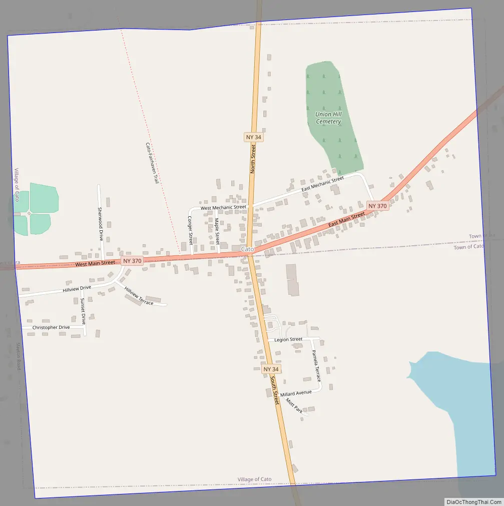
Online Interactive Map
Click on ![]() to view map in "full screen" mode.
to view map in "full screen" mode.
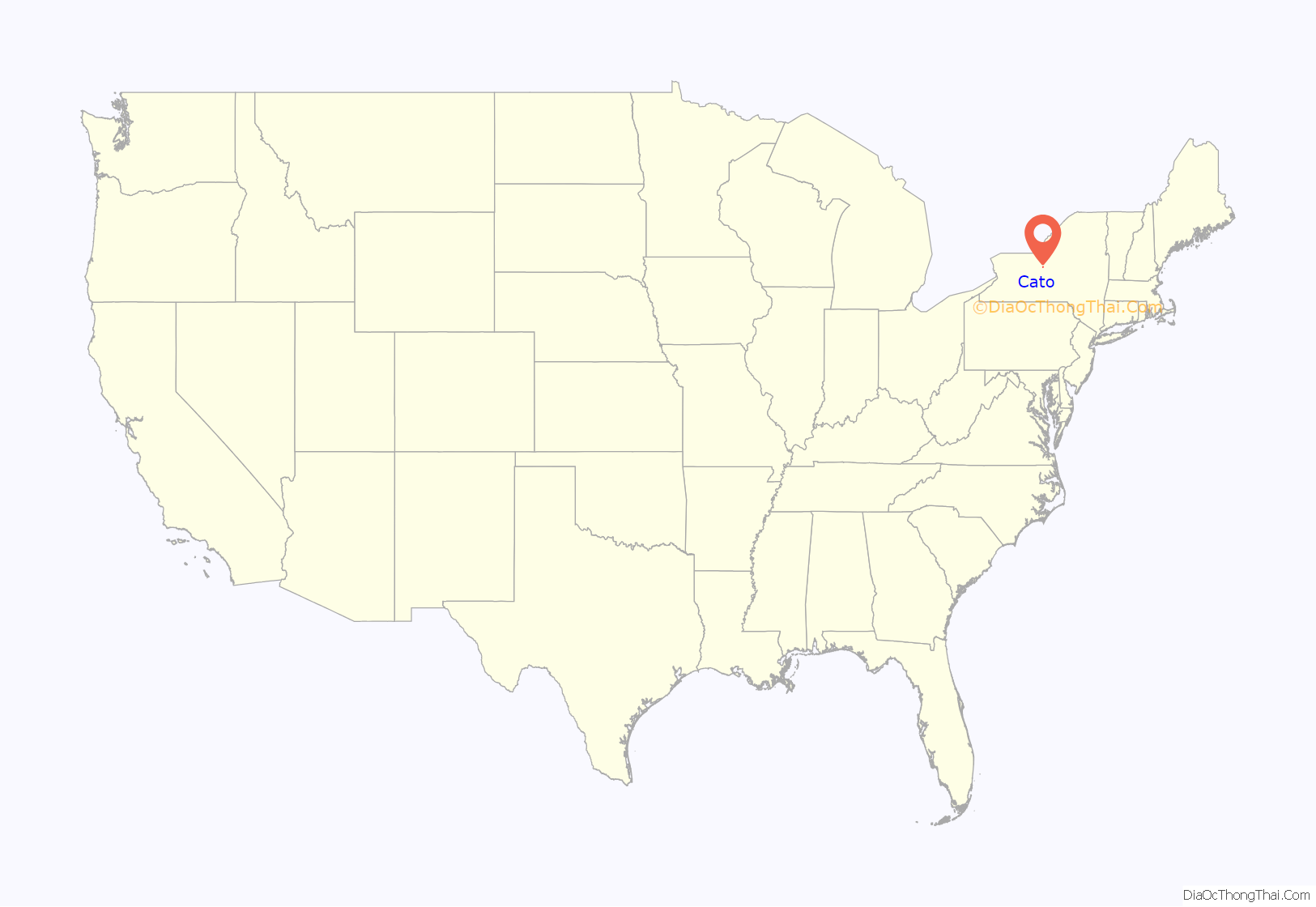
Cato location map. Where is Cato village?
History
The village was part of the Central New York Military Tract, land set aside in 1782 for veterans of the American Revolution. Prior native occupants were compelled to live on reservations established at that time. The first permanent settler arrived around 1805, and the new community was called “Jakway’s Corners”.
Railroad service came to the village in 1869, aiding its prosperity, but rail service ended in 1953.
Cato is home to the 1993 Section 3 Class D state football champions. Modern Cato is partly a bedroom community, with many residents commuting to surrounding cities.
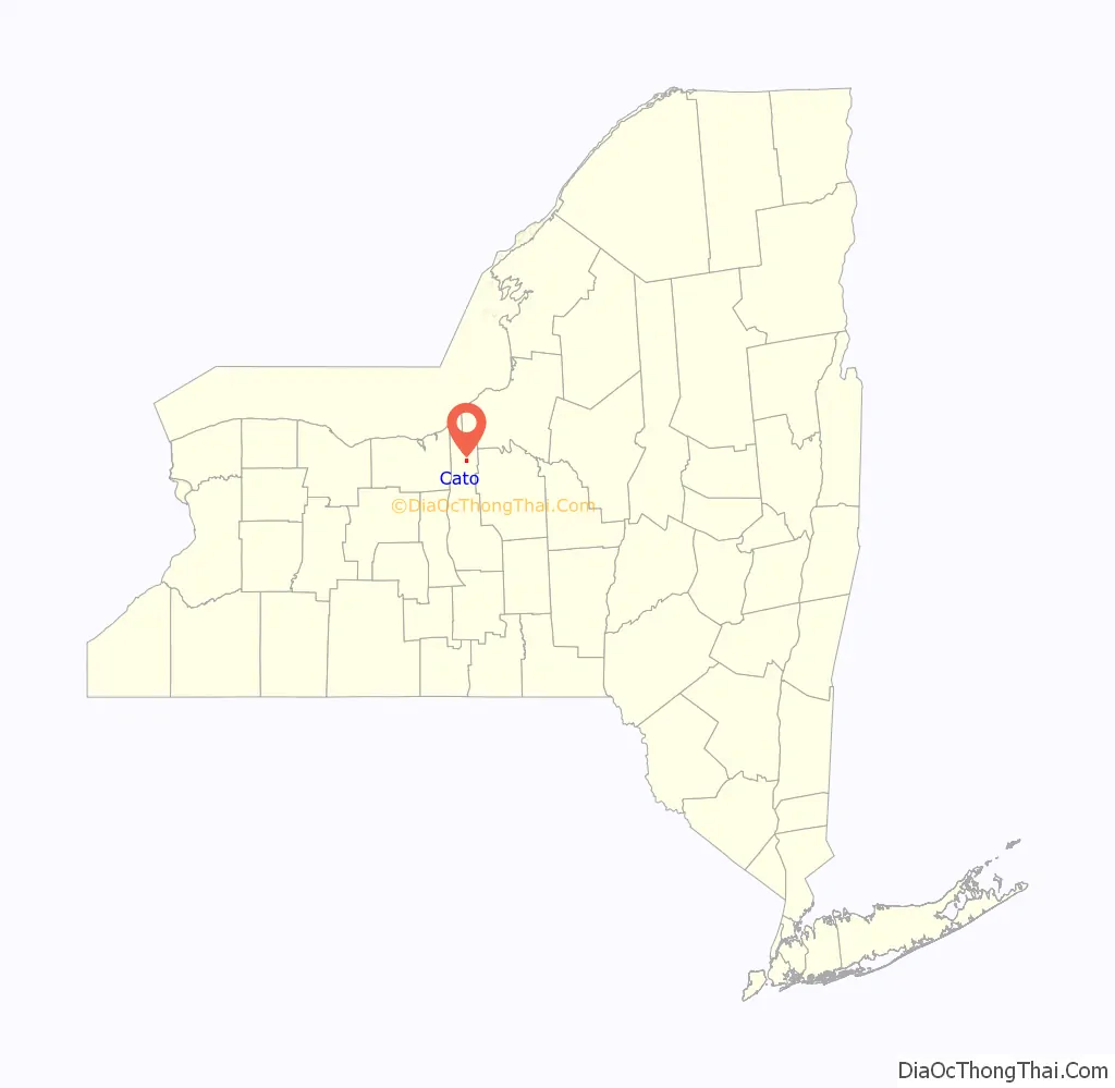
Cato Road Map
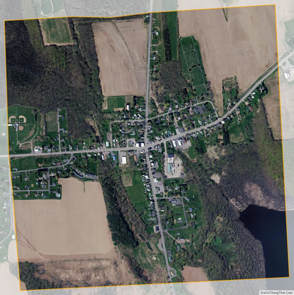
Cato city Satellite Map
Geography
According to the United States Census Bureau, the village has a total area of 1.0 square mile (2.6 km), of which 0.023 square miles (0.06 km), or 2.44%, is water.
The village is located in a drumlin field.
Parker Pond, formerly known as “Forest Lake”, is a small lake at the southeast edge of the village. Muskrat Creek drains from the lake and flows southward to the Seneca River (and Erie Canal).
The village is at the junction of NY-34 and NY-370. Locating places within the village is extremely simple, since virtually all locations which may be visited by a non-resident are located on these two highways.
See also
Map of New York State and its subdivision:- Albany
- Allegany
- Bronx
- Broome
- Cattaraugus
- Cayuga
- Chautauqua
- Chemung
- Chenango
- Clinton
- Columbia
- Cortland
- Delaware
- Dutchess
- Erie
- Essex
- Franklin
- Fulton
- Genesee
- Greene
- Hamilton
- Herkimer
- Jefferson
- Kings
- Lake Ontario
- Lewis
- Livingston
- Madison
- Monroe
- Montgomery
- Nassau
- New York
- Niagara
- Oneida
- Onondaga
- Ontario
- Orange
- Orleans
- Oswego
- Otsego
- Putnam
- Queens
- Rensselaer
- Richmond
- Rockland
- Saint Lawrence
- Saratoga
- Schenectady
- Schoharie
- Schuyler
- Seneca
- Steuben
- Suffolk
- Sullivan
- Tioga
- Tompkins
- Ulster
- Warren
- Washington
- Wayne
- Westchester
- Wyoming
- Yates
- Alabama
- Alaska
- Arizona
- Arkansas
- California
- Colorado
- Connecticut
- Delaware
- District of Columbia
- Florida
- Georgia
- Hawaii
- Idaho
- Illinois
- Indiana
- Iowa
- Kansas
- Kentucky
- Louisiana
- Maine
- Maryland
- Massachusetts
- Michigan
- Minnesota
- Mississippi
- Missouri
- Montana
- Nebraska
- Nevada
- New Hampshire
- New Jersey
- New Mexico
- New York
- North Carolina
- North Dakota
- Ohio
- Oklahoma
- Oregon
- Pennsylvania
- Rhode Island
- South Carolina
- South Dakota
- Tennessee
- Texas
- Utah
- Vermont
- Virginia
- Washington
- West Virginia
- Wisconsin
- Wyoming