Cayuga is a village in Cayuga County, New York, United States. The population was 549 at the 2010 census. The village derives its name from the indigenous Cayuga people and the lake named after them.
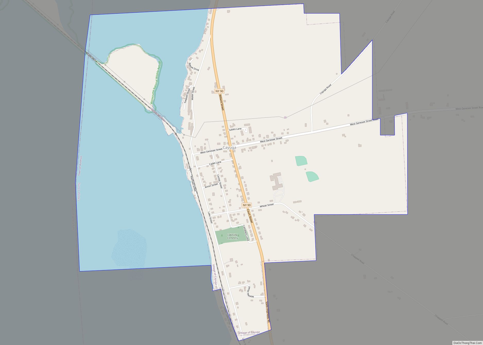
The village of Cayuga is in the western part of the town of Aurelius.
| Name: | Cayuga village |
|---|---|
| LSAD Code: | 47 |
| LSAD Description: | village (suffix) |
| State: | New York |
| County: | Cayuga County |
| Incorporated: | 1857 |
| Elevation: | 482 ft (147 m) |
| Total Area: | 1.37 sq mi (3.54 km²) |
| Land Area: | 0.90 sq mi (2.34 km²) |
| Water Area: | 0.46 sq mi (1.20 km²) |
| Total Population: | 472 |
| Population Density: | 522.12/sq mi (201.63/km²) |
| ZIP code: | 13034 |
| Area code: | 315 |
| FIPS code: | 3613068 |
| GNISfeature ID: | 0946081 |
| Website: | www.villagecayugany.com |
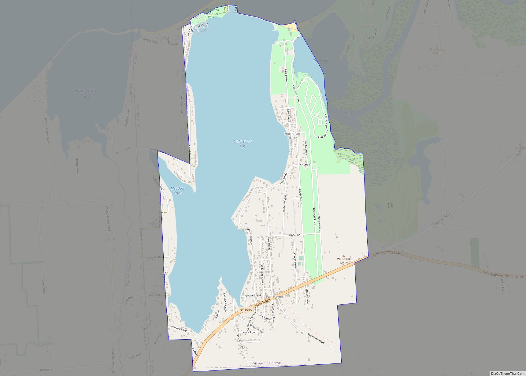
Online Interactive Map
Click on ![]() to view map in "full screen" mode.
to view map in "full screen" mode.
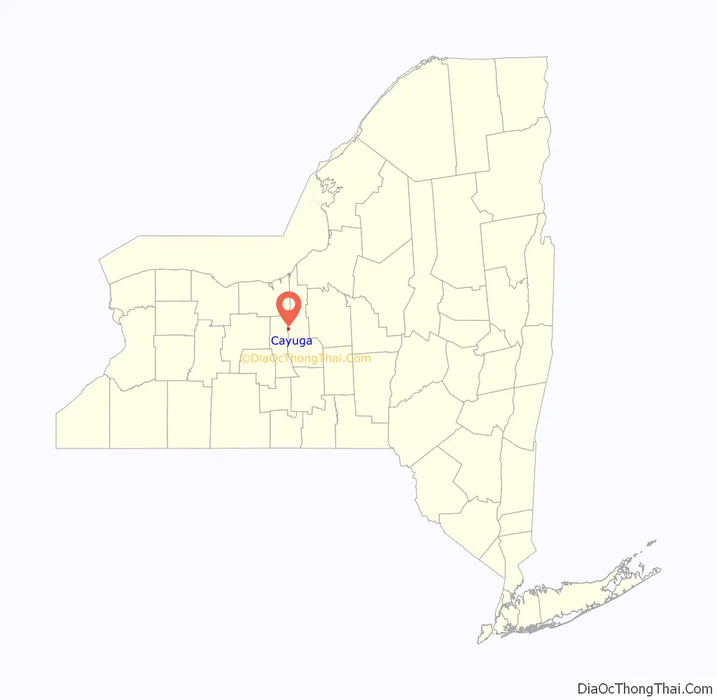
Cayuga location map. Where is Cayuga village?

History
The Sullivan Expedition of 1779 passed through the town. The village was incorporated in 1857, and re-incorporated in 1874.
The Hutchinson Homestead was listed on the National Register of Historic Places in 2009.
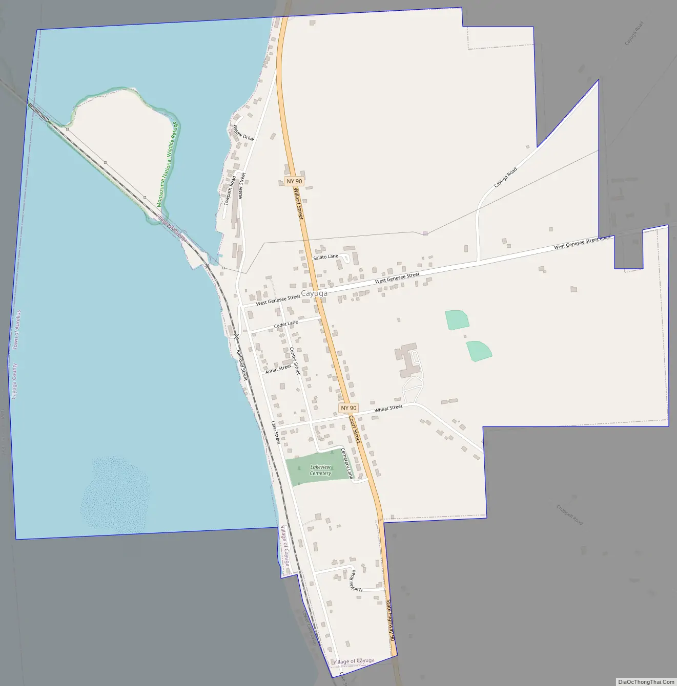
Cayuga Road Map
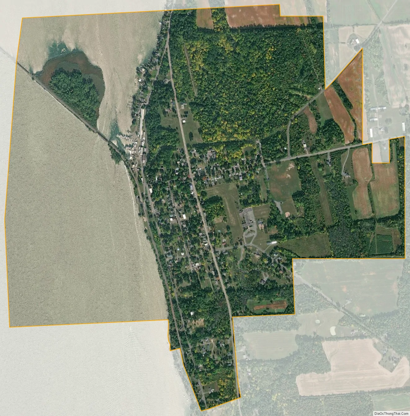
Cayuga city Satellite Map
Geography
According to the United States Census Bureau, Cayuga has a total area of 1.4 square miles (3.5 km), of which 0.89 square miles (2.3 km) is land and 0.46 square miles (1.2 km), or 33.81%, is water.
Cayuga is located on the eastern shore of the northern end of Cayuga Lake.
New York State Route 90 is a north–south highway through the village.
See also
Map of New York State and its subdivision:- Albany
- Allegany
- Bronx
- Broome
- Cattaraugus
- Cayuga
- Chautauqua
- Chemung
- Chenango
- Clinton
- Columbia
- Cortland
- Delaware
- Dutchess
- Erie
- Essex
- Franklin
- Fulton
- Genesee
- Greene
- Hamilton
- Herkimer
- Jefferson
- Kings
- Lake Ontario
- Lewis
- Livingston
- Madison
- Monroe
- Montgomery
- Nassau
- New York
- Niagara
- Oneida
- Onondaga
- Ontario
- Orange
- Orleans
- Oswego
- Otsego
- Putnam
- Queens
- Rensselaer
- Richmond
- Rockland
- Saint Lawrence
- Saratoga
- Schenectady
- Schoharie
- Schuyler
- Seneca
- Steuben
- Suffolk
- Sullivan
- Tioga
- Tompkins
- Ulster
- Warren
- Washington
- Wayne
- Westchester
- Wyoming
- Yates
- Alabama
- Alaska
- Arizona
- Arkansas
- California
- Colorado
- Connecticut
- Delaware
- District of Columbia
- Florida
- Georgia
- Hawaii
- Idaho
- Illinois
- Indiana
- Iowa
- Kansas
- Kentucky
- Louisiana
- Maine
- Maryland
- Massachusetts
- Michigan
- Minnesota
- Mississippi
- Missouri
- Montana
- Nebraska
- Nevada
- New Hampshire
- New Jersey
- New Mexico
- New York
- North Carolina
- North Dakota
- Ohio
- Oklahoma
- Oregon
- Pennsylvania
- Rhode Island
- South Carolina
- South Dakota
- Tennessee
- Texas
- Utah
- Vermont
- Virginia
- Washington
- West Virginia
- Wisconsin
- Wyoming