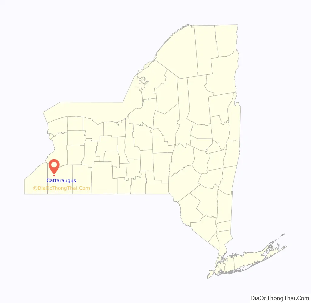
Cattaraugus is a village in Cattaraugus County, New York, United States. The population was 996 at the 2020 census. The village lies in the northeast part of the town of New Albion, north of Salamanca.
| Name: | Cattaraugus village |
|---|---|
| LSAD Code: | 47 |
| LSAD Description: | village (suffix) |
| State: | New York |
| County: | Cattaraugus County |
| Elevation: | 1,375 ft (419 m) |
| Total Area: | 1.12 sq mi (2.90 km²) |
| Land Area: | 1.12 sq mi (2.89 km²) |
| Water Area: | 0.00 sq mi (0.01 km²) |
| Total Population: | 960 |
| Population Density: | 859.44/sq mi (331.71/km²) |
| ZIP code: | 14719 |
| Area code: | 716 |
| FIPS code: | 3613024 |
| GNISfeature ID: | 0946066 |
| Website: | cattaraugusny.org |
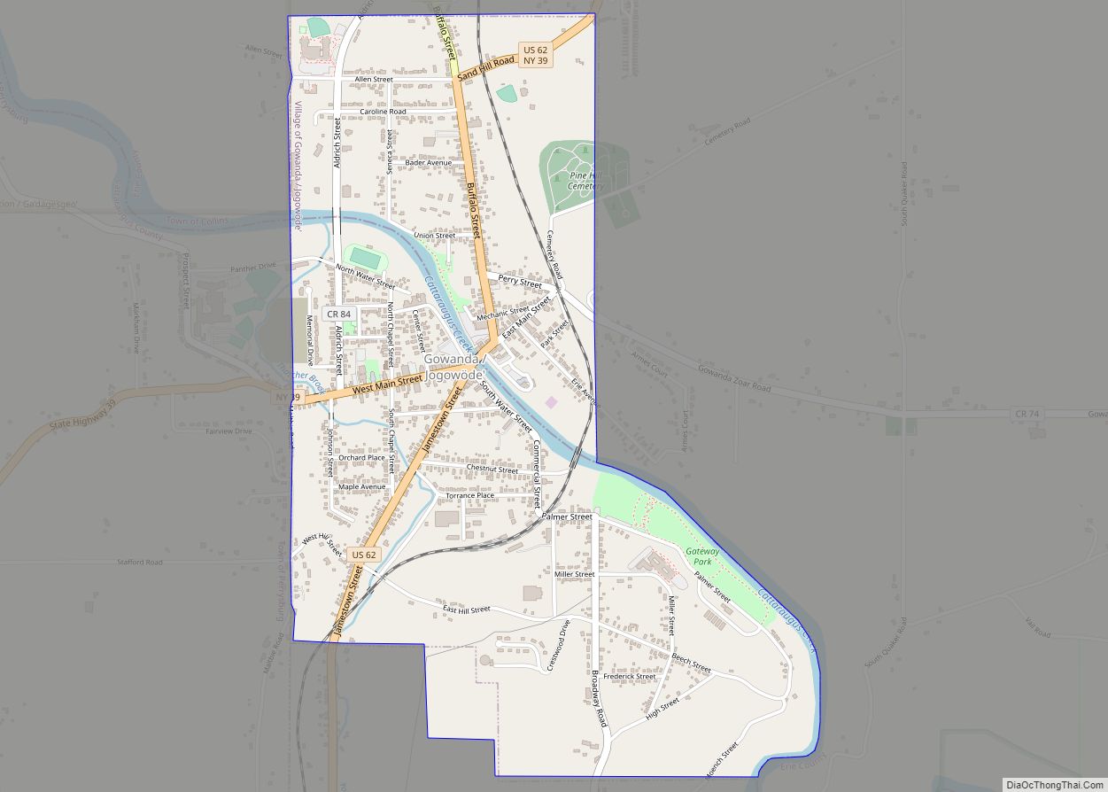
Online Interactive Map
Click on ![]() to view map in "full screen" mode.
to view map in "full screen" mode.
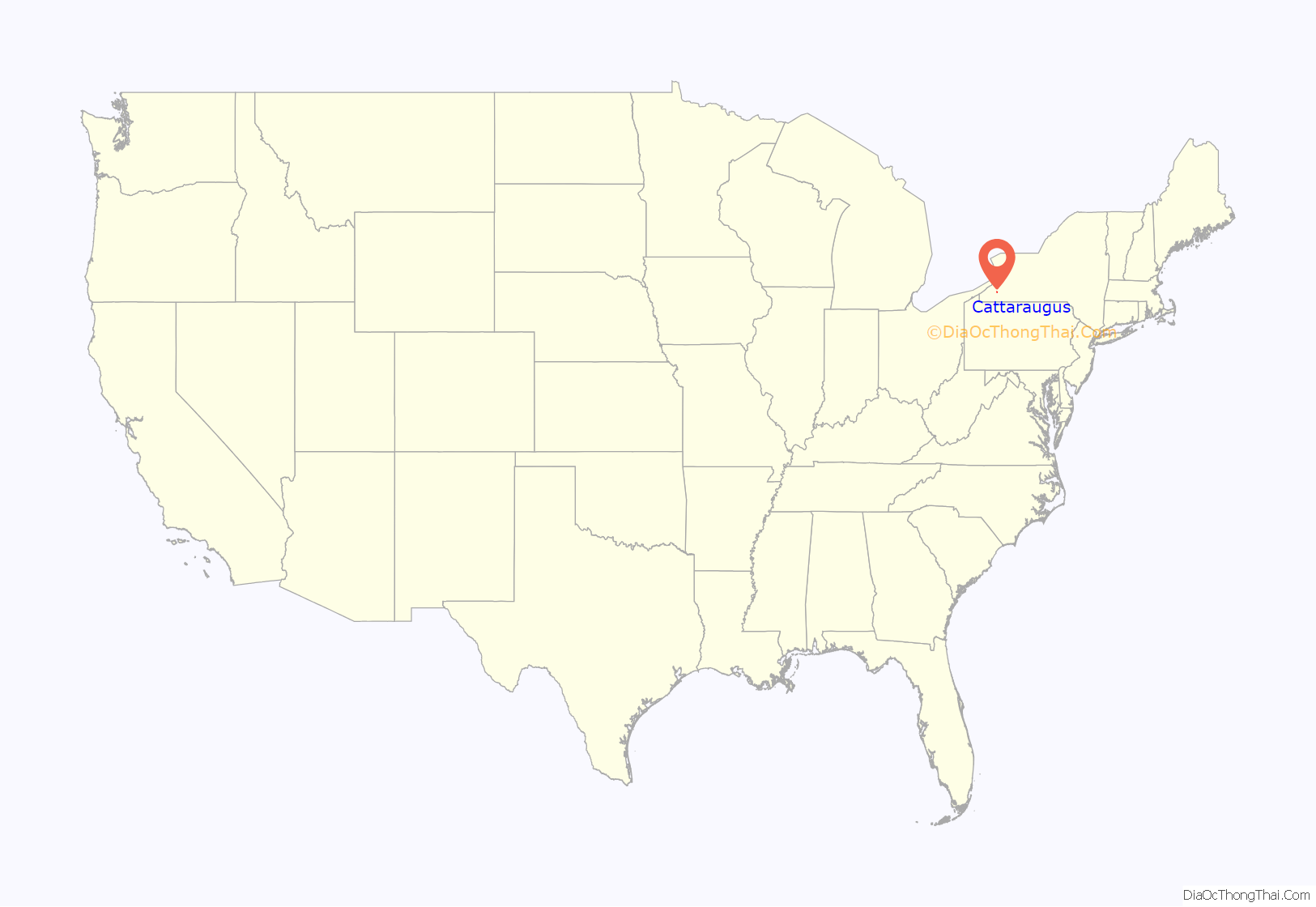
Cattaraugus location map. Where is Cattaraugus village?
History
In 1828, the brothers Calvin and Arad Rich settled in the hills surrounding the area. Cattaraugus developed most after the arrival of the Erie Railroad in 1851. Shortly after, the village became a boomtown growing to 1,500 inhabitants and even being visited by US President Millard Fillmore. By 1860 the township boasted 305 dwellings, 1557 oxen, 383 horses, and 8 school districts with 649 children in school. In the same year, it is well documented Abraham Lincoln had come to visit. Other prominent visitors include US Presidents Teddy Roosevelt and Franklin D. Roosevelt. As well as Mark Twain who then named his housecat “Cattaraugus” The village was incorporated in 1882. Its name derives from Cattaraugus Creek.
The Cattaraugus Village Commercial Historic District was listed on the National Register of Historic Places in 2014.
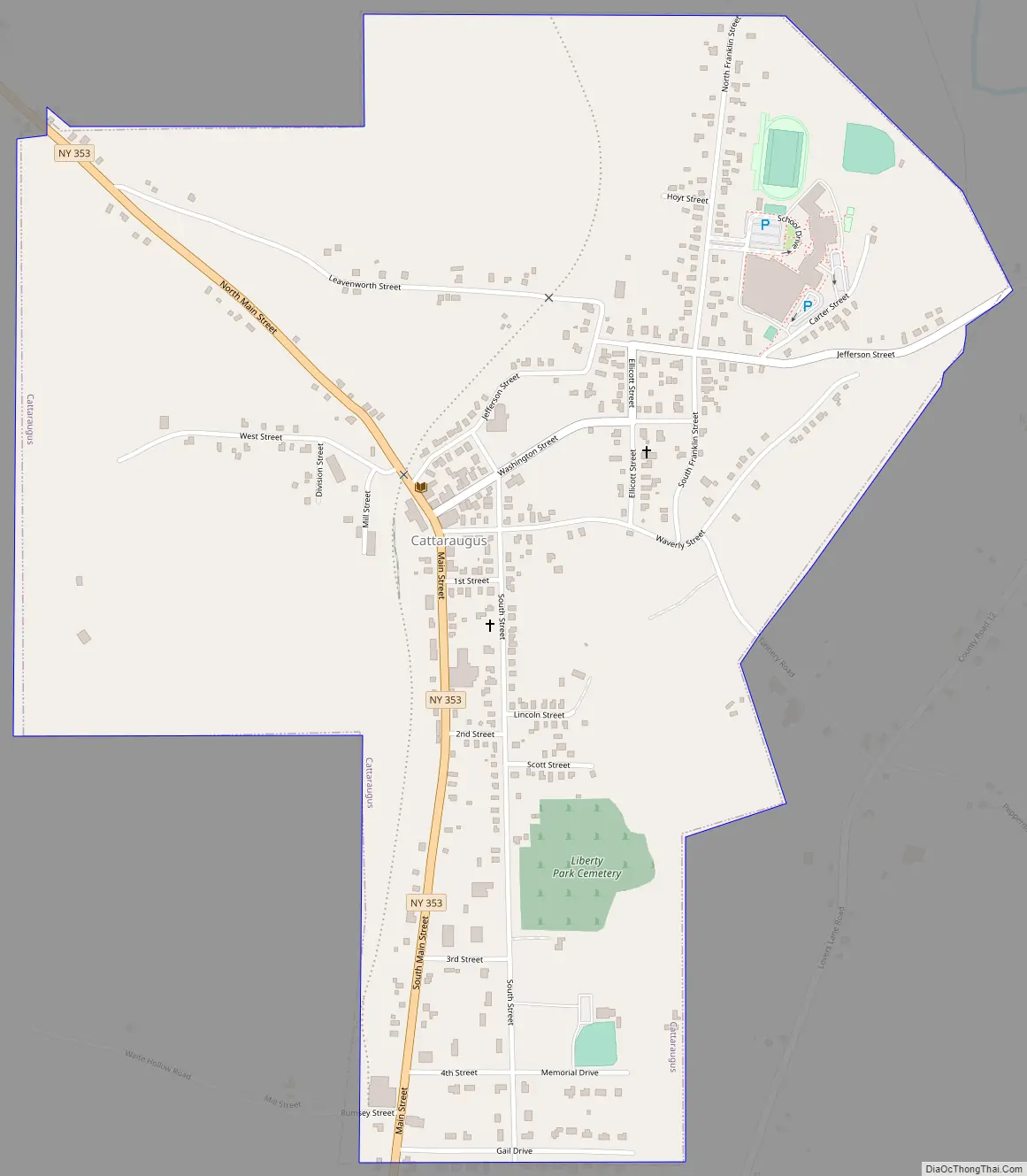
Cattaraugus Road Map
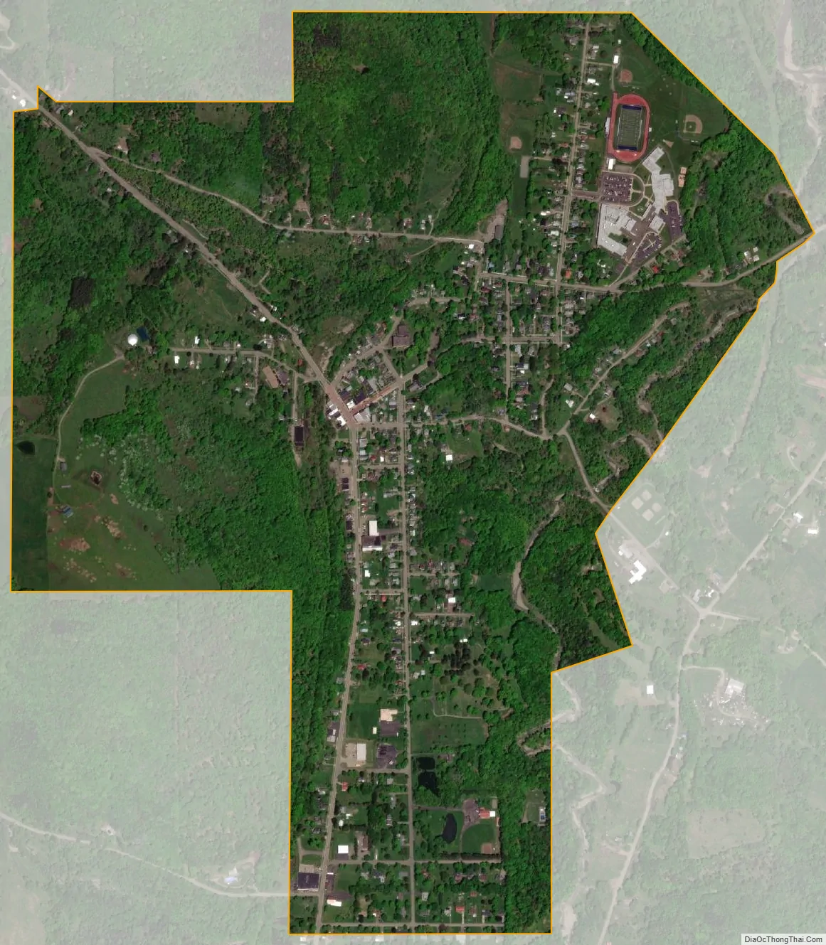
Cattaraugus city Satellite Map
Geography
Cattaraugus is located in the northern part of the town of New Albion at 42°19′48″N 78°51′56″W / 42.33000°N 78.86556°W / 42.33000; -78.86556 (42.330044, -78.865673).
According to the United States Census Bureau, the village has a total area of 1.1 square miles (2.9 km), all land.
NY Route 353 and Skinner Hollow pass through the village. Cattaraugus County Route 12 (which follows the briefly designated NY 264 of the 1930s), the only county route in the county to enter a village, enters the village from the northeast and terminates within the village. The village is built primarily on a hillside; the southwestern portion of the village (around Route 353) is on the highest ground, while a series of side streets run downhill from Route 353 heading northeast. Only two of the village’s streets run uphill from Route 353: Rumsey Street (the easternmost tip of Waite Hollow Road) on the village’s southern boundary and West Street at the peak of the hill.
Since 2013, the Seneca Transit System has provided public bus service to the village.
The New York and Lake Erie Railroad terminates at a Setterstix plant in Cattaraugus after the portion of the railway southeast of Cattaraugus was decommissioned in the early 1990s. The rail service has been disrupted by floods and landslides since the late 2000s. The right-of-way of the portion heading southeast from Cattaraugus is now the Pat McGee Trail, which was established in 2005.
See also
Map of New York State and its subdivision:- Albany
- Allegany
- Bronx
- Broome
- Cattaraugus
- Cayuga
- Chautauqua
- Chemung
- Chenango
- Clinton
- Columbia
- Cortland
- Delaware
- Dutchess
- Erie
- Essex
- Franklin
- Fulton
- Genesee
- Greene
- Hamilton
- Herkimer
- Jefferson
- Kings
- Lake Ontario
- Lewis
- Livingston
- Madison
- Monroe
- Montgomery
- Nassau
- New York
- Niagara
- Oneida
- Onondaga
- Ontario
- Orange
- Orleans
- Oswego
- Otsego
- Putnam
- Queens
- Rensselaer
- Richmond
- Rockland
- Saint Lawrence
- Saratoga
- Schenectady
- Schoharie
- Schuyler
- Seneca
- Steuben
- Suffolk
- Sullivan
- Tioga
- Tompkins
- Ulster
- Warren
- Washington
- Wayne
- Westchester
- Wyoming
- Yates
- Alabama
- Alaska
- Arizona
- Arkansas
- California
- Colorado
- Connecticut
- Delaware
- District of Columbia
- Florida
- Georgia
- Hawaii
- Idaho
- Illinois
- Indiana
- Iowa
- Kansas
- Kentucky
- Louisiana
- Maine
- Maryland
- Massachusetts
- Michigan
- Minnesota
- Mississippi
- Missouri
- Montana
- Nebraska
- Nevada
- New Hampshire
- New Jersey
- New Mexico
- New York
- North Carolina
- North Dakota
- Ohio
- Oklahoma
- Oregon
- Pennsylvania
- Rhode Island
- South Carolina
- South Dakota
- Tennessee
- Texas
- Utah
- Vermont
- Virginia
- Washington
- West Virginia
- Wisconsin
- Wyoming