Cazenovia is a village located in the Town of Cazenovia in Madison County, New York, United States. As of the 2010 census, the village had a population of 2,835. The village lies on the southeastern shore of Cazenovia Lake, which is approximately 4 miles (6.4 km) long and .5 mile across. Cazenovia is within a half hour of Syracuse, New York. The village is located on US Route 20 and New York State Route 13, and is home to Cazenovia College.
| Name: | Cazenovia village |
|---|---|
| LSAD Code: | 47 |
| LSAD Description: | village (suffix) |
| State: | New York |
| County: | Madison County |
| Elevation: | 1,224 ft (373 m) |
| Total Area: | 1.89 sq mi (4.89 km²) |
| Land Area: | 1.89 sq mi (4.89 km²) |
| Water Area: | 0.00 sq mi (0.00 km²) |
| Total Population: | 2,767 |
| Population Density: | 1,466.35/sq mi (566.06/km²) |
| ZIP code: | 13035 |
| Area code: | 315 |
| FIPS code: | 3613145 |
| GNISfeature ID: | 0946090 |
Online Interactive Map
Click on ![]() to view map in "full screen" mode.
to view map in "full screen" mode.
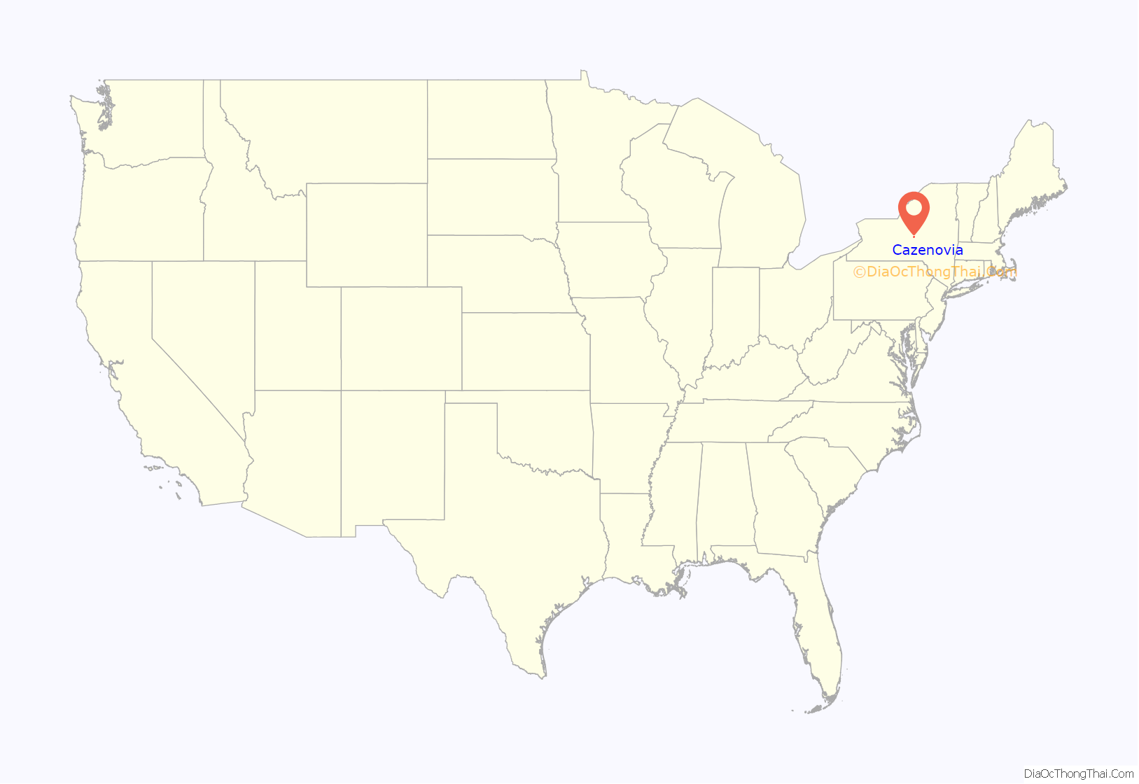
Cazenovia location map. Where is Cazenovia village?
History
Cazenovia was established in 1794 by John Lincklaen, a young Dutch naval officer who purchased the town under the auspices of the Holland Land Company. Some of the first buildings established in Cazenovia were what is now the Presbyterian Church and the company store. The town is named after Theophilus Cazenove, an agent with the land company.
The village was incorporated in 1810 and was the first county seat (until 1817). Many of the village’s historic buildings are encompassed by the Albany Street Historic District and Cazenovia Village Historic District. Also listed on the National Register of Historic Places is the Lehigh Valley Railroad Depot.
The most famous event in Cazenovia’s history was the 1850 Fugitive Slave Convention, organized by abolitionist Gerrit Smith and chaired by former slave Frederick Douglass to consider how to react to Fugitive Slave Act of 1850, which passed days later.
The Lorenzo New York State Historic Site was listed in the National Register of Historic Places in July 1970. This land, located off Route 13 (Rippleton Road), now belongs to the NY State Historic Trust after being bought from the previous owner, George Ledyard, upon his death. There is a school house, mansion, farmhouse, and a landscaped garden that guests can tour throughout the year by appointment or during regular hours.
In 2005, the Cazenovia High School Academic Decathlon team won the school’s first state title, sending the team to the national competition in Chicago. The team retained its state title the following four years, traveling to national competitions in San Antonio, Texas, in 2006, Honolulu, Hawaii, in 2007, Anaheim, California, in 2008, and Memphis, Tennessee, in 2009.
On March 31, 2021 New York State legalized recreational cannabis. Villages can’t limit a resident’s right to possess or consume weed. However, the villages can prohibit retail outlets from selling it. On July 1, 2021, the village board voted unanimously to opt out of allowing retail cannabis sales in the village. It was one of the first villages in the state to opt out.
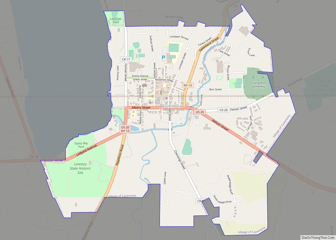
Cazenovia Road Map
Cazenovia city Satellite Map
See also
Map of New York State and its subdivision:- Albany
- Allegany
- Bronx
- Broome
- Cattaraugus
- Cayuga
- Chautauqua
- Chemung
- Chenango
- Clinton
- Columbia
- Cortland
- Delaware
- Dutchess
- Erie
- Essex
- Franklin
- Fulton
- Genesee
- Greene
- Hamilton
- Herkimer
- Jefferson
- Kings
- Lake Ontario
- Lewis
- Livingston
- Madison
- Monroe
- Montgomery
- Nassau
- New York
- Niagara
- Oneida
- Onondaga
- Ontario
- Orange
- Orleans
- Oswego
- Otsego
- Putnam
- Queens
- Rensselaer
- Richmond
- Rockland
- Saint Lawrence
- Saratoga
- Schenectady
- Schoharie
- Schuyler
- Seneca
- Steuben
- Suffolk
- Sullivan
- Tioga
- Tompkins
- Ulster
- Warren
- Washington
- Wayne
- Westchester
- Wyoming
- Yates
- Alabama
- Alaska
- Arizona
- Arkansas
- California
- Colorado
- Connecticut
- Delaware
- District of Columbia
- Florida
- Georgia
- Hawaii
- Idaho
- Illinois
- Indiana
- Iowa
- Kansas
- Kentucky
- Louisiana
- Maine
- Maryland
- Massachusetts
- Michigan
- Minnesota
- Mississippi
- Missouri
- Montana
- Nebraska
- Nevada
- New Hampshire
- New Jersey
- New Mexico
- New York
- North Carolina
- North Dakota
- Ohio
- Oklahoma
- Oregon
- Pennsylvania
- Rhode Island
- South Carolina
- South Dakota
- Tennessee
- Texas
- Utah
- Vermont
- Virginia
- Washington
- West Virginia
- Wisconsin
- Wyoming
