Chittenango is a village located in Madison County, New York, United States. The village is in the southern part of the Town of Sullivan. The population was 4,896 at the 2020 census. Chittenango is the birthplace of L. Frank Baum, author of The Wonderful Wizard of Oz.
| Name: | Chittenango village |
|---|---|
| LSAD Code: | 47 |
| LSAD Description: | village (suffix) |
| State: | New York |
| County: | Madison County |
| Elevation: | 453 ft (138 m) |
| Total Area: | 2.48 sq mi (6.43 km²) |
| Land Area: | 2.48 sq mi (6.43 km²) |
| Water Area: | 0.00 sq mi (0.00 km²) |
| Total Population: | 4,896 |
| Population Density: | 1,971.01/sq mi (760.92/km²) |
| ZIP code: | 13037 |
| Area code: | 315 |
| FIPS code: | 3615561 |
| GNISfeature ID: | 0969996 |
| Website: | http://www.chittenango.org/ |
Online Interactive Map
Click on ![]() to view map in "full screen" mode.
to view map in "full screen" mode.
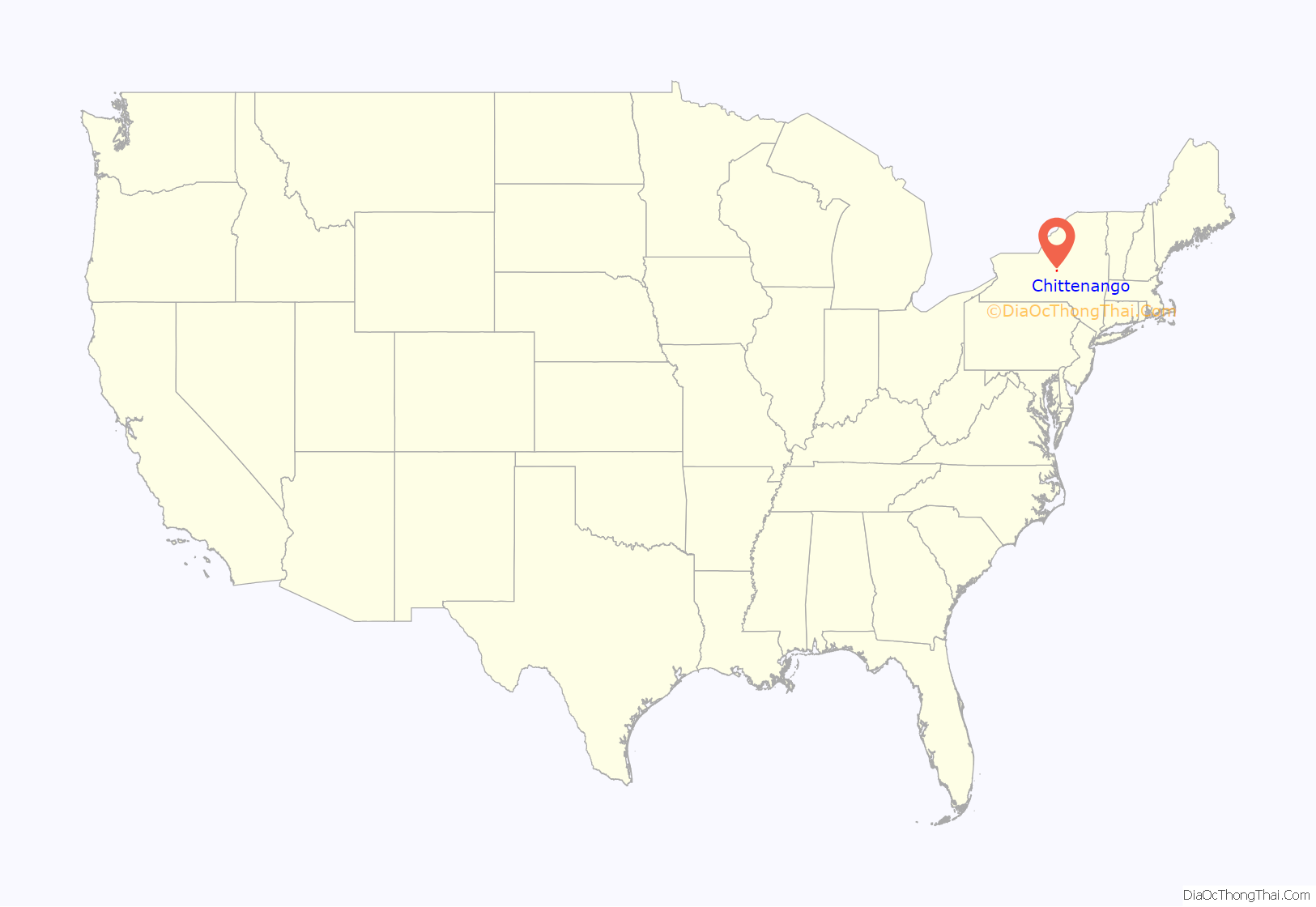
Chittenango location map. Where is Chittenango village?
History
The name of the village is derived from the Oneida name for Chittenango Creek, Chu-de-nääng′, meaning “where waters run north.” While the name “Chittenango” is often thought by locals to mean “river flowing north” or “where the waters divide and run north,” a reference to the direction of water flow from the creek’s point of origin to Oneida Lake, there is no derivation for these alternatives. On an 1825 map of the area, the village is called Chittening, a name used by early settlers which is thought to be derived directly from Chu-de-nääng′. According to American anthropologist Lewis H. Morgan who studied Iroquois customs and language in his 1851 book League of the Iroquois, the name “Chittenango” may have come from Chu-de-nääng′ Ga-hun′-da, a redundant combination of the Oneida terms for “Chittenango Creek” (Chu-de-nääng′) and “creek” (Ga-hun′-da).
Initial growth of this village is largely attributed to the construction of the Erie Canal which officially opened in 1825, joining Buffalo on Lake Erie with Albany, the capital of New York, and the Hudson River. The Erie Canal passes just north of the village. The Chittenango Canal Company, incorporated in 1818, constructed a canal 1.5 mi (2.4 km) in length connecting Chittenango to the Erie Canal. The village became a virtual canal town upon the construction of the Chittenango Canal Boat Landing, which featured a three-bay dry dock where canal boats were built and repaired. The canal brought prosperity, growth and expansion to the village. It created a need for inns, hotels and restaurants, and area farms and factories found the canal useful as an inexpensive and easy way to ship goods further along the canal or beyond. Because the canal connected to the Hudson River, boats were able to ship goods south to the metropolis of Manhattan.
Development increased considerably due to John B. Yates, who opened and operated grist and saw mills, a woolen mill, stores, and founded the village’s first church in 1828, the Dutch Reformed Church, now the First Presbyterian Church of Chittenango.
The village was incorporated on March 15, 1842. At the time, it contained between 900 and 1,000 inhabitants, about 180 dwellings, three churches, the Yates Polytechnic Institute, a large woolen factory, two large water lime factories, one flouring mill, three taverns and ten stores. In 1853, the first bank in the village, the Chittenango Bank, was organized and began business with capital of $110,000, which increased to $150,000 one year later. The bank closed business nearly one decade later, and in December 1863 the First National Bank of Chittenango was organized, occupying the same building erected by the first bank. This bank also closed down in 1883.
Soon after the incorporation of the village, the first fire company and engine house was built in 1843.
The first newspaper in the village was the Chittenango Herald, established in 1831 by Isaac Lyon. It later bore successively the name of Chittenango Republican, the Chittenango Phoenix, and the Democratic Gazette, until it was discontinued in 1853. In 1869 the Madison County Times was established and papers were published until 1975, at which time the Chittenango-Bridgeport Times was formed. This paper ran until 2009 when it merged with other greater Syracuse area papers to form the current Eagle Newspapers.
The Chittenango Pottery Company, largely owing its early success to its location near the Chittenango Landing, was established in 1897. After burning down twice, the present, now abandoned brick structure was erected. After years of neglect and disrepair, the building was demolished in 2015.
The Chittenango Pottery and St. Paul’s Church are listed on the National Register of Historic Places.
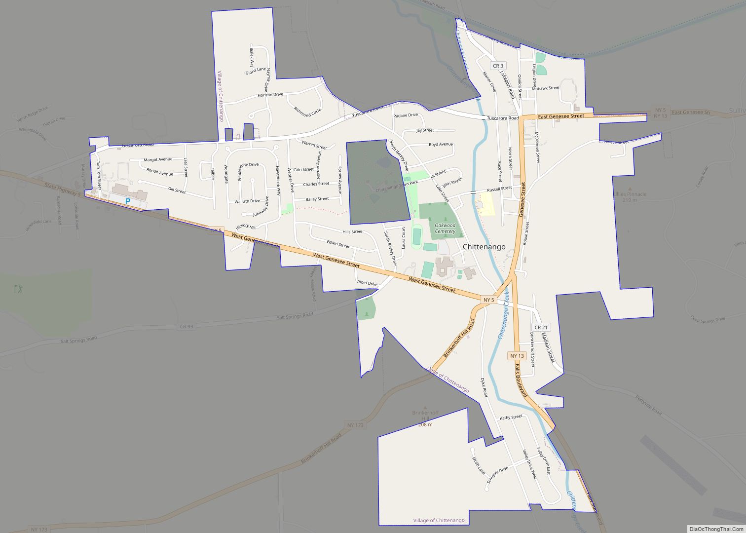
Chittenango Road Map
Chittenango city Satellite Map
Geography
Chittenango is located at 43°2′45″N 75°52′26″W / 43.04583°N 75.87389°W / 43.04583; -75.87389 (43.045901, -75.873785).
According to the United States Census Bureau, the village has a total area of 2.4 square miles (6.2 km), all land.
See also
Map of New York State and its subdivision:- Albany
- Allegany
- Bronx
- Broome
- Cattaraugus
- Cayuga
- Chautauqua
- Chemung
- Chenango
- Clinton
- Columbia
- Cortland
- Delaware
- Dutchess
- Erie
- Essex
- Franklin
- Fulton
- Genesee
- Greene
- Hamilton
- Herkimer
- Jefferson
- Kings
- Lake Ontario
- Lewis
- Livingston
- Madison
- Monroe
- Montgomery
- Nassau
- New York
- Niagara
- Oneida
- Onondaga
- Ontario
- Orange
- Orleans
- Oswego
- Otsego
- Putnam
- Queens
- Rensselaer
- Richmond
- Rockland
- Saint Lawrence
- Saratoga
- Schenectady
- Schoharie
- Schuyler
- Seneca
- Steuben
- Suffolk
- Sullivan
- Tioga
- Tompkins
- Ulster
- Warren
- Washington
- Wayne
- Westchester
- Wyoming
- Yates
- Alabama
- Alaska
- Arizona
- Arkansas
- California
- Colorado
- Connecticut
- Delaware
- District of Columbia
- Florida
- Georgia
- Hawaii
- Idaho
- Illinois
- Indiana
- Iowa
- Kansas
- Kentucky
- Louisiana
- Maine
- Maryland
- Massachusetts
- Michigan
- Minnesota
- Mississippi
- Missouri
- Montana
- Nebraska
- Nevada
- New Hampshire
- New Jersey
- New Mexico
- New York
- North Carolina
- North Dakota
- Ohio
- Oklahoma
- Oregon
- Pennsylvania
- Rhode Island
- South Carolina
- South Dakota
- Tennessee
- Texas
- Utah
- Vermont
- Virginia
- Washington
- West Virginia
- Wisconsin
- Wyoming
