Eggertsville is a hamlet and census-designated place (CDP) within the town of Amherst in Erie County, New York, United States. The population of the CDP was 15,019 at the 2010 census.
Eggertsville is part of the Buffalo–Niagara Falls Metropolitan Statistical Area.
| Name: | Eggertsville CDP |
|---|---|
| LSAD Code: | 57 |
| LSAD Description: | CDP (suffix) |
| State: | New York |
| County: | Erie County |
| Elevation: | 653 ft (199 m) |
| Total Area: | 2.86 sq mi (7.41 km²) |
| Land Area: | 2.86 sq mi (7.41 km²) |
| Water Area: | 0.00 sq mi (0.00 km²) |
| Total Population: | 15,561 |
| Population Density: | 5,439.01/sq mi (2,100.37/km²) |
| ZIP code: | 14226 |
| Area code: | 716 |
| FIPS code: | 3623701 |
| GNISfeature ID: | 0949425 |
Online Interactive Map
Click on ![]() to view map in "full screen" mode.
to view map in "full screen" mode.
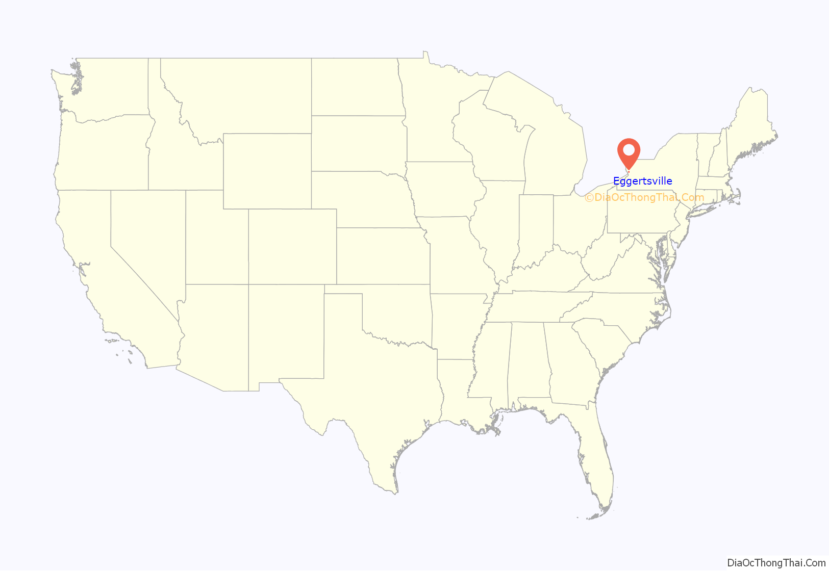
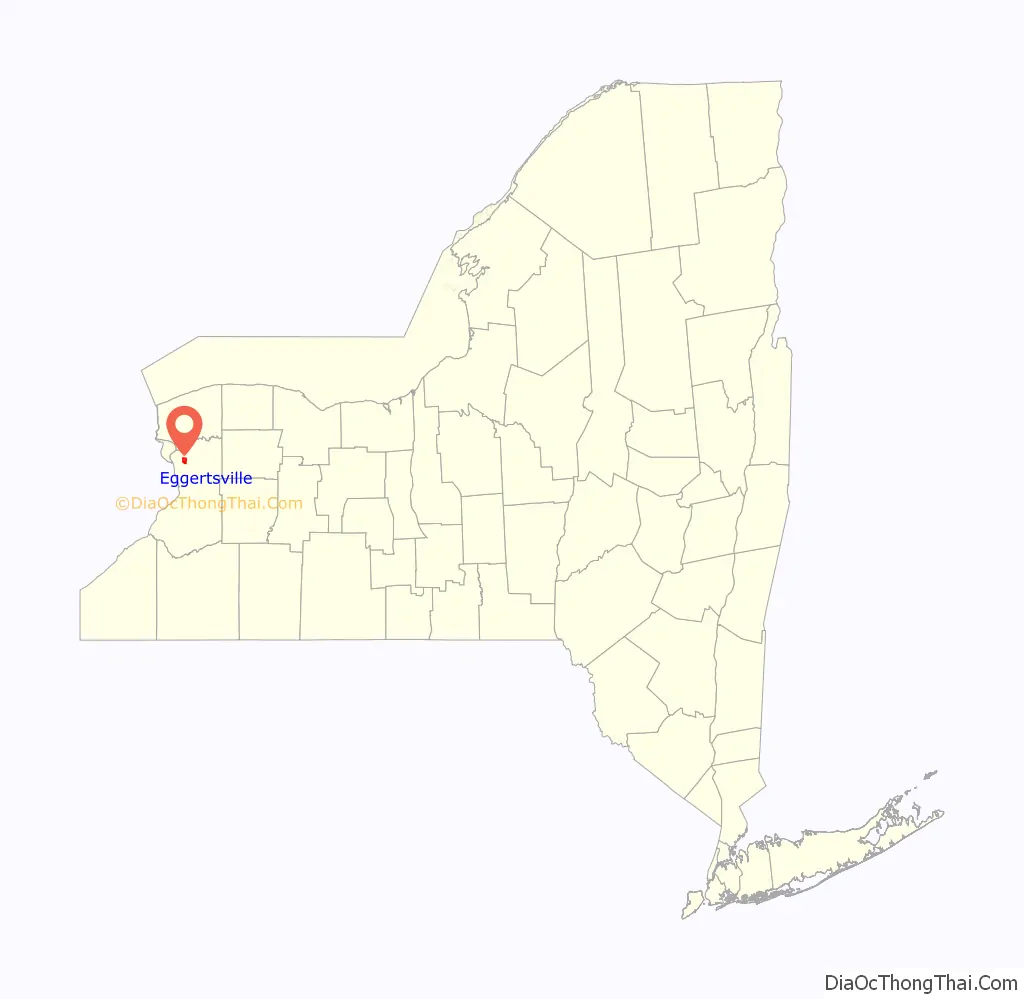
Eggertsville location map. Where is Eggertsville CDP?
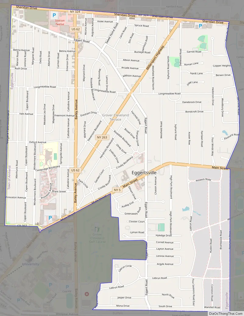
Eggertsville Road Map
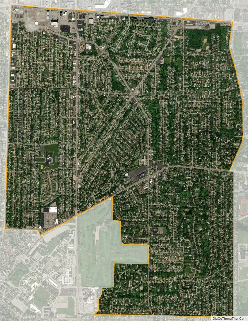
Eggertsville city Satellite Map
Geography
Eggertsville is located at 42°57′47″N 78°48′13″W / 42.96306°N 78.80361°W / 42.96306; -78.80361 (42.96314, -78.80364), in the southwestern corner of the town of Amherst, directly adjacent to the northeast corner of the city of Buffalo. As delineated by the U.S. Census Bureau, the northern boundary of the CDP is New York State Route 324, and the eastern boundary is formed by Getzville Road and Berryman Drive. The southern and western borders of the CDP follow the town boundary of Amherst.
New York State Route 5, Main Street, passes through the CDP, leading southwest to the center of Buffalo and east towards Williamsville in the town of Amherst.
According to the United States Census Bureau, the CDP has a total area of 2.9 square miles (7.4 km), all land.
See also
Map of New York State and its subdivision:- Albany
- Allegany
- Bronx
- Broome
- Cattaraugus
- Cayuga
- Chautauqua
- Chemung
- Chenango
- Clinton
- Columbia
- Cortland
- Delaware
- Dutchess
- Erie
- Essex
- Franklin
- Fulton
- Genesee
- Greene
- Hamilton
- Herkimer
- Jefferson
- Kings
- Lake Ontario
- Lewis
- Livingston
- Madison
- Monroe
- Montgomery
- Nassau
- New York
- Niagara
- Oneida
- Onondaga
- Ontario
- Orange
- Orleans
- Oswego
- Otsego
- Putnam
- Queens
- Rensselaer
- Richmond
- Rockland
- Saint Lawrence
- Saratoga
- Schenectady
- Schoharie
- Schuyler
- Seneca
- Steuben
- Suffolk
- Sullivan
- Tioga
- Tompkins
- Ulster
- Warren
- Washington
- Wayne
- Westchester
- Wyoming
- Yates
- Alabama
- Alaska
- Arizona
- Arkansas
- California
- Colorado
- Connecticut
- Delaware
- District of Columbia
- Florida
- Georgia
- Hawaii
- Idaho
- Illinois
- Indiana
- Iowa
- Kansas
- Kentucky
- Louisiana
- Maine
- Maryland
- Massachusetts
- Michigan
- Minnesota
- Mississippi
- Missouri
- Montana
- Nebraska
- Nevada
- New Hampshire
- New Jersey
- New Mexico
- New York
- North Carolina
- North Dakota
- Ohio
- Oklahoma
- Oregon
- Pennsylvania
- Rhode Island
- South Carolina
- South Dakota
- Tennessee
- Texas
- Utah
- Vermont
- Virginia
- Washington
- West Virginia
- Wisconsin
- Wyoming