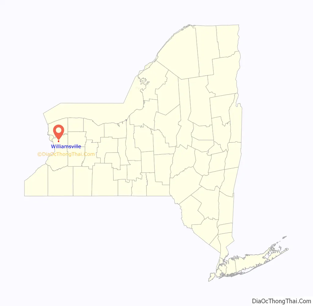
Williamsville is a village in Erie County, New York, United States. The population was 5,423 at the 2020 census. The village is named after Jonas Williams, an early settler. It is part of the Buffalo–Niagara Falls Metropolitan Statistical Area.
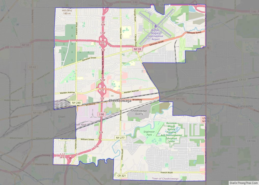
Williamsville is located mostly within the town of Amherst, but Creek Road and Creek Heights in the south part of the village (near the Wehrle Drive underpass of the New York State Thruway) are in the town of Cheektowaga. The village is in the northeastern quadrant of Erie County.
The Williamsville Central School District is a school system covering Williamsville, most of the eastern part of Amherst, and a small portion of the western end of Clarence.
| Name: | Williamsville village |
|---|---|
| LSAD Code: | 47 |
| LSAD Description: | village (suffix) |
| State: | New York |
| County: | Erie County |
| Elevation: | 676 ft (206 m) |
| Total Area: | 1.27 sq mi (3.28 km²) |
| Land Area: | 1.26 sq mi (3.26 km²) |
| Water Area: | 0.01 sq mi (0.02 km²) |
| Total Population: | 5,423 |
| Population Density: | 4,310.81/sq mi (1,664.45/km²) |
| ZIP code: | 14221, 14231 |
| Area code: | 716 |
| FIPS code: | 3682084 |
| GNISfeature ID: | 0971319 |
| Website: | www.walkablewilliamsville.com |
Online Interactive Map
Click on ![]() to view map in "full screen" mode.
to view map in "full screen" mode.
Williamsville location map. Where is Williamsville village?

History
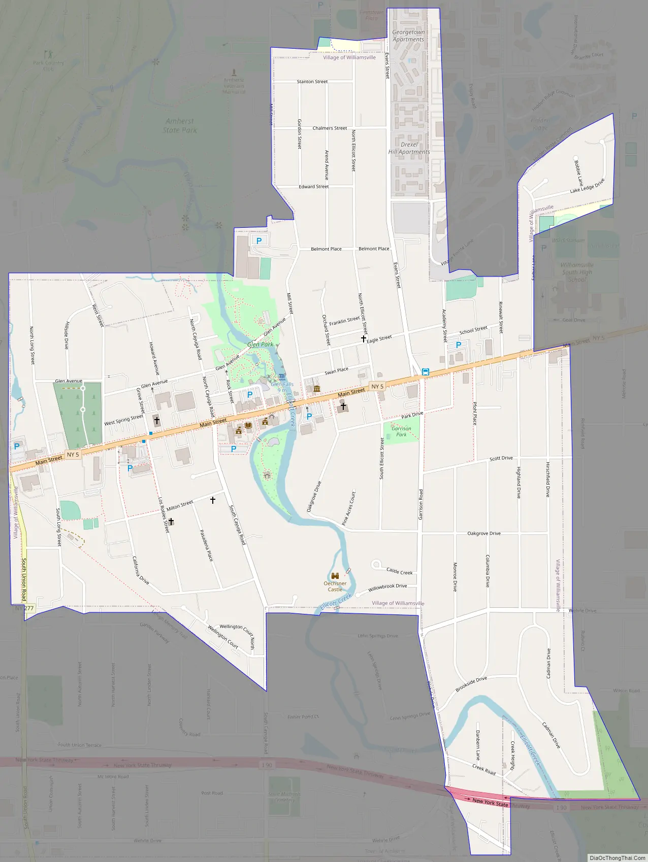
The community developed where the major road between Batavia and Buffalo crossed Ellicott Creek just above Glen Falls. The water power offered by the waterfall attracted millers. The first mill was built by Jonas Williams in 1811, giving the village its first name, “Williams Mills”. It still stands today, next to Glen Park, and is known as the Williamsville Water Mill.
Several other mills were built near Glen Falls during the 19th century. In 1841, a raceway was constructed to divert water from Ellicott Creek to the mills, creating an island known today as Island Park. A stagecoach stop, tavern, and inn was built along the main road near Ellicott Creek by Oziel Smith in 1832. Today it is known as the Eagle House. The close crossing of the main road and Ellicott Creek’s Glen Falls was the initial attraction, around which Williamsville grew. The village was incorporated in 1850.
Ss. Peter and Paul Church was loosely operating in the early 1820s, and the current church construction began in 1834 following the sale of land for the church from a non-parishioner, Oziel Smith, and was finished in 1836. St. John Neumann arrived to lead Ss. Peter and Paul Catholic Church from 1836 to 1840. Ss. Peter and Paul School was started by St. John Neumann in 1836, who also served as one of its first teachers.
During the War of 1812, American troops were stationed in Williamsville in the area between Garrison Road and Ellicott Creek. American soldiers and British prisoners were treated in a field hospital and log barracks that lined Garrison Road. A small cemetery, located on Aero Drive between Wehrle and Youngs Road, was used to bury the men who did not survive. General Winfield Scott used the Evans House as his headquarters in the Spring of 1813 when his entire army of 5,000–6,000 men were stationed in Williamsville. In 1813, when the British burned Buffalo, people fled to the safety of Williamsville, nearby Harris Hill, and Erie, Pennsylvania.
The village of Williamsville was one of more than 550 villages incorporated by New York State in 1850.
In 1983, Williamsville passed a Historic Preservation Code “to promote the awareness of landmarks of historic, cultural, social and architectural significance in the Village of Williamsville and to safe guard the heritage, character and quality of life unique to the Village through the preservation of these landmarks.”
Every summer in Williamsville, Old Home Days is held in Island Park, located directly on Main Street in the village. The Carnival begins with a parade on the opening Tuesday, and for four days, thousands of people enjoy rides, food, and the people of Williamsville. The Old Home Days festival is in remembrance of several women who in the mid-19th century came to the park once each summer to drink tea and catch up on the years past.
In 2010, government downsizing activist Kevin Gaughan campaigned to dissolve the village government. After a highly contentious campaign, a dissolution referendum was held on August 17, 2010, where voters rejected dissolution by a 5–1 margin.
Williamsville Road Map
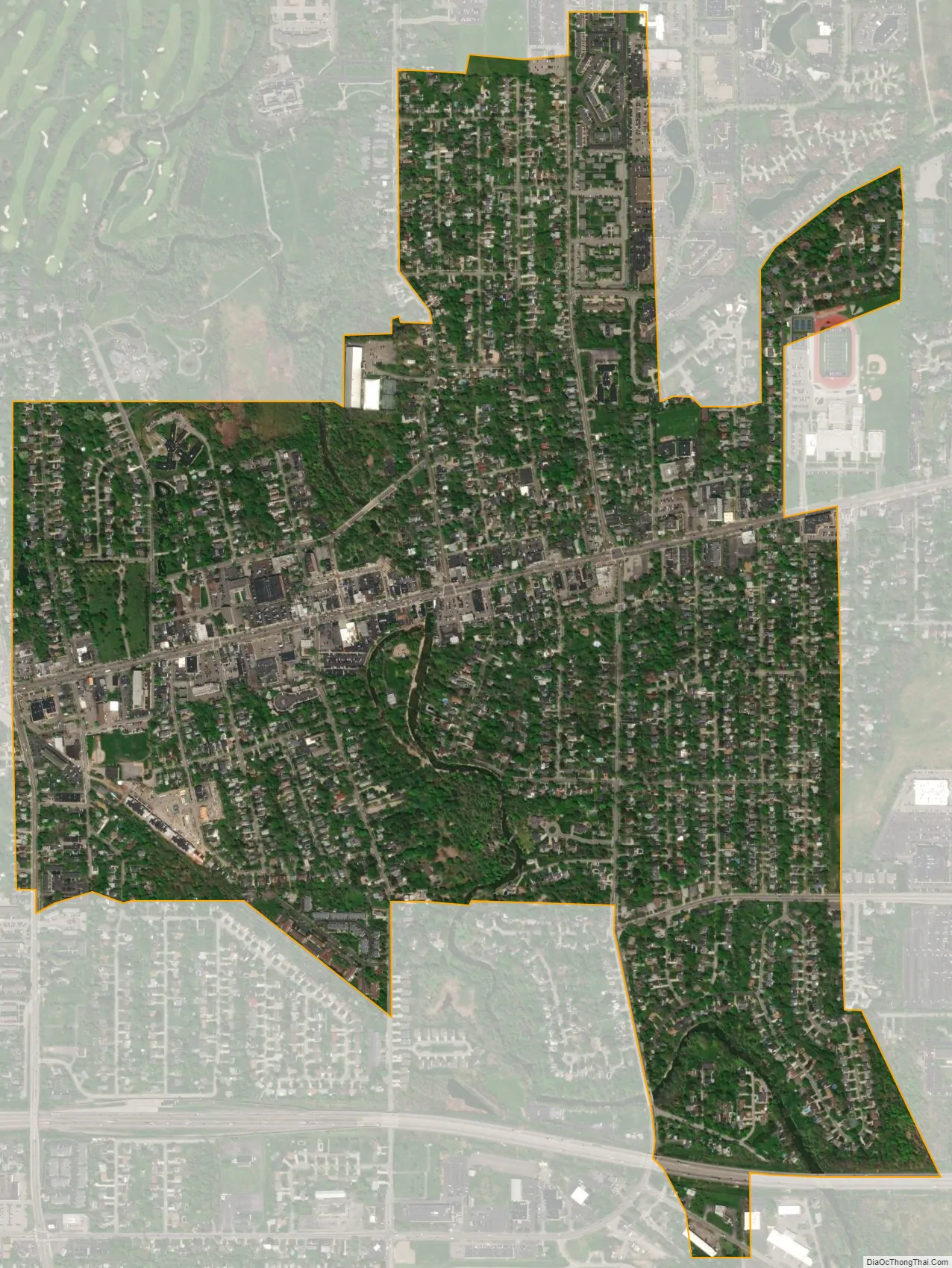
Williamsville city Satellite Map
Geography
According to the United States Census Bureau, the village has a total area of 1.2 square miles (3.1 km), all land.
Ellicott Creek flows through the village from south to north. The Onondaga Escarpment runs through the village east to west. Glen Falls marks the place where Ellicott Creek falls over the escarpment. An early name for Ellicott Creek was “Eleven Mile Creek”.
Main Street is part of the east–west New York State Route 5 (NY 5). American surveyor Joseph Ellicott had the “Great Iroquois Trail”, an ancient path from the Hudson River to Lake Erie, improved. It was known as the “Buffalo Road” and, later, “Main Street”. North Union Road, part of NY 277, is a major north–south road through the west end of the village. Transit Road, surveyed by Joseph Ellicott, was named for an important surveying instrument (a transit level). Transit Road marks the boundary between townships (Amherst and Clarence, Cheektowaga and Lancaster), inter alia. Joseph Ellicott’s surveys of western New York divided the Holland Purchase land into a grid of more or less square of townships with boundaries aligned north–south and east–west, a system related to the Public Land Survey System (PLSS) used in most of the rest of post-colonial America. In western New York, strict accordance to the PLSS was not required or followed, since the land was not federally owned, but had passed directly from the Seneca Indians to land speculators such as the Holland Land Company.
The New York State Thruway (Interstate 90 or I-90) passes through the south part of the village and connects to I-290. A Thruway toll plaza located near the village has been a matter of controversy for years and recent proposals suggest it may be moved farther east.
See also
Map of New York State and its subdivision:- Albany
- Allegany
- Bronx
- Broome
- Cattaraugus
- Cayuga
- Chautauqua
- Chemung
- Chenango
- Clinton
- Columbia
- Cortland
- Delaware
- Dutchess
- Erie
- Essex
- Franklin
- Fulton
- Genesee
- Greene
- Hamilton
- Herkimer
- Jefferson
- Kings
- Lake Ontario
- Lewis
- Livingston
- Madison
- Monroe
- Montgomery
- Nassau
- New York
- Niagara
- Oneida
- Onondaga
- Ontario
- Orange
- Orleans
- Oswego
- Otsego
- Putnam
- Queens
- Rensselaer
- Richmond
- Rockland
- Saint Lawrence
- Saratoga
- Schenectady
- Schoharie
- Schuyler
- Seneca
- Steuben
- Suffolk
- Sullivan
- Tioga
- Tompkins
- Ulster
- Warren
- Washington
- Wayne
- Westchester
- Wyoming
- Yates
- Alabama
- Alaska
- Arizona
- Arkansas
- California
- Colorado
- Connecticut
- Delaware
- District of Columbia
- Florida
- Georgia
- Hawaii
- Idaho
- Illinois
- Indiana
- Iowa
- Kansas
- Kentucky
- Louisiana
- Maine
- Maryland
- Massachusetts
- Michigan
- Minnesota
- Mississippi
- Missouri
- Montana
- Nebraska
- Nevada
- New Hampshire
- New Jersey
- New Mexico
- New York
- North Carolina
- North Dakota
- Ohio
- Oklahoma
- Oregon
- Pennsylvania
- Rhode Island
- South Carolina
- South Dakota
- Tennessee
- Texas
- Utah
- Vermont
- Virginia
- Washington
- West Virginia
- Wisconsin
- Wyoming