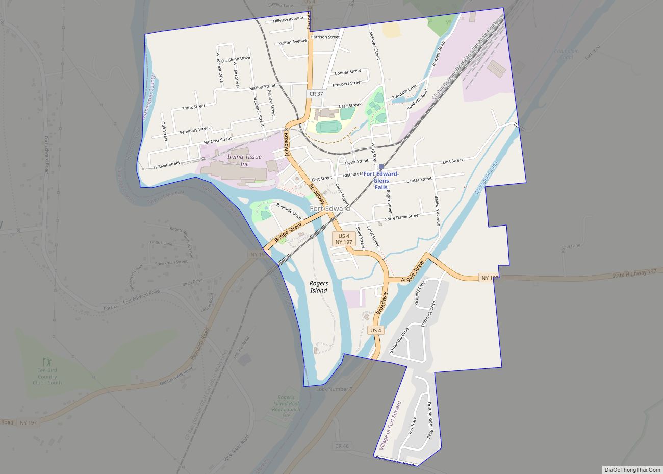
Fort Edward is a village in Washington County, New York, United States. It is part of the Glens Falls Metropolitan Statistical Area. The village population was 3,375 at the 2010 census. The name is derived from the younger brother of King George III, Edward Augustus, Duke of York and Albany.
The village is part of the town of Fort Edward, which contains the county seat of Washington County just north of the village limits.
| Name: | Fort Edward village |
|---|---|
| LSAD Code: | 47 |
| LSAD Description: | village (suffix) |
| State: | New York |
| County: | Washington County |
| Elevation: | 138 ft (42 m) |
| Total Area: | 1.91 sq mi (4.96 km²) |
| Land Area: | 1.76 sq mi (4.56 km²) |
| Water Area: | 0.15 sq mi (0.39 km²) |
| Total Population: | 3,108 |
| Population Density: | 1,763.90/sq mi (681.14/km²) |
| ZIP code: | 12828 |
| Area code: | 518 |
| FIPS code: | 3626770 |
| GNISfeature ID: | 0950467 |
| Website: | villageoffortedward.com//index.asp |
Online Interactive Map
Click on ![]() to view map in "full screen" mode.
to view map in "full screen" mode.
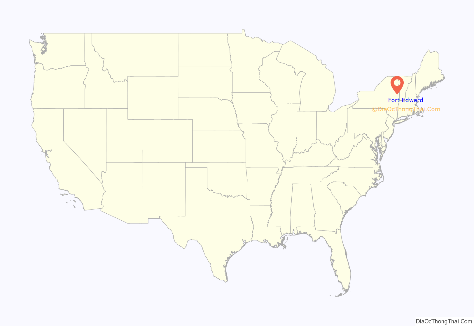
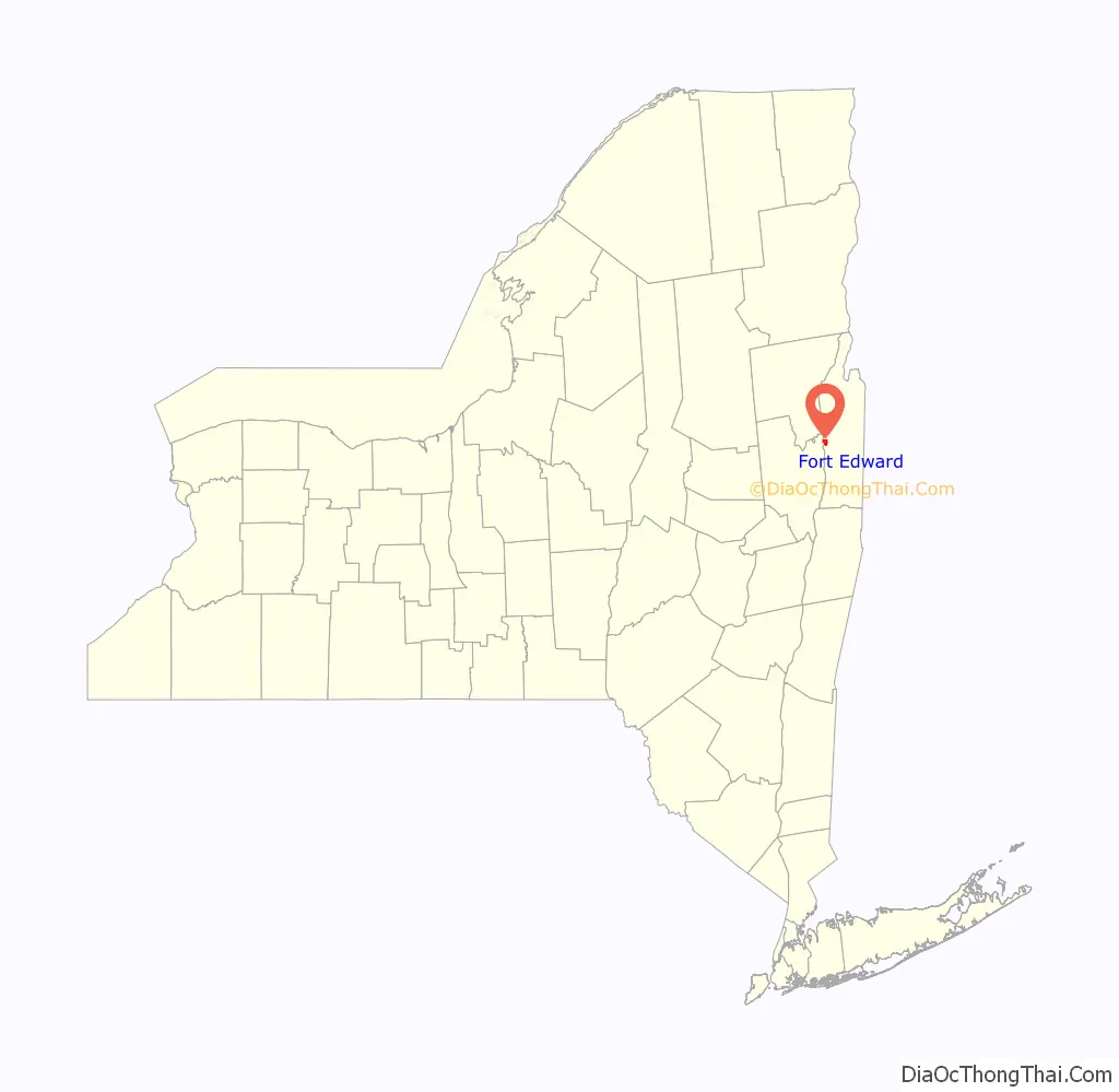
Fort Edward location map. Where is Fort Edward village?
History
Early history
Fort Edward, or “The Fort”, has been strategically important during its long and illustrious history, for it commands the Hudson River and Champlain River valleys. The Hudson River at this point north is no longer a navigable waterway because of waterfalls and rapids. Historically, travelers through this area would leave the Hudson at Fort Edward and carry their canoes overland to Lake George. The Indians called the area around Fort Edward Wahcoloosencoochaleva, which means “The Great Carrying Place.” Fort Edward’s location was the most northerly point on the Hudson River for the early Dutch, and was near the boundary between the Province of New York and New France.
As early as 1709 during Queen Anne’s War, a stockade (Fort Nicholson) was erected in the area due to its strategic importance. Fort Nicholson was garrisoned by 450 men, including seven companies of “regulars in scarlet uniform from old England.” A crude stockade was built to protect storehouses and log huts. It was later abandoned and then re-constructed in 1731 as Fort Lydius, the trading post of John Lydius, a fur trader from Albany. In 1755, the fortification was reconstructed as Fort Lyman during the French and Indian War in 1755; however, Sir William Johnson that same year renamed it Fort Edward. Also at this time, a large military complex was constructed on nearby Roger’s Island. Today this site is listed on the National Register of Historic Places (NRHP). Another smaller fort was constructed on the opposite shore of the Hudson River.
During the American Revolution, the area was taken by British forces under John Burgoyne in 1777.
Post Colonial history
The completion of the Champlain Canal, in 1823, linked the areas to the north and south, and replaced a smaller canal that bypassed local rapids.
The village of Fort Edward incorporated in 1849, setting itself off from the town of Fort Edward.
The Old Fort House Museum
The Old Fort House Museum Campus on Lower Broadway in the village is home to the Fort Edward Historical Association. It houses:
- The Old Fort House, built in 1772 from timbers salvaged from the abandoned Fort Edward,
- An 1840s Plank Road Tollhouse,
- The 1853 law office of a Washington County Judge who practiced law in Fort Edward,
- The one-room Riverside Schoolhouse,
- The Cronkhite Pavilion, which features Native American, military, and historic displays regarding the Fort Edward area, and
- The Fort Edward Water Works Barn, which houses exhibits on early transportation and farming.
Fort Edward Road Map
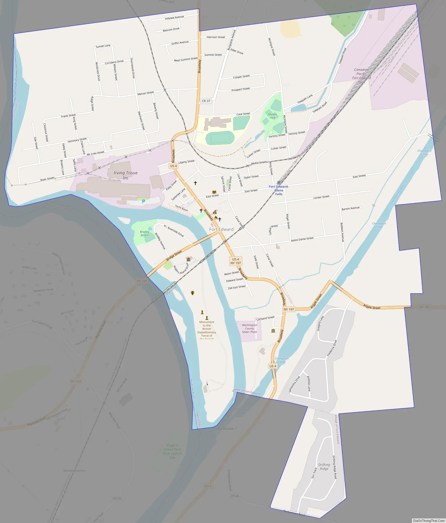
Fort Edward city Satellite Map
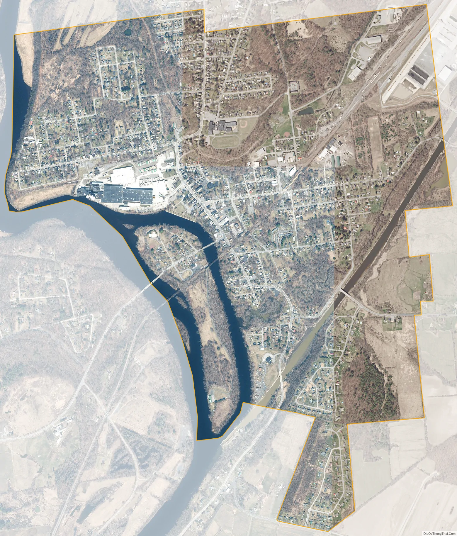
Geography
According to the United States Census Bureau, the village has a total area of 1.9 square miles (5.0 km), of which 1.8 square miles (4.6 km) is land and 0.1 square mile (0.4 km) (7.25%) is water.
New York Route 197 joins U.S. Route 4 at Fort Edward, and the Champlain Canal joins the Hudson River south of the village.
Fort Edward is on the opposite shore of the Hudson River from the town of Moreau in Saratoga County.
See also
Map of New York State and its subdivision:- Albany
- Allegany
- Bronx
- Broome
- Cattaraugus
- Cayuga
- Chautauqua
- Chemung
- Chenango
- Clinton
- Columbia
- Cortland
- Delaware
- Dutchess
- Erie
- Essex
- Franklin
- Fulton
- Genesee
- Greene
- Hamilton
- Herkimer
- Jefferson
- Kings
- Lake Ontario
- Lewis
- Livingston
- Madison
- Monroe
- Montgomery
- Nassau
- New York
- Niagara
- Oneida
- Onondaga
- Ontario
- Orange
- Orleans
- Oswego
- Otsego
- Putnam
- Queens
- Rensselaer
- Richmond
- Rockland
- Saint Lawrence
- Saratoga
- Schenectady
- Schoharie
- Schuyler
- Seneca
- Steuben
- Suffolk
- Sullivan
- Tioga
- Tompkins
- Ulster
- Warren
- Washington
- Wayne
- Westchester
- Wyoming
- Yates
- Alabama
- Alaska
- Arizona
- Arkansas
- California
- Colorado
- Connecticut
- Delaware
- District of Columbia
- Florida
- Georgia
- Hawaii
- Idaho
- Illinois
- Indiana
- Iowa
- Kansas
- Kentucky
- Louisiana
- Maine
- Maryland
- Massachusetts
- Michigan
- Minnesota
- Mississippi
- Missouri
- Montana
- Nebraska
- Nevada
- New Hampshire
- New Jersey
- New Mexico
- New York
- North Carolina
- North Dakota
- Ohio
- Oklahoma
- Oregon
- Pennsylvania
- Rhode Island
- South Carolina
- South Dakota
- Tennessee
- Texas
- Utah
- Vermont
- Virginia
- Washington
- West Virginia
- Wisconsin
- Wyoming