Freeport is a village in the town of Hempstead, in Nassau County, on the South Shore of Long Island, in New York state. The population was 43,713 at the 2010 census, making it the second largest village in New York by population.
A settlement since the 1640s, it was once an oystering community and later a resort popular with the New York City theater community. It is now primarily a bedroom suburb but retains a modest commercial waterfront and some light industry.
| Name: | Freeport village |
|---|---|
| LSAD Code: | 47 |
| LSAD Description: | village (suffix) |
| State: | New York |
| County: | Nassau County |
| Incorporated: | 1892 |
| Elevation: | 20 ft (6 m) |
| Total Area: | 4.87 sq mi (12.61 km²) |
| Land Area: | 4.58 sq mi (11.86 km²) |
| Water Area: | 0.29 sq mi (0.76 km²) |
| Total Population: | 44,472 |
| Population Density: | 9,714.29/sq mi (3,750.58/km²) |
| ZIP code: | 11520 |
| Area code: | 516 |
| FIPS code: | 3627485 |
| GNISfeature ID: | 2390852 |
| Website: | www.freeportny.com |
Online Interactive Map
Click on ![]() to view map in "full screen" mode.
to view map in "full screen" mode.
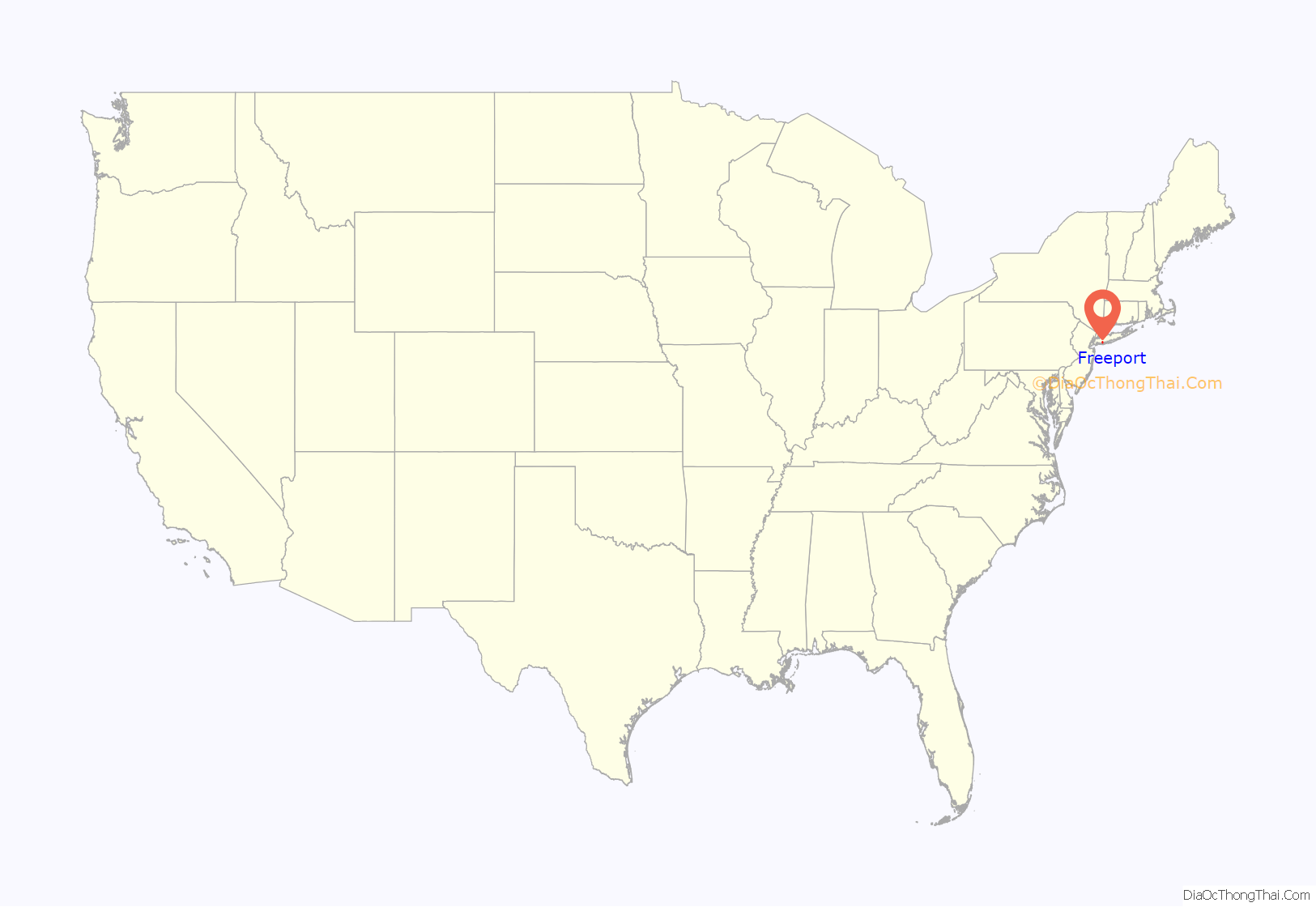
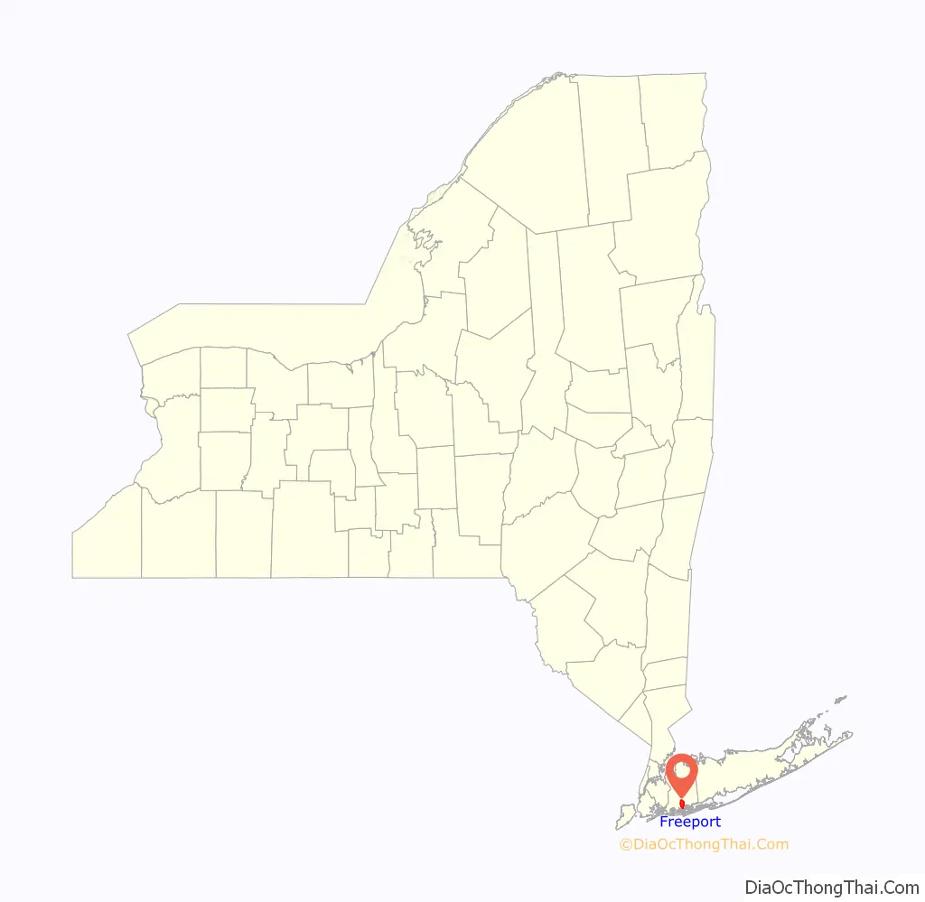
Freeport location map. Where is Freeport village?
History
Pre-colonial settlement
Before people of European ancestry came to the area, the land was part of the territory of the Meroke Indians. Written records of the community go back to the 1640s. The village now known as Freeport was part of an area called “the Great South Woods” during colonial times. In the mid-17th century, the area was renamed Raynor South, and ultimately Raynortown, after a herdsman named Edward Raynor, who had moved to the area from Hempstead in 1659, cleared land, and built a cabin.
19th century: development
In 1853, residents voted to rename the village Freeport, adopting a variant of a nickname used by ship captains during colonial times because they were not charged customs duties to land their cargo.
After the Civil War, Freeport became a center for commercial oystering. This trade began to decline as early as the beginning of the 20th century because of changing salinity and increased pollution in Great South Bay. Nonetheless, even as of the early 21st century Freeport and nearby Point Lookout have the largest concentration of commercial fishing activity anywhere near New York City.
From 1868, Freeport was served by the Southside Railroad, which was a major boon to development. The most prominent figure in this boom was developer John J. Randall; among his other contributions to the shape of Freeport today were several canals, including the Woodcleft Canal, one side of which is now the site of the “Nautical Mile”. Randall, who opposed all of Freeport’s being laid out in a grid, put up a Victorian house virtually overnight on a triangular plot at the corner of Lena Avenue and Wilson Place to spite the grid designers. The Freeport Spite House still is standing and occupied.
In January 1873, before Nassau County had split off from Queens, the Queens County treasurer set up an office at Freeport. The village residents voted to incorporate the village on October 18, 1892. At that time, it had a population of 1,821. In 1898, Freeport established a municipal electric utility, which still operates today, giving the village lower electricity rates than those in surrounding communities. It is one of two municipally owned electric systems in Nassau County; the other is in Rockville Centre. Public street lighting was begun in 1907, and a public fire alarm system was adopted in 1910.
1900–1939: expansion
In the years after incorporation, Freeport was a tourist and sportsman’s destination for its boating and fishing.
From 1902 into the late 1920s, the New York and Long Island Traction Corporation ran trolleys through Freeport to Jamaica, Hempstead, and Brooklyn. These trolleys went down Main Street in Freeport, connecting to a ferry at Scott’s Hotel near Ray Street. In later years these ferries departed from Ellison’s dock on Little Swift Creek, served by separate trolleys operated by the Great South Bay Ferry Company. The ferries took people to Point Lookout, about three miles (5 km) south of Freeport, where there is an ocean beach. For a few years after 1913, the short-lived Freeport Railroad Company ran a trolley nicknamed “the Fishermen’s Delight” along Grove Street (now Guy Lombardo Avenue) from Sunrise Highway to the waterfront. Also in this era, in 1910 Arthur and Albert Heinrich flew the first American-made, American-powered monoplane, built in their Merrick Road airplane factory (see also Heinrich Pursuit). WGBB, founded in 1924, became Long Island’s first 24-hour radio station.
In the late 19th century, Freeport was the summer resort of wealthy politicians, publishers, and so forth. At the time, travel from Freeport to New York City required a journey of several hours on a coal-powered train, or an even more arduous automobile trip on the single-lane Merrick Road.
According to Elinor Smith, the arrival of Diamond Jim Brady and Lillian Russell around the start of the 20th century marked the beginning of what by 1914 would become an unofficial theatrical artists’ colony, especially of vaudeville performers. Freeport’s population was largest in the summer season, during which most of the theaters of the time were closed and performers left for cooler climes. Some had year-round family homes in Freeport. Leo Carrillo and Victor Moore were early arrivals, later joined by Fannie Brice, Trixie Friganza, Sophie Tucker, Harry Ruby, Fred Stone, Helen Broderick, Moran and Mack, Will Rogers, Bert Kalmar, Richard Whiting, Harry von Tilzer, Rae Samuels, Belle Baker, Grace Hayes, Pat Rooney, Duffy and Sweeney, the Four Mortons, McKay and Ardine, and Eva Tanguay. Buster Keaton, W. C. Fields, and many other theatrical performers who did not own homes there were also frequent visitors.
Several of Freeport’s actors gathered together as the Long Island Good Hearted Thespian Society (LIGHTS), with a clubhouse facing onto Great South Bay. LIGHTS presented summer shows in Freeport from the mid-1910s to the mid-1920s. LIGHTS also sponsored a summertime “Christmas Parade”, featuring clowns, acrobats, and once even some borrowed elephants. It was held at this unlikely time of year because the theater people were all working during the real Christmas season. A Coney Island–style amusement park called Playland Park thrived from the early 1920s until the early 1930s but was destroyed by a fire on June 28, 1931.
With the resurgence of the Ku Klux Klan on Long Island in the 1920s many villages in Nassau and Suffolk counties were the focal point of Klan activity. According to a story in Newsday detailing the history of Long Island,
1940–present: recent history
By 1937, Freeport’s population exceeded 20,000, and it was the largest village in Nassau County. After World War II the village became a bedroom community for New York City. The separation between the two eras was marked by a fire that destroyed the Shorecrest Hotel (originally the Crystal Lake Hotel) on January 14, 1958. During the 1950s local merchants resisted building any shopping malls in the village and subsequently suffered a great loss of business when large malls were built in communities in the central part of Long Island.
The landscape of Freeport underwent further change with a significant increase in apartment building construction. When such buildings went up in just two years in the early 1960s, the Village passed a moratorium on multi-unit residential construction.
While never a major boatbuilding center, Freeport can boast some notable figures in that field. Fred and Mirto Scopinich operated their boatyard in Freeport from just after World War I until they moved it to East Quogue in the late 1960s. Their Freeport Point Shipyard built boats for the United States Coast Guard, but also for Prohibition-era rumrunners. From 1937 to 1945 the shipyard built small boats for the United States Navy and British Royal Navy. The marina and dealership operated by Al Grover in 1950 remains in Freeport and in his family. Grover’s company built fishing skiffs from the 1970s until about 1990. One of these, a 26-footer, carried Grover and his sons from Nova Scotia to Portugal in 1985, the first-ever crossing of the Atlantic Ocean by a boat powered by an outboard motor. Columbian Bronze operated in Freeport from its 1901 founding until it closed shop in 1988. Among this company’s achievements was the propeller for the USS Nautilus, an operational nuclear-powered submarine and the first vessel to complete a submerged transit across the North Pole.
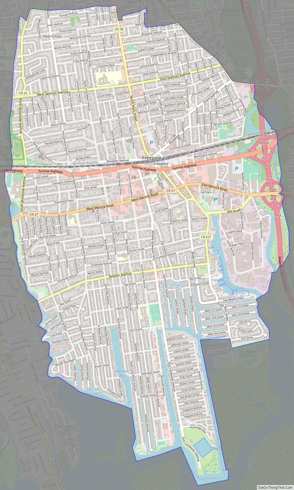
Freeport Road Map
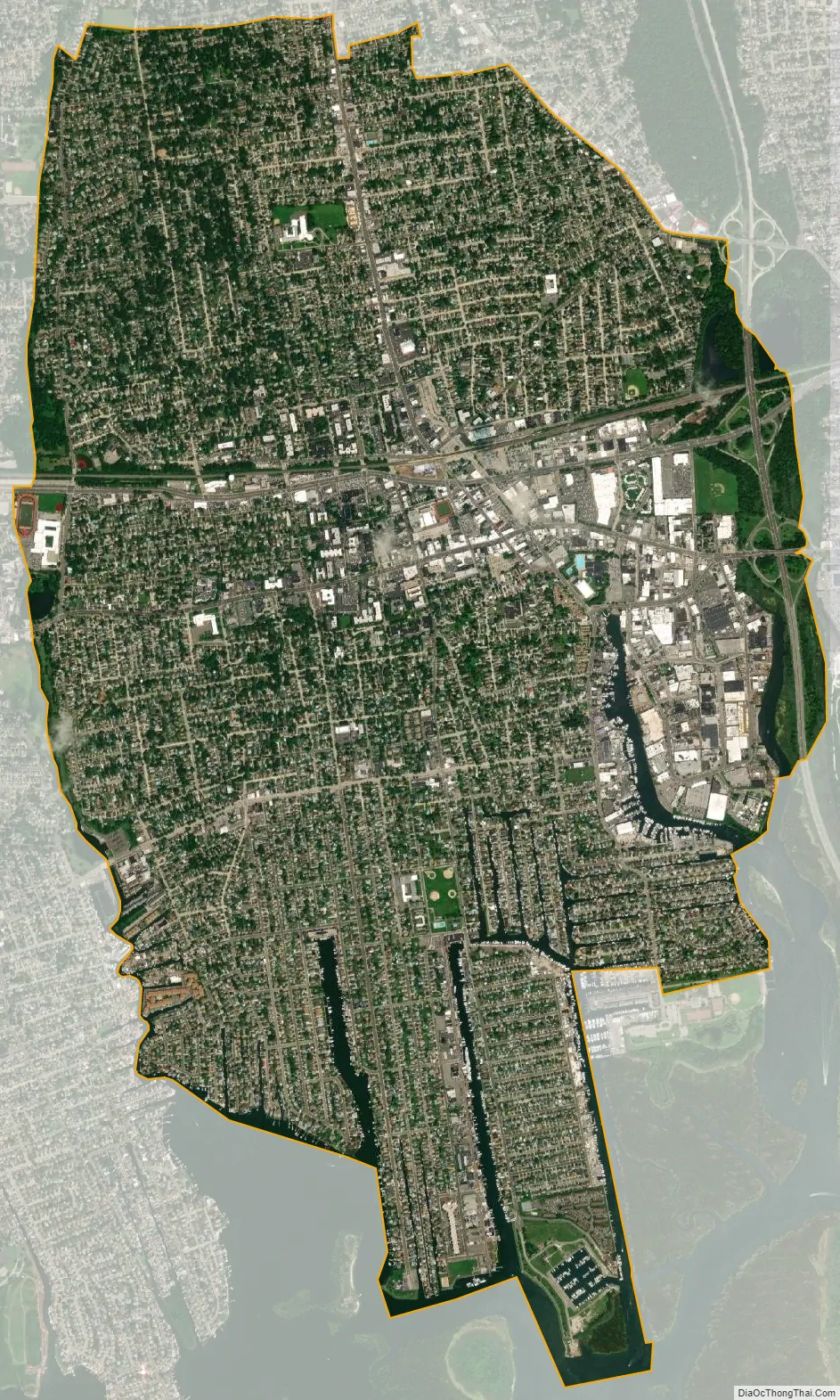
Freeport city Satellite Map
Geography
According to the United States Census Bureau, the village has a total area of 4.6 square miles (12 km).
The village is bisected by east–west New York State Route 27 (Sunrise Highway). The Meadowbrook State Parkway defines its eastern boundary.
The south part of the village is penetrated by several canals that allow access to the Atlantic Ocean by means of passage through salt marshes. The oldest canal is the late 19th-century Woodcleft Canal. Freeport has extensive small-boat facilities and a resident fishing fleet, as well as charter and open water fishing boats.
See also
Map of New York State and its subdivision:- Albany
- Allegany
- Bronx
- Broome
- Cattaraugus
- Cayuga
- Chautauqua
- Chemung
- Chenango
- Clinton
- Columbia
- Cortland
- Delaware
- Dutchess
- Erie
- Essex
- Franklin
- Fulton
- Genesee
- Greene
- Hamilton
- Herkimer
- Jefferson
- Kings
- Lake Ontario
- Lewis
- Livingston
- Madison
- Monroe
- Montgomery
- Nassau
- New York
- Niagara
- Oneida
- Onondaga
- Ontario
- Orange
- Orleans
- Oswego
- Otsego
- Putnam
- Queens
- Rensselaer
- Richmond
- Rockland
- Saint Lawrence
- Saratoga
- Schenectady
- Schoharie
- Schuyler
- Seneca
- Steuben
- Suffolk
- Sullivan
- Tioga
- Tompkins
- Ulster
- Warren
- Washington
- Wayne
- Westchester
- Wyoming
- Yates
- Alabama
- Alaska
- Arizona
- Arkansas
- California
- Colorado
- Connecticut
- Delaware
- District of Columbia
- Florida
- Georgia
- Hawaii
- Idaho
- Illinois
- Indiana
- Iowa
- Kansas
- Kentucky
- Louisiana
- Maine
- Maryland
- Massachusetts
- Michigan
- Minnesota
- Mississippi
- Missouri
- Montana
- Nebraska
- Nevada
- New Hampshire
- New Jersey
- New Mexico
- New York
- North Carolina
- North Dakota
- Ohio
- Oklahoma
- Oregon
- Pennsylvania
- Rhode Island
- South Carolina
- South Dakota
- Tennessee
- Texas
- Utah
- Vermont
- Virginia
- Washington
- West Virginia
- Wisconsin
- Wyoming


