Glasco is a hamlet (and census-designated place) in Ulster County, New York, United States. The population was 2,013 at the 2020 census.
Glasco is a community in the Town of Saugerties east of U.S. Route 9W. The community is north of Kingston.
| Name: | Glasco CDP |
|---|---|
| LSAD Code: | 57 |
| LSAD Description: | CDP (suffix) |
| State: | New York |
| County: | Ulster County |
| Elevation: | 151 ft (46 m) |
| Total Area: | 2.29 sq mi (5.92 km²) |
| Land Area: | 1.62 sq mi (4.19 km²) |
| Water Area: | 0.67 sq mi (1.74 km²) |
| Total Population: | 2,013 |
| Population Density: | 1,245.67/sq mi (480.82/km²) |
| ZIP code: | 12432 |
| Area code: | 845 |
| FIPS code: | 3629014 |
| GNISfeature ID: | 0951155 |
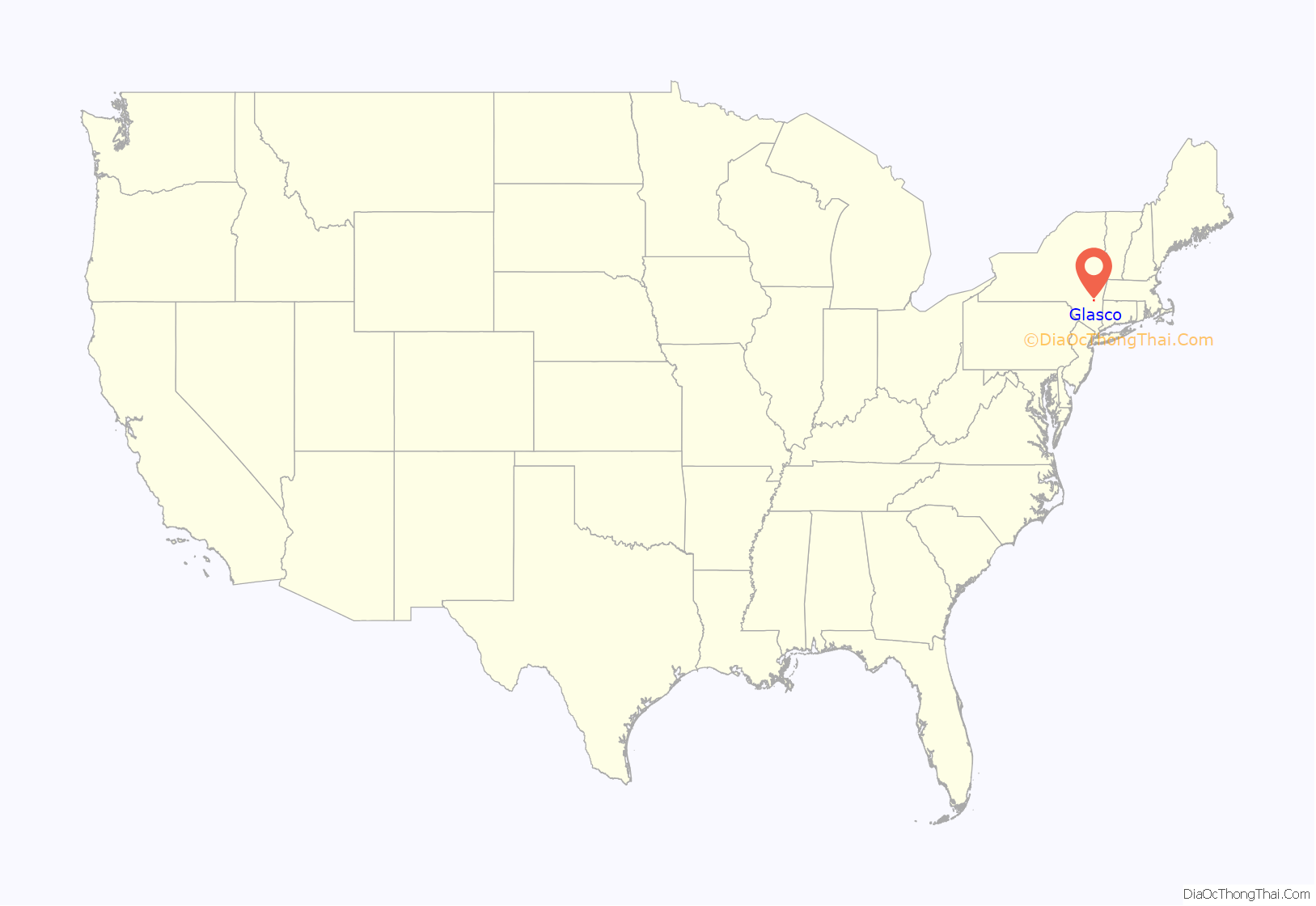
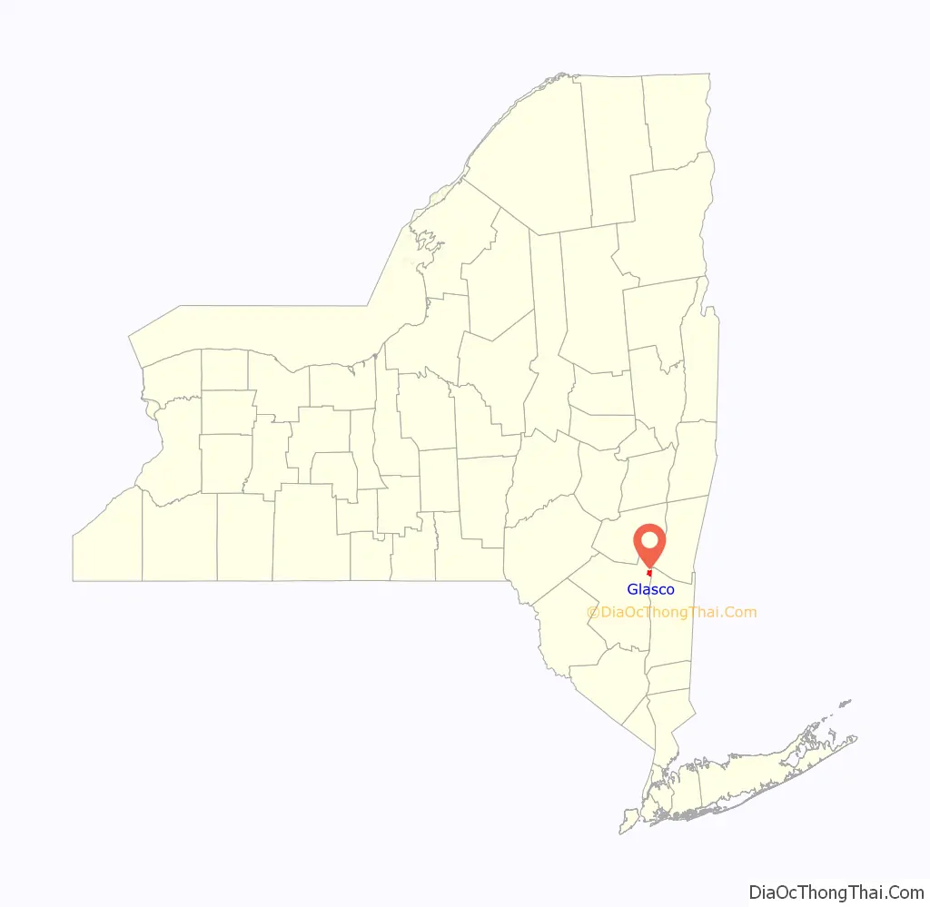
Online Interactive Map
Click on ![]() to view map in "full screen" mode.
to view map in "full screen" mode.
Glasco location map. Where is Glasco CDP?
History
Glasco’s name was taken from a glass company located in the mountain area several miles inland. The glass was carried by horse down the “Glasco Turnpike” to the banks of the Hudson where it was shipped on for ports of sale. The settlement along the river where the glass was loaded became known as Glasco.
Settled largely by unskilled workers, first from Ireland and then from Italy, they came to the area in great numbers in the late 19th century by ferry after landing in New York City. They tended to live in company housing on the banks of the river. At one point, the town boasted over six brick factories, a ferry service, a school, churches and several saloons. Bricks were sent down the Hudson River by barge to furnish the construction of America’s cities. The Hudson River also played a role in other economic activities. Some entrepreneurial immigrants opened small businesses to service the community, such as harvesting ice from the Hudson River, which was stored in large ice houses along the banks of the river and sold in the summers to homes and businesses. Fishing was also a cottage industry among those not working in the brickyards. In the bluffs above the clay mining operations of the brickyards, small estates and dairy farms were established.
By the mid 20th century, the brick yards had all closed down. One family operator, Washburn, allegedly relocated to Virginia to continue brick making. Other brickyards were abandoned and simply vanished into the undergrown of trees and wildlife.
Recently, residents of New York City have begun to purchase weekend homes within the boundaries of Glasco. At the foot of the Catskill Mountains, and within walking distance of the Hudson River (relatively unpolluted at that point), the hamlet has seen real estate prices skyrocket since 2000, along with an increase in single-family home construction.
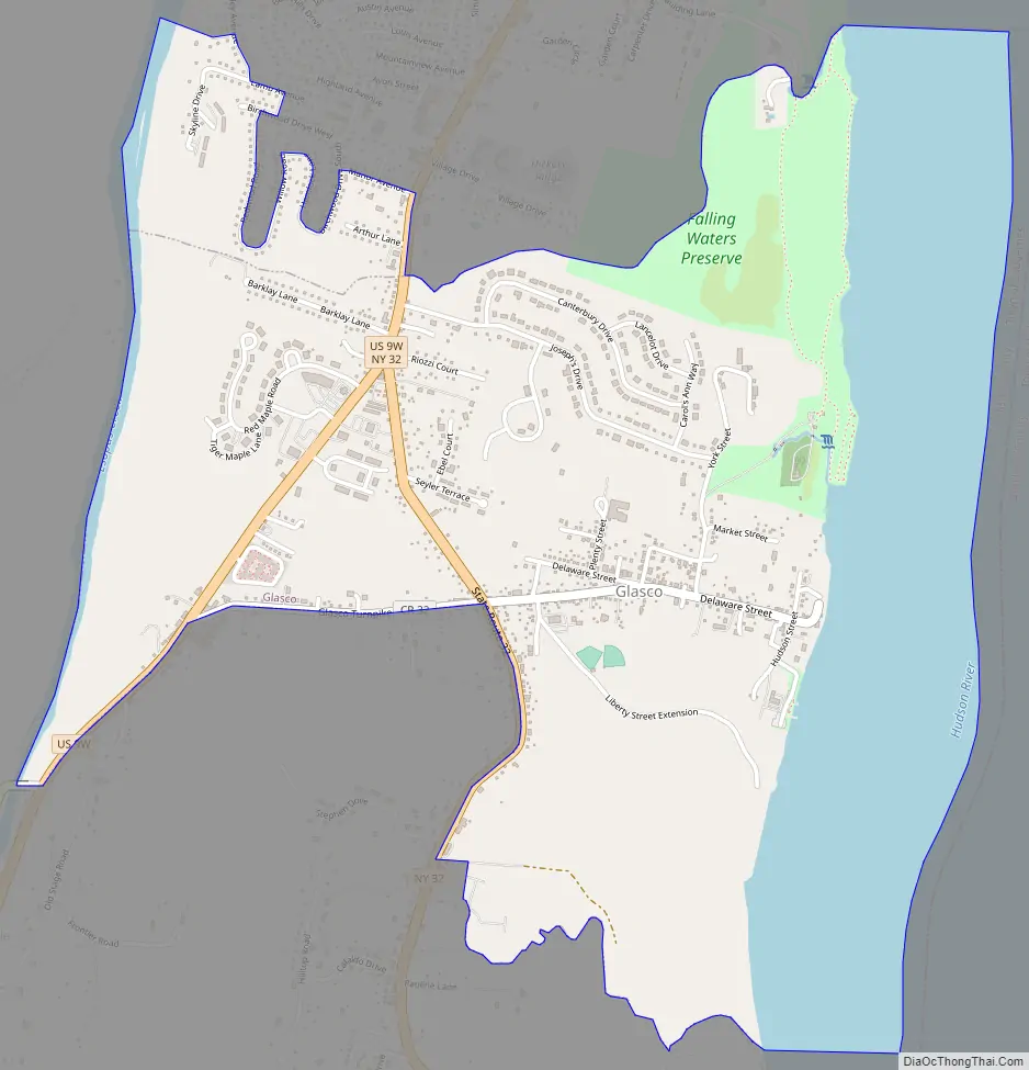
Glasco Road Map
Glasco city Satellite Map
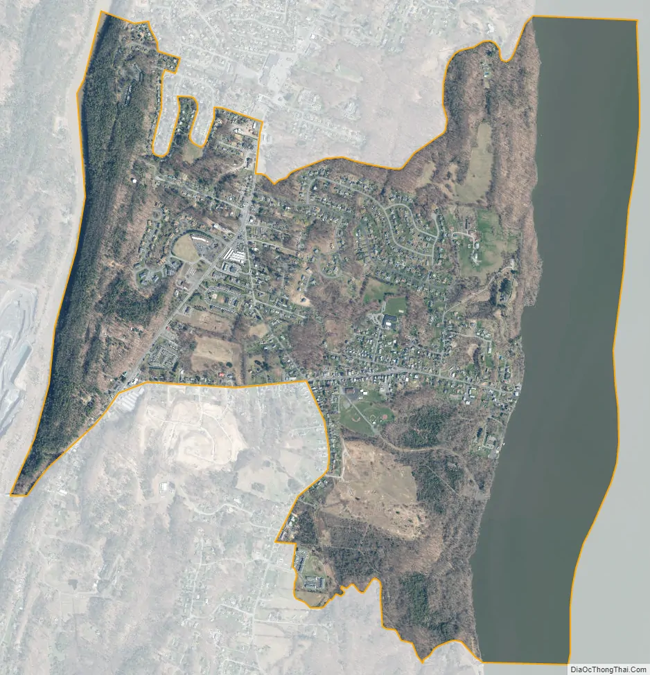
Geography
Glasco is located at 42°2′51″N 73°57′10″W / 42.04750°N 73.95278°W / 42.04750; -73.95278 (42.047539, -73.952860).
According to the United States Census Bureau, the CDP has a total area of 2.6 square miles (6.7 km), of which, 1.9 square miles (4.9 km) of it is land and 0.8 square miles (2.1 km) of it (29.92%) is water.
Glasco is on the west bank of the Hudson River.
See also
Map of New York State and its subdivision:- Albany
- Allegany
- Bronx
- Broome
- Cattaraugus
- Cayuga
- Chautauqua
- Chemung
- Chenango
- Clinton
- Columbia
- Cortland
- Delaware
- Dutchess
- Erie
- Essex
- Franklin
- Fulton
- Genesee
- Greene
- Hamilton
- Herkimer
- Jefferson
- Kings
- Lake Ontario
- Lewis
- Livingston
- Madison
- Monroe
- Montgomery
- Nassau
- New York
- Niagara
- Oneida
- Onondaga
- Ontario
- Orange
- Orleans
- Oswego
- Otsego
- Putnam
- Queens
- Rensselaer
- Richmond
- Rockland
- Saint Lawrence
- Saratoga
- Schenectady
- Schoharie
- Schuyler
- Seneca
- Steuben
- Suffolk
- Sullivan
- Tioga
- Tompkins
- Ulster
- Warren
- Washington
- Wayne
- Westchester
- Wyoming
- Yates
- Alabama
- Alaska
- Arizona
- Arkansas
- California
- Colorado
- Connecticut
- Delaware
- District of Columbia
- Florida
- Georgia
- Hawaii
- Idaho
- Illinois
- Indiana
- Iowa
- Kansas
- Kentucky
- Louisiana
- Maine
- Maryland
- Massachusetts
- Michigan
- Minnesota
- Mississippi
- Missouri
- Montana
- Nebraska
- Nevada
- New Hampshire
- New Jersey
- New Mexico
- New York
- North Carolina
- North Dakota
- Ohio
- Oklahoma
- Oregon
- Pennsylvania
- Rhode Island
- South Carolina
- South Dakota
- Tennessee
- Texas
- Utah
- Vermont
- Virginia
- Washington
- West Virginia
- Wisconsin
- Wyoming


