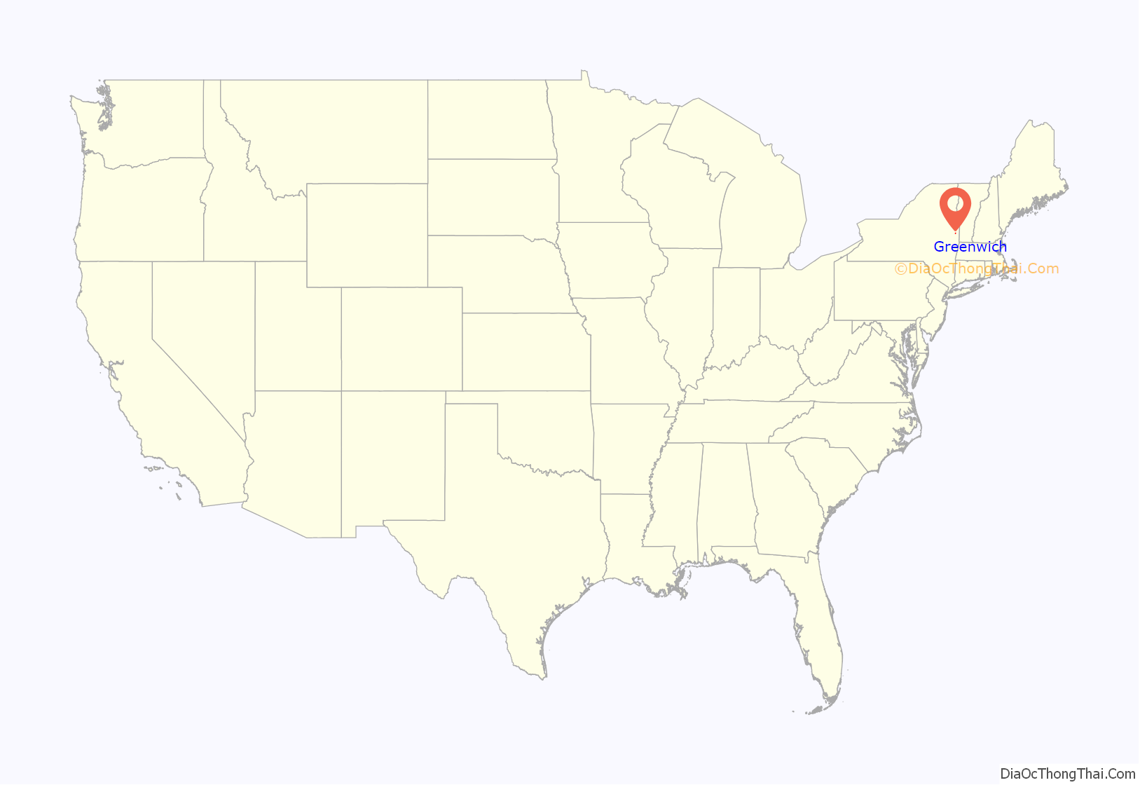
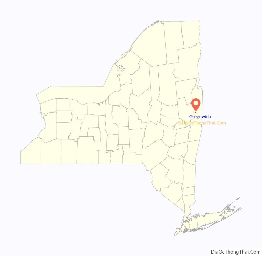
Formerly known as Whipple City, Greenwich (/ˈɡriːnwɪtʃ/) is a village in Washington County, New York, United States. It is part of the Glens Falls Metropolitan Statistical Area. The village population was 1,777 at the 2010 census.
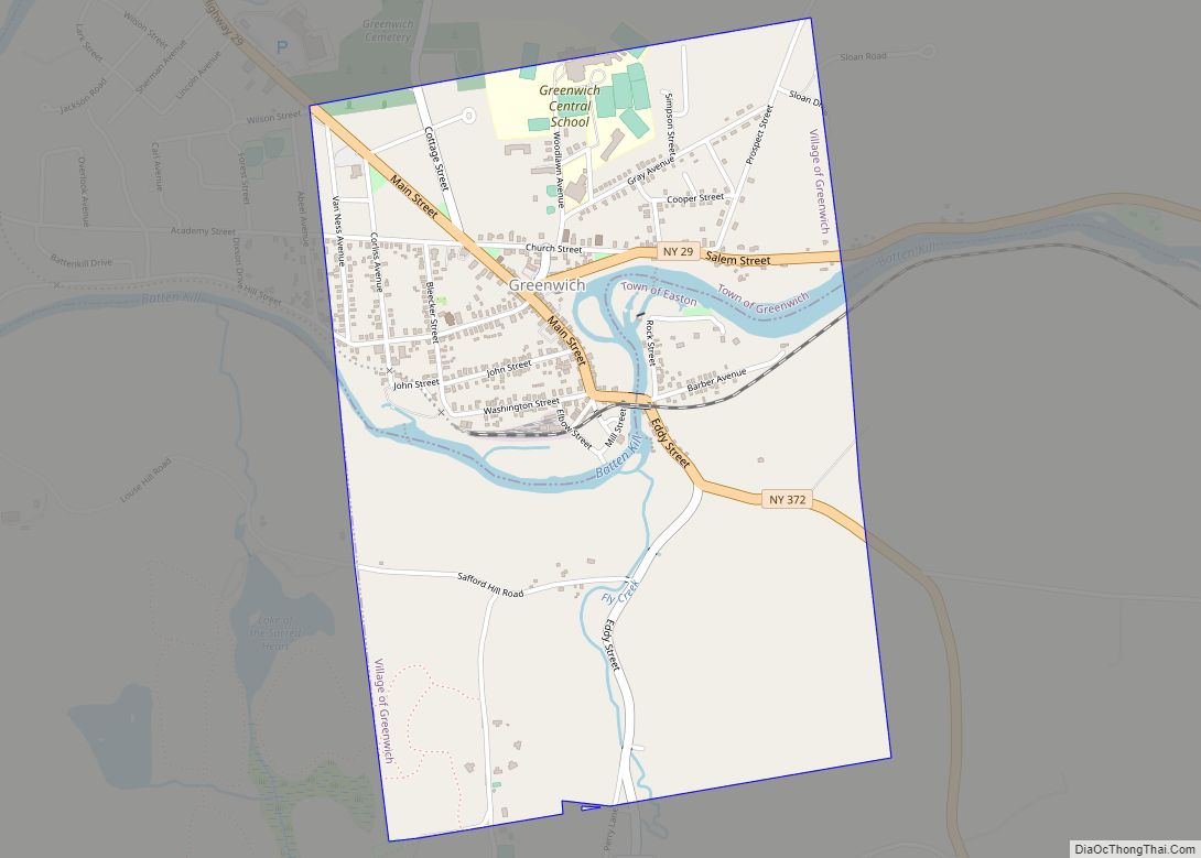
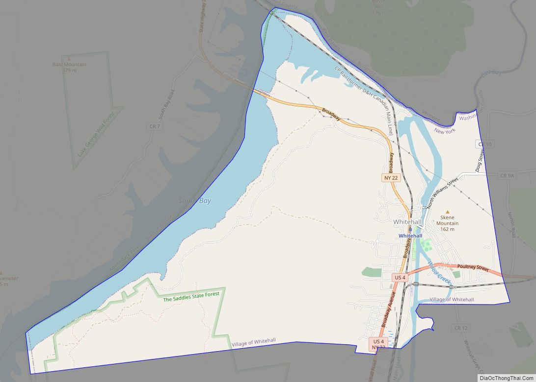
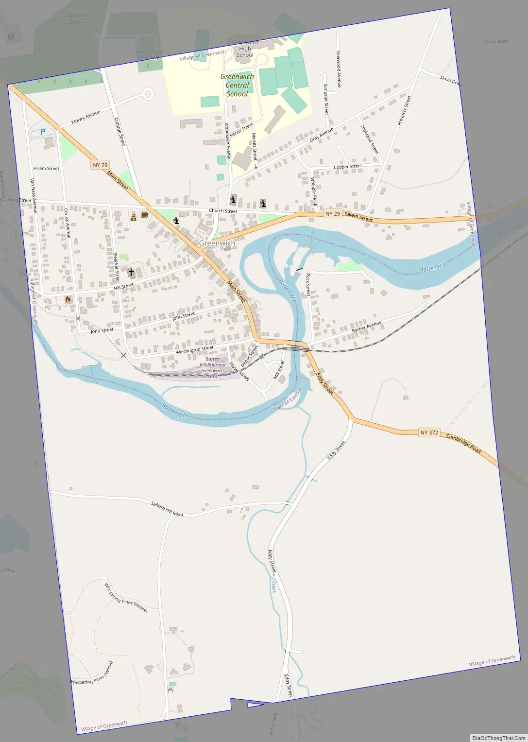
The Village of Greenwich is located at the southern town line of the Town of Greenwich; a small part of the village is in the Town of Easton. The village developed on both sides of the Battenkill River and is served by Route NY-29.
| Name: | Greenwich village |
|---|---|
| LSAD Code: | 47 |
| LSAD Description: | village (suffix) |
| State: | New York |
| County: | Washington County |
| Elevation: | 374 ft (114 m) |
| Total Area: | 1.47 sq mi (3.81 km²) |
| Land Area: | 1.47 sq mi (3.81 km²) |
| Water Area: | 0.00 sq mi (0.00 km²) |
| Total Population: | 1,651 |
| Population Density: | 1,123.13/sq mi (433.59/km²) |
| ZIP code: | 12834 |
| Area code: | 518 |
| FIPS code: | 3630675 |
| GNISfeature ID: | 0951780 |
| Website: | www.villageofgreenwich.org |
Online Interactive Map
Click on ![]() to view map in "full screen" mode.
to view map in "full screen" mode.
Greenwich location map. Where is Greenwich village?
History
This area was settled by European Americans after the American Revolutionary War, as migrants moved into New York from New England. The community was originally named Whipple City after Job Whipple, the owner of a successful cotton mill (1804). In 1809, the community set itself off from the town by incorporating as Union Village. Cotton and textile manufacturing, based on cotton from the Deep South, continued to be a profitable industry in the village for some time through the 19th century. It connected the villagers to the economy of King Cotton. In 1867, the village changed its name to Greenwich.
An important station of the Underground Railroad was located in Greenwich, and local people helped fugitive slaves reach freedom in upstate New York or Canada. A historical marker, containing a map showing locations of safe houses and commemorating Greenwich’s contribution to the Underground Railroad, was dedicated in 2004.
United States President Chester A. Arthur attended prep school in Greenwich while his father served here as pastor at Bottskill Baptist Church.
The Village of Greenwich Historic District was listed on the National Register of Historic Places in 1995.
Greenwich Road Map
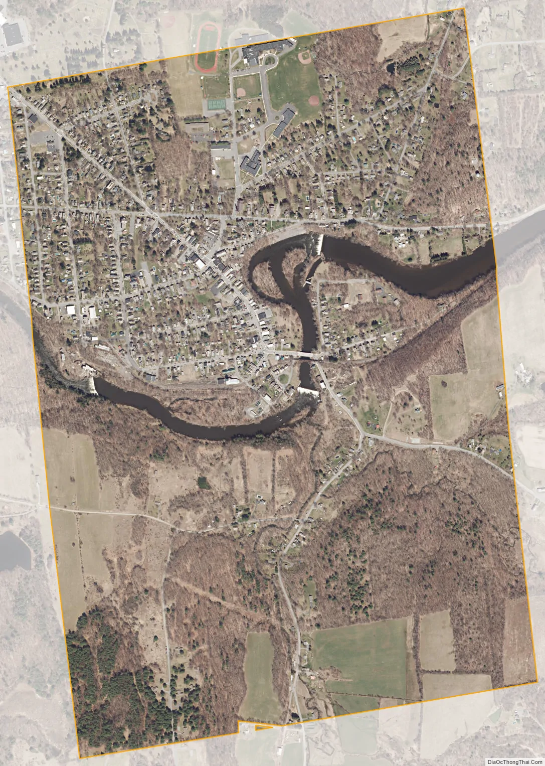
Greenwich city Satellite Map
Geography
According to the United States Census Bureau, the village has a total area of 1.485 square miles (3.85 km), all land.
The Batten Kill, a river in the southern part of the town, has historically provided power. It has attracted many settlements, besides Greenwich village, along its course.
New York Route 29 passes through the village from east to west. The northern terminus of New York Route 372 is in the village, where it joins NY-29.
See also
Map of New York State and its subdivision:- Albany
- Allegany
- Bronx
- Broome
- Cattaraugus
- Cayuga
- Chautauqua
- Chemung
- Chenango
- Clinton
- Columbia
- Cortland
- Delaware
- Dutchess
- Erie
- Essex
- Franklin
- Fulton
- Genesee
- Greene
- Hamilton
- Herkimer
- Jefferson
- Kings
- Lake Ontario
- Lewis
- Livingston
- Madison
- Monroe
- Montgomery
- Nassau
- New York
- Niagara
- Oneida
- Onondaga
- Ontario
- Orange
- Orleans
- Oswego
- Otsego
- Putnam
- Queens
- Rensselaer
- Richmond
- Rockland
- Saint Lawrence
- Saratoga
- Schenectady
- Schoharie
- Schuyler
- Seneca
- Steuben
- Suffolk
- Sullivan
- Tioga
- Tompkins
- Ulster
- Warren
- Washington
- Wayne
- Westchester
- Wyoming
- Yates
- Alabama
- Alaska
- Arizona
- Arkansas
- California
- Colorado
- Connecticut
- Delaware
- District of Columbia
- Florida
- Georgia
- Hawaii
- Idaho
- Illinois
- Indiana
- Iowa
- Kansas
- Kentucky
- Louisiana
- Maine
- Maryland
- Massachusetts
- Michigan
- Minnesota
- Mississippi
- Missouri
- Montana
- Nebraska
- Nevada
- New Hampshire
- New Jersey
- New Mexico
- New York
- North Carolina
- North Dakota
- Ohio
- Oklahoma
- Oregon
- Pennsylvania
- Rhode Island
- South Carolina
- South Dakota
- Tennessee
- Texas
- Utah
- Vermont
- Virginia
- Washington
- West Virginia
- Wisconsin
- Wyoming