Harris Hill is a hamlet and census-designated place (CDP) located in the town of Clarence in Erie County, New York, United States. The population was 5,508 at the 2010 census. It is part of the Buffalo–Niagara Falls Metropolitan Statistical Area. The region is named after Asa Harris, a former officer in the American Colonial Army, who established a tavern near the top of a low hill northeast of Buffalo.
| Name: | Harris Hill CDP |
|---|---|
| LSAD Code: | 57 |
| LSAD Description: | CDP (suffix) |
| State: | New York |
| County: | Erie County |
| Elevation: | 728 ft (222 m) |
| Total Area: | 4.04 sq mi (10.46 km²) |
| Land Area: | 4.04 sq mi (10.46 km²) |
| Water Area: | 0.00 sq mi (0.00 km²) |
| Total Population: | 5,839 |
| Population Density: | 1,445.30/sq mi (558.04/km²) |
| FIPS code: | 3632391 |
| GNISfeature ID: | 0952264 |
Online Interactive Map
Click on ![]() to view map in "full screen" mode.
to view map in "full screen" mode.
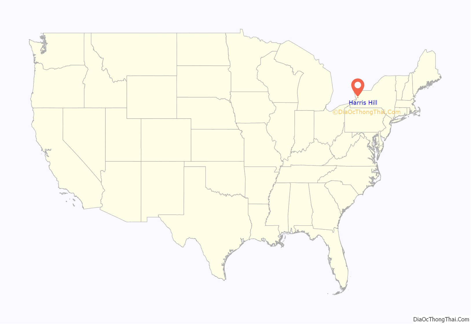
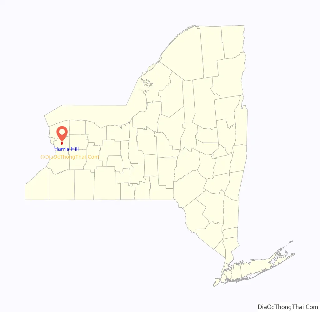
Harris Hill location map. Where is Harris Hill CDP?
History
Asa Harris’s Tavern was a stop on the Underground Railroad. Freed slaves would sneak under Main Street (present-day NY Route 5) through limestone caves and exit north at the bottom of the Onondaga Formation into a swampy forest. The tavern has since been re-purposed as the Home Town Cleaners. It has since been renamed Reed’s Laundry and Dry cleaning.
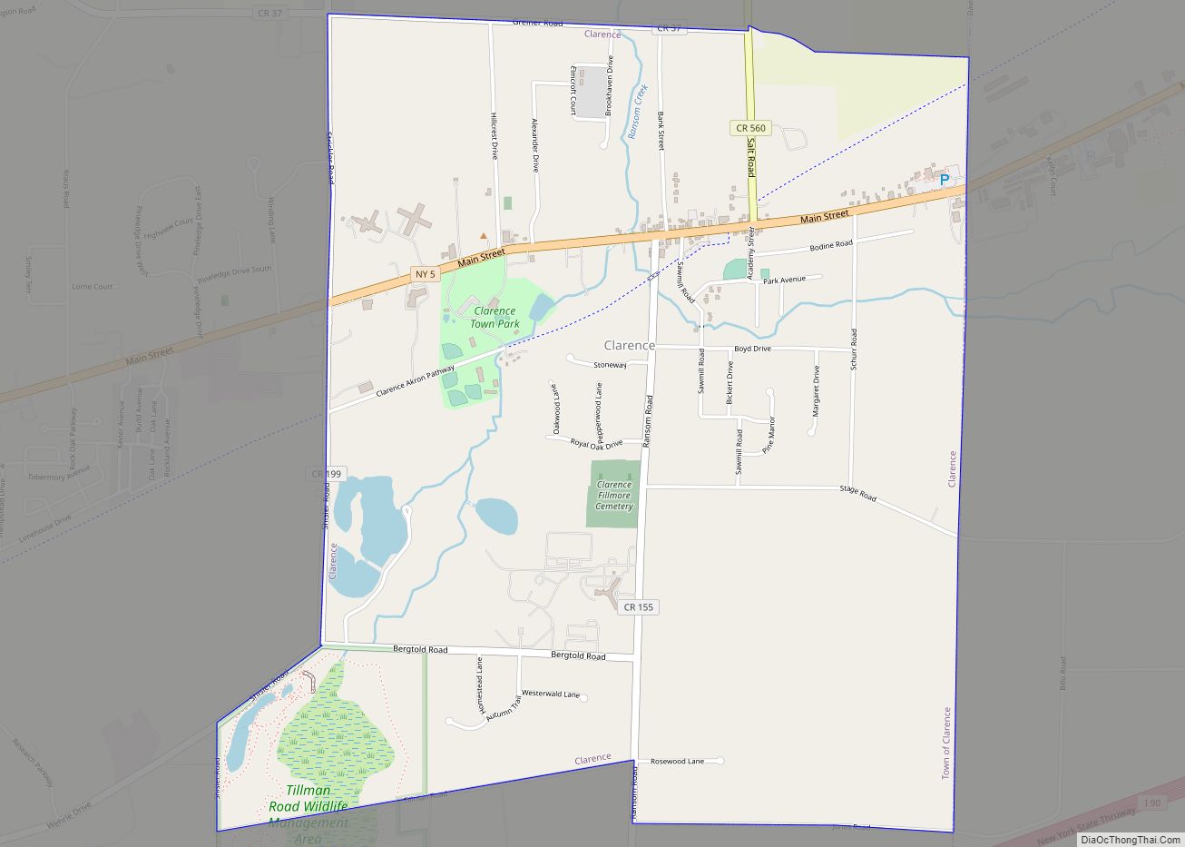
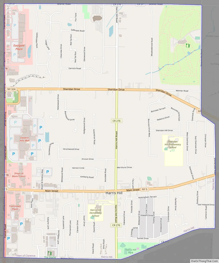
Harris Hill Road Map
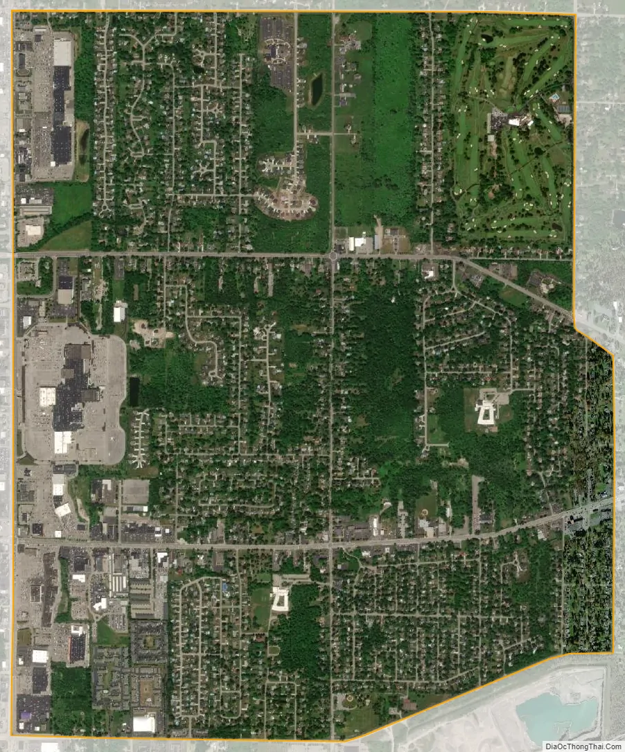
Harris Hill city Satellite Map
Geography
Harris Hill is located at 42°58′1″N 78°40′40″W / 42.96694°N 78.67778°W / 42.96694; -78.67778 (42.967058, -78.677828). Harris Hill’s ZIP code 14221 is shared with nearby Williamsville.
According to the United States Census Bureau, the CDP has a total area of 4.0 square miles (10 km), all land.
Harris Hill is located in the southwest corner of the town, just north of the northern Lancaster town line, and is centered on the intersection of Main Street (NY Route 5) and Harris Hill Road.
Just to the southeast of Harris Hill, is a large crushed stone quarry located in the town of Lancaster. The quarry plunges some 30 meters into the bedrock. The quarry, now owned by Buffalo Crushed Stone, was opened in 1904. Buffalo Crushed Stone is located on the south side of Wehrle Drive, just east of Harris Hill Road in Lancaster.
See also
Map of New York State and its subdivision:- Albany
- Allegany
- Bronx
- Broome
- Cattaraugus
- Cayuga
- Chautauqua
- Chemung
- Chenango
- Clinton
- Columbia
- Cortland
- Delaware
- Dutchess
- Erie
- Essex
- Franklin
- Fulton
- Genesee
- Greene
- Hamilton
- Herkimer
- Jefferson
- Kings
- Lake Ontario
- Lewis
- Livingston
- Madison
- Monroe
- Montgomery
- Nassau
- New York
- Niagara
- Oneida
- Onondaga
- Ontario
- Orange
- Orleans
- Oswego
- Otsego
- Putnam
- Queens
- Rensselaer
- Richmond
- Rockland
- Saint Lawrence
- Saratoga
- Schenectady
- Schoharie
- Schuyler
- Seneca
- Steuben
- Suffolk
- Sullivan
- Tioga
- Tompkins
- Ulster
- Warren
- Washington
- Wayne
- Westchester
- Wyoming
- Yates
- Alabama
- Alaska
- Arizona
- Arkansas
- California
- Colorado
- Connecticut
- Delaware
- District of Columbia
- Florida
- Georgia
- Hawaii
- Idaho
- Illinois
- Indiana
- Iowa
- Kansas
- Kentucky
- Louisiana
- Maine
- Maryland
- Massachusetts
- Michigan
- Minnesota
- Mississippi
- Missouri
- Montana
- Nebraska
- Nevada
- New Hampshire
- New Jersey
- New Mexico
- New York
- North Carolina
- North Dakota
- Ohio
- Oklahoma
- Oregon
- Pennsylvania
- Rhode Island
- South Carolina
- South Dakota
- Tennessee
- Texas
- Utah
- Vermont
- Virginia
- Washington
- West Virginia
- Wisconsin
- Wyoming