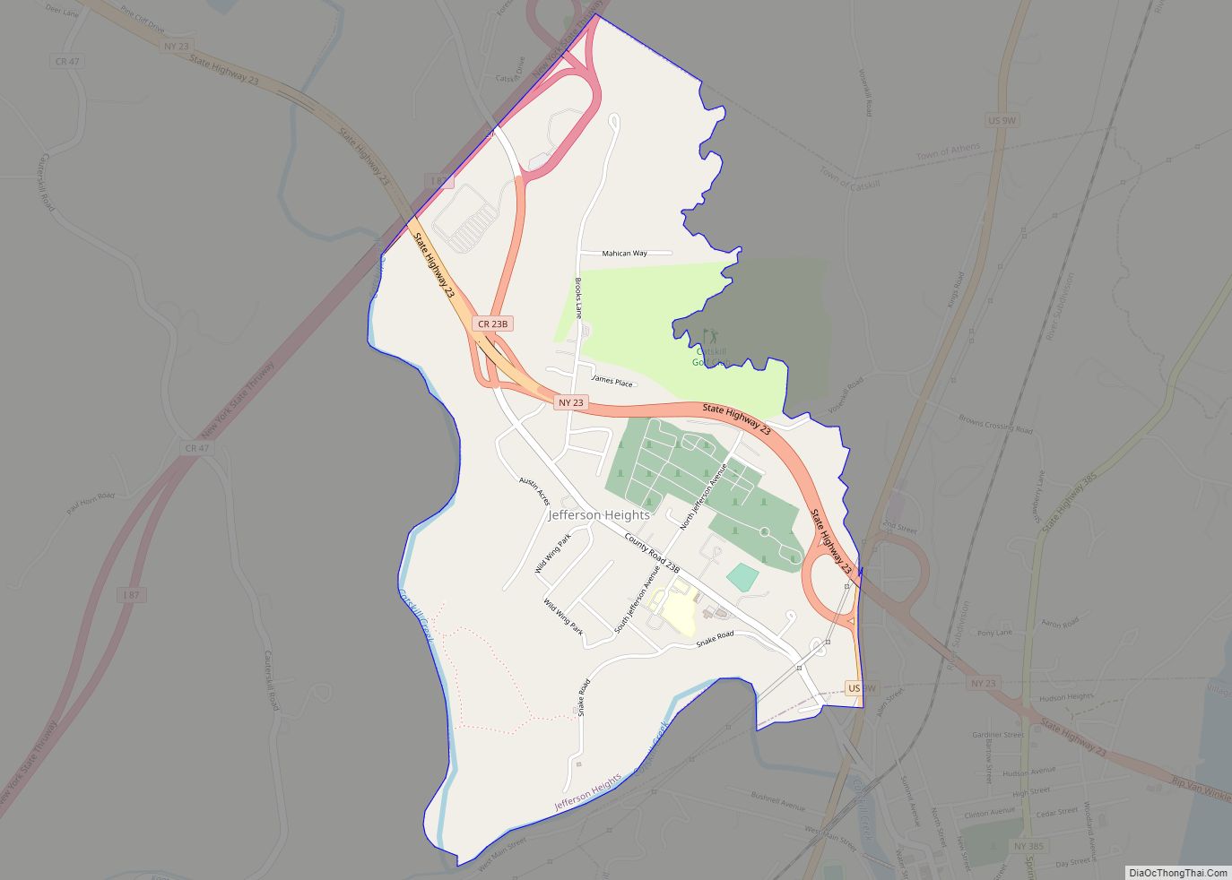
Jefferson Heights is a hamlet and census-designated place (CDP) in Greene County, New York, United States. The population was 1,122 at the 2020 census.
The community of Jefferson Heights is in the town of Catskill, northwest of the village of Catskill. The building that once housed the community hospital is now a medical arts facility.
| Name: | Jefferson Heights CDP |
|---|---|
| LSAD Code: | 57 |
| LSAD Description: | CDP (suffix) |
| State: | New York |
| County: | Greene County |
| Elevation: | 177 ft (54 m) |
| Total Area: | 1.50 sq mi (3.88 km²) |
| Land Area: | 1.48 sq mi (3.82 km²) |
| Water Area: | 0.02 sq mi (0.05 km²) |
| Total Population: | 1,122 |
| Population Density: | 760.68/sq mi (293.65/km²) |
| FIPS code: | 3638451 |
| GNISfeature ID: | 0953961 |
Online Interactive Map
Click on ![]() to view map in "full screen" mode.
to view map in "full screen" mode.
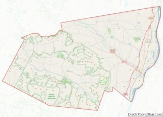
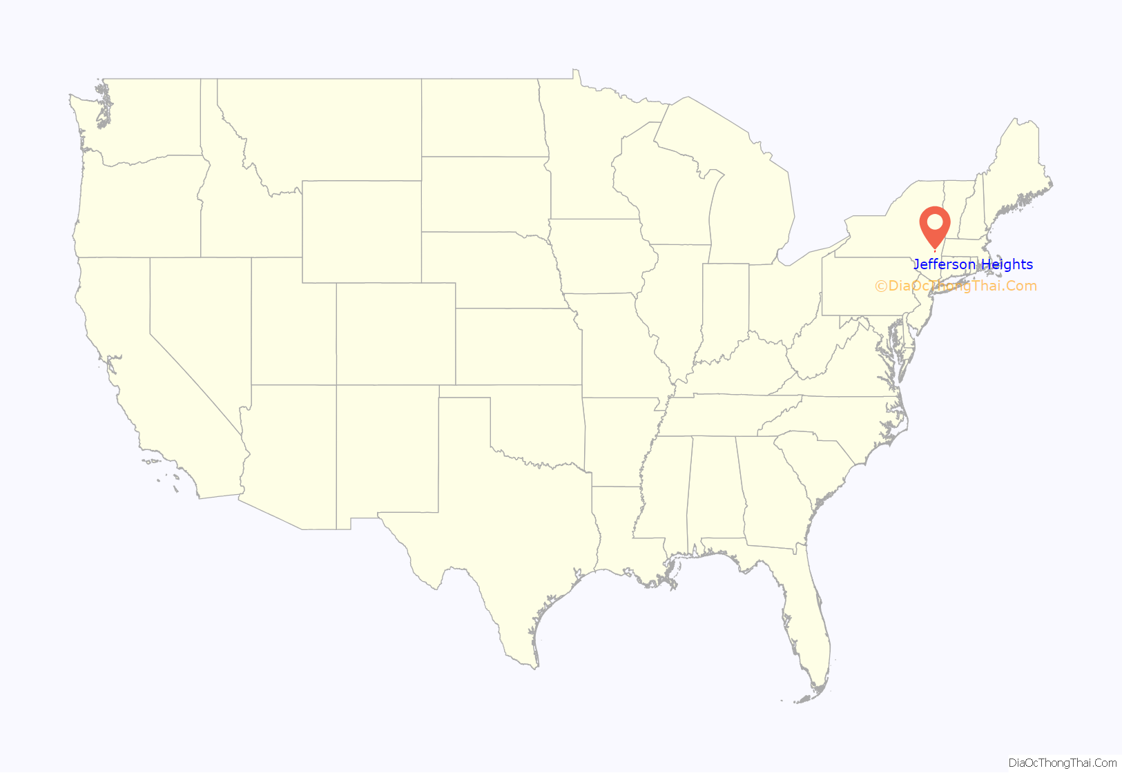
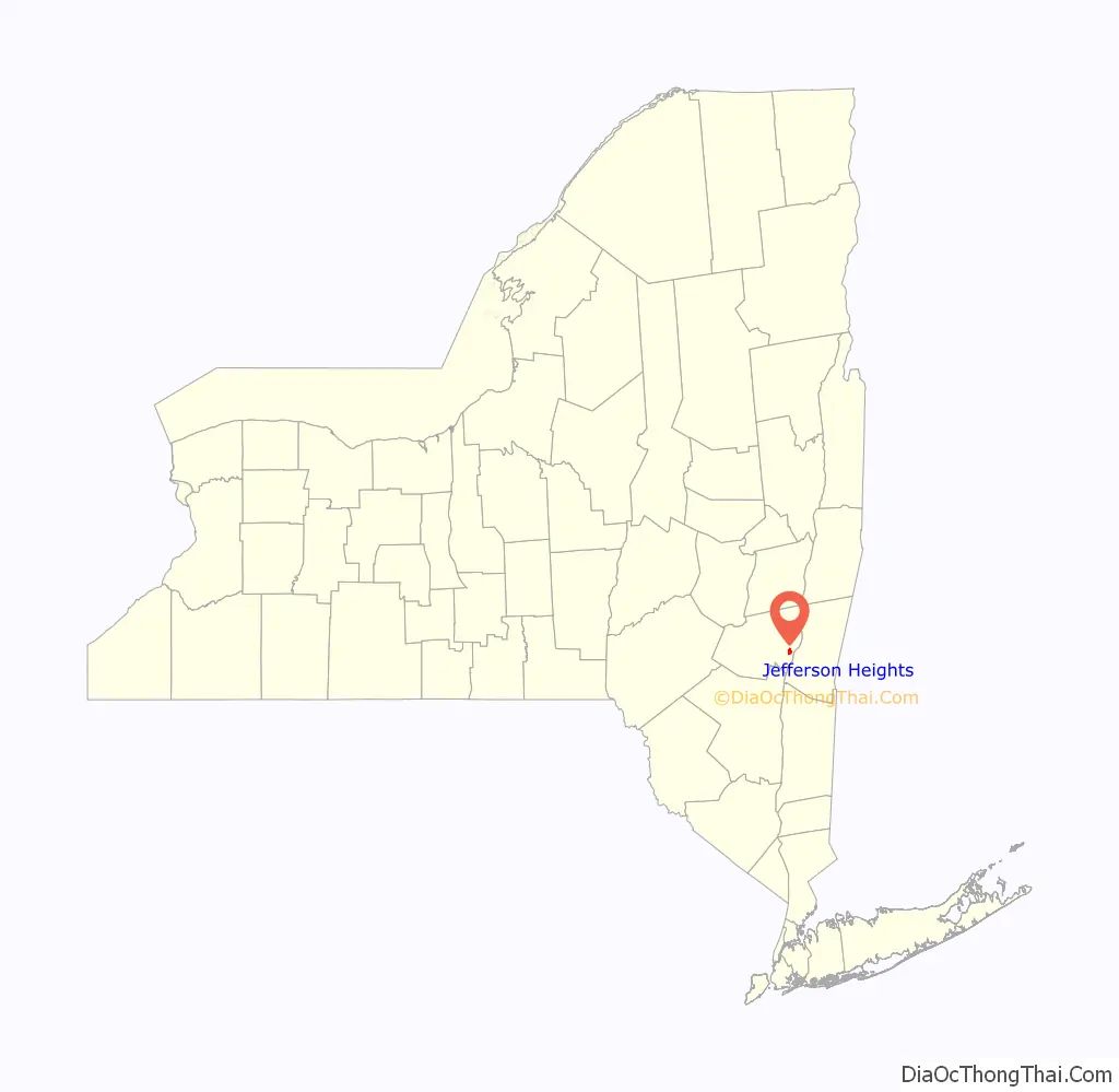
Jefferson Heights location map. Where is Jefferson Heights CDP?
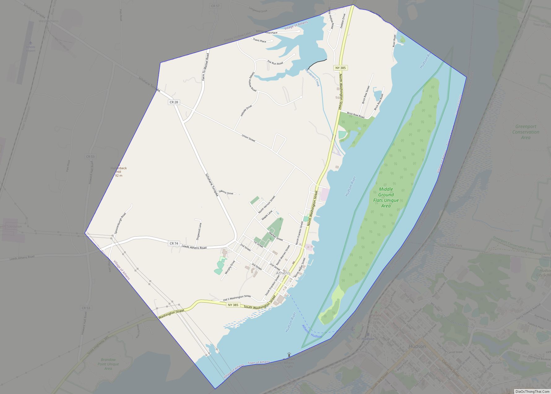
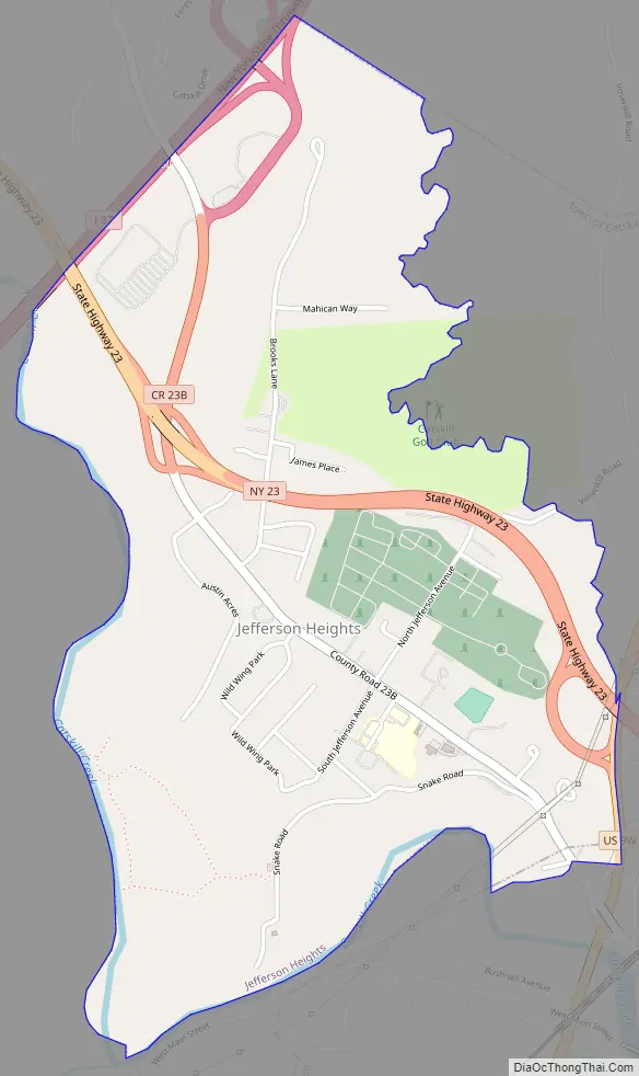
Jefferson Heights Road Map
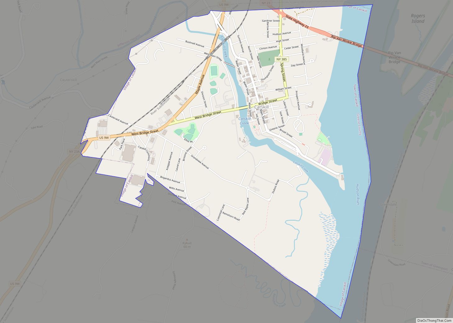
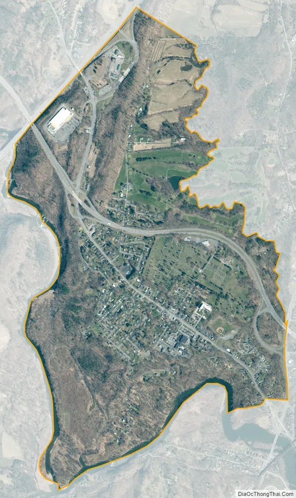
Jefferson Heights city Satellite Map
Geography
Jefferson Heights is located in southeastern Greene County at 42°14′7″N 73°52′34″W / 42.23528°N 73.87611°W / 42.23528; -73.87611 (42.235394, -73.876021), in the northeastern part of the town of Catskill. It is bordered to the southeast by the village of Catskill and to the northwest by the hamlet of Leeds.
New York State Route 23 is a four-lane highway through the northern part of Jefferson Heights, leading east to the Rip Van Winkle Bridge over the Hudson River and northwest 8 miles (13 km) to Cairo. Interstate 87, the New York State Thruway, runs along the northwest border of Jefferson Heights, and Thruway Exit 21 (Cairo – Catskill – NY Route 23) is in the northern part of the CDP. Albany, the state capital, is 32 miles (51 km) to the north by the Thruway, and New York City is 121 miles (195 km) to the south.
According to the United States Census Bureau, the Jefferson Heights CDP has a total area of 1.5 square miles (3.9 km), of which 0.02 square miles (0.05 km), or 1.40%, is water. Catskill Creek, a tributary of the Hudson River, forms the southern and western edge of the CDP, and Hans Vosen Kill, a tributary of Catskill Creek, forms the eastern edge.
See also
Map of New York State and its subdivision:- Albany
- Allegany
- Bronx
- Broome
- Cattaraugus
- Cayuga
- Chautauqua
- Chemung
- Chenango
- Clinton
- Columbia
- Cortland
- Delaware
- Dutchess
- Erie
- Essex
- Franklin
- Fulton
- Genesee
- Greene
- Hamilton
- Herkimer
- Jefferson
- Kings
- Lake Ontario
- Lewis
- Livingston
- Madison
- Monroe
- Montgomery
- Nassau
- New York
- Niagara
- Oneida
- Onondaga
- Ontario
- Orange
- Orleans
- Oswego
- Otsego
- Putnam
- Queens
- Rensselaer
- Richmond
- Rockland
- Saint Lawrence
- Saratoga
- Schenectady
- Schoharie
- Schuyler
- Seneca
- Steuben
- Suffolk
- Sullivan
- Tioga
- Tompkins
- Ulster
- Warren
- Washington
- Wayne
- Westchester
- Wyoming
- Yates
- Alabama
- Alaska
- Arizona
- Arkansas
- California
- Colorado
- Connecticut
- Delaware
- District of Columbia
- Florida
- Georgia
- Hawaii
- Idaho
- Illinois
- Indiana
- Iowa
- Kansas
- Kentucky
- Louisiana
- Maine
- Maryland
- Massachusetts
- Michigan
- Minnesota
- Mississippi
- Missouri
- Montana
- Nebraska
- Nevada
- New Hampshire
- New Jersey
- New Mexico
- New York
- North Carolina
- North Dakota
- Ohio
- Oklahoma
- Oregon
- Pennsylvania
- Rhode Island
- South Carolina
- South Dakota
- Tennessee
- Texas
- Utah
- Vermont
- Virginia
- Washington
- West Virginia
- Wisconsin
- Wyoming