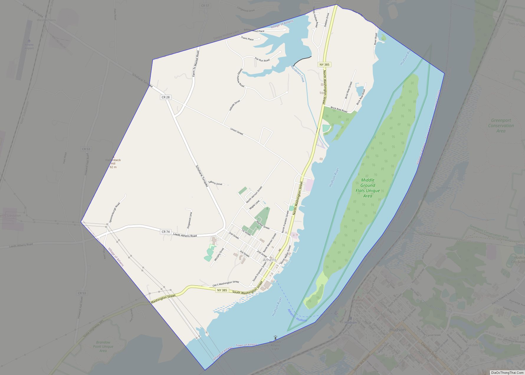
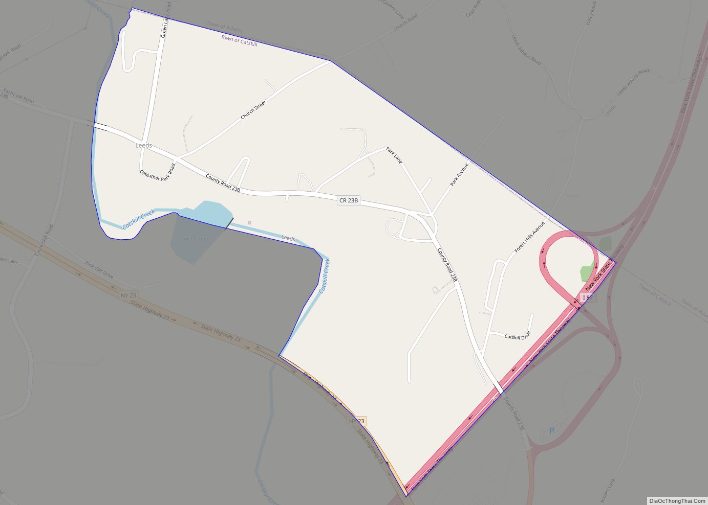
Leeds is a hamlet and census-designated place (CDP) in Greene County, New York, United States. The population was 377 at the 2010 census.
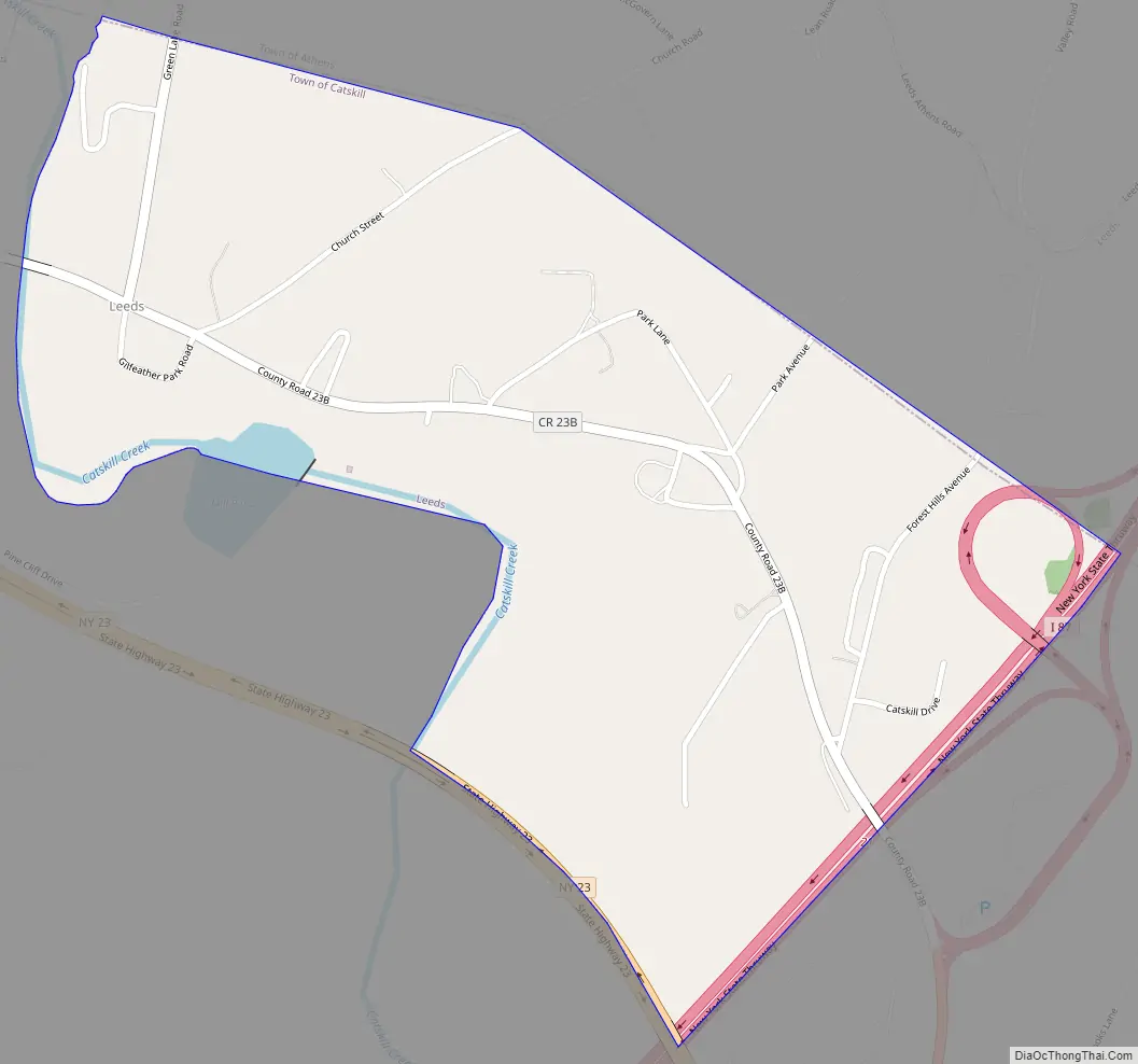
Leeds is located in the town of Catskill, near the northern town line. The community is located north of Route 23 and west of the New York State Thruway (Interstate 87) and is northwest of the village of Catskill.
| Name: | Leeds CDP |
|---|---|
| LSAD Code: | 57 |
| LSAD Description: | CDP (suffix) |
| State: | New York |
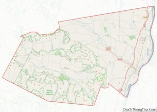
| County: | Greene County |
| Elevation: | 171 ft (48 m) |
| Total Area: | 0.93 sq mi (2.42 km²) |
| Land Area: | 0.92 sq mi (2.39 km²) |
| Water Area: | 0.01 sq mi (0.02 km²) |
| Total Population: | 429 |
| Population Density: | 464.79/sq mi (179.39/km²) |
| ZIP code: | 12451 |
| Area code: | 518 |
| FIPS code: | 3641784 |
| GNISfeature ID: | 0955168 |
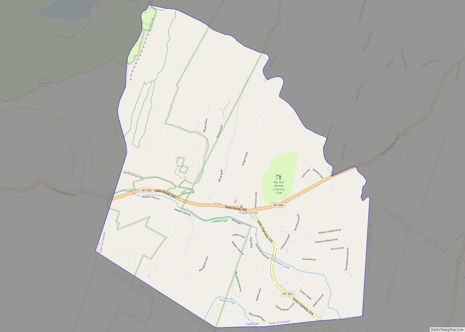
Online Interactive Map
Click on ![]() to view map in "full screen" mode.
to view map in "full screen" mode.
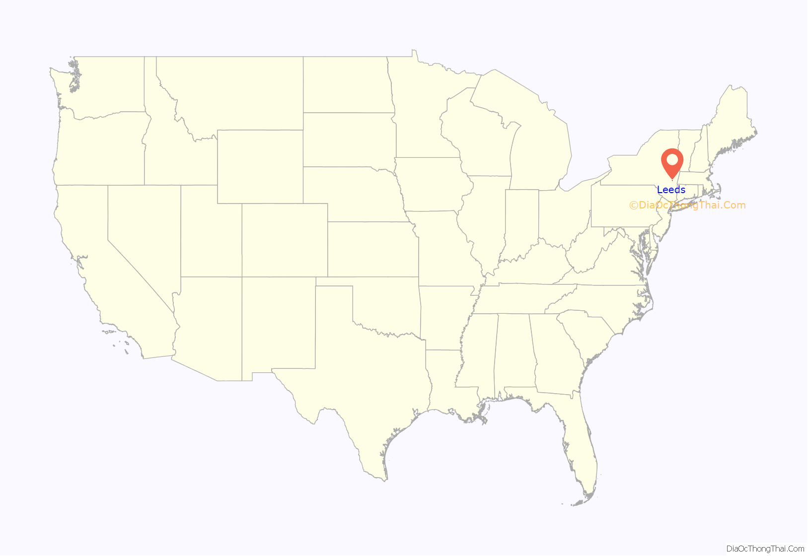
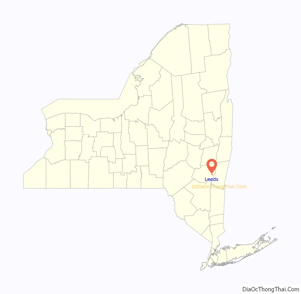
Leeds location map. Where is Leeds CDP?
History
Leeds was also known as “Madison” and “Mill Village”, and in the local Native American language the area was known as Pasqoecq. It is named after Leeds, United Kingdom.
Leeds Road Map
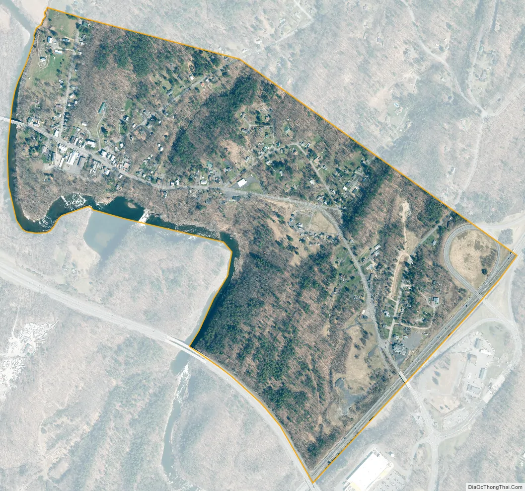
Leeds city Satellite Map
Geography
Leeds is located in eastern Greene County at 42°15′12″N 73°53′48″W / 42.25333°N 73.89667°W / 42.25333; -73.89667 (42.253466, -73.896634), on the north side of Catskill Creek. The center of the hamlet overlooks Mill Pond, a widening of the creek.
According to the United States Census Bureau, the CDP has a total area of 0.54 square miles (1.4 km), of which 0.01 square miles (0.02 km), or 1.74%, is water.
See also
Map of New York State and its subdivision:- Albany
- Allegany
- Bronx
- Broome
- Cattaraugus
- Cayuga
- Chautauqua
- Chemung
- Chenango
- Clinton
- Columbia
- Cortland
- Delaware
- Dutchess
- Erie
- Essex
- Franklin
- Fulton
- Genesee
- Greene
- Hamilton
- Herkimer
- Jefferson
- Kings
- Lake Ontario
- Lewis
- Livingston
- Madison
- Monroe
- Montgomery
- Nassau
- New York
- Niagara
- Oneida
- Onondaga
- Ontario
- Orange
- Orleans
- Oswego
- Otsego
- Putnam
- Queens
- Rensselaer
- Richmond
- Rockland
- Saint Lawrence
- Saratoga
- Schenectady
- Schoharie
- Schuyler
- Seneca
- Steuben
- Suffolk
- Sullivan
- Tioga
- Tompkins
- Ulster
- Warren
- Washington
- Wayne
- Westchester
- Wyoming
- Yates
- Alabama
- Alaska
- Arizona
- Arkansas
- California
- Colorado
- Connecticut
- Delaware
- District of Columbia
- Florida
- Georgia
- Hawaii
- Idaho
- Illinois
- Indiana
- Iowa
- Kansas
- Kentucky
- Louisiana
- Maine
- Maryland
- Massachusetts
- Michigan
- Minnesota
- Mississippi
- Missouri
- Montana
- Nebraska
- Nevada
- New Hampshire
- New Jersey
- New Mexico
- New York
- North Carolina
- North Dakota
- Ohio
- Oklahoma
- Oregon
- Pennsylvania
- Rhode Island
- South Carolina
- South Dakota
- Tennessee
- Texas
- Utah
- Vermont
- Virginia
- Washington
- West Virginia
- Wisconsin
- Wyoming