Malden-on-Hudson (/ˈmældən/-), commonly known as Malden, is a hamlet (and census-designated place) in Ulster County, New York, United States. The population was 365 at the 2020 census.
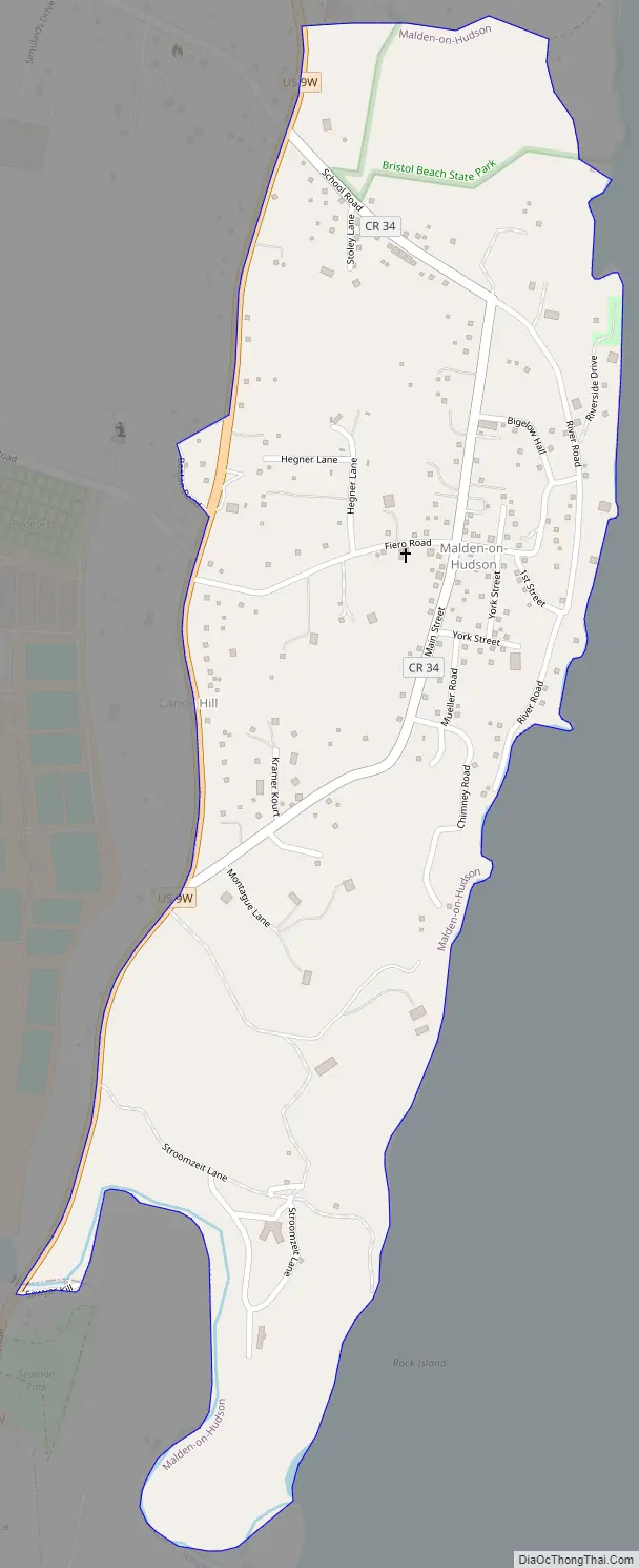
The community of Malden is in the eastern part of the Town of Saugerties, north of the Village of Saugerties. There is a public boat launch on the Hudson River that is often used by the Malden Yacht Club, a group of local kayakers.
| Name: | Malden-on-Hudson CDP |
|---|---|
| LSAD Code: | 57 |
| LSAD Description: | CDP (suffix) |
| State: | New York |
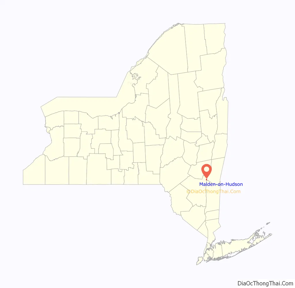
| County: | Ulster County |
| Elevation: | 98 ft (30 m) |
| Total Area: | 0.50 sq mi (1.30 km²) |
| Land Area: | 0.50 sq mi (1.30 km²) |
| Water Area: | 0.00 sq mi (0.00 km²) |
| Total Population: | 365 |
| Population Density: | 728.54/sq mi (281.28/km²) |
| ZIP code: | 12453 |
| Area code: | 845 |
| FIPS code: | 3644677 |
| GNISfeature ID: | 1852904 |
Online Interactive Map
Click on ![]() to view map in "full screen" mode.
to view map in "full screen" mode.
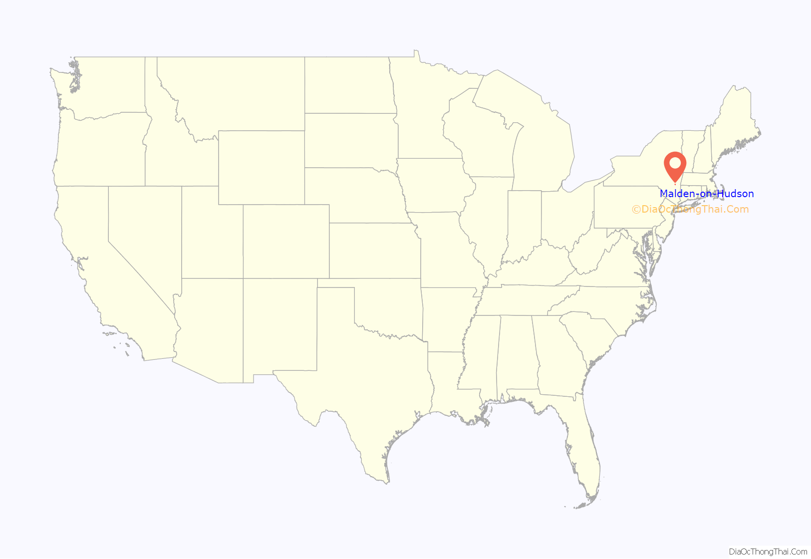
Malden-on-Hudson location map. Where is Malden-on-Hudson CDP?
Malden-on-Hudson Road Map
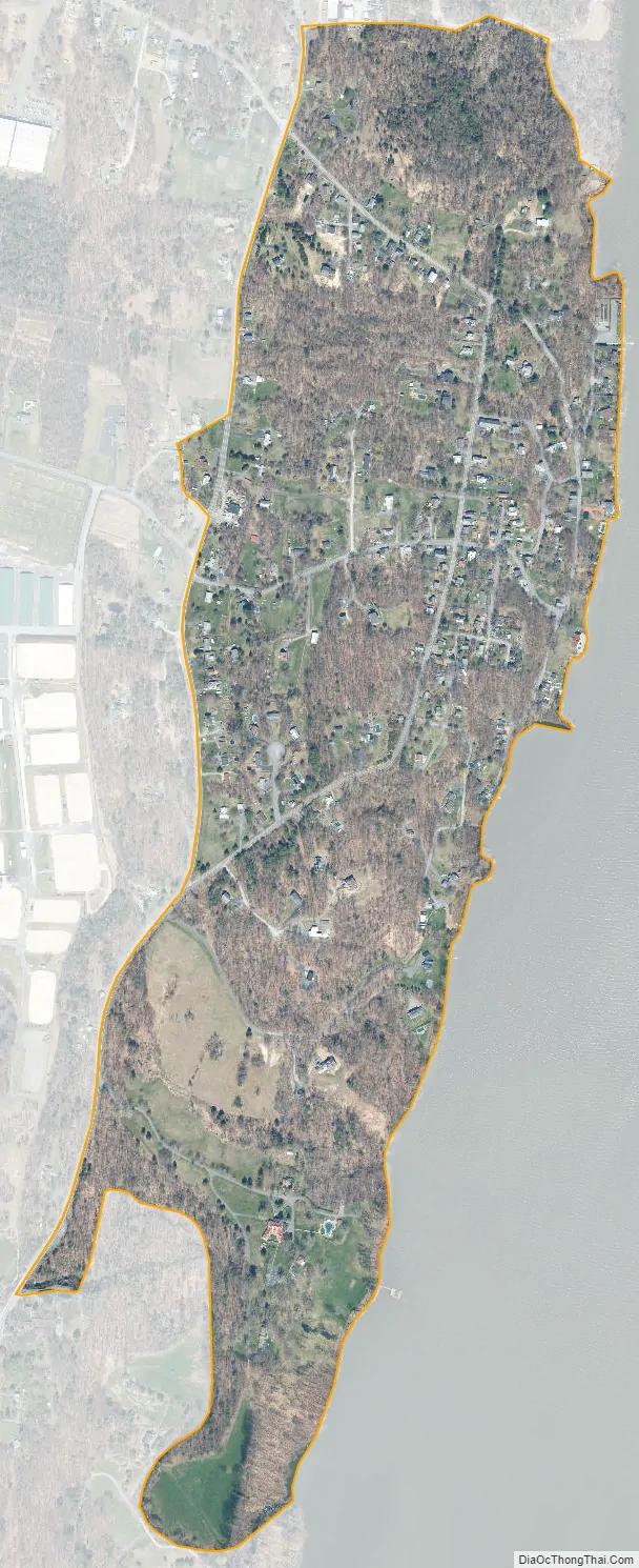
Malden-on-Hudson city Satellite Map
Geography
Malden is located at 42°5′36″N 73°56′5″W / 42.09333°N 73.93472°W / 42.09333; -73.93472 (42.093279, -73.934804).
According to the United States Census Bureau, the CDP has a total area of 0.5 square miles (1.3 km), all land.
The community is on the west bank of the Hudson River.
See also
Map of New York State and its subdivision:- Albany
- Allegany
- Bronx
- Broome
- Cattaraugus
- Cayuga
- Chautauqua
- Chemung
- Chenango
- Clinton
- Columbia
- Cortland
- Delaware
- Dutchess
- Erie
- Essex
- Franklin
- Fulton
- Genesee
- Greene
- Hamilton
- Herkimer
- Jefferson
- Kings
- Lake Ontario
- Lewis
- Livingston
- Madison
- Monroe
- Montgomery
- Nassau
- New York
- Niagara
- Oneida
- Onondaga
- Ontario
- Orange
- Orleans
- Oswego
- Otsego
- Putnam
- Queens
- Rensselaer
- Richmond
- Rockland
- Saint Lawrence
- Saratoga
- Schenectady
- Schoharie
- Schuyler
- Seneca
- Steuben
- Suffolk
- Sullivan
- Tioga
- Tompkins
- Ulster
- Warren
- Washington
- Wayne
- Westchester
- Wyoming
- Yates
- Alabama
- Alaska
- Arizona
- Arkansas
- California
- Colorado
- Connecticut
- Delaware
- District of Columbia
- Florida
- Georgia
- Hawaii
- Idaho
- Illinois
- Indiana
- Iowa
- Kansas
- Kentucky
- Louisiana
- Maine
- Maryland
- Massachusetts
- Michigan
- Minnesota
- Mississippi
- Missouri
- Montana
- Nebraska
- Nevada
- New Hampshire
- New Jersey
- New Mexico
- New York
- North Carolina
- North Dakota
- Ohio
- Oklahoma
- Oregon
- Pennsylvania
- Rhode Island
- South Carolina
- South Dakota
- Tennessee
- Texas
- Utah
- Vermont
- Virginia
- Washington
- West Virginia
- Wisconsin
- Wyoming


