Mechanicville is a city in Saratoga County, New York, United States. The population was 5,196 at the time of the 2010 census. It is the smallest city by area in the state. The name is derived from the occupations of early residents.
The city is located on the eastern border of Saratoga County and is north of Albany, the state capital. Mechanicville borders the towns of Stillwater (of which it was once a part) and Halfmoon in the county, and the town of Schaghticoke, Rensselaer County.
| Name: | Mechanicville city |
|---|---|
| LSAD Code: | 25 |
| LSAD Description: | city (suffix) |
| State: | New York |
| County: | Saratoga County |
| Elevation: | 104 ft (31.7 m) |
| Total Area: | 0.92 sq mi (2.38 km²) |
| Land Area: | 0.84 sq mi (2.17 km²) |
| Water Area: | 0.08 sq mi (0.20 km²) |
| Total Population: | 5,163 |
| Population Density: | 6,153.75/sq mi (2,376.54/km²) |
| ZIP code: | 12118 |
| Area code: | 518 |
| FIPS code: | 3646360 |
| GNISfeature ID: | 0956897 |
| Website: | mechanicville.com |
Online Interactive Map
Click on ![]() to view map in "full screen" mode.
to view map in "full screen" mode.
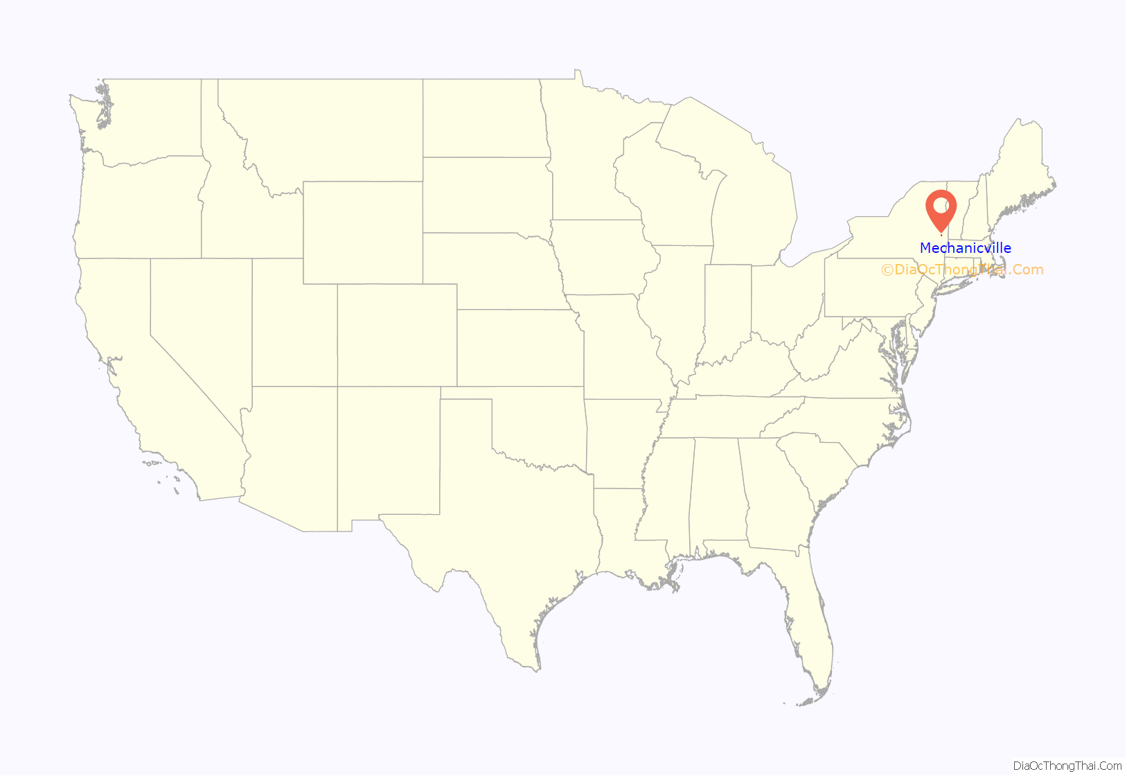
Mechanicville location map. Where is Mechanicville city?
History
The first listing of a settlement on Thenendehowa Creek is in 1721. At that time, Cornelius Van Buren had a sawmill at the mouth of the creek where it emptied into the Hudson River.
The first documented occurrence of the name “Mechanicville” dates back to 1829. The name comes from the early settlers, who were independent mastercraftsmen such as millers, carpenters, or butchers, whose professions were commonly known as the “mechanical arts” at the time.
About 35 years later, small flour mills were already established. When the Champlain Canal reached the settlement in 1823, and especially when the Rensselaer and Saratoga Railroad laid a track through the area in 1835, Mechanicville became an important commerce interchange.
The community became an incorporated village in 1859, when it had about 1000 inhabitants. It grew rapidly as textile mills, factories, and a linen thread company came to Mechanicville.
The first conspicuous casualty of the American Civil War, Elmer E. Ellsworth, was buried in Mechanicville in 1861.
In 1878, additional railways came to the village, and it became an important center of papermaking.
In 1898, Robert Newton King built a hydroelectric power plant on the Hudson River. The Mechanicville Hydroelectric Plant is now the oldest continuously-operating hydroelectric plant in the United States and was listed on the National Register of Historic Places in 1989.
By 1900, Mechanicville was a major transfer yard and car repair center for the railways. In the 1920s, Mechanicville had a population of nearly 10,000.
In both the 1900 and 1910 censuses, Mechanicville was enumerated with the town of Half Moon, just to the south of Stillwater.
Mechanicville became a city in 1915. By 1932, it became the terminal of the first experimental high-voltage direct-current (HVDC) scheme in the U.S.: the HVDC Mechanicville–Schenectady line.
With the decline of the railroads, Mechanicville suffered. The largest paper mill in the world, which Mechanicville had hosted since 1904, ceased operations in 1971, and the once thriving industrial city is today a quiet residential city, with most inhabitants working in Albany, Schenectady, and other nearby communities.
On November 1, 2001, Mechanicville was featured on the Daily Show with then-rising comedian Steve Carell. The Mechanicville Hydroelectric Plant and Col. Elmer E. Ellsworth Monument and Grave are listed on the National Register of Historic Places.
Mechanicville-Stillwater tornado
On May 31, 1998, a large tornado tore through Mechanicville and the adjacent town of Stillwater. It was spawned by a series of severe storms in the late afternoon, causing major damage to the town’s old industrial section located on US Route 4 and NY-32, along the Hudson River. One of the two historic smokestacks (visible from two miles away) was knocked down by the tornado. In 2005, the other smokestack and the conjoined building were bulldozed. Houses on the Viall Avenue hill sections of Mechanicville and Stillwater were completely destroyed. The tornado was rated F3 on the Fujita scale (winds estimated at 165 MPH).
Rail yard
In January 2012, a new intermodal and automotive terminal opened on the site of a former Boston and Maine rail yard. The new rail yard was built by Pan Am Southern, a joint venture between Pan Am Railways and Norfolk Southern.
The $40 million facility Is also used for filet-toupee operations, converting double stack container trains from the west to single stack by removing the top layer of containers. This allows the rest of the train to proceed east along track that lacks double stack clearance, particularly the 43⁄4 mile Hoosac Tunnel. The removed containers are trucked to local destinations. Toupee refers to the reverse process, where a single stack train coming from the east has additional containers placed on top for the rest of its trip. Some 300 trucks a day visit the site. The automotive terminal opened in 2014.
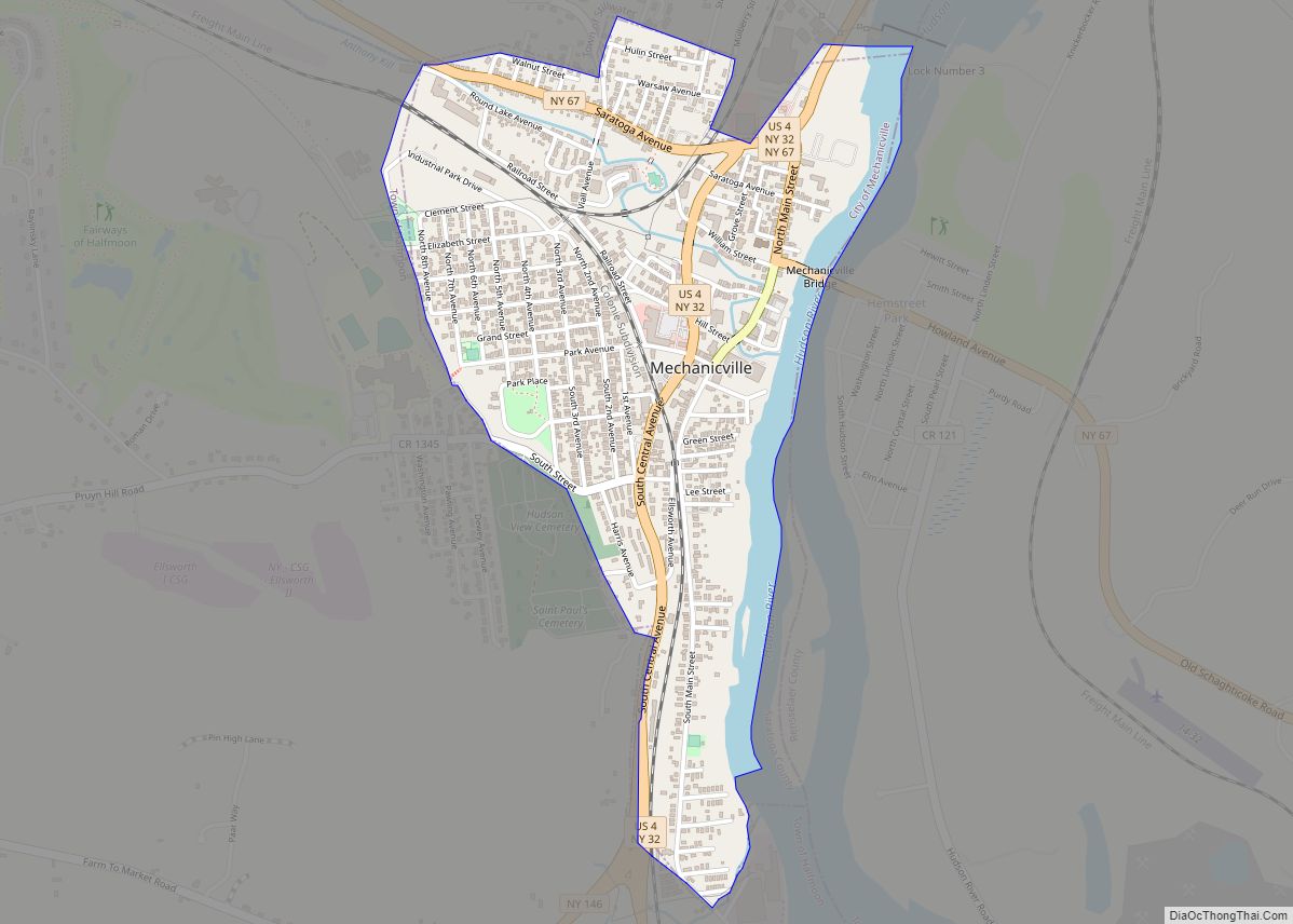
Mechanicville Road Map
Mechanicville city Satellite Map
Geography
Mechanicville is located at 42°54′14″N 73°41′26″W / 42.90389°N 73.69056°W / 42.90389; -73.69056 (42.903922, -73.690458).
According to the United States Census Bureau, the city has a total area of 0.9 square miles (2.3 km), of which 0.8 square miles (2.1 km) is land and 0.1 square miles (0.26 km) (8.79%) is water. The city of Mechanicville is on the west bank of the Hudson River at the influx of the Anthony Kill. US Route 4, and conjoined New York State Route 32 are north-south highways through Mechanicville. New York State Route 67 intersects NY-32 and US-4 in the city. County Roads 75 and 1345 also lead into the city.
See also
Map of New York State and its subdivision:- Albany
- Allegany
- Bronx
- Broome
- Cattaraugus
- Cayuga
- Chautauqua
- Chemung
- Chenango
- Clinton
- Columbia
- Cortland
- Delaware
- Dutchess
- Erie
- Essex
- Franklin
- Fulton
- Genesee
- Greene
- Hamilton
- Herkimer
- Jefferson
- Kings
- Lake Ontario
- Lewis
- Livingston
- Madison
- Monroe
- Montgomery
- Nassau
- New York
- Niagara
- Oneida
- Onondaga
- Ontario
- Orange
- Orleans
- Oswego
- Otsego
- Putnam
- Queens
- Rensselaer
- Richmond
- Rockland
- Saint Lawrence
- Saratoga
- Schenectady
- Schoharie
- Schuyler
- Seneca
- Steuben
- Suffolk
- Sullivan
- Tioga
- Tompkins
- Ulster
- Warren
- Washington
- Wayne
- Westchester
- Wyoming
- Yates
- Alabama
- Alaska
- Arizona
- Arkansas
- California
- Colorado
- Connecticut
- Delaware
- District of Columbia
- Florida
- Georgia
- Hawaii
- Idaho
- Illinois
- Indiana
- Iowa
- Kansas
- Kentucky
- Louisiana
- Maine
- Maryland
- Massachusetts
- Michigan
- Minnesota
- Mississippi
- Missouri
- Montana
- Nebraska
- Nevada
- New Hampshire
- New Jersey
- New Mexico
- New York
- North Carolina
- North Dakota
- Ohio
- Oklahoma
- Oregon
- Pennsylvania
- Rhode Island
- South Carolina
- South Dakota
- Tennessee
- Texas
- Utah
- Vermont
- Virginia
- Washington
- West Virginia
- Wisconsin
- Wyoming
