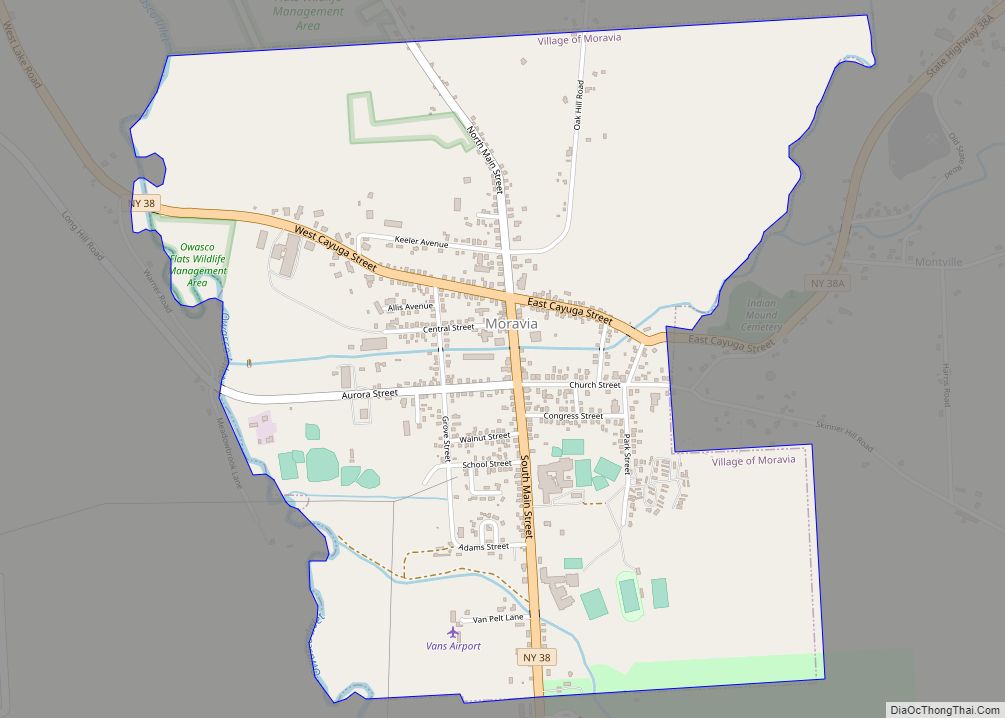
The village of Moravia in Cayuga County, New York, United States is a community with population of about 1,200. The village of Moravia is in the southern part of the town of Moravia and is south of Auburn.
Nearby Fillmore Glen State Park contains a replica of the cabin in which President Millard Fillmore was born.
| Name: | Moravia village |
|---|---|
| LSAD Code: | 47 |
| LSAD Description: | village (suffix) |
| State: | New York |
| County: | Cayuga County |
| Elevation: | 735 ft (224 m) |
| Total Area: | 1.72 sq mi (4.47 km²) |
| Land Area: | 1.70 sq mi (4.41 km²) |
| Water Area: | 0.02 sq mi (0.06 km²) |
| Total Population: | 1,224 |
| Population Density: | 718.73/sq mi (277.48/km²) |
| ZIP code: | 13118 |
| Area code: | 315 |
| FIPS code: | 3648296 |
| GNISfeature ID: | 0957642 |
| Website: | www.cayugacounty.us/villageofmoravia |
Online Interactive Map
Click on ![]() to view map in "full screen" mode.
to view map in "full screen" mode.
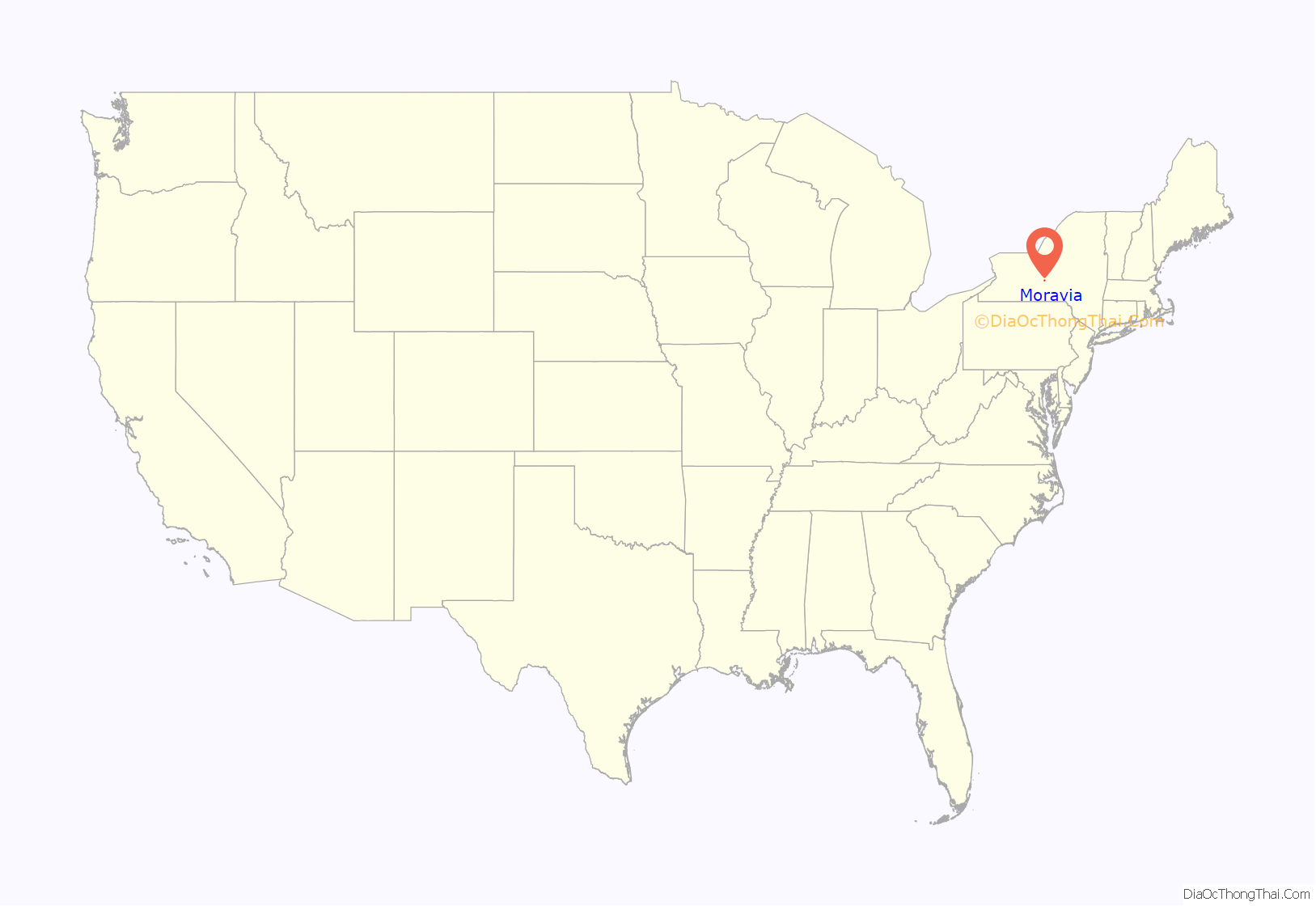
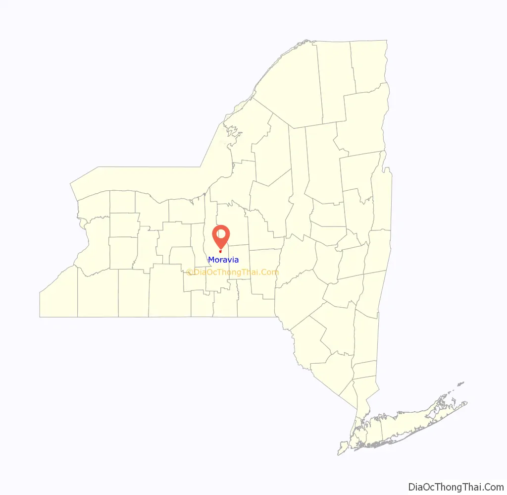
Moravia location map. Where is Moravia village?
History
The village was in the Central New York Military Tract and is on the site of a former native village.
Moravia village was founded in 1789 by John Stoyell, a veteran. It was then called “Owasco Flats”. The village of Moravia was incorporated in 1837 and re-incorporated in 1859 when enlarged.
The Powers Library, erected in 1880, is the oldest continuously used library in New York.
Dozens of Italianate houses built in the late 1800s, plus many other residences, churches, a cemetery, and other properties in the village are documented, and are listed on the National Register of Historic Places either as individual buildings or within historic districts: see National Register of Historic Places listings in Cayuga County, New York.
The village population was 1,282 at the 2010 census.
Moravia Road Map
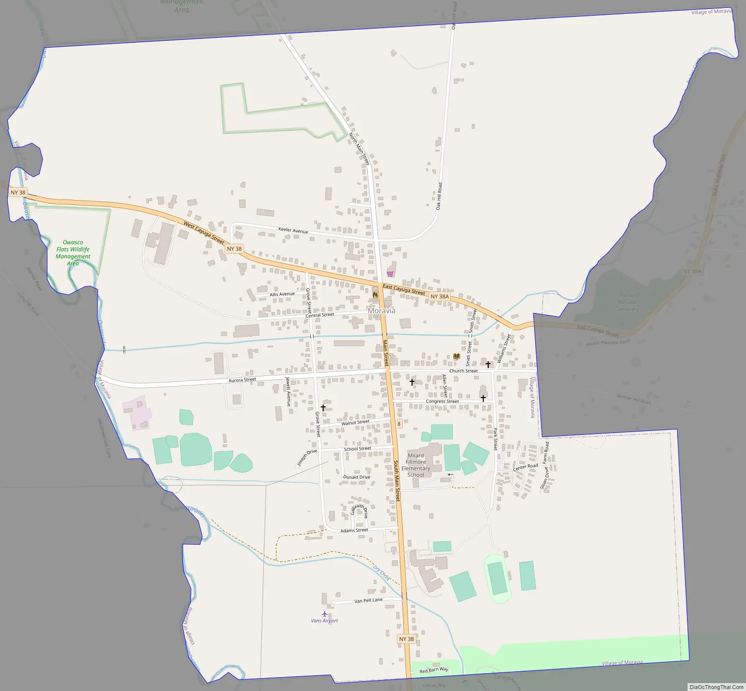
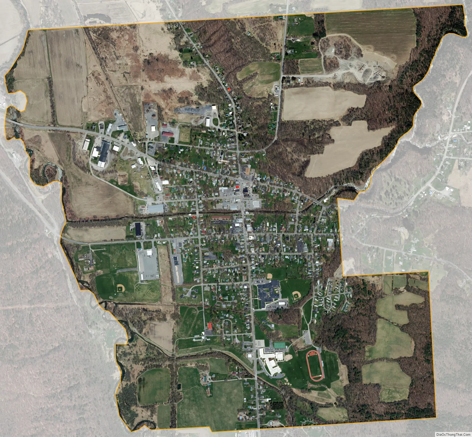
Moravia city Satellite Map
Geography
Moravia is located at 42°42′39″N 76°25′22″W / 42.71083°N 76.42278°W / 42.71083; -76.42278 (42.711108, -76.42302).
According to the United States Census Bureau, the village has a total area of 1.73 square miles (4.47 km), of which 1.70 square miles (4.41 km) is land and 0.02 square miles (0.06 km), or 1.24%, is water.
The village is south of Owasco Lake, and the Owasco Inlet flows through the village.
New York State Route 38 intersects New York State Route 38A in Moravia village.
See also
Map of New York State and its subdivision:- Albany
- Allegany
- Bronx
- Broome
- Cattaraugus
- Cayuga
- Chautauqua
- Chemung
- Chenango
- Clinton
- Columbia
- Cortland
- Delaware
- Dutchess
- Erie
- Essex
- Franklin
- Fulton
- Genesee
- Greene
- Hamilton
- Herkimer
- Jefferson
- Kings
- Lake Ontario
- Lewis
- Livingston
- Madison
- Monroe
- Montgomery
- Nassau
- New York
- Niagara
- Oneida
- Onondaga
- Ontario
- Orange
- Orleans
- Oswego
- Otsego
- Putnam
- Queens
- Rensselaer
- Richmond
- Rockland
- Saint Lawrence
- Saratoga
- Schenectady
- Schoharie
- Schuyler
- Seneca
- Steuben
- Suffolk
- Sullivan
- Tioga
- Tompkins
- Ulster
- Warren
- Washington
- Wayne
- Westchester
- Wyoming
- Yates
- Alabama
- Alaska
- Arizona
- Arkansas
- California
- Colorado
- Connecticut
- Delaware
- District of Columbia
- Florida
- Georgia
- Hawaii
- Idaho
- Illinois
- Indiana
- Iowa
- Kansas
- Kentucky
- Louisiana
- Maine
- Maryland
- Massachusetts
- Michigan
- Minnesota
- Mississippi
- Missouri
- Montana
- Nebraska
- Nevada
- New Hampshire
- New Jersey
- New Mexico
- New York
- North Carolina
- North Dakota
- Ohio
- Oklahoma
- Oregon
- Pennsylvania
- Rhode Island
- South Carolina
- South Dakota
- Tennessee
- Texas
- Utah
- Vermont
- Virginia
- Washington
- West Virginia
- Wisconsin
- Wyoming