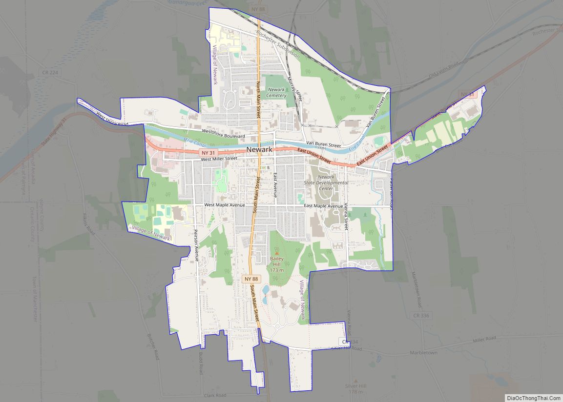
Newark is a village in Wayne County, New York, United States, 35 miles (56 km) south east of Rochester and 48 miles (77 km) west of Syracuse. The population was 9,017 at the 2020 census. The Village of Newark is in the south part of the Town of Arcadia and is in the south of Wayne County. It is the most populous community in Wayne County.
| Name: | Newark village |
|---|---|
| LSAD Code: | 47 |
| LSAD Description: | village (suffix) |
| State: | New York |
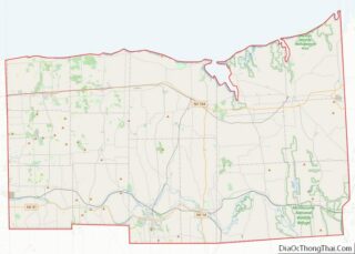
| County: | Wayne County |
| Incorporated: | July 21, 1853 (1853-07-21) |
| Elevation: | 457 ft (135 m) |
| Total Area: | 5.42 sq mi (14.05 km²) |
| Land Area: | 5.42 sq mi (14.04 km²) |
| Water Area: | 0.01 sq mi (0.01 km²) |
| Total Population: | 9,017 |
| Population Density: | 1,663.96/sq mi (642.46/km²) |
| Area code: | 315 and 680 |
| FIPS code: | 3649891 |
| GNISfeature ID: | 0958486 |
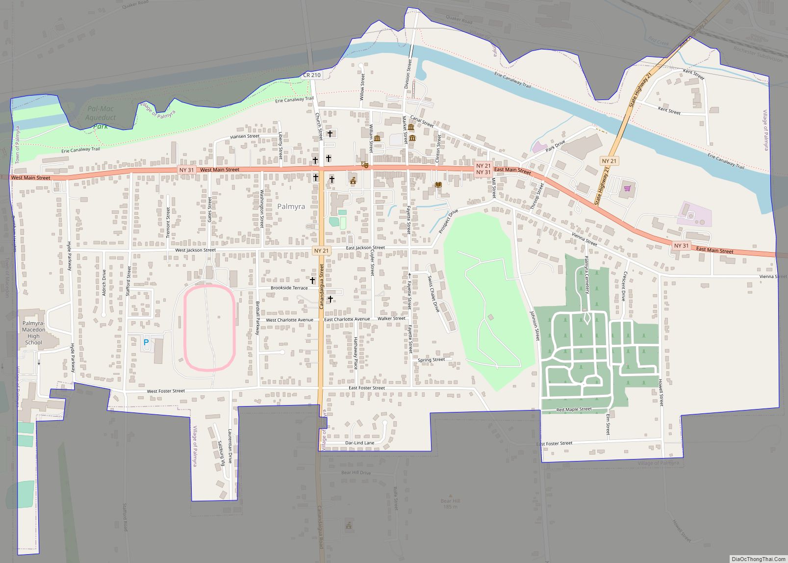
Online Interactive Map
Click on ![]() to view map in "full screen" mode.
to view map in "full screen" mode.
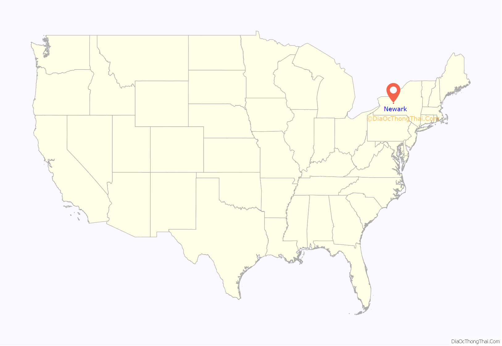
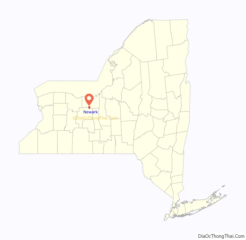
Newark location map. Where is Newark village?
History
The current village includes the former “Miller’s Basin” and “Lockville” prior to its own incorporation in 1839. The Village of Newark was incorporated in 1853. It was in Newark, New York that Jackson & Perkins Company, famous for its roses, was founded in 1872 by Albert Jackson and his son-in law Charles H. Perkins. The Perkins mansion is now listed on the historic register.
The Jackson–Perkins residence, 310 High Street, is significant for its association with the growth and development of the Jackson and Perkins Company, one of the largest and best-known horticultural firms in the United States. The company was established in 1872 by Albert E. Jackson and his son-in-law, Charles H. Perkins, fruit growers and amateur gardeners, who had purchased the property in 1864.
Initially, Perkins, a lawyer, banker and vice-president of Chase Bros. Nursery (Rochester) began experimenting with cultivating grapes and other fruits on the property; however, his growing passion for roses led to a substantial increase in horticultural activity, and in 1884 the company hired E. Alvin Miller, a professional propagator and breeder. This marked a substantial enlargement in the size and professionalism of the company, which began to cultivate roses and other ornamentals on a large scale. Although the growth of the company led to the acquisition of additional farms, the family’s High Street estate remained the center of operations, with experiments in propagation taking place on site and the residence’s library serving as the company’s main office. In 1910, Charles Perkins’s son, George C. Perkins, took over as president. Charles H. Perkins began living in Santa Ana, California during the winters where he began a large poultry business with his brother, Wyllys. He also had an orange ranch run by his oldest son Albert J. Perkins. After George C. resigned, his cousin Charles “Charlie” Perkins became president until the 1960s.
In the first decades of the twentieth century, Jackson and Perkins achieved worldwide fame, particularly for its roses. In 1908, the company received an award from the National Rose Society for Great Britain for the popular “Dorothy Perkins” climbing rose. During the 1920s and 30s the company’s research directors were prolific in developing hundreds of new varieties and the company sold millions of plants. In addition to roses, Jackson and Perkins also became major distributors of clematis, lilacs, boxwoods, azaleas, and rhododendrons. After specializing in the wholesale trade for more than half a century, Jackson and Perkins’s popular exhibit at the 1939 New York World’s Fair led to its entrance into the retail market as a mail order business.
During WWII the largest rose grower in the world folded in Germany due to the war. This left the door open for J&P to become the “Rose Capital of America” and the world’s rose garden. Jackson and Perkins is now located in Hodges, South Carolina, a division of the Park Seed Co. and is a full service nursery that disseminates more than one million catalogues and ships more than three million roses and other plants to customers each year.
In 1852, Charles W. Stuart purchased a farm on what is now North Main St, and in need of an income he sold fruit trees door to door to area farms. This was the beginning of a direct selling business and C.W. Stuart Nursery became one of the largest wholesale nurseries in the country.
In 1949, the C.H. Stuart Co.(C.W. Stuart’s son), with many successes direct selling, formed a small division, Sarah Coventry Inc., named after C.H. Stuart’s great-granddaughter, Sarah Coventry Beale, which marketed costume jewelry until 1984.
In 1900, 4,578 people lived in Newark, New York; in 1910, 6,227; and in 1940, 9,646. Newark has become the industrial and retail center of the county. The Jackson–Perkins House and United States Post Office are listed on the National Register of Historic Places.
Remnants of the former Enlarged Erie Canal Lock 59 (also called the Upper Lockville Lock) are located along North Clinton Street across from the current Lock 28B in Newark, just off N.Y. Route 31. It was a double-chamber lock built in 1841, and had a lift of 7.88 feet (2.40 m) to the west. The former Enlarged Erie Canal Lock 58 (also called the Middle Lockville Lock) is a few blocks east off Lyons Street, but one of the chambers is being used by a scrap company. Volunteers cleared the other chamber as part of a canal trail project. Located where Military Brook enters the canal on West Union Street is a little known remnant of the original Erie Canal. It is where Military Brook a.k.a. Whipspool Creek was routed UNDER the canal to the north side where it eventually flowed through the Newark Cemetery on its way to the Ganargua Creek.
In December 1954, the Hoffman Clock Museum was founded and opened within the Newark Public Library. The collection is named for Augustus Hoffman, Newark resident and Lyons watchmaker and jeweler who amassed much of the collection that now makes up the museum.
The village is part of the Erie Canalway National Heritage Corridor. Erie Canal Lock 28B is located below the bridge on North Clinton Street, just off N.Y. Route 31. It was built around 1913, and has a lift of 12 feet (3.7 m) to the west.
Village of Arcadia
There was a community of Lockville, first settled circa 1805, approximately 3⁄4 mile (1.2 km) on the east of what used to be known as Miller’s Basin in the vicinity of the current East Union and Vienna streets. The name of ‘Lockville’ came from its location near three locks, numbered 57, 58 and 59, built on the original Erie Canal route. In 1839, Lockville became incorporated as the Village of Arcadia. It merged into Newark when that community was incorporated as a village in 1853.
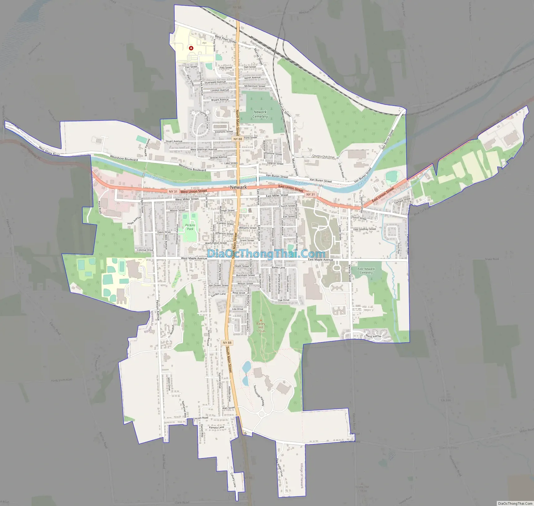
Newark Road Map
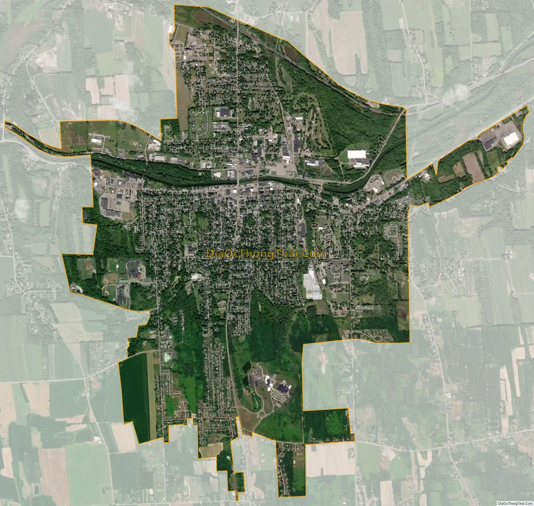
Newark city Satellite Map
Geography
Newark is located at 43°02′48″N 77°05′43″W / 43.04667°N 77.09528°W / 43.04667; -77.09528. Newark is located along the southern edge of Wayne County, bordering Ontario County. According to the United States Census Bureau, the village has a total area of 5.4 square miles (14 km), of which, 5.4 square miles (14 km) is land and 0.19% is water. The center of the village is at Main Street (New York State Route 88) and Union Street (New York State Route 31). Route 31 runs next to the southern bank of the Erie Canal.
See also
Map of New York State and its subdivision:- Albany
- Allegany
- Bronx
- Broome
- Cattaraugus
- Cayuga
- Chautauqua
- Chemung
- Chenango
- Clinton
- Columbia
- Cortland
- Delaware
- Dutchess
- Erie
- Essex
- Franklin
- Fulton
- Genesee
- Greene
- Hamilton
- Herkimer
- Jefferson
- Kings
- Lake Ontario
- Lewis
- Livingston
- Madison
- Monroe
- Montgomery
- Nassau
- New York
- Niagara
- Oneida
- Onondaga
- Ontario
- Orange
- Orleans
- Oswego
- Otsego
- Putnam
- Queens
- Rensselaer
- Richmond
- Rockland
- Saint Lawrence
- Saratoga
- Schenectady
- Schoharie
- Schuyler
- Seneca
- Steuben
- Suffolk
- Sullivan
- Tioga
- Tompkins
- Ulster
- Warren
- Washington
- Wayne
- Westchester
- Wyoming
- Yates
- Alabama
- Alaska
- Arizona
- Arkansas
- California
- Colorado
- Connecticut
- Delaware
- District of Columbia
- Florida
- Georgia
- Hawaii
- Idaho
- Illinois
- Indiana
- Iowa
- Kansas
- Kentucky
- Louisiana
- Maine
- Maryland
- Massachusetts
- Michigan
- Minnesota
- Mississippi
- Missouri
- Montana
- Nebraska
- Nevada
- New Hampshire
- New Jersey
- New Mexico
- New York
- North Carolina
- North Dakota
- Ohio
- Oklahoma
- Oregon
- Pennsylvania
- Rhode Island
- South Carolina
- South Dakota
- Tennessee
- Texas
- Utah
- Vermont
- Virginia
- Washington
- West Virginia
- Wisconsin
- Wyoming