Santa Ana (Spanish for ‘Saint Anne’) is the county seat of Orange County, California. Located in the Greater Los Angeles region of Southern California, the city’s population was 310,227 at the 2020 census, making Santa Ana the second most populous city in Orange County (after Anaheim), the 13th-most populous city in California, and the 64th densest large city in the United States. Santa Ana is a major regional economic and cultural hub for the Orange Coast.
Santa Ana’s origins began in 1810, when the Spanish governor of California granted Rancho Santiago de Santa Ana to José Antonio Yorba. Following the Mexican War of Independence, the Yorba family rancho was enlarged, becoming one of the largest and most valuable in the region and home to a diverse Californio community. Following the American Conquest of California, the rancho was sold to the Sepúlveda family, who subsequently lost their land claim. In 1869, William H. Spurgeon then purchased the rancho and formally founded the modern city of Santa Ana.
Approximately four-fifths Latino, Santa Ana has been characterized by The New York Times as the “face of a new California, a state where Latinos have more influence in everyday life—electorally, culturally and demographically—than almost anywhere else in the country.”
| Name: | Santa Ana city |
|---|---|
| LSAD Code: | 25 |
| LSAD Description: | city (suffix) |
| State: | California |
| County: | Orange County |
| Founded: | 1869 |
| Incorporated: | June 1, 1886 |
| Elevation: | 115 ft (35 m) |
| Total Area: | 27.37 sq mi (70.89 km²) |
| Land Area: | 27.34 sq mi (70.81 km²) |
| Water Area: | 0.03 sq mi (0.08 km²) 0.90% |
| Total Population: | 310,227 |
| Population Density: | 11,000/sq mi (4,400/km²) |
| Area code: | 657/714, 949 |
| FIPS code: | 0669000 |
| Website: | santa-ana.org |
Explore the city of Santa Ana and its attractions with this comprehensive collection of Santa Ana maps. From a road map to a reference map and things to do, this Santa Ana map collection will help you get the most out of your trip.
Discover the beauty of Santa Ana with this Santa Ana map collection. Featuring a road map, reference map and things to do, you’ll be able to explore the city and its attractions with ease. Located near Los Angeles, Santa Ana is home to a number of fascinating historical landmarks, palm trees, beaches and nightlife. Whether you’re looking for a place to live, work, raise your family, or just have some fun, this map collection has something for you.
Online Interactive Map
Click on ![]() to view map in "full screen" mode.
to view map in "full screen" mode.
Get a sneak preview of what Santa Ana has to offer with this interactive map. See what attractions and neighborhoods are popular in the Santa Ana areas like the historical district and downtown. You can also get a snapshot of the best attractions to see where you can find the best restaurants, nightlife, and shopping.
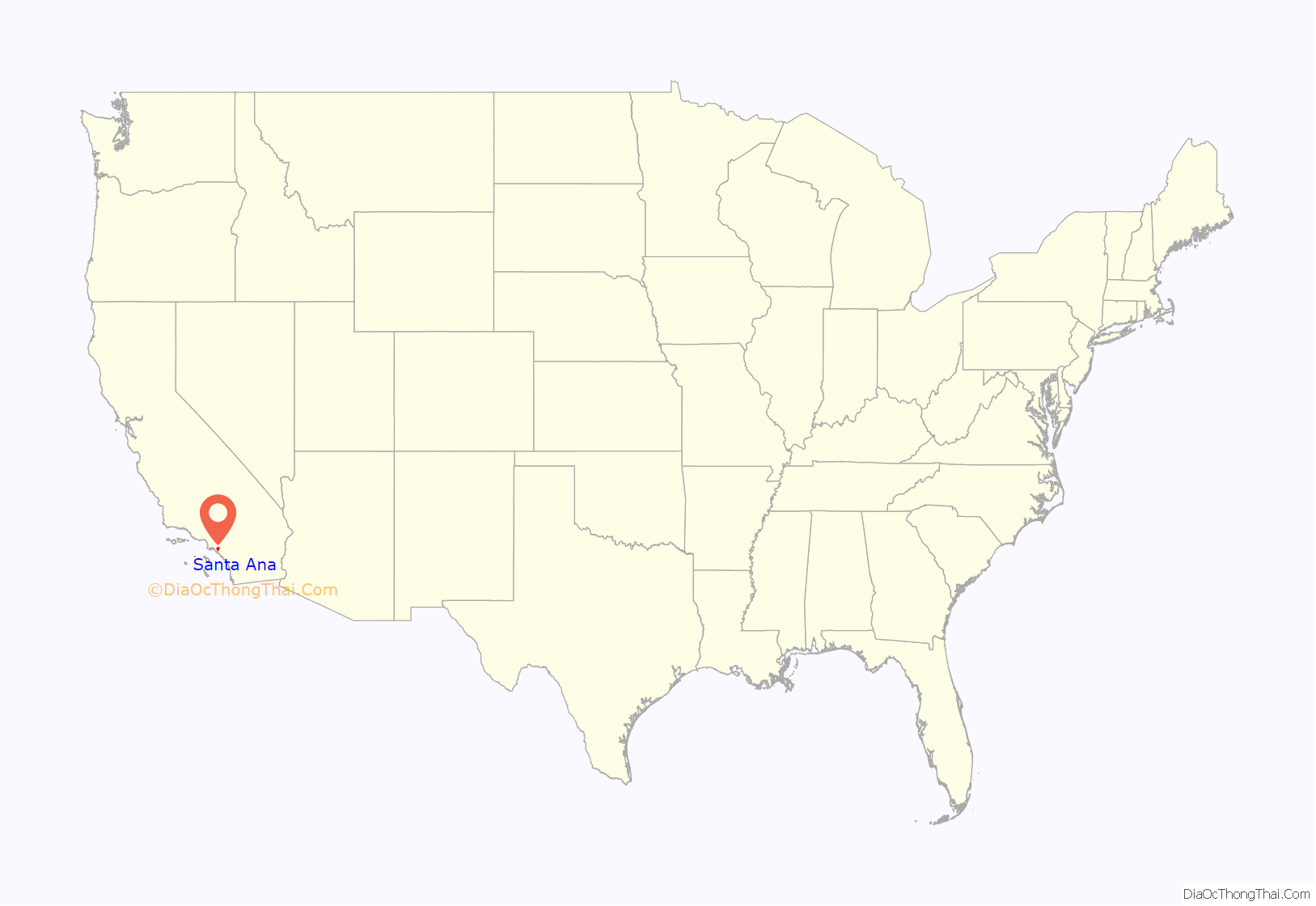
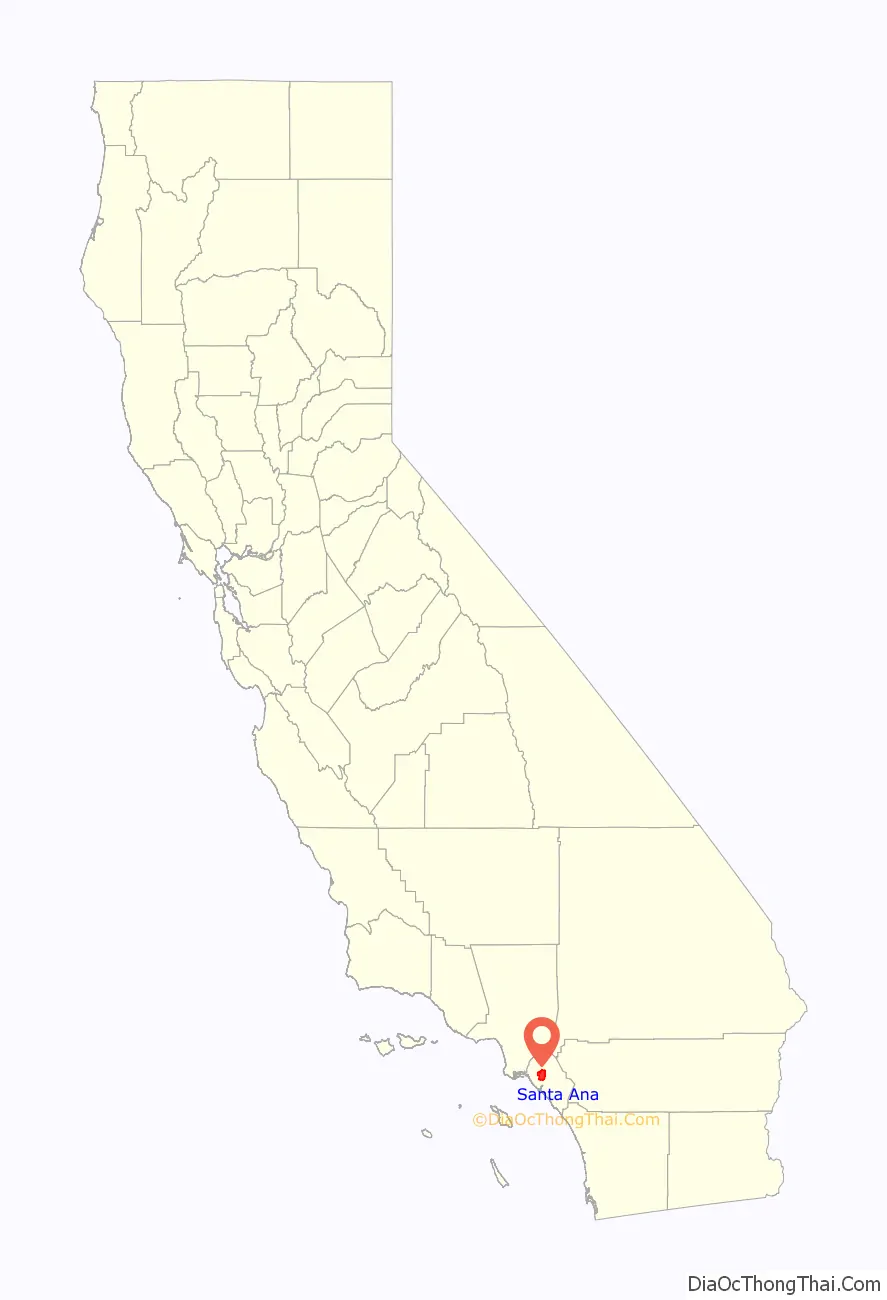
Santa Ana location map. Where is Santa Ana city?
History
Members of the Tongva and Juaneño/Luiseño are indigenous to the area. The Tongva called the Santa Ana area “Hotuuk.” The village of Pajbenga was located at modern day Santa Ana along the Santa Ana River.
Spanish and Mexican eras
After the 1769 expedition of Gaspar de Portolá out of Mexico City, then capital of New Spain, Friar Junípero Serra named the area Vallejo de Santa Ana (Valley of Saint Anne, or Santa Ana Valley). On November 1, 1776, Mission San Juan Capistrano was established within this valley.
In 1810, the first year of the Mexican War of Independence, Jose Antonio Yorba, a sergeant of the Spanish army, was granted land that he called Rancho Santiago de Santa Ana. Yorba’s rancho included the lands where the cities of Olive, Orange, Irvine, Yorba Linda, Villa Park, Santa Ana, Tustin, Costa Mesa and unincorporated El Modena, and Santa Ana Heights, are today. This rancho was the only land grant in Orange County granted under Spanish Rule. Surrounding land grants in Orange County were granted after Mexican Independence by the new government.
After the Mexican-American war ended in 1848, Alta California became part of the United States and American settlers arrived in this area.
Post-Conquest era
Santa Ana was listed as a township of Los Angeles County in the 1860 and 1870 census, with an area encompassing most of what is now northern and central Orange County. It had a population of 756 in 1860 and 880 in 1870. The Anaheim district was enumerated separately from Santa Ana in 1870.
Claimed in 1869 by Kentuckian William H. Spurgeon on land obtained from the descendants of Jose Antonio Yorba, Santa Ana was incorporated as a city in 1886 with a population of 2000 and in 1889 became the seat of the newly formed Orange County.
In 1877, the Southern Pacific Railroad built a branch line from Los Angeles to Santa Ana, which offered free right of way, land for a depot, and $10,000 in cash to the railroad in exchange for terminating the line in Santa Ana and not neighboring Tustin. In 1887, the California Central Railway (which became a subsidiary of the Atchison, Topeka and Santa Fe Railway the following year) broke the Southern Pacific’s local monopoly on rail travel, offering service between Los Angeles and San Diego by way of Santa Ana as a major intermediate station.
In 1890, whites made up 71 percent of the city’s population, most of whom migrated to Santa Ana from confederate states following the American Civil War in search of real estate ventures and other economic opportunities.
20th century
By 1905, the Los Angeles Interurban Railway, a predecessor to the Pacific Electric Railway, extended from Los Angeles to Santa Ana, running along Fourth Street downtown. Firestone Boulevard, the first direct automobile route between Los Angeles and Santa Ana, opened in 1935; it was enlarged into the Santa Ana Freeway in 1953. The Pacific Electric Santa Ana Line ran from 1905 to 1958.
Santa Ana was the home of the original Glenn L. Martin aviation company, founded in 1912 before merging with the Wright Company in 1916. Later, Glenn Luther Martin created a second company of the same name in Cleveland, Ohio which eventually merged with the Lockheed Corporation to form the largest defense contractor in the world, Lockheed Martin.
Although there was a significant wave of Mexican migration to the city following the 1910 Mexican Revolution, the city remained majority white in 1939.
During World War II, the Santa Ana Army Air Base was built as a training center for the United States Army Air Forces. The base was responsible for continued population growth in Santa Ana and the rest of Orange County as many veterans moved to the area to raise families after the end of the war.
Santa Ana was at the center of Orange County’s economic boom in the 1950s with its agricultural and defense industries. However, most of this prosperity was only experienced by the city’s white residents, while Latinos did not similarly benefit. Instead, economic inequality between the two groups rapidly increased during this time.
In 1958, the Honer Plaza and Bullock’s Fashion Square malls opened and would supplant Downtown Santa Ana, with its department stores such as Rankin’s, Ward’s, Penney’s and Buffums. Fashion Square was completely renovated and became MainPlace Mall in 1987.
Latino city
By the 1970s, Santa Ana was becoming an increasingly Latino city, with white flight to surrounding suburbs coinciding with the city’s downtown becoming increasingly frequented by Latinos. This changed perceptions of the city and its economic value, with property values dropping significantly by 1974, while surrounding cities of Laguna Beach, Newport Beach, and Villa Park increased in value.
Santa Ana entered the 1980s as a city of equal numbers of whites and Latinos. What had been the white commercial center of the city, Fourth Street, was now a street of Latino businesses and character. Latino immigrant and working-class families could now be found in every neighborhood of the city, rather than in just a few ethnic enclaves, as they were previously. Santa Ana became more often referred to as Santana and Fourth Street as La Cuatro.
Having been a charter city since November 11, 1952, the citizens of Santa Ana amended the charter in November 1988 to provide for the direct election of the Mayor who until that point had been appointed from the council membership. Miguel A. Pulido was the first mayor of Latino descent in the city’s history and the first Mayor directly elected by the voters.
Since the 1980s, Santa Ana has been characterized by an effort to revitalize the downtown area which had declined in influence, even as it had become a dynamic commercial and entertainment center for working-class Latinos. The Santa Ana Artist’s Village was created around Cal State Fullerton’s Grand Central Art Center to attract artists and young professionals to live-work lofts and new businesses. The process continued into 2009 with the reopening of the historic Yost Theater.
In the 2010s, gentrification became a larger concern of Santa Ana residents, with its roots starting in the 1990s. Despite strong Latino political representation, gentrification efforts have increasingly displaced the Mexican immigrant presence in the downtown area of the city in favor of outsiders. Primarily Spanish-speaking businesses that served immigrant populations have been demolished in favor of arts projects to draw in outside investment, which bring clientele who further question why Spanish-speaking businesses are present, leading to a cycle of displacement.
Residents formed a social movement to address lead concentrations in lower-income areas of the city. A 2020 study found that areas of Santa Ana with a median income below $50,000 had five times higher lead concentrations than higher-income areas of the city, which is particularly a concern for children. Residents continue to advocate for environmental justice in the city.
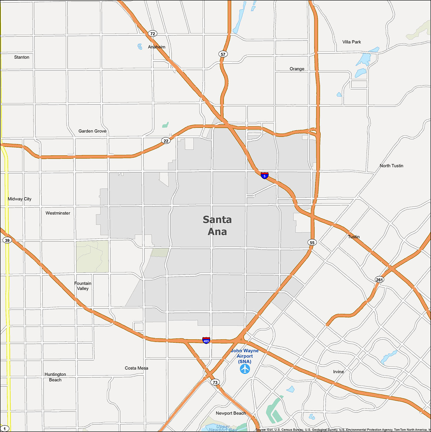
Santa Ana Road Map
Use this Santa Ana road map to plan your route and explore the city with ease. This printable road map will help you get around the city, and for any travel outside Santa Ana, you can refer to the California road map for highway information. The Santa Ana road map includes the following major highways: I-5, US Highways 22 and 55, and the Barranca Parkway. Additionally, the map includes major roads such as 1st Street, 4th Street, 5th Street, 17th Street, Bristol Street, Dyer Road, Edinger Avenue, Euclid Street, Fairview Street, Garden Grove Boulevard, Grand Avenue, Harbor Boulevard, Hesperian Street, Irvine Boulevard, La Veta Avenue, Mabury Street, MacArthur Boulevard, Main Place Drive, Main Street, Memory Lane, Mortimer Street, Owens Drive, Red Hill Avenue, Santa Ana Boulevard, Sunflower Avenue, The City Drive, Tustin Street, Warner Avenue, and Westminster Boulevard.
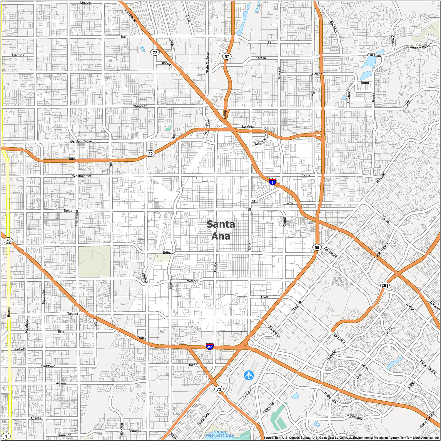
Exploring the city of Santa Ana is a great way to get to know the area and all that it has to offer. With this map of Santa Ana, you can easily find places of interest and plan your next outing. You can see all the different areas of Santa Ana, from the John Wayne Airport (SNA) to the cities of Anaheim, Costa Mesa, Fountain Valley, Garden Grove, Huntington Beach, Irvine, Newport Beach, Orange, Santa Ana, Tustin, Villa Park, and Westminster, as well as the census-designated place (CDP) of North Tustin. This map of Santa Ana will help you plan your next trip to this growing city and get a closer look at all that it has to offer.
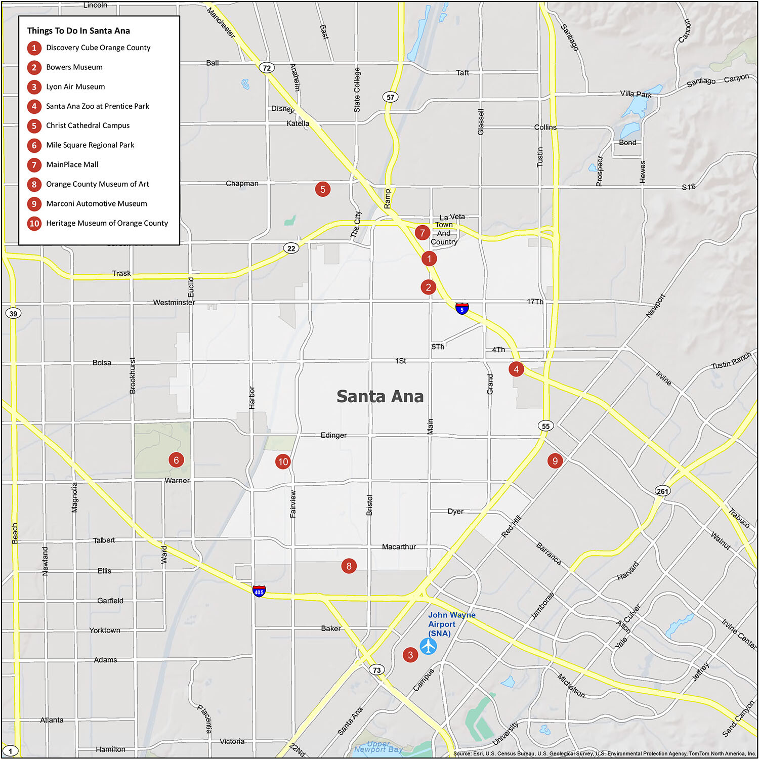
10 things to do in Santa Ana city
If you’re looking for a way to explore the hidden gems of Santa Ana, then this guide is for you. With this map, you can get a glimpse of the city and its attractions, and plan your visit accordingly. From the Discovery Cube Orange County to the Marconi Automotive Museum, there are plenty of things to do in Santa Ana. So, start exploring and enjoy your visit!
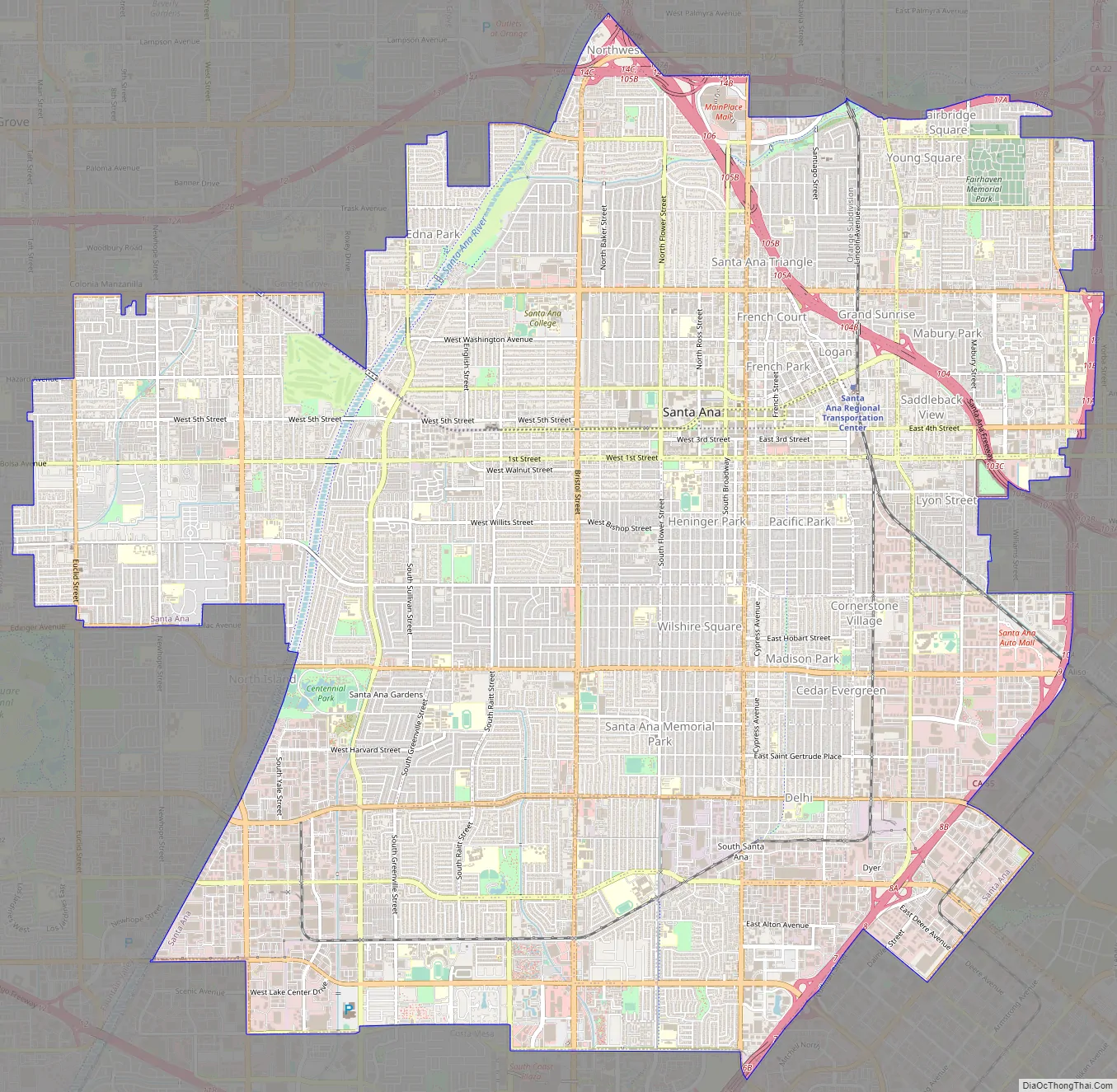
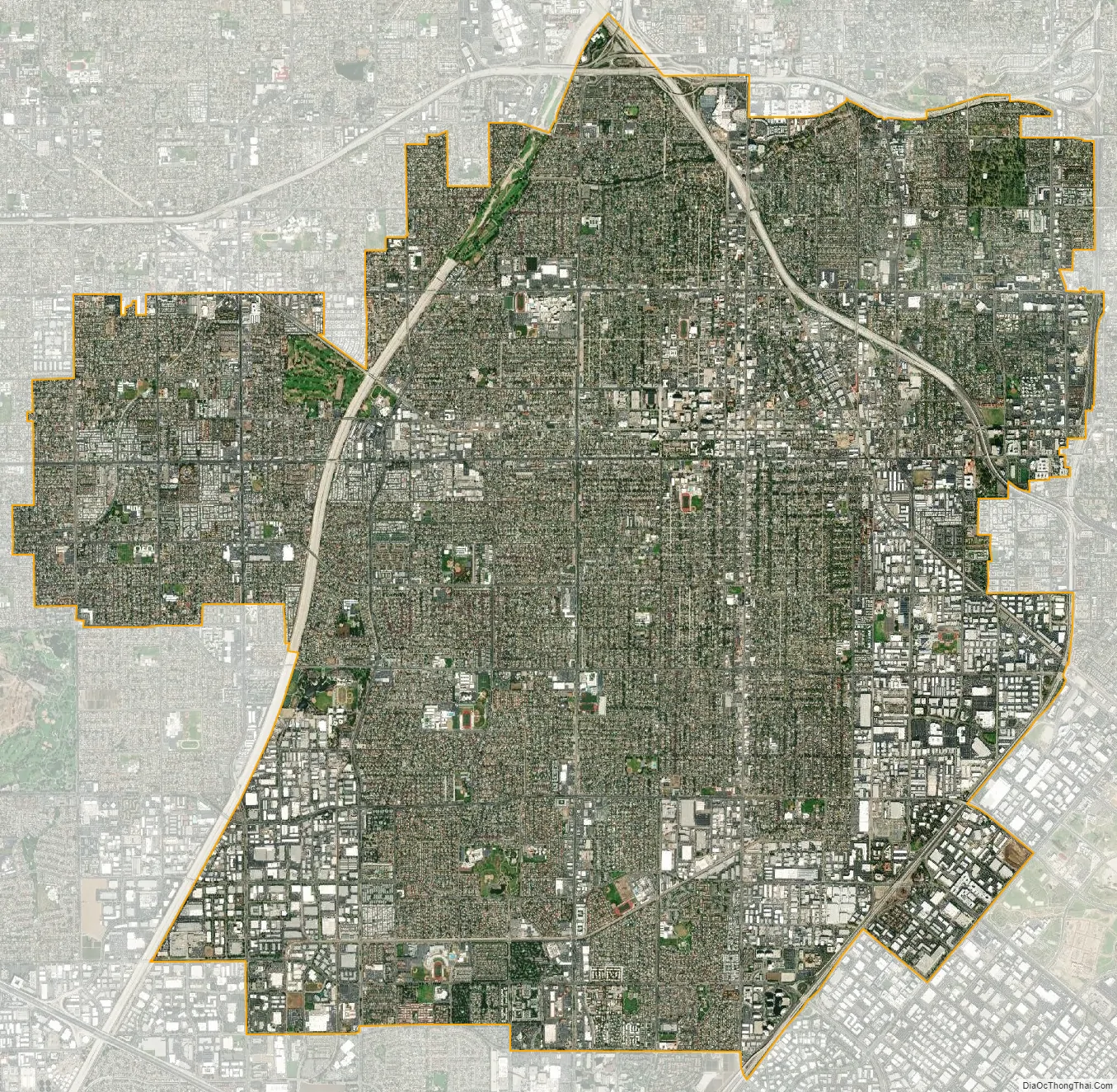
Santa Ana city Satellite Map
Geography
Santa Ana is located at 33°44′27″N 117°52′53″W / 33.74083°N 117.88139°W / 33.74083; -117.88139 (33.740717, -117.881408).
According to the United States Census Bureau, the city has a total area of 27.5 square miles (71 km). 27.3 square miles (71 km) of it is land and 0.2 square miles (0.52 km) of it (0.90%) is water. With 12,471.5 people per sq. mile, it is the fourth-most densely populated city in the United States with a population of 300,000 or more.
Santa Ana is nested on flat, low-lying plains with little land elevation change. Running through the west end of the city is the mostly channelized Santa Ana River, which is also largely seasonal due to the construction of the Prado Dam and Seven Oaks Dam. The river has caused several severe floods in the 20th century, and is a continued threat despite the existence of the dams.
Cityscape
Now fully developed, Santa Ana has several distinct districts. The core of the city is the downtown area, which contains both retail and housing, as well as the Santa Ana Civic Center, which is a dense campus of administrative buildings for both the city and the county of Orange. The civic center is also home to the Ronald Reagan Federal Building and Courthouse. Several historic homes dating from the late 1800s can be found as well, and their preservation is a key issue as development of the downtown area continues.
North of downtown is the “Midtown” district along Main St., home to entertainment destinations such as the Bowers Museum, MainPlace Mall, and the Discovery Science Center.
Near the intersection of the Santa Ana Freeway and the Costa Mesa Freeway is the newly designated “Metro East” area, which the city council has envisioned as a secondary mixed-use development district. Currently the area is occupied by several office towers, but little retail or housing. Also on the east side of the city is the Santa Ana Zoo, notable for its collection of monkeys and species from South and Central America.
The southeast end of the city is part of the South Coast Metro area, which is shared with the city of Costa Mesa. South Coast Plaza, a major shopping center, is the primary destination of this area, which also contains several high-rise office and apartment buildings. Yokohama Tire Corporation’s United States headquarters are located at 1 MacArthur Place in the South Coast Metro area of Santa Ana, and Banc of California’s headquarters relocated from the neighboring city of Irvine.
Climate
Santa Ana experiences a hot semi-arid climate (Köppen: BSh), with hot, dry summers and mild winters with moderate rainfall. The summer months of June to September average a daytime high of 83 °F (28.3 °C) and a nighttime low of 63 °F (17.2 °C). The winter months of December to March average a daytime high of 70 °F (21.1 °C) and a nighttime low of 48 °F (8.9 °C). Rainfall averages about 13.6 in (345 mm) per year, most of which falls from November through April. There are an average of 36 days with measurable precipitation annually.
The record high temperature for Santa Ana was 112 °F (44 °C) on June 14, 1917. The record low temperature was 22 °F (−6 °C) on December 31, 1918, and January 1, 1919. There are an average of 25.6 days with highs of 90 °F (32 °C) or higher and an average of 0.2 days with lows of 32 °F (0 °C) or lower.
The wettest “rain year” in Santa Ana was from July 1940 to June 1941 with 34.34 inches (872.2 mm), and the driest was from July 2017 to June 2018 with a mere 2.73 inches (69.3 mm). The most rainfall in one month was 13.99 inches (355.3 mm) in February 1998. The most rainfall in 24 hours was 4.69 inches (119.1 mm) on February 16, 1927.
See also
Map of California State and its subdivision:- Alameda
- Alpine
- Amador
- Butte
- Calaveras
- Colusa
- Contra Costa
- Del Norte
- El Dorado
- Fresno
- Glenn
- Humboldt
- Imperial
- Inyo
- Kern
- Kings
- Lake
- Lassen
- Los Angeles
- Madera
- Marin
- Mariposa
- Mendocino
- Merced
- Modoc
- Mono
- Monterey
- Napa
- Nevada
- Orange
- Placer
- Plumas
- Riverside
- Sacramento
- San Benito
- San Bernardino
- San Diego
- San Francisco
- San Joaquin
- San Luis Obispo
- San Mateo
- Santa Barbara
- Santa Clara
- Santa Cruz
- Shasta
- Sierra
- Siskiyou
- Solano
- Sonoma
- Stanislaus
- Sutter
- Tehama
- Trinity
- Tulare
- Tuolumne
- Ventura
- Yolo
- Yuba
- Alabama
- Alaska
- Arizona
- Arkansas
- California
- Colorado
- Connecticut
- Delaware
- District of Columbia
- Florida
- Georgia
- Hawaii
- Idaho
- Illinois
- Indiana
- Iowa
- Kansas
- Kentucky
- Louisiana
- Maine
- Maryland
- Massachusetts
- Michigan
- Minnesota
- Mississippi
- Missouri
- Montana
- Nebraska
- Nevada
- New Hampshire
- New Jersey
- New Mexico
- New York
- North Carolina
- North Dakota
- Ohio
- Oklahoma
- Oregon
- Pennsylvania
- Rhode Island
- South Carolina
- South Dakota
- Tennessee
- Texas
- Utah
- Vermont
- Virginia
- Washington
- West Virginia
- Wisconsin
- Wyoming


