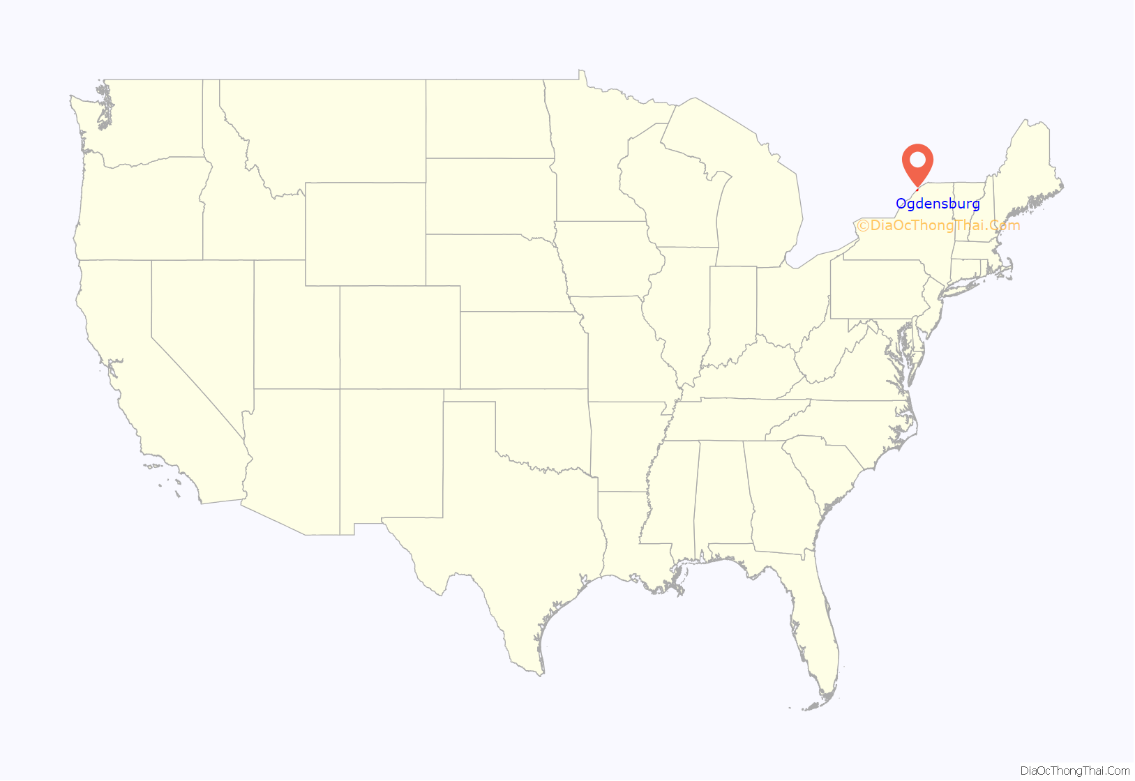
Ogdensburg (Mohawk: Kaniatarahòn:tsi) is a city in St. Lawrence County, New York, United States. The population was 10,436 at the 2019 census. In the late 18th century, European-American settlers named the community after American land owner and developer Samuel Ogden. The city is at the northern border of New York at the mouth of the Oswegatchie River on the south bank of the St. Lawrence River. The only formally designated city in the county, it is located between Massena, New York to the east and Brockville, Ontario to the west.
The port of Ogdensburg is the only U.S. port on the St. Lawrence Seaway. The Ogdensburg–Prescott International Bridge, northeast of the city, links the United States and Canada, with a direct highway from Prescott to Ottawa, the capital of Canada.
| Name: | Ogdensburg city |
|---|---|
| LSAD Code: | 25 |
| LSAD Description: | city (suffix) |
| State: | New York |
| County: | St. Lawrence County |
| Elevation: | 295 ft (90 m) |
| Total Area: | 8.14 sq mi (21.07 km²) |
| Land Area: | 4.96 sq mi (12.83 km²) |
| Water Area: | 3.18 sq mi (8.24 km²) |
| Total Population: | 10,064 |
| Population Density: | 2,030.67/sq mi (784.11/km²) |
| Area code: | 315 |
| FIPS code: | 3654485 |
| GNISfeature ID: | 0976759 |
| Website: | http://www.ogdensburg.org/ |
Online Interactive Map
Click on ![]() to view map in "full screen" mode.
to view map in "full screen" mode.
Ogdensburg location map. Where is Ogdensburg city?
History
This was ancient territory for thousands of years of indigenous peoples of varying cultures. By 1000 CE, Iroquoian-speaking people were settling along the St. Lawrence River and practicing agriculture, as well as hunting and fishing. The earliest French explorers recorded Stadacona and Hochelaga as villages of these people in the early 16th century. By the end of the century, later explorers found the villages utterly abandoned with no signs of life.
Since the 1950s, historians, linguists, and archeologists have found evidence of a distinct people, now called the St. Lawrence Iroquoians, who inhabited the areas along the St. Lawrence River from before 1300 until the late 16th century. They spoke Laurentian and were a group distinct from the later historical Five Nations of the Iroquois Haudenosaunee who emerged along the southern edge of the Great Lakes and were based in present-day New York and Pennsylvania. By the late 16th century, the St. Lawrence Iroquoians had disappeared from the St. Lawrence Valley, probably due to warfare by the Mohawk of the Haudenosaunee over the fur trade.
By the time of later French contact, for instance in the early 17th century with Samuel de Champlain, the Five Nations of the Haudenosaunee: Mohawk, Onondaga, Oneida, Cayuga, and Seneca, were allied in the Iroquois Confederacy, based in present-day New York. Onondaga settlements extended up along the south shore of Lake Ontario. Both the Huron and Mohawk used the St. Lawrence Valley for hunting grounds and as a path for war parties.
The earliest European settlement in the area was a French mission, built by Abbé Picquet in 1749 as part of the colony of New France in North America. Located near the mouth of the Fleuve Oswegache (Oswegatchie River), he named it Fort de La Présentation (Fort of the Presentation). The mission attracted Native Americans for the fur trade, many of whom settled in the village and converted to Catholicism. Mostly Onondaga, the converted Iroquois at the mission became known to the French as Oswegatchie after their transliterated name for the river.
By 1755, there were 3,000 Iroquois living at the mission settlement. By comparison, Montreal had only 4,000 residents at the time. It was bordered by a mission village, Kahnewake, located on the south side of the St. Lawrence River.
The Oswegatchie became known as one of the Seven Nations of Canada. The residents were hostile to the encroachments of British colonists on their territory. During the 1750s and the French and Indian War, warriors from this fort allied with French officers in attacking British colonists in the Champlain, Mohawk and Ohio valleys.
The city is near the site of the 1760 Battle of the Thousand Islands between British and French forces during the Seven Years’ War (known in the later United States as the French and Indian War.) Both sides made use of Indian allies. After the British victory in the war, France ceded its land in Canada and east of the Mississippi to England.
The English renamed this installation as Fort Oswegatchie, after the native name for the river (and as the English transliterated the French into English phonetic spelling). As with the other mission settlements, the British did not disturb the relationship of the Oswegatchie, as they called the native people, and their Catholic priests. The British considered this community part of Lower Canada or Quebec province. The village remained under British rule until 1796 following the American Revolutionary War. With the northern border redefined by Jay’s Treaty, the settlement became part of United States territory, which extended to the south shore of the St. Lawrence River in this area up to Cornwall, Ontario where the border followed the 45th parallel to the east along a latitude line.
The first settlers under an American flag arrived that year in 1796. American settlers essentially drove the Oswegatchie, former British allies, out of the area; many went to Akwesasne or other Mohawk reserves in Canada.
New American residents named the village Ogdensburgh after Samuel Ogden, an early landowner. The community developed around this early settlement, which was designated the county seat from 1802 to 1828. During the War of 1812, the city was captured by British forces to end the partial blockade on the St. Lawrence River and harassment that had been conducted from the community. In the absence of US troops, the local merchants restored an extensive trade with Canadian towns across the river.
The community was incorporated as a village in 1817. Unlike Plattsburgh, it removed the “h” in the spelling of its name. The locale was chartered as the City of Ogdensburg in 1868. It is located between Brockville, Ontario to the west and Massena, New York to the east.
In 1940 the town was the site of the signing of the Ogdensburg Agreement between Canadian Prime Minister Mackenzie King and United States President Franklin D. Roosevelt. This renewed the ties between the two countries after the 1939 outbreak of World War II in Europe. The celebrated German POW Franz von Werra escaped from Canada to Ogdensburg in a rowboat.
Ogdensburg hosted various minor league baseball teams between 1900 and 1951. Ogdensburg (1900–1901), the Ogdensburg Colts (1936–1939), Ottawa-Ogdensburg Senators (1940) and Ogdensburg Maples (1946–1951) played as members of the Northern New York League (1900–1901), Canadian–American League (1936–1940) and Border League (1946–1951). Ogdensburg was an affiliate of the Philadelphia Phillies (1940) and New York Giants (1948). Teams played at Winter Park, known today as Father Martin Park.
Ogdensburg Road Map
Ogdensburg city Satellite Map
See also
Map of New York State and its subdivision:- Albany
- Allegany
- Bronx
- Broome
- Cattaraugus
- Cayuga
- Chautauqua
- Chemung
- Chenango
- Clinton
- Columbia
- Cortland
- Delaware
- Dutchess
- Erie
- Essex
- Franklin
- Fulton
- Genesee
- Greene
- Hamilton
- Herkimer
- Jefferson
- Kings
- Lake Ontario
- Lewis
- Livingston
- Madison
- Monroe
- Montgomery
- Nassau
- New York
- Niagara
- Oneida
- Onondaga
- Ontario
- Orange
- Orleans
- Oswego
- Otsego
- Putnam
- Queens
- Rensselaer
- Richmond
- Rockland
- Saint Lawrence
- Saratoga
- Schenectady
- Schoharie
- Schuyler
- Seneca
- Steuben
- Suffolk
- Sullivan
- Tioga
- Tompkins
- Ulster
- Warren
- Washington
- Wayne
- Westchester
- Wyoming
- Yates
- Alabama
- Alaska
- Arizona
- Arkansas
- California
- Colorado
- Connecticut
- Delaware
- District of Columbia
- Florida
- Georgia
- Hawaii
- Idaho
- Illinois
- Indiana
- Iowa
- Kansas
- Kentucky
- Louisiana
- Maine
- Maryland
- Massachusetts
- Michigan
- Minnesota
- Mississippi
- Missouri
- Montana
- Nebraska
- Nevada
- New Hampshire
- New Jersey
- New Mexico
- New York
- North Carolina
- North Dakota
- Ohio
- Oklahoma
- Oregon
- Pennsylvania
- Rhode Island
- South Carolina
- South Dakota
- Tennessee
- Texas
- Utah
- Vermont
- Virginia
- Washington
- West Virginia
- Wisconsin
- Wyoming
