Orient is a hamlet and census-designated place (CDP) in Suffolk County, Long Island, New York, United States. The CDP’s population was 743 at the 2010 census.
Orient and Orient Point are used almost interchangeably. However, Orient Point refers specifically to the physical point at the end of the North Fork of Long Island, while Orient is the hamlet in which the point is located.
| Name: | Orient CDP |
|---|---|
| LSAD Code: | 57 |
| LSAD Description: | CDP (suffix) |
| State: | New York |
| County: | Suffolk County |
| Elevation: | 13 ft (4 m) |
| Total Area: | 10.09 sq mi (26.13 km²) |
| Land Area: | 5.13 sq mi (13.28 km²) |
| Water Area: | 4.96 sq mi (12.85 km²) |
| Total Population: | 999 |
| Population Density: | 194.89/sq mi (75.25/km²) |
| ZIP code: | 11957 |
| Area code: | 631 |
| FIPS code: | 3655321 |
| GNISfeature ID: | 0959470 |
Online Interactive Map
Click on ![]() to view map in "full screen" mode.
to view map in "full screen" mode.
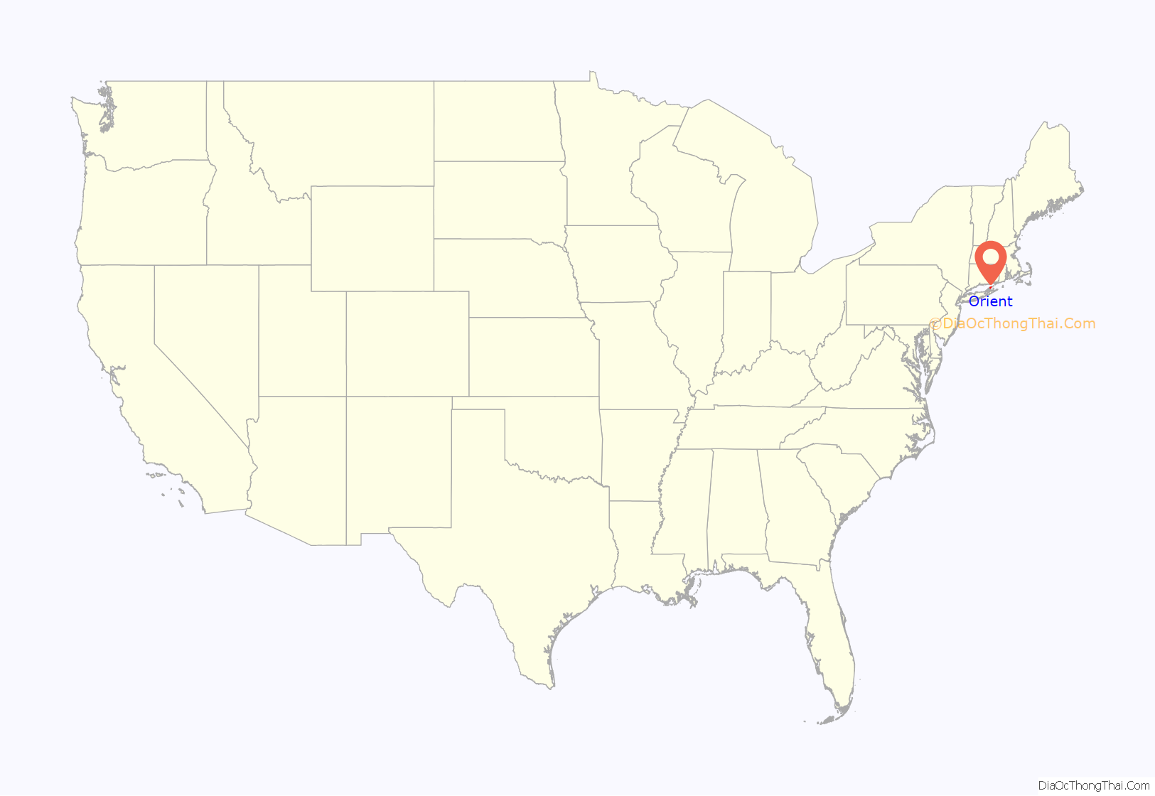
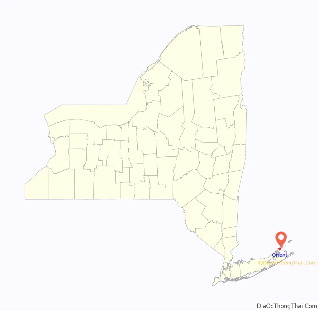
Orient location map. Where is Orient CDP?
History
Orient is the easternmost town on Long Island’s North Fork. It was originally named Poquatuck, after the name of the local Native American tribe that resided along the inland waterways, then named Oyster Ponds because of the nearby oyster beds.
Orient and East Marion were originally called Oysterponds because of the abundance of shellfish in the area. What is now Orient was known as Lower Neck, while East Marion was called Upper Neck. The communities separated in 1836 and East Marion was named for Revolutionary War Gen. Francis Marion, known as the Swamp Fox. “East” was tacked onto Marion because of an existing Marion upstate.
The name Orient was chosen to reflect that area’s easternmost position on the North Fork. A later legend has it that when Oyster Bay, New York became famous during the presidency of Teddy Roosevelt, the name was changed to Orient to match the name of its most prominent land feature, Orient Point.
Orient’s winter population swells to well over 1000 in the summer months. Other than a post office, a gas station, a country store, and a few seasonal tourist stands, there is no center of commerce, hence its residents depend on nearby Greenport for everyday necessities. Many make a living at the United States Department of Agriculture lab on nearby Plum Island, a 5-minute boat ride from Orient Point across Plum Gut, or at businesses further west. Truck farming and commercial fishing industries remain as well. Definitely New England in style and flavor, the hamlet of Orient has homes built over the last three centuries. Locals joke that a “new house” is anything built since World War II.
The hamlet was originally settled by five families given a land grant by the King of England in the 17th century, and their surnames, King, Terry, Glover, Latham, Tuthill and Vail, still exist in local families. Later, Orient was used as a base of operations by British commanders such as Benedict Arnold and local Tories during the American Revolution to conduct raids on Yankee-held Connecticut. Among Benedict Arnold’s headquarters was a local tavern owned and operated by the Vail family on what is now known as “Village Lane”. Many of the hamlet’s older structures are included in the Orient Historic District, added to the National Register of Historic Places in 1976.
Ferry service has connected Orient Point to southern New England for over a century. The Cross Sound Ferry currently operates a vehicle/passenger ferry service between Orient Point and New London, Connecticut. This service has expanded in recent years with Sea Jet service being provided to the Mohegan Sun and Foxwoods Casino.
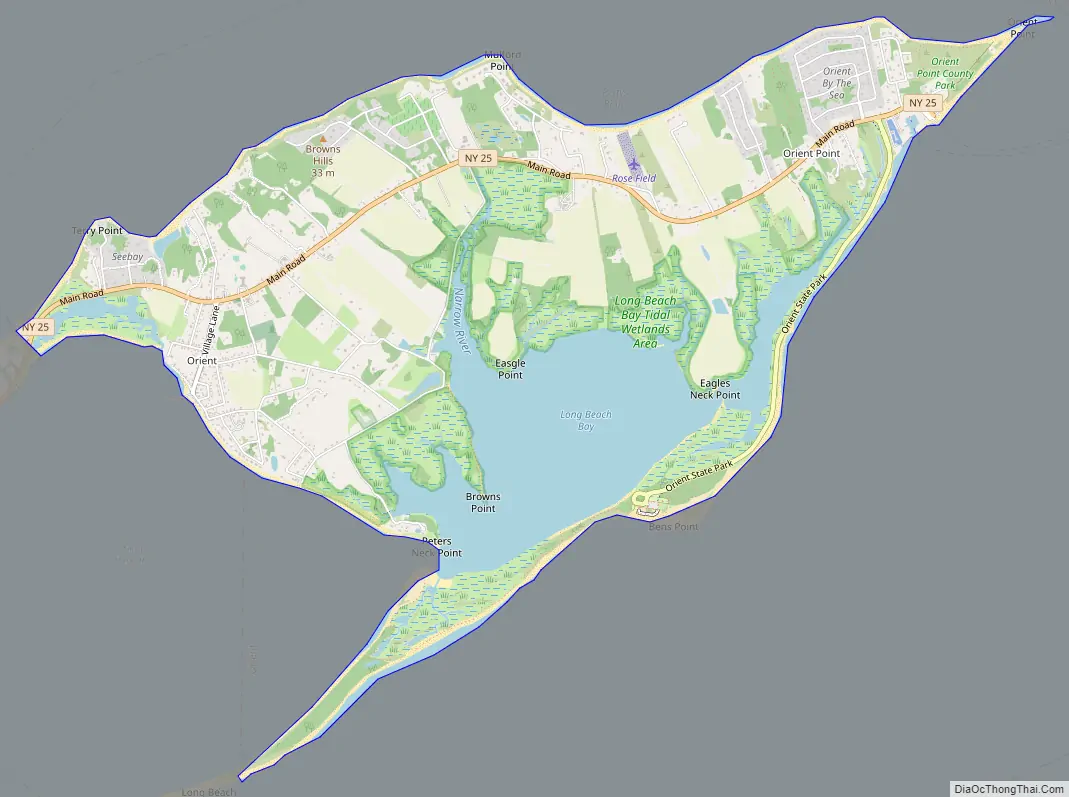
Orient Road Map
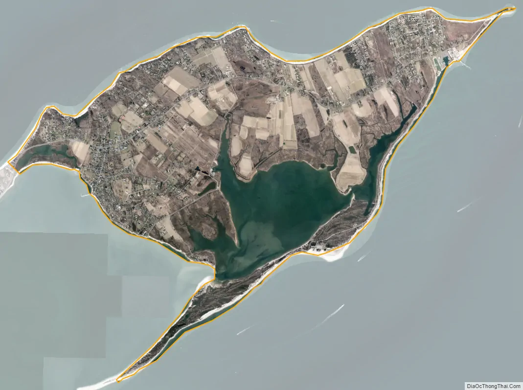
Orient city Satellite Map
Geography
According to the United States Census Bureau, the CDP has a total area of 6.1 square miles (16 km), of which 5.1 square miles (13 km) is land and 16.83%, or 1.0 square mile (2.6 km), is water.
Climate
Though Orient’s climate is influenced by both subtropical and continental air, it has a humid continental climate (Dfa), though due to the Atlantic Ocean current it borders on humid subtropical (Cfa.) The CDP experiences moderately cold, damp winters and warm, humid summers. The temperatures tend to be more moderate, especially during summer days, than other parts of the island due to the CDP’s coastal location and a constant onshore flow.
See also
Map of New York State and its subdivision:- Albany
- Allegany
- Bronx
- Broome
- Cattaraugus
- Cayuga
- Chautauqua
- Chemung
- Chenango
- Clinton
- Columbia
- Cortland
- Delaware
- Dutchess
- Erie
- Essex
- Franklin
- Fulton
- Genesee
- Greene
- Hamilton
- Herkimer
- Jefferson
- Kings
- Lake Ontario
- Lewis
- Livingston
- Madison
- Monroe
- Montgomery
- Nassau
- New York
- Niagara
- Oneida
- Onondaga
- Ontario
- Orange
- Orleans
- Oswego
- Otsego
- Putnam
- Queens
- Rensselaer
- Richmond
- Rockland
- Saint Lawrence
- Saratoga
- Schenectady
- Schoharie
- Schuyler
- Seneca
- Steuben
- Suffolk
- Sullivan
- Tioga
- Tompkins
- Ulster
- Warren
- Washington
- Wayne
- Westchester
- Wyoming
- Yates
- Alabama
- Alaska
- Arizona
- Arkansas
- California
- Colorado
- Connecticut
- Delaware
- District of Columbia
- Florida
- Georgia
- Hawaii
- Idaho
- Illinois
- Indiana
- Iowa
- Kansas
- Kentucky
- Louisiana
- Maine
- Maryland
- Massachusetts
- Michigan
- Minnesota
- Mississippi
- Missouri
- Montana
- Nebraska
- Nevada
- New Hampshire
- New Jersey
- New Mexico
- New York
- North Carolina
- North Dakota
- Ohio
- Oklahoma
- Oregon
- Pennsylvania
- Rhode Island
- South Carolina
- South Dakota
- Tennessee
- Texas
- Utah
- Vermont
- Virginia
- Washington
- West Virginia
- Wisconsin
- Wyoming


