Port Ewen is a hamlet (and census-designated place) in Ulster County, New York, United States. The population was 3,678 at the 2020 census. Port Ewen is in the Town of Esopus, south of Kingston, along U.S. Route 9W.
| Name: | Port Ewen CDP |
|---|---|
| LSAD Code: | 57 |
| LSAD Description: | CDP (suffix) |
| State: | New York |
| County: | Ulster County |
| Elevation: | 184 ft (56 m) |
| Total Area: | 2.74 sq mi (7.10 km²) |
| Land Area: | 2.09 sq mi (5.41 km²) |
| Water Area: | 0.65 sq mi (1.69 km²) |
| Total Population: | 3,678 |
| Population Density: | 1,760.65/sq mi (679.74/km²) |
| ZIP code: | 12466 |
| Area code: | 845 |
| FIPS code: | 3659311 |
| GNISfeature ID: | 0960965 |
Online Interactive Map
Click on ![]() to view map in "full screen" mode.
to view map in "full screen" mode.
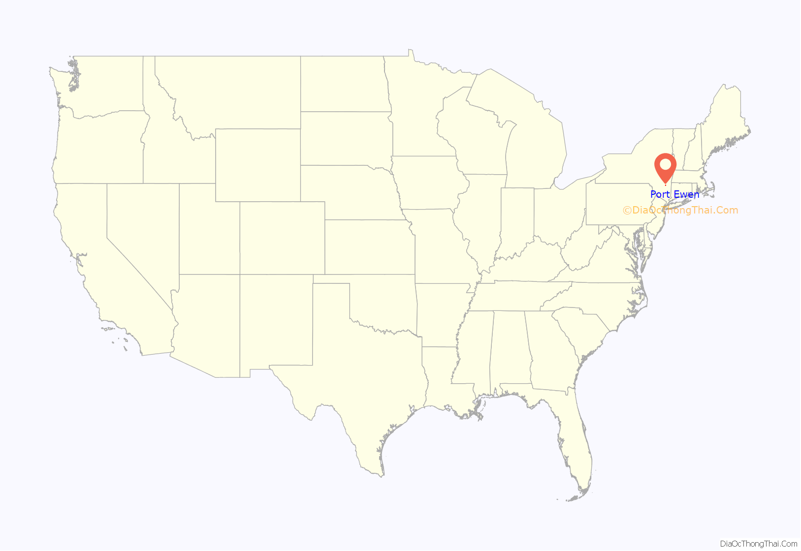
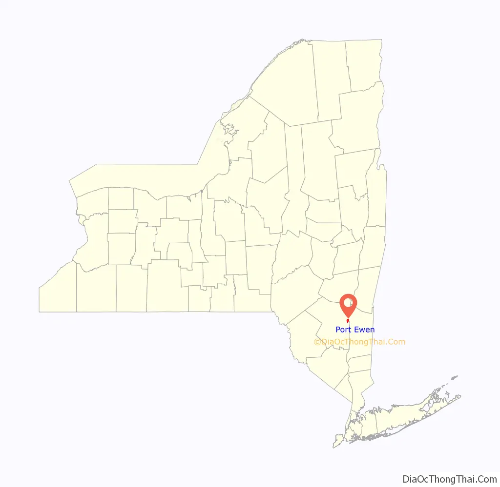
Port Ewen location map. Where is Port Ewen CDP?
History
The prospect of finding work with the Pennsylvania Coal Company attracted many to Port Ewen. Port Ewen was served by the West Shore Railroad, which shipped, among other freight, high explosives produced by the Nitro Powder Company in Kingston.
Before the opening of the Kingston–Port Ewen Suspension Bridge in 1921, those wishing to cross Rondout Creek would have to take the Skillypot, a chain ferry that ran to Sleightsburgh, and one which was noted for its sporadic service.
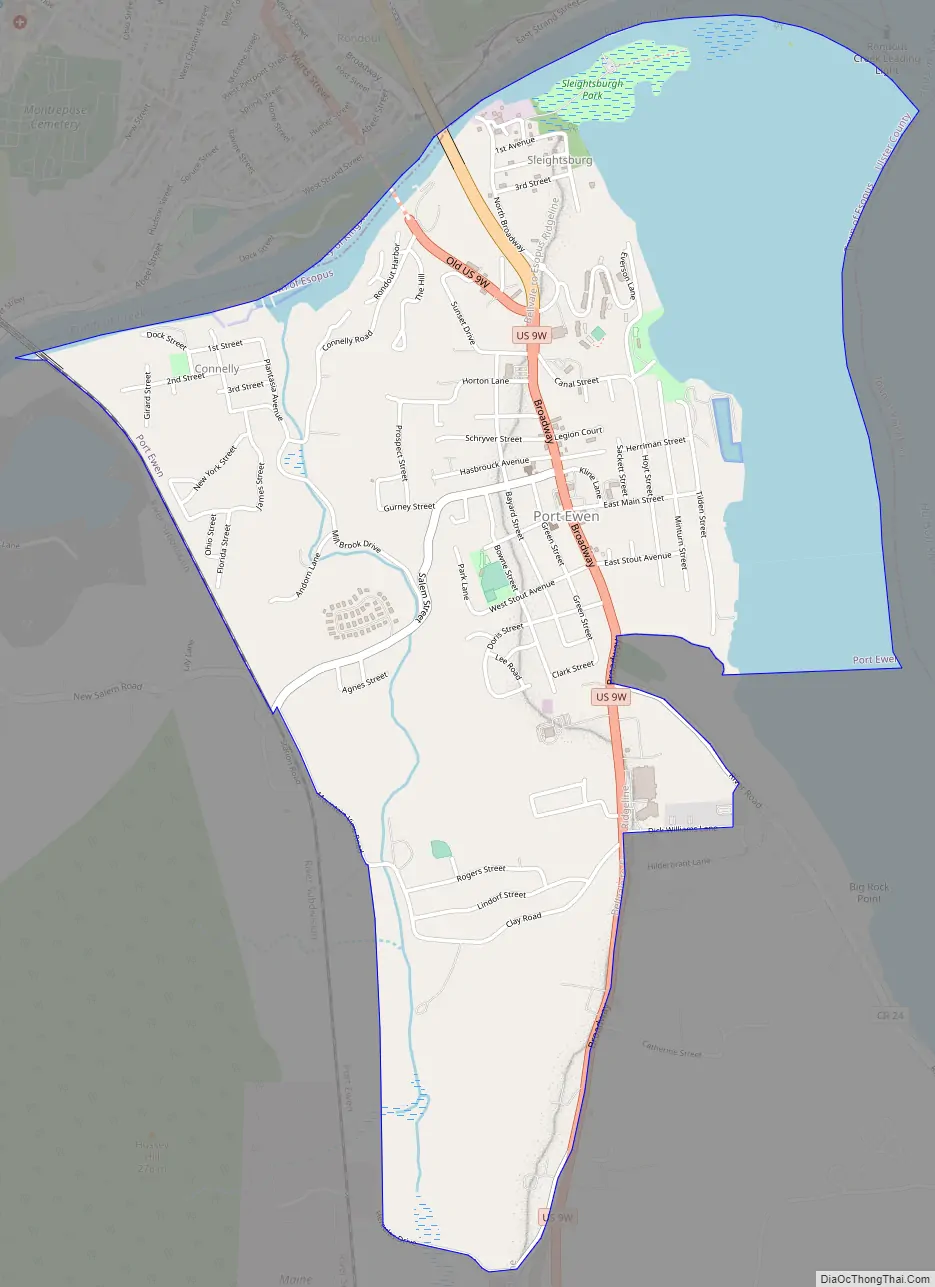
Port Ewen Road Map
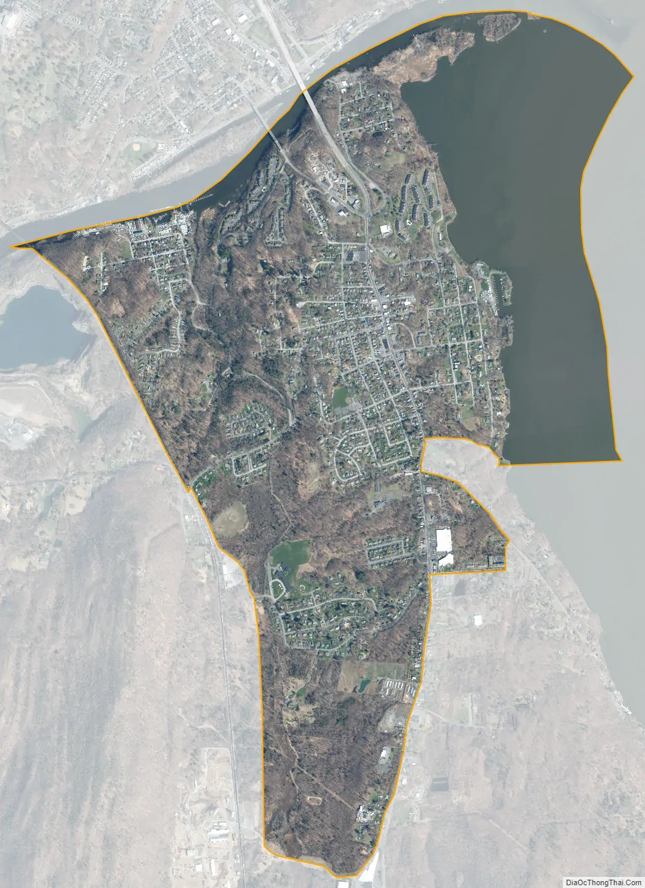
Port Ewen city Satellite Map
Geography
Port Ewen is on the west bank of the Hudson River at the mouth of Rondout Creek.
Port Ewen is located at 41°54′25″N 73°58′43″W / 41.90694°N 73.97861°W / 41.90694; -73.97861 (41.906980, -73.978599).
According to the United States Census Bureau, the CDP has a total area of 2.7 square miles (7.0 km), of which 2.0 square miles (5.2 km) is land and 0.7 square miles (1.8 km) (26.97%) is water.
See also
Map of New York State and its subdivision:- Albany
- Allegany
- Bronx
- Broome
- Cattaraugus
- Cayuga
- Chautauqua
- Chemung
- Chenango
- Clinton
- Columbia
- Cortland
- Delaware
- Dutchess
- Erie
- Essex
- Franklin
- Fulton
- Genesee
- Greene
- Hamilton
- Herkimer
- Jefferson
- Kings
- Lake Ontario
- Lewis
- Livingston
- Madison
- Monroe
- Montgomery
- Nassau
- New York
- Niagara
- Oneida
- Onondaga
- Ontario
- Orange
- Orleans
- Oswego
- Otsego
- Putnam
- Queens
- Rensselaer
- Richmond
- Rockland
- Saint Lawrence
- Saratoga
- Schenectady
- Schoharie
- Schuyler
- Seneca
- Steuben
- Suffolk
- Sullivan
- Tioga
- Tompkins
- Ulster
- Warren
- Washington
- Wayne
- Westchester
- Wyoming
- Yates
- Alabama
- Alaska
- Arizona
- Arkansas
- California
- Colorado
- Connecticut
- Delaware
- District of Columbia
- Florida
- Georgia
- Hawaii
- Idaho
- Illinois
- Indiana
- Iowa
- Kansas
- Kentucky
- Louisiana
- Maine
- Maryland
- Massachusetts
- Michigan
- Minnesota
- Mississippi
- Missouri
- Montana
- Nebraska
- Nevada
- New Hampshire
- New Jersey
- New Mexico
- New York
- North Carolina
- North Dakota
- Ohio
- Oklahoma
- Oregon
- Pennsylvania
- Rhode Island
- South Carolina
- South Dakota
- Tennessee
- Texas
- Utah
- Vermont
- Virginia
- Washington
- West Virginia
- Wisconsin
- Wyoming


