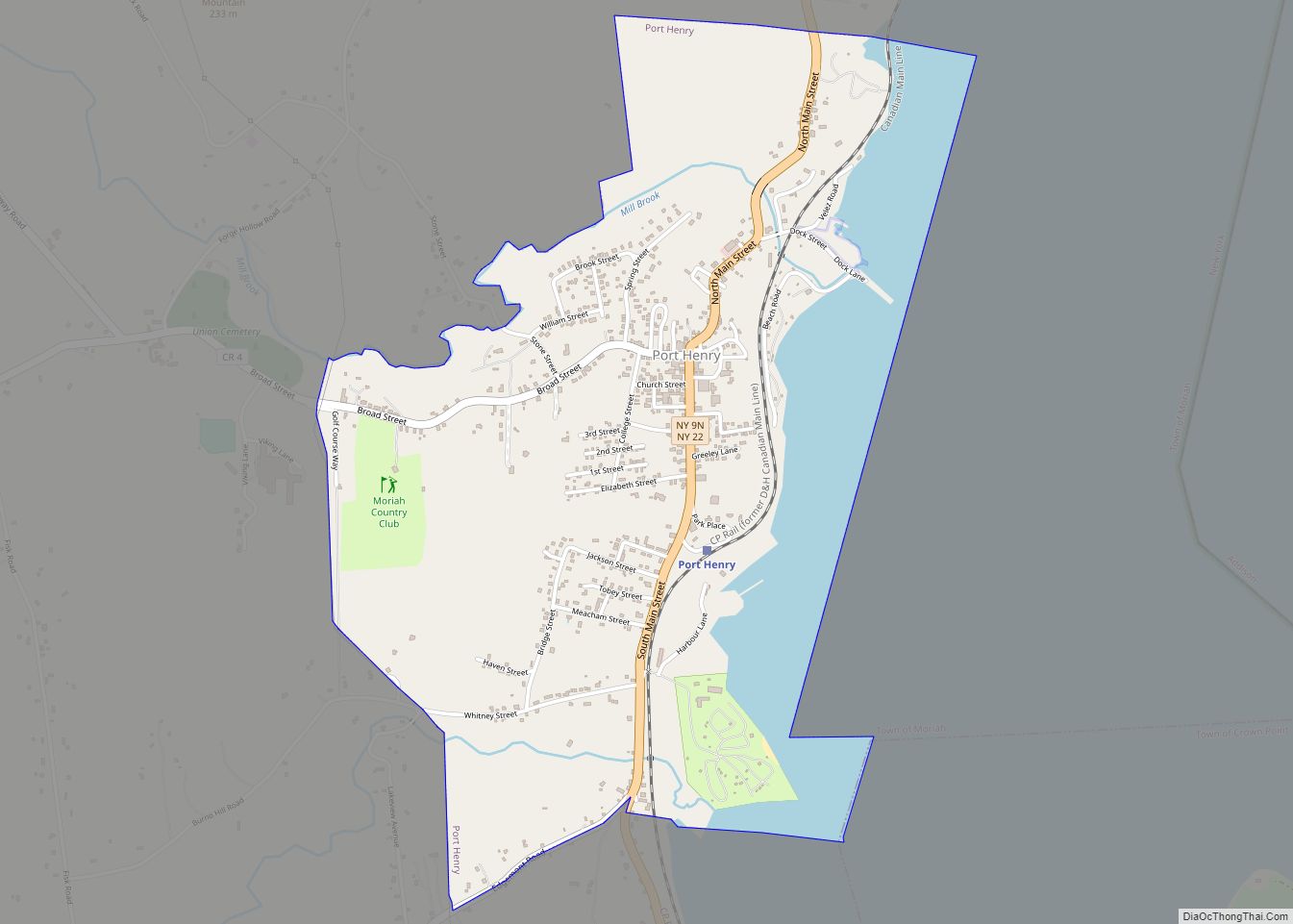
Port Henry is a hamlet (and census-designated place) in Essex County, New York, United States. The population was 1,194 at the 2010 census.
Port Henry lies on the eastern side of the town of Moriah and is approximately one hour’s drive (52 miles or 84 km) south of Plattsburgh. It is 44 miles (71 km) by road south-southwest of Burlington, Vermont, 115 miles (185 km) north of Albany and 113 miles (182 km) south of Montreal, Quebec.
| Name: | Port Henry CDP |
|---|---|
| LSAD Code: | 57 |
| LSAD Description: | CDP (suffix) |
| State: | New York |
| County: | Essex County |
| Incorporated: | May 1, 1869 |
| Elevation: | 243 ft (74 m) |
| Total Area: | 1.73 sq mi (4.48 km²) |
| Land Area: | 1.39 sq mi (3.60 km²) |
| Water Area: | 0.34 sq mi (0.88 km²) |
| Total Population: | 1,150 |
| Population Density: | 826.74/sq mi (319.26/km²) |
| ZIP code: | 12974 |
| Area code: | 518 |
| FIPS code: | 3659333 |
| GNISfeature ID: | 0960967 |
| Website: | http://www.porthenrymoriah.com |
Online Interactive Map
Click on ![]() to view map in "full screen" mode.
to view map in "full screen" mode.
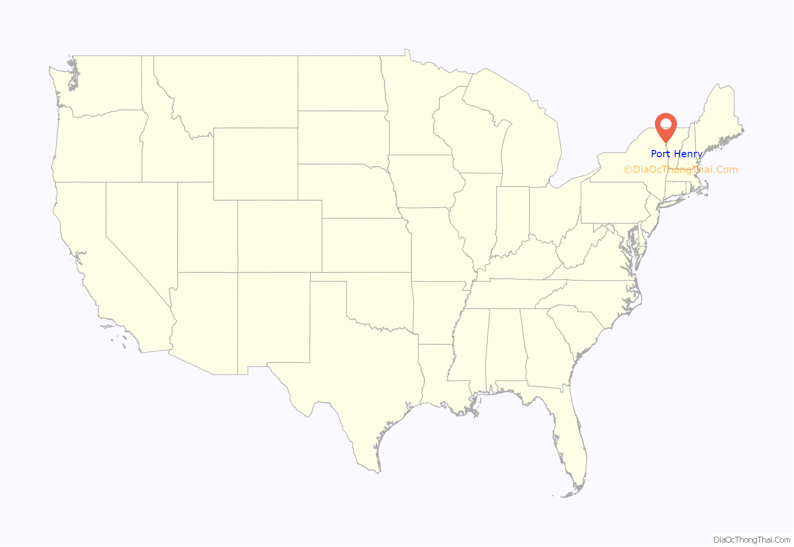
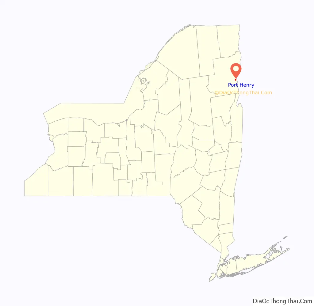
Port Henry location map. Where is Port Henry CDP?
History
Port Henry is in a tract of land set aside by the British Crown for veterans of the Seven Years’ War (also known as the French and Indian War). Although a mill was built in 1765, no other European-American settlers arrived until 1785, after the American Revolutionary War.
The Iroquoian-speaking Mohawk and Oswegatchie, members of the Seven Nations of Canada, were still living in the town until after 1800.
Most of the Iroquois from the territory of New York had been resettled in Canada, forced out of New York and the United States due to their alliance with the British during the war. In the early years, timber harvesting was a major industry and 20 mills were located in the area. The first dock was built on Lake Champlain by 1820 for shipping lumber to other ports.
Early settlers discovered iron ore a few miles inland. Its extraction and processing became an important industry in the township for about one hundred and fifty years. A blast furnace constructed in 1822 in Port Henry was one of the first in the United States, and Republic Steel established major operations in the county. The village residents used Lake Champlain and the Hudson River to transport its ore and products to major markets such as Albany and New York City. Later a railroad connected the village to markets.
The village of Port Henry was incorporated in 1869. By the end of the 19th century, residents harvested smelt from the lake for the restaurant trade, by ice fishing. The Delaware & Hudson Railroad Depot, Moriah Town Office Building, Mount Moriah Presbyterian Church, Port Henry Fire Department Building, Sherman Free Library, and Van Ornam & Murdock Block are listed on the National Register of Historic Places. The Essex County Republication was published in Port Henry in the 19th and early 20th centuries, after which it moved to Keeseville.
Effective March 31, 2017, the Village of Port Henry was dissolved by the result of a public referendum. The village ceased to exist as a municipality. Village operations were absorbed by the Town of Moriah. Port Henry continues to exist as a hamlet within the town.
Port Henry Road Map
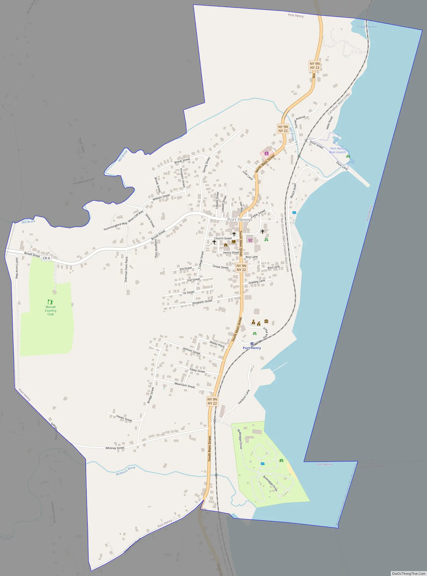
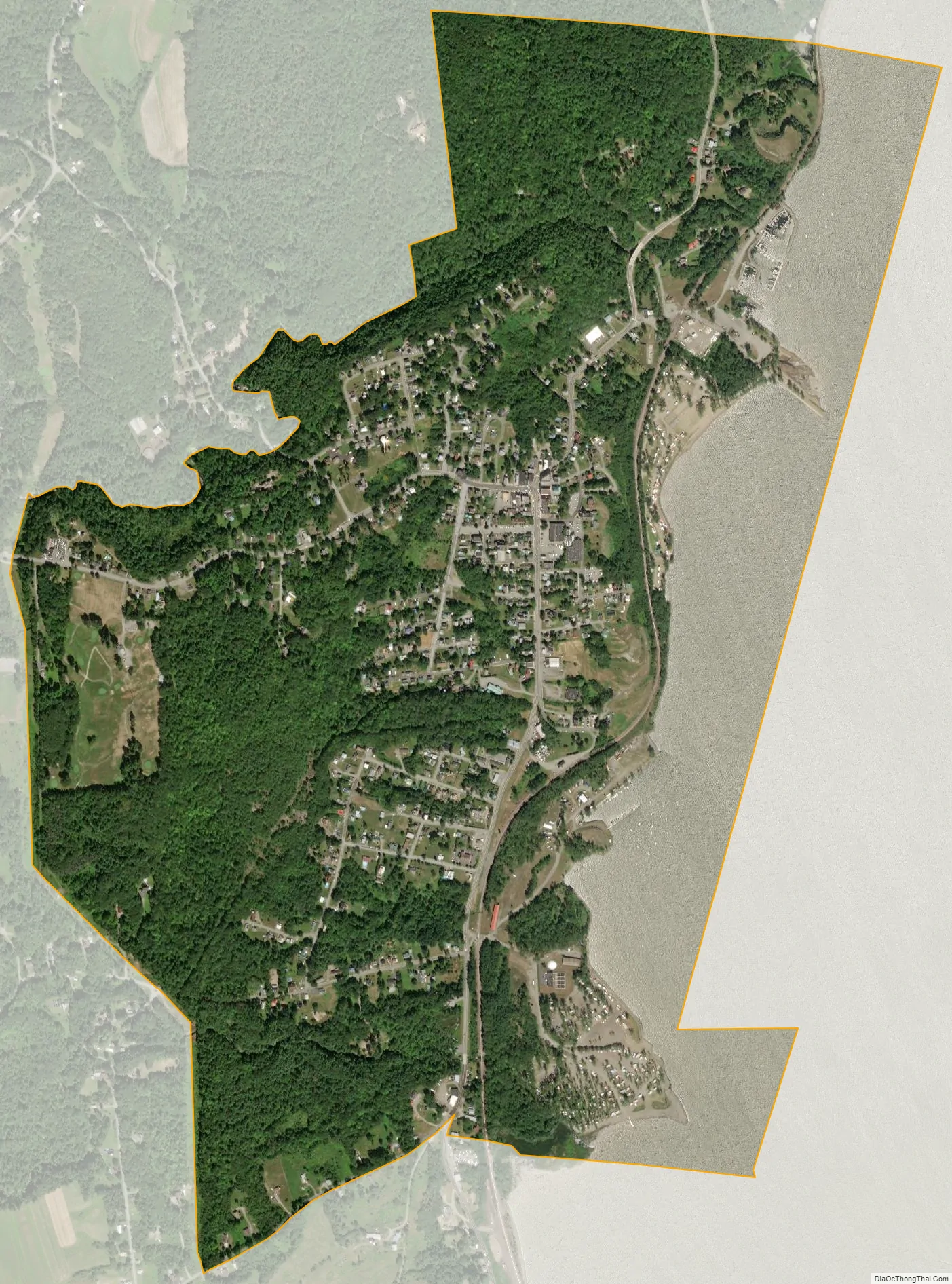
Port Henry city Satellite Map
Geography
Port Henry is located in eastern Essex County at 44°2′43″N 73°27′40″W / 44.04528°N 73.46111°W / 44.04528; -73.46111 (44.045238, −73.461011), in the eastern part of the town of Moriah. The village is on the western shore of Lake Champlain at the northern end of Bulwagga Bay and is in the Adirondack Park.
According to the United States Census Bureau, the village has a total area of 1.5 square miles (3.8 km), of which 1.2 square miles (3.0 km) is land and 0.3 square miles (0.8 km), or 20.29%, is water. Port Henry is located on conjoined New York State Route 9N and New York State Route 22 (North/South Main Street) at the junction of County Road 4 (Broad Street).
See also
Map of New York State and its subdivision:- Albany
- Allegany
- Bronx
- Broome
- Cattaraugus
- Cayuga
- Chautauqua
- Chemung
- Chenango
- Clinton
- Columbia
- Cortland
- Delaware
- Dutchess
- Erie
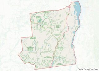
- Essex
- Franklin
- Fulton
- Genesee
- Greene
- Hamilton
- Herkimer
- Jefferson
- Kings
- Lake Ontario
- Lewis
- Livingston
- Madison
- Monroe
- Montgomery
- Nassau
- New York
- Niagara
- Oneida
- Onondaga
- Ontario
- Orange
- Orleans
- Oswego
- Otsego
- Putnam
- Queens
- Rensselaer
- Richmond
- Rockland
- Saint Lawrence
- Saratoga
- Schenectady
- Schoharie
- Schuyler
- Seneca
- Steuben
- Suffolk
- Sullivan
- Tioga
- Tompkins
- Ulster
- Warren
- Washington
- Wayne
- Westchester
- Wyoming
- Yates
- Alabama
- Alaska
- Arizona
- Arkansas
- California
- Colorado
- Connecticut
- Delaware
- District of Columbia
- Florida
- Georgia
- Hawaii
- Idaho
- Illinois
- Indiana
- Iowa
- Kansas
- Kentucky
- Louisiana
- Maine
- Maryland
- Massachusetts
- Michigan
- Minnesota
- Mississippi
- Missouri
- Montana
- Nebraska
- Nevada
- New Hampshire
- New Jersey
- New Mexico
- New York
- North Carolina
- North Dakota
- Ohio
- Oklahoma
- Oregon
- Pennsylvania
- Rhode Island
- South Carolina
- South Dakota
- Tennessee
- Texas
- Utah
- Vermont
- Virginia
- Washington
- West Virginia
- Wisconsin
- Wyoming