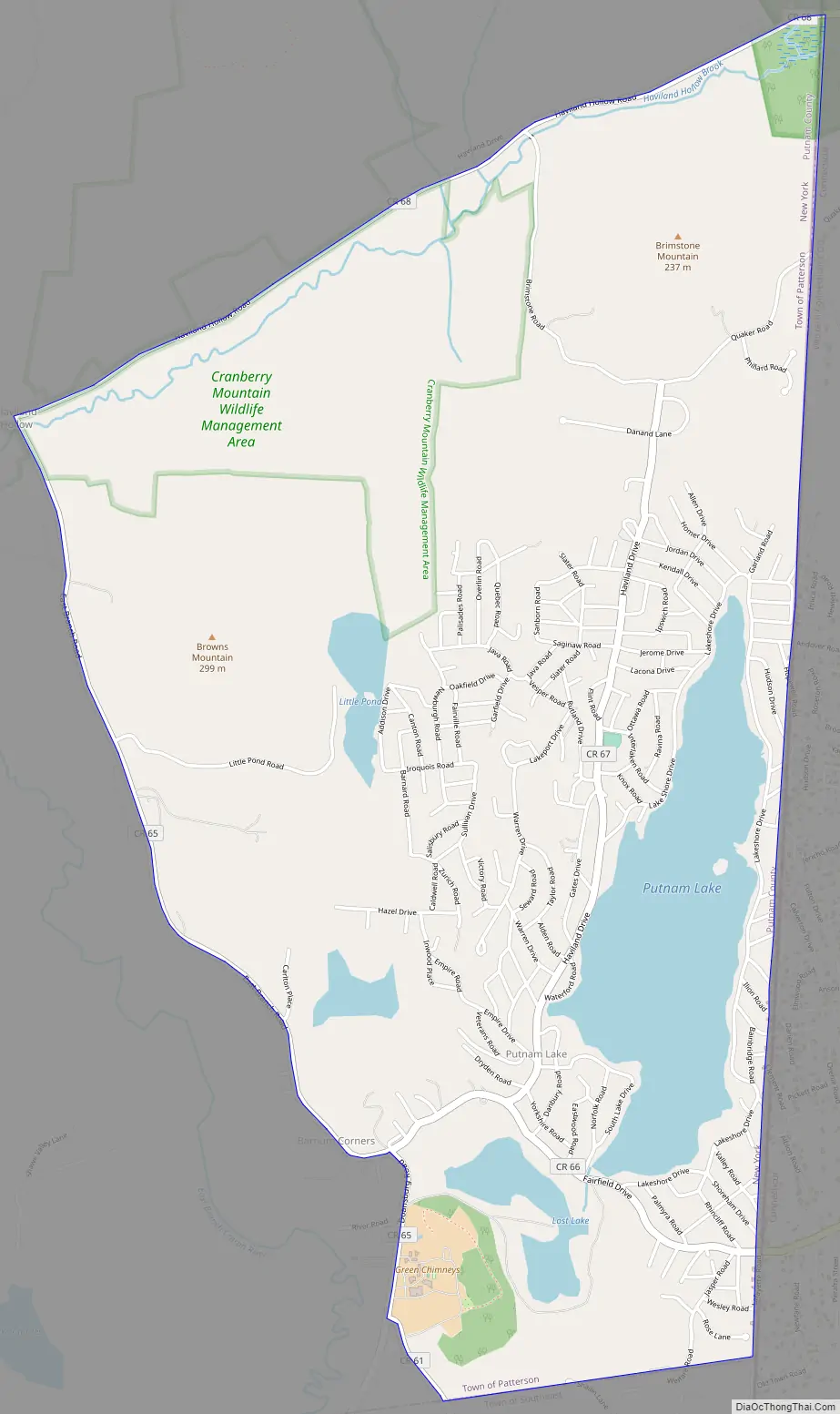
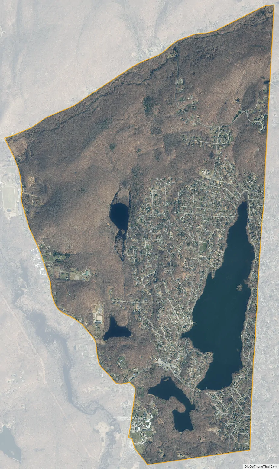
Putnam Lake is a hamlet and census-designated place in the eastern part of the town of Patterson in Putnam County, New York, United States. As of the 2010 census, the population was 3,844. Putnam Lake is adjacent to the Connecticut border, which is crossed by a number of local streets. The community surrounds a lake, which is also called Putnam Lake.
| Name: | Putnam Lake CDP |
|---|---|
| LSAD Code: | 57 |
| LSAD Description: | CDP (suffix) |
| State: | New York |
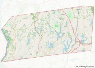
| County: | Putnam County |
| Elevation: | 512 ft (156 m) |
| Total Area: | 4.97 sq mi (12.88 km²) |
| Land Area: | 4.55 sq mi (11.79 km²) |
| Water Area: | 0.42 sq mi (1.09 km²) |
| Total Population: | 3,776 |
| Population Density: | 829.34/sq mi (320.18/km²) |
| FIPS code: | 3660103 |
| GNISfeature ID: | 0962011 |
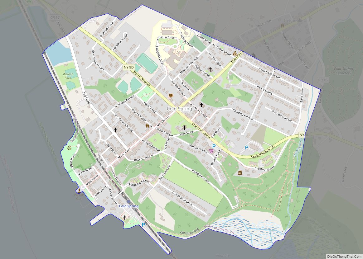
Online Interactive Map
Click on ![]() to view map in "full screen" mode.
to view map in "full screen" mode.
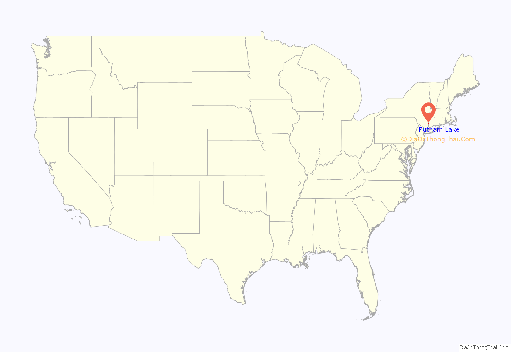
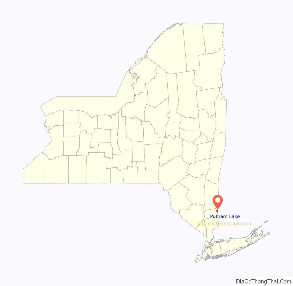
Putnam Lake location map. Where is Putnam Lake CDP?
History
Up until the end of World War I, Putnam Lake was a small rural hamlet called Valleyville, consisting mainly of dairy farms. In the years leading into the Great Depression, failing farms were bought by developers McGolrick Realty Co. in association with Warren and Arthur Smadbeck, to create a recreational community for New York City citizens.
In 1930, the State Line Golf and Country Club in association with the Smadbecks’ New York Daily Mirror Holding Co. bought five farms, totaling 1,111 acres (4.50 km) of land in Patterson, encroaching New Fairfield, Connecticut. Morlock Brook was dammed, flooding the area of Valleyville, creating the 200-acre (0.81 km) lake.
The area around Putnam Lake was divided into 11,000 plots, each 20 by 100 feet (6.1 by 30.5 m), which were to be occupied by summer cottages, general stores, restaurants, gas stations, dance pavilions, and taverns. The New York Daily Mirror first published advertisements for the community in 1931, and 75 percent of the lots were sold in the first year. Some 2000 homes were built by 1932, which made Putnam Lake the most densely populated community in Patterson, if only for the summer. Some families made Putnam Lake their year-round residence, and a school house was constructed where the Veterans of Foreign Wars building now stands on Fairfield Drive.
The Putnam Lake Property Owners Association, now known as the Putnam Lake Community Council, was formed in the 1930s, with Herbert M. Holton as its first president. The PLCC was, and still is, a volunteer organization which collected dues from families living in Putnam Lake. The PLCC once provided paved roads, electricity, and fire protection, as well as social and recreational activities for Putnam Lake families including the community swimming pool, clubhouse, and tennis court. The PLCC now owns and is responsible for the beaches, parks, Memorial Field, and the boat house.
In May 1952, Memorial Field, to be dedicated to the Putnam Lake casualties of World War II, was proposed to replace the swimming pool, which had not been used since the early 1930s because it was contaminated with seepage and infested with leeches. Construction proceeded through the leadership of Henry Sherer, and in 1955, Edward Angerola, chairmen of the Memorial Field committee. Tiles were used to divert water running through the ground, and fill was brought in from the land surrounding the firehouse. Memorial Field’s baseball diamond and field is used in the warmer months.
In 2011 a petition was circulated to create a park district. The petition was certified by the Town of Patterson and the property and assets were transferred to the Town at the end of 2012.
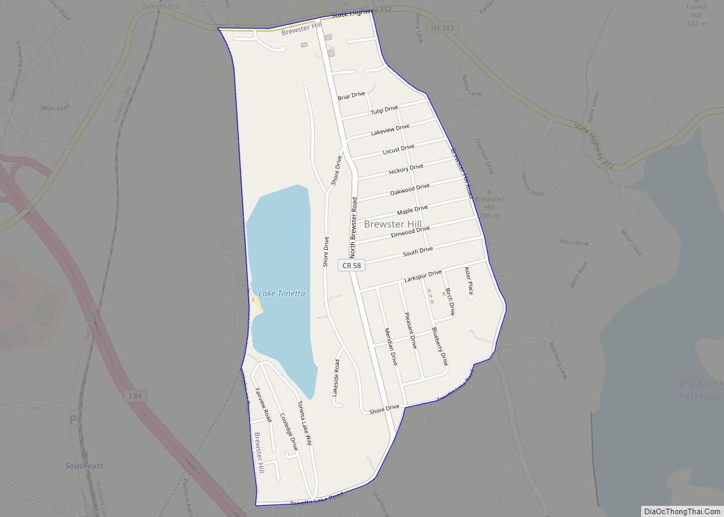
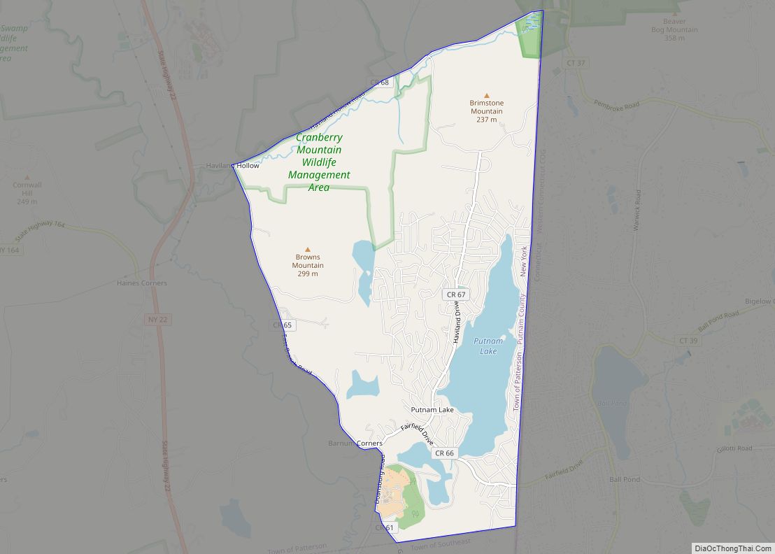
Putnam Lake Road Map
Putnam Lake city Satellite Map
Geography
Putnam Lake is located at 41°28′10″N 73°32′37″W / 41.46944°N 73.54361°W / 41.46944; -73.54361 (41.469378, -73.543671).
According to the United States Census Bureau, the CDP has a total area of 4.3 square miles (11 km), of which 3.9 square miles (10 km) is land and 0.4 square miles (1.0 km), or 10.21%, is water.
See also
Map of New York State and its subdivision:- Albany
- Allegany
- Bronx
- Broome
- Cattaraugus
- Cayuga
- Chautauqua
- Chemung
- Chenango
- Clinton
- Columbia
- Cortland
- Delaware
- Dutchess
- Erie
- Essex
- Franklin
- Fulton
- Genesee
- Greene
- Hamilton
- Herkimer
- Jefferson
- Kings
- Lake Ontario
- Lewis
- Livingston
- Madison
- Monroe
- Montgomery
- Nassau
- New York
- Niagara
- Oneida
- Onondaga
- Ontario
- Orange
- Orleans
- Oswego
- Otsego
- Putnam
- Queens
- Rensselaer
- Richmond
- Rockland
- Saint Lawrence
- Saratoga
- Schenectady
- Schoharie
- Schuyler
- Seneca
- Steuben
- Suffolk
- Sullivan
- Tioga
- Tompkins
- Ulster
- Warren
- Washington
- Wayne
- Westchester
- Wyoming
- Yates
- Alabama
- Alaska
- Arizona
- Arkansas
- California
- Colorado
- Connecticut
- Delaware
- District of Columbia
- Florida
- Georgia
- Hawaii
- Idaho
- Illinois
- Indiana
- Iowa
- Kansas
- Kentucky
- Louisiana
- Maine
- Maryland
- Massachusetts
- Michigan
- Minnesota
- Mississippi
- Missouri
- Montana
- Nebraska
- Nevada
- New Hampshire
- New Jersey
- New Mexico
- New York
- North Carolina
- North Dakota
- Ohio
- Oklahoma
- Oregon
- Pennsylvania
- Rhode Island
- South Carolina
- South Dakota
- Tennessee
- Texas
- Utah
- Vermont
- Virginia
- Washington
- West Virginia
- Wisconsin
- Wyoming