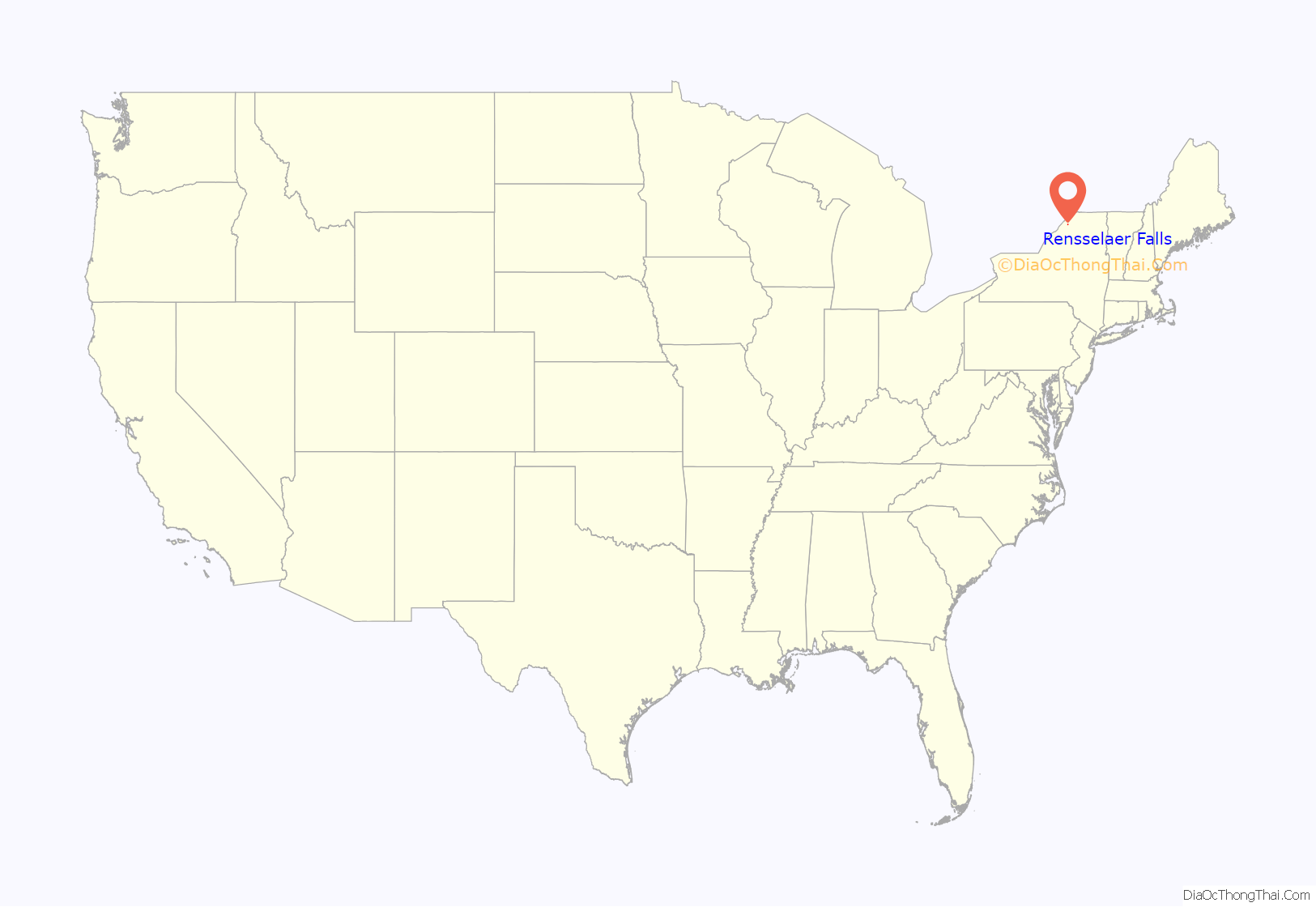
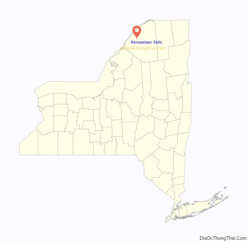
Rensselaer Falls is a village located in St. Lawrence County, New York. As of the 2010 census, the village had a total population of 332. The current name came from mill owner Henry Van Rensselaer.
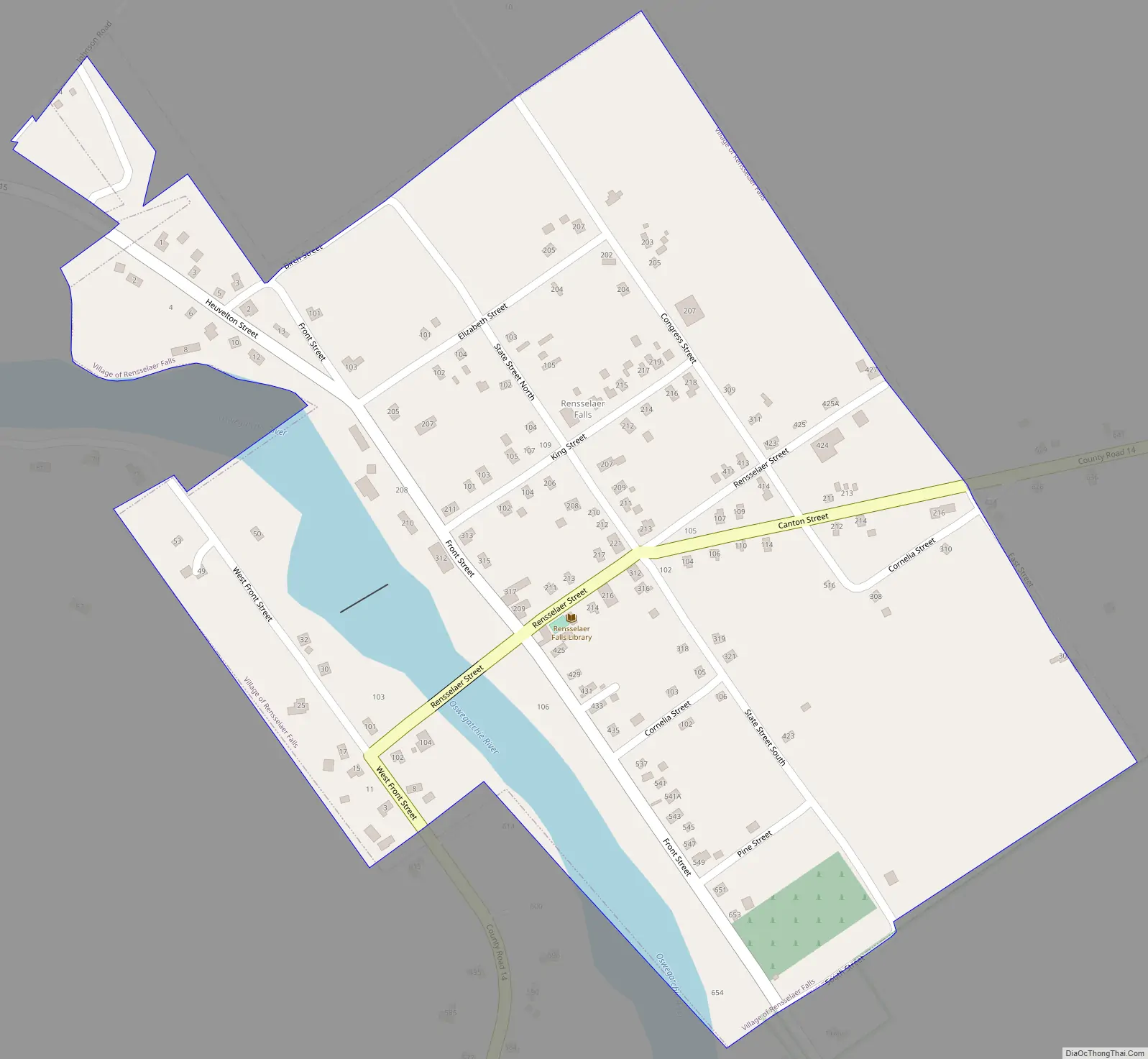
The Village of Rensselaer Falls is in the western part of the Town of Canton and is due west of the Village of Canton.
| Name: | Rensselaer Falls village |
|---|---|
| LSAD Code: | 47 |
| LSAD Description: | village (suffix) |
| State: | New York |
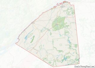
| County: | St. Lawrence County |
| Elevation: | 328 ft (100 m) |
| Total Area: | 0.32 sq mi (0.82 km²) |
| Land Area: | 0.29 sq mi (0.75 km²) |
| Water Area: | 0.03 sq mi (0.07 km²) |
| Total Population: | 361 |
| Population Density: | 1,240.55/sq mi (479.68/km²) |
| FIPS code: | 3661159 |
| GNISfeature ID: | 0976882 |
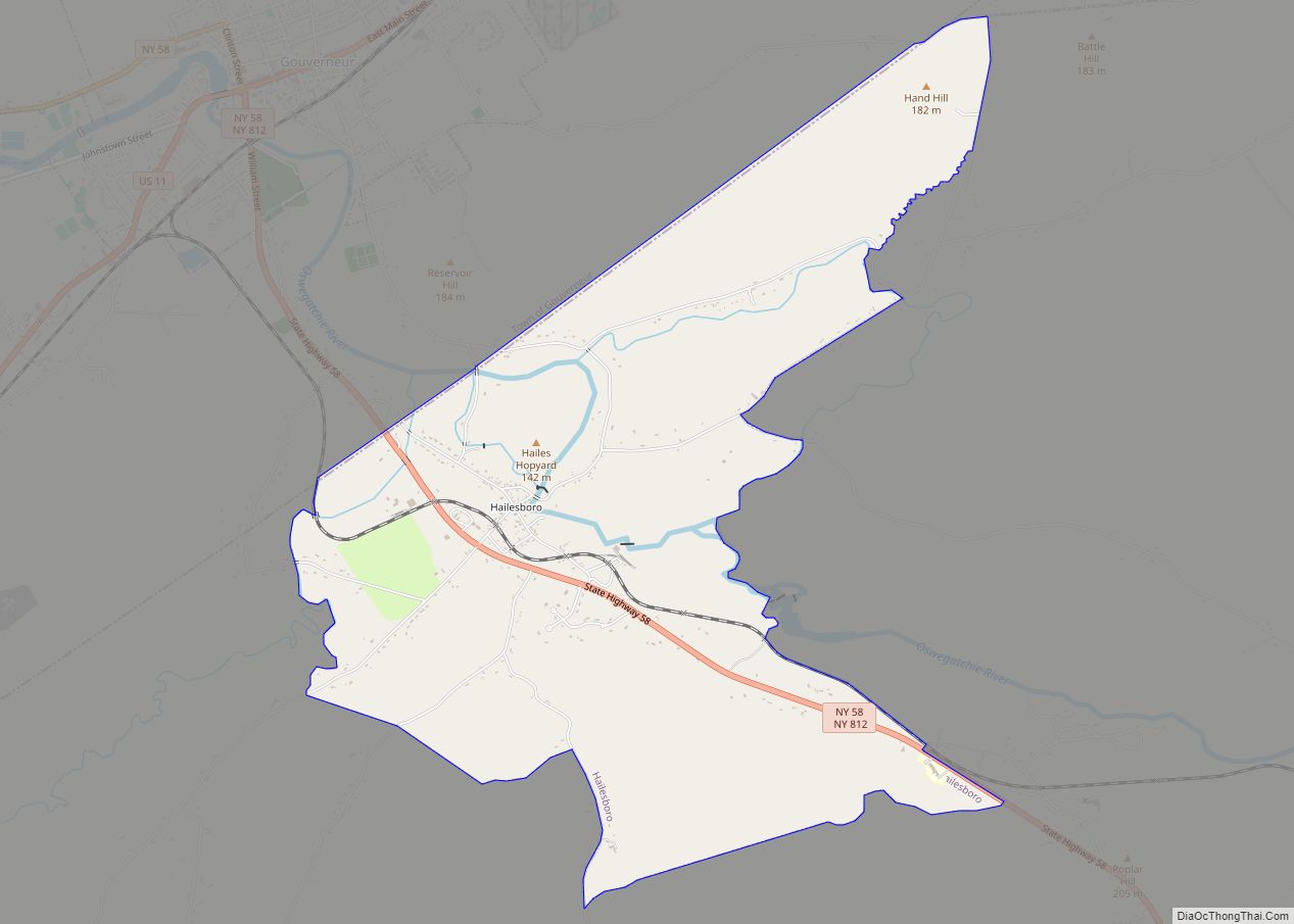
Online Interactive Map
Click on ![]() to view map in "full screen" mode.
to view map in "full screen" mode.
Rensselaer Falls location map. Where is Rensselaer Falls village?
History
A six-foot drop in the river attracted early settlers to the available water power. The community was first called “Tateville” and later “Canton Falls.” The current name was established by the post office in 1851.
The Congregational Church was listed on the National Register of Historic Places in 2005.
Rensselaer Falls Road Map
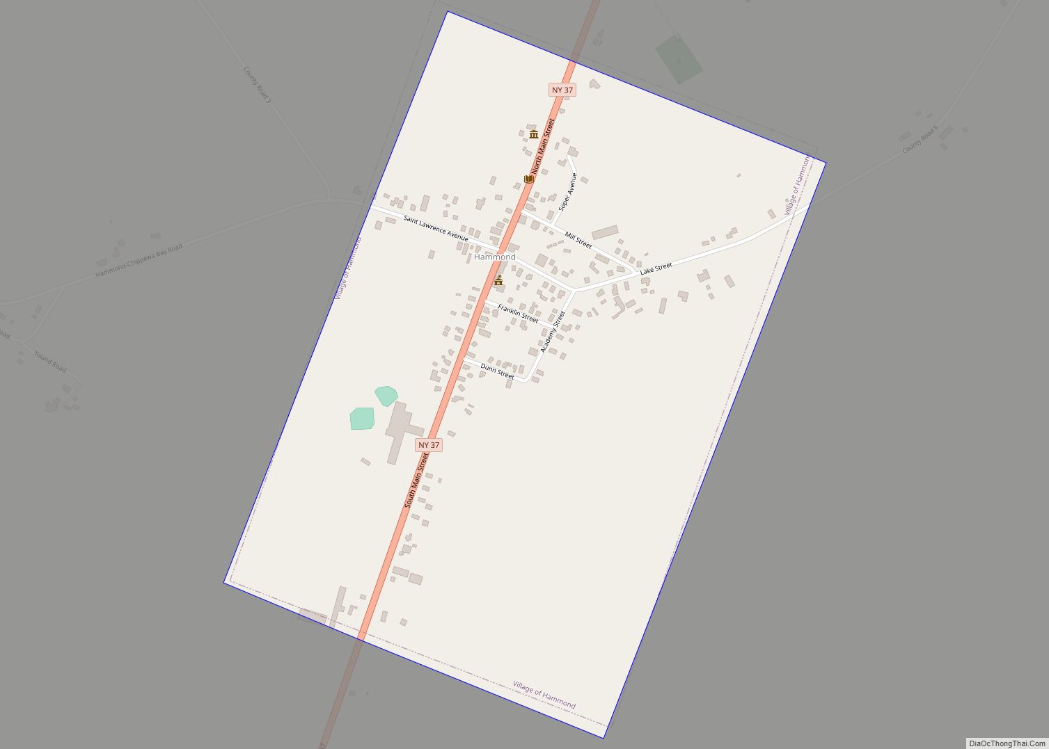
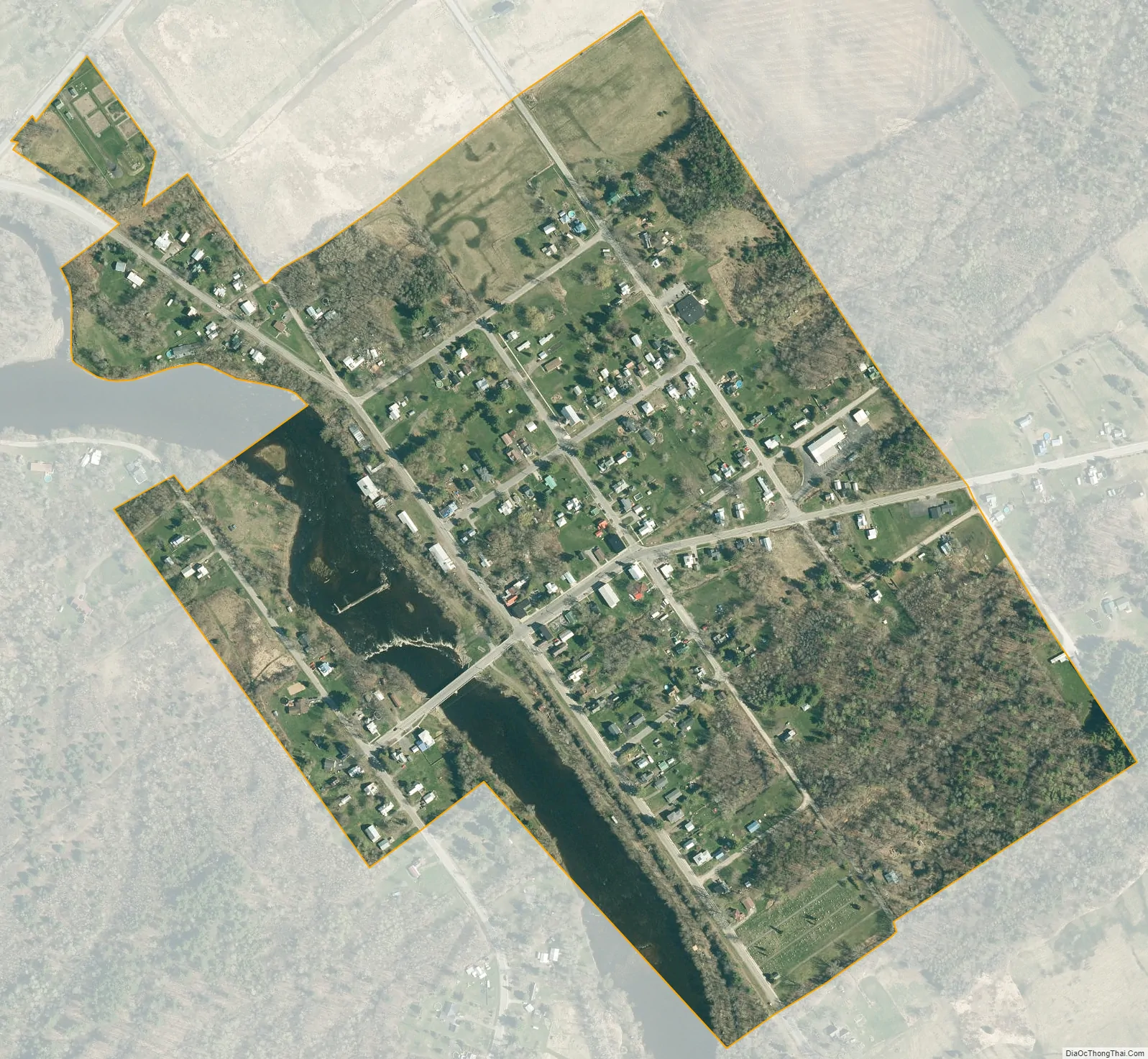
Rensselaer Falls city Satellite Map
Geography
Rensselaer Falls is located at 44°35’26” North, 75°19’16” West (44.590673, -75.321134).
According to the United States Census Bureau, the village has a total area of 0.3 square miles (0.78 km), of which 0.3 square miles (0.78 km) is land and 0.04 square miles (0.10 km) is water. The total area is 6.25% water.
The village is on the bank of the Oswegatchie River.
The village is at the junction of County Roads 14 (Rensselaer Street) and 15 (Front/Heuvelton Street). Rensselaer Falls borders the Upper and Lower Lakes Wildlife Management Area.
See also
Map of New York State and its subdivision:- Albany
- Allegany
- Bronx
- Broome
- Cattaraugus
- Cayuga
- Chautauqua
- Chemung
- Chenango
- Clinton
- Columbia
- Cortland
- Delaware
- Dutchess
- Erie
- Essex
- Franklin
- Fulton
- Genesee
- Greene
- Hamilton
- Herkimer
- Jefferson
- Kings
- Lake Ontario
- Lewis
- Livingston
- Madison
- Monroe
- Montgomery
- Nassau
- New York
- Niagara
- Oneida
- Onondaga
- Ontario
- Orange
- Orleans
- Oswego
- Otsego
- Putnam
- Queens
- Rensselaer
- Richmond
- Rockland
- Saint Lawrence
- Saratoga
- Schenectady
- Schoharie
- Schuyler
- Seneca
- Steuben
- Suffolk
- Sullivan
- Tioga
- Tompkins
- Ulster
- Warren
- Washington
- Wayne
- Westchester
- Wyoming
- Yates
- Alabama
- Alaska
- Arizona
- Arkansas
- California
- Colorado
- Connecticut
- Delaware
- District of Columbia
- Florida
- Georgia
- Hawaii
- Idaho
- Illinois
- Indiana
- Iowa
- Kansas
- Kentucky
- Louisiana
- Maine
- Maryland
- Massachusetts
- Michigan
- Minnesota
- Mississippi
- Missouri
- Montana
- Nebraska
- Nevada
- New Hampshire
- New Jersey
- New Mexico
- New York
- North Carolina
- North Dakota
- Ohio
- Oklahoma
- Oregon
- Pennsylvania
- Rhode Island
- South Carolina
- South Dakota
- Tennessee
- Texas
- Utah
- Vermont
- Virginia
- Washington
- West Virginia
- Wisconsin
- Wyoming