Rhinecliff is a hamlet and census-designated place (CDP) located along the Hudson River in the town of Rhinebeck in northern Dutchess County, New York, United States. As of the 2010 census, the population of Rhinecliff was 425.
| Name: | Rhinecliff CDP |
|---|---|
| LSAD Code: | 57 |
| LSAD Description: | CDP (suffix) |
| State: | New York |
| County: | Dutchess County |
| Elevation: | 55 ft (17 m) |
| Total Area: | 1.04 sq mi (2.70 km²) |
| Land Area: | 1.03 sq mi (2.66 km²) |
| Water Area: | 0.01 sq mi (0.04 km²) |
| Total Population: | 380 |
| Population Density: | 370.01/sq mi (142.80/km²) |
| ZIP code: | 12574 |
| Area code: | 845 |
| FIPS code: | 3661368 |
| GNISfeature ID: | 962439 |
Online Interactive Map
Click on ![]() to view map in "full screen" mode.
to view map in "full screen" mode.
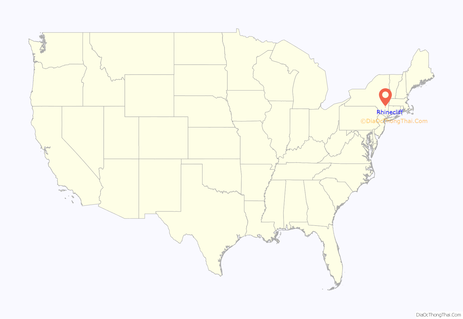
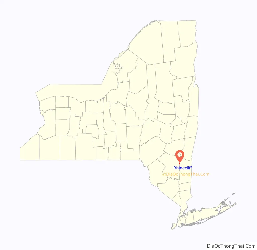
Rhinecliff location map. Where is Rhinecliff CDP?
History
Today’s Rhinecliff was founded by Europeans in 1686 as the town of Kipsbergen by five Dutchmen, among them Hendrikus and Jacobus Kip. They moved from Kingston on the west bank to live in the new settlement along the eastern shore of the Hudson. By this time England had already taken over New Netherland, the former Dutch colony that included Manhattan.
In 1849, under the influence of the Hudson River School of painters, the hamlet was renamed as “Rhinecliff”. The name was taken from the original name of the Jones-Schermerhorn estate, now known as “Wyndcliffe”.
Anna L. and Levi P. Morton, who owned the nearby Ellerslie estate, constructed and endowed the Morton Memorial Library in Rhinecliff in memory of their daughter Lena. It was dedicated as a library in 1908.
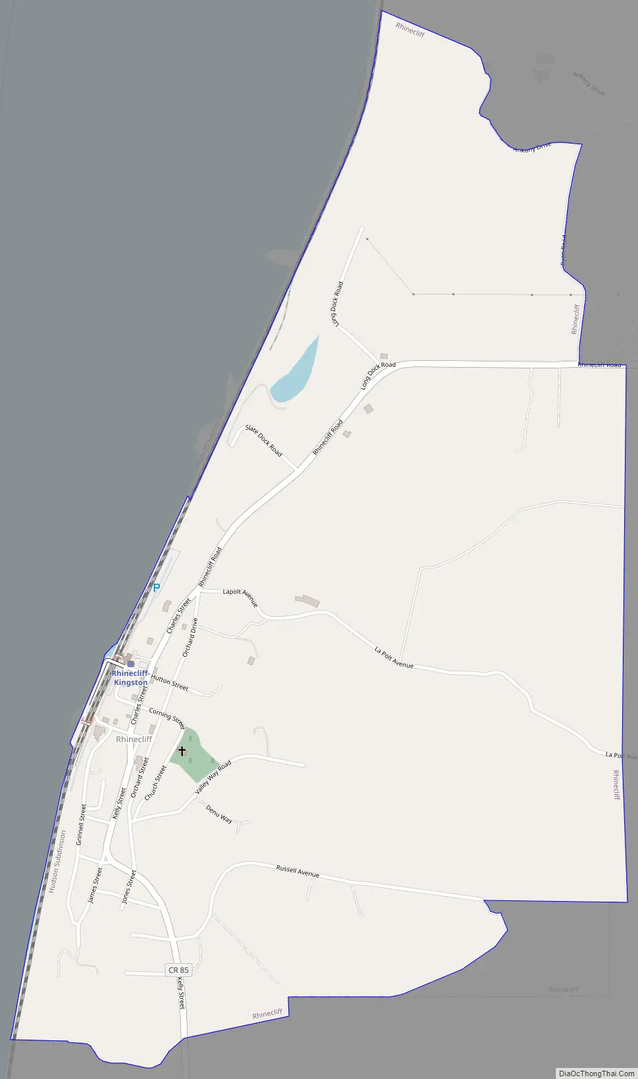
Rhinecliff Road Map
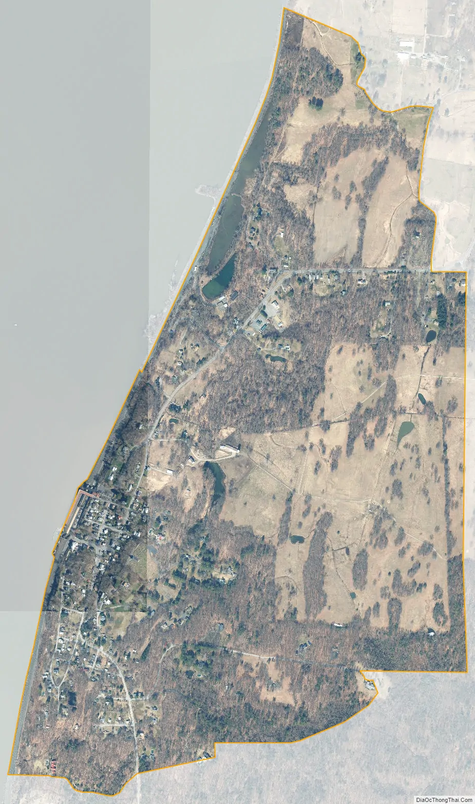
Rhinecliff city Satellite Map
Geography
Rhinecliff is located in the western part of the town of Rhinebeck, 1 mile (1.6 km) west of Rhinebeck village. It is directly across the Hudson River from the city of Kingston. The closest river crossing is the Kingston–Rhinecliff Bridge (New York State Route 199), 4 miles (6 km) to the north. According to the U.S. Census Bureau, the Rhinecliff CDP has a total area of 1.0 square mile (2.6 km), of which 0.02 square miles (0.04 km), or 1.37%, is water.
Rhinecliff is one of the oldest intact hamlets along the Hudson River and is listed in the National Register of Historic Places as a contributor to the Hudson River National Historic Landmark District. At 20 miles (30 km) long, this historic district is the largest National Historic Landmark (NHL) designation in the country.
Rhinecliff is also included in the Local Waterfront Redevelopment Program (LWRP). It is designated a Scenic Area of Statewide Significance (SASS), a contributor to the DEC Mid-Hudson Historic Shorelands Scenic District, a contributor to DEC Scenic Roads designations, and is in the Hudson River National Heritage Corridor. The hamlet serves as the water and rail gateway to the larger Town of Rhinebeck.
The hamlet is demarcated by large agricultural and wooded area to the north, east, and south, and bounded by the Hudson River on the west. Steep topography, formed by contorted slate ridges and valleys, define the site-specific and seemingly random orientation of the small, frame nineteenth-century houses and winding narrow roads. The hamlet had a mid-nineteenth century building boom, but its boundaries and building density have changed very little over the last one hundred years.
See also
Map of New York State and its subdivision:- Albany
- Allegany
- Bronx
- Broome
- Cattaraugus
- Cayuga
- Chautauqua
- Chemung
- Chenango
- Clinton
- Columbia
- Cortland
- Delaware
- Dutchess
- Erie
- Essex
- Franklin
- Fulton
- Genesee
- Greene
- Hamilton
- Herkimer
- Jefferson
- Kings
- Lake Ontario
- Lewis
- Livingston
- Madison
- Monroe
- Montgomery
- Nassau
- New York
- Niagara
- Oneida
- Onondaga
- Ontario
- Orange
- Orleans
- Oswego
- Otsego
- Putnam
- Queens
- Rensselaer
- Richmond
- Rockland
- Saint Lawrence
- Saratoga
- Schenectady
- Schoharie
- Schuyler
- Seneca
- Steuben
- Suffolk
- Sullivan
- Tioga
- Tompkins
- Ulster
- Warren
- Washington
- Wayne
- Westchester
- Wyoming
- Yates
- Alabama
- Alaska
- Arizona
- Arkansas
- California
- Colorado
- Connecticut
- Delaware
- District of Columbia
- Florida
- Georgia
- Hawaii
- Idaho
- Illinois
- Indiana
- Iowa
- Kansas
- Kentucky
- Louisiana
- Maine
- Maryland
- Massachusetts
- Michigan
- Minnesota
- Mississippi
- Missouri
- Montana
- Nebraska
- Nevada
- New Hampshire
- New Jersey
- New Mexico
- New York
- North Carolina
- North Dakota
- Ohio
- Oklahoma
- Oregon
- Pennsylvania
- Rhode Island
- South Carolina
- South Dakota
- Tennessee
- Texas
- Utah
- Vermont
- Virginia
- Washington
- West Virginia
- Wisconsin
- Wyoming


