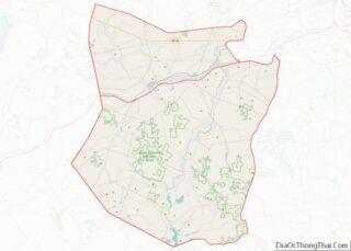
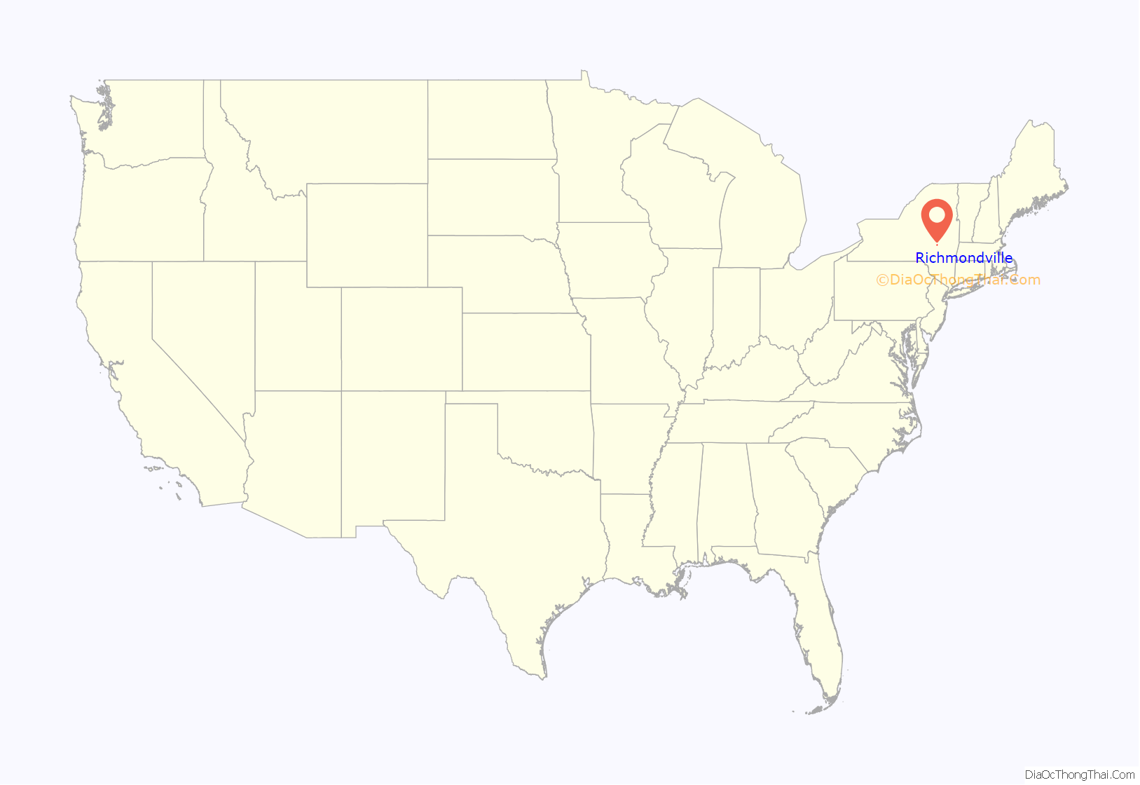
Richmondville is a village in Schoharie County, New York, United States. The population was 918 at the 2010 census.
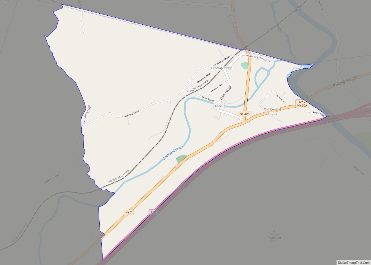
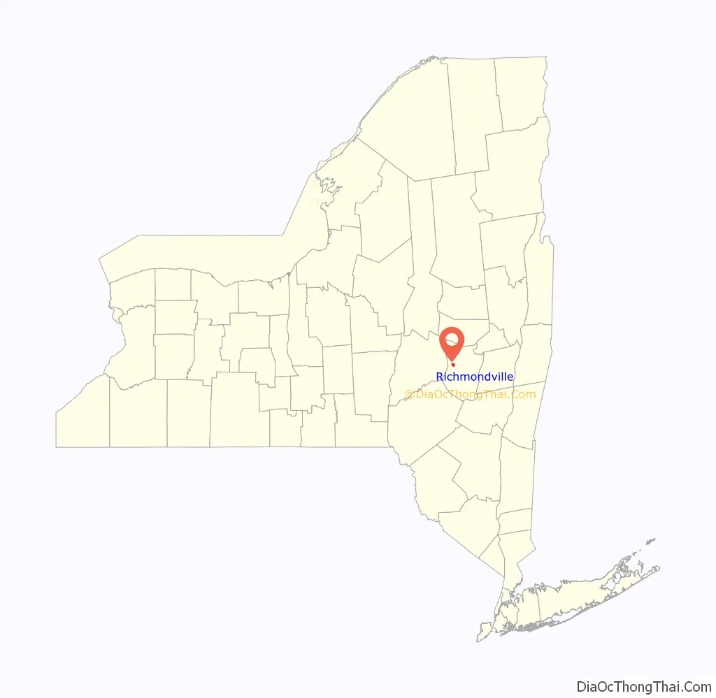
The Village of Richmondville is in the center of the Town of Richmondville and is northeast of Oneonta.
| Name: | Richmondville village |
|---|---|
| LSAD Code: | 47 |
| LSAD Description: | village (suffix) |
| State: | New York |
| County: | Schoharie County |
| Elevation: | 1,096 ft (334 m) |
| Total Area: | 1.85 sq mi (4.78 km²) |
| Land Area: | 1.85 sq mi (4.78 km²) |
| Water Area: | 0.00 sq mi (0.00 km²) |
| Total Population: | 858 |
| Population Density: | 464.79/sq mi (179.42/km²) |
| ZIP code: | 12149 |
| Area code: | 518 |
| FIPS code: | 3661588 |
| GNISfeature ID: | 2391095 |
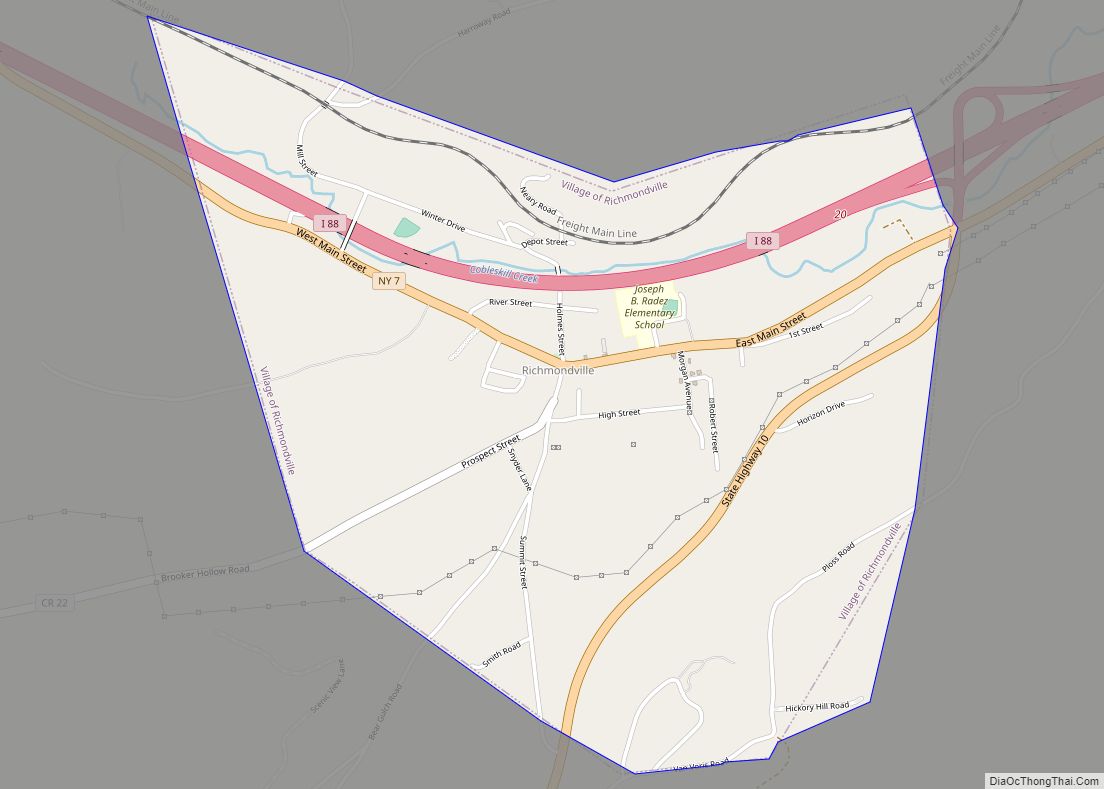
Online Interactive Map
Click on ![]() to view map in "full screen" mode.
to view map in "full screen" mode.
Richmondville location map. Where is Richmondville village?
History
The early village was the location of many mills and small factories. The village was incorporated in 1881.
The Bunn–Tillapaugh Feed Mill and Richmondville United Methodist Church are listed on the National Register of Historic Places.
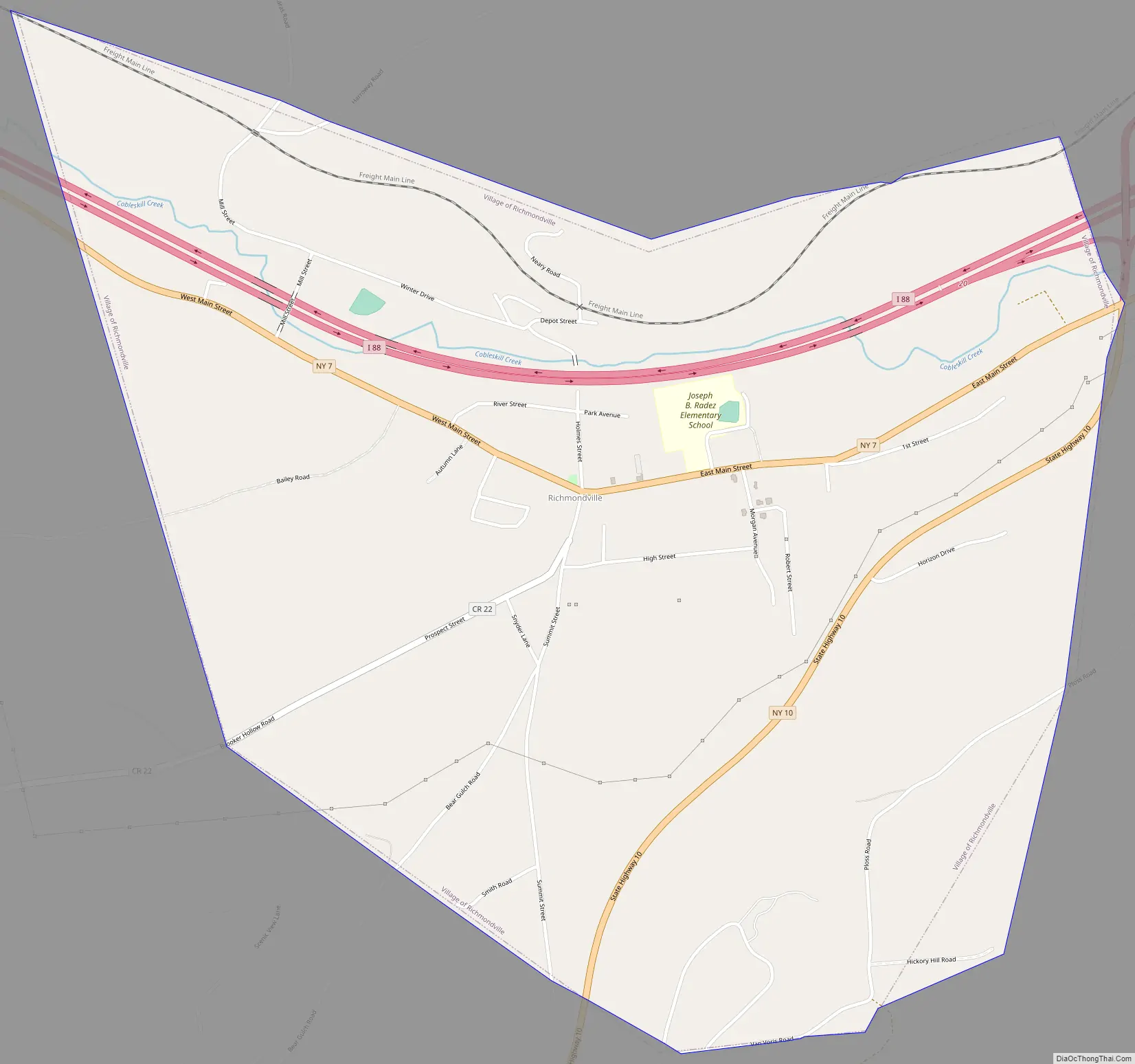
Richmondville Road Map
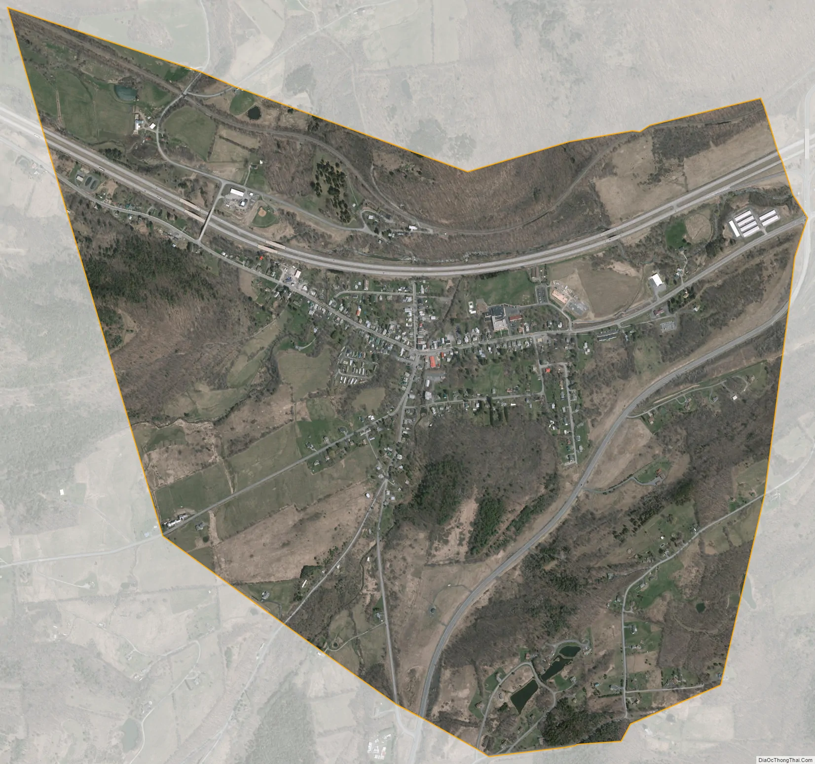
Richmondville city Satellite Map
Geography
Richmondville is located at 42°38′1″N 74°33′59″W / 42.63361°N 74.56639°W / 42.63361; -74.56639 (42.633838, -74.566627).
According to the United States Census Bureau, the village has a total area of 1.8 square miles (4.7 km), all land.
Interstate 88 passes through the village. State routes 7 (Main Street) and 10, along with County Road 22, intersect in the village.
See also
Map of New York State and its subdivision:- Albany
- Allegany
- Bronx
- Broome
- Cattaraugus
- Cayuga
- Chautauqua
- Chemung
- Chenango
- Clinton
- Columbia
- Cortland
- Delaware
- Dutchess
- Erie
- Essex
- Franklin
- Fulton
- Genesee
- Greene
- Hamilton
- Herkimer
- Jefferson
- Kings
- Lake Ontario
- Lewis
- Livingston
- Madison
- Monroe
- Montgomery
- Nassau
- New York
- Niagara
- Oneida
- Onondaga
- Ontario
- Orange
- Orleans
- Oswego
- Otsego
- Putnam
- Queens
- Rensselaer
- Richmond
- Rockland
- Saint Lawrence
- Saratoga
- Schenectady
- Schoharie
- Schuyler
- Seneca
- Steuben
- Suffolk
- Sullivan
- Tioga
- Tompkins
- Ulster
- Warren
- Washington
- Wayne
- Westchester
- Wyoming
- Yates
- Alabama
- Alaska
- Arizona
- Arkansas
- California
- Colorado
- Connecticut
- Delaware
- District of Columbia
- Florida
- Georgia
- Hawaii
- Idaho
- Illinois
- Indiana
- Iowa
- Kansas
- Kentucky
- Louisiana
- Maine
- Maryland
- Massachusetts
- Michigan
- Minnesota
- Mississippi
- Missouri
- Montana
- Nebraska
- Nevada
- New Hampshire
- New Jersey
- New Mexico
- New York
- North Carolina
- North Dakota
- Ohio
- Oklahoma
- Oregon
- Pennsylvania
- Rhode Island
- South Carolina
- South Dakota
- Tennessee
- Texas
- Utah
- Vermont
- Virginia
- Washington
- West Virginia
- Wisconsin
- Wyoming