Oneonta (/ˌoʊniˈɒntə/ OH-nee-ON-tə) is a city in southern Otsego County, New York, United States. It is one of the northernmost cities of Appalachia. Oneonta is home to the State University of New York at Oneonta and Hartwick College. SUNY Oneonta began as a normal school and a teacher’s college in 1889, and Hartwick College moved into the city in 1928. The approximately 5,800 students from SUNY Oneonta and the approximately 1,500 students at Hartwick make up a significant percentage of the population of Oneonta. According to the 2020 U.S. Census, Oneonta had a population of 13,079. Its nickname is “City of the Hills.” While the word “oneonta” is of undetermined origin, it is popularly believed to mean “place of open rocks” in the Mohawk language. This refers to a prominent geological formation known as “Table Rock” at the western end of the city.
The city is surrounded by the town of Oneonta, a separate municipal and political jurisdiction. Oneonta Municipal Airport (N66) is north of the city.
| Name: | Oneonta city |
|---|---|
| LSAD Code: | 25 |
| LSAD Description: | city (suffix) |
| State: | New York |
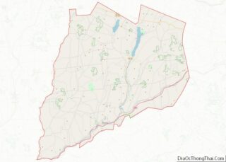
| County: | Otsego County |
| Total Area: | 4.36 sq mi (11.31 km²) |
| Land Area: | 4.36 sq mi (11.30 km²) |
| Water Area: | 0.00 sq mi (0.01 km²) |
| Total Population: | 13,079 |
| Population Density: | 2,999.08/sq mi (1,157.88/km²) |
| ZIP code: | 13820 |
| Area code: | 607 |
| FIPS code: | 3654881 |
| Website: | www.oneonta.ny.us |
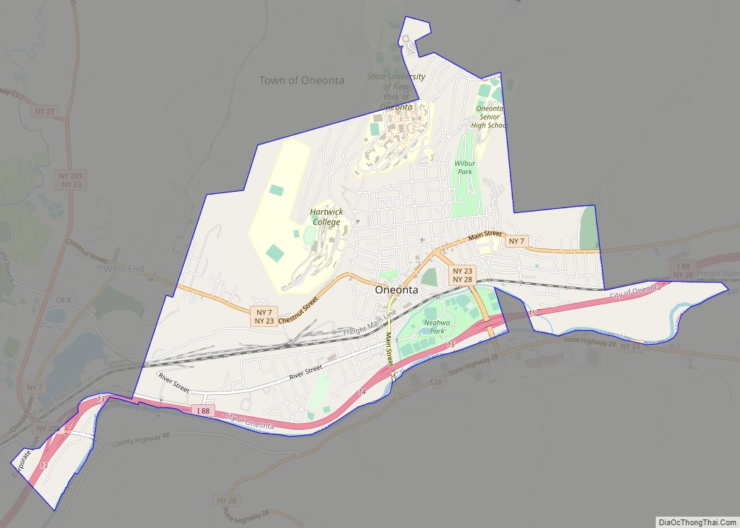
Online Interactive Map
Click on ![]() to view map in "full screen" mode.
to view map in "full screen" mode.
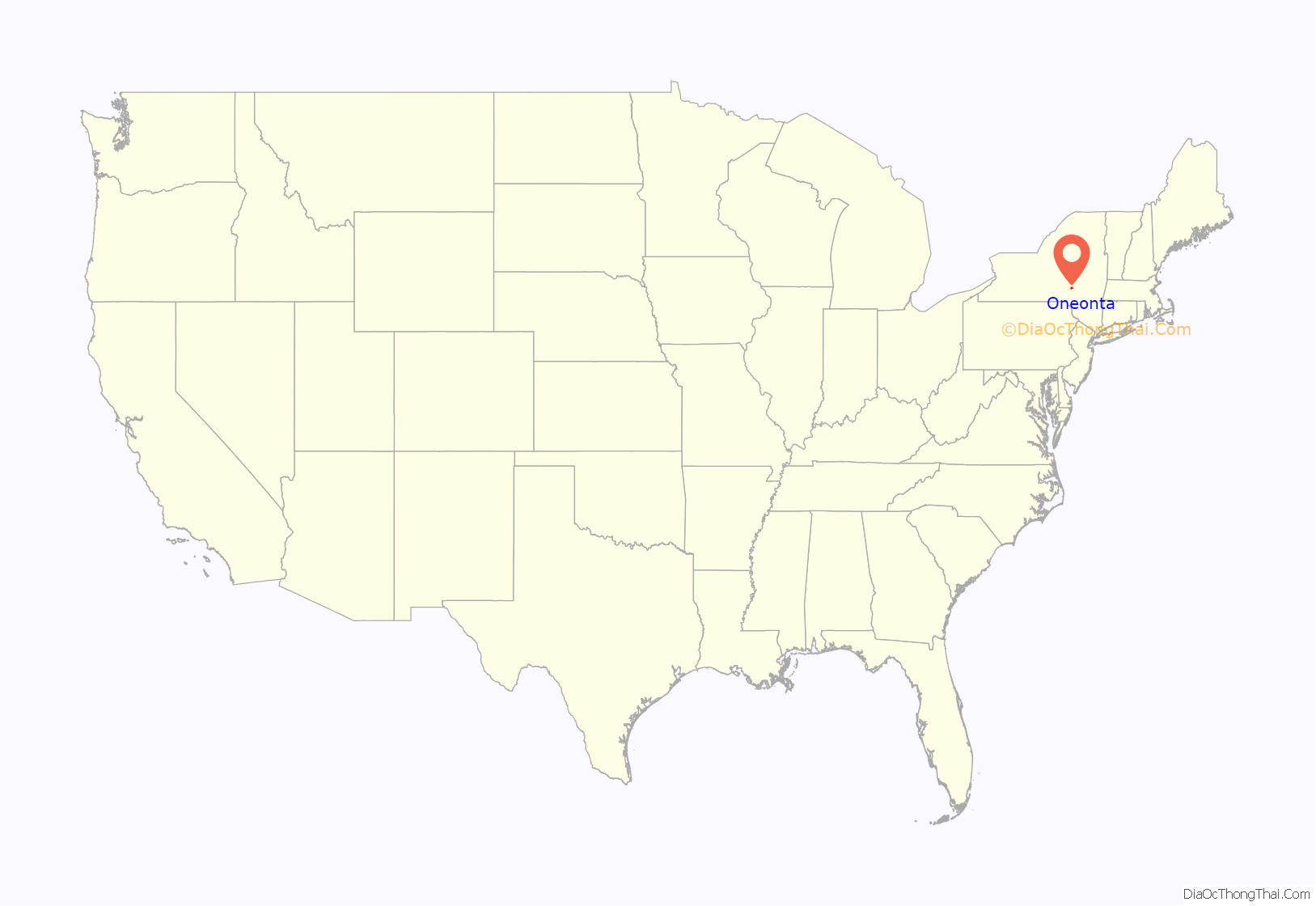
Oneonta location map. Where is Oneonta city?
History
Indigenous ancestors of Algonquin and Iroquoian-speaking Native Americans inhabited the land in the territory of Oneonta before European colonists settled in the area. The Five Nations of the Iroquois Confederacy are believed to have emerged and gained dominance prior to the 15th century; they were in place at the time of early French and Dutch colonization.
The area’s early European-American settlers did not arrive until around 1775 and consisted mainly of ethnic Palatine German and Dutch settlers moving out of the Hudson and eastern Mohawk valleys. The first such settler in the area now known as the Town of Oneonta was Henry Scramling (b. ~1743; d. 1808). He had secured a grant of 1,000 acres in the Susquehanna Valley, moved from German Flatts and settled about 1773 in the Oneonta Plains near the mouth of the Otego Creek. He left during the Revolution and returned after the conflict with his brothers, George and David Scramling, and his brothers-in-law, John and David Young. Their farms were not far from the mouth of the Otego Creek. The army led by General James Clinton passed through the area in order to join the Sullivan Expedition in 1779 against Iroquois settlements.
The first hamlet developed around 1800 and was later known as “Milfordville.” In 1830, the Town of Oneonta was formed from parts of two other Towns in the county. Milfordville changed its name to Oneonta in 1832. In 1848, it was incorporated as a village within the Town.
In the mid-19th century, the Delaware and Hudson Railroad reached Oneonta, stimulating development as a railroad center and attracting new industries. Oneonta was once home to the largest locomotive roundhouse in the world.
Dudley M. Campbell and Willard Vincent Huntington wrote accounts of Oneonta’s history. In 1896, Edgar Luderne Welch’s Oneonta Historical Souvenir was published covering the new normal school and other institutions in the community.
The village incorporated as a city in 1908. In February of 1991 Mayor David Brenner of Oneonta, New York and Mayor Danny Hicks of Oneonta, Alabama officially recognized their cities as sister cities at a centennial celebration for Oneonta, Alabama.
Oneonta Road Map
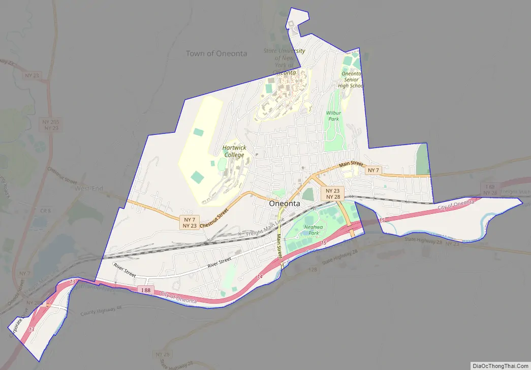
Oneonta city Satellite Map

Geography
Oneonta is located at 42°27′21″N 75°3′44″W / 42.45583°N 75.06222°W / 42.45583; -75.06222 (42.456003, -75.062302). According to the United States Census Bureau, the city has a total area of 4.4 square miles (11.3 km), all land.
The city lies between Binghamton and Albany.
The Susquehanna River flows westward past the south part of the city.
Interstate 88 follows the course of the Susquehanna River past Oneonta. New York State Route 7, New York State Route 23 and New York State Route 28 pass through the city.
See also
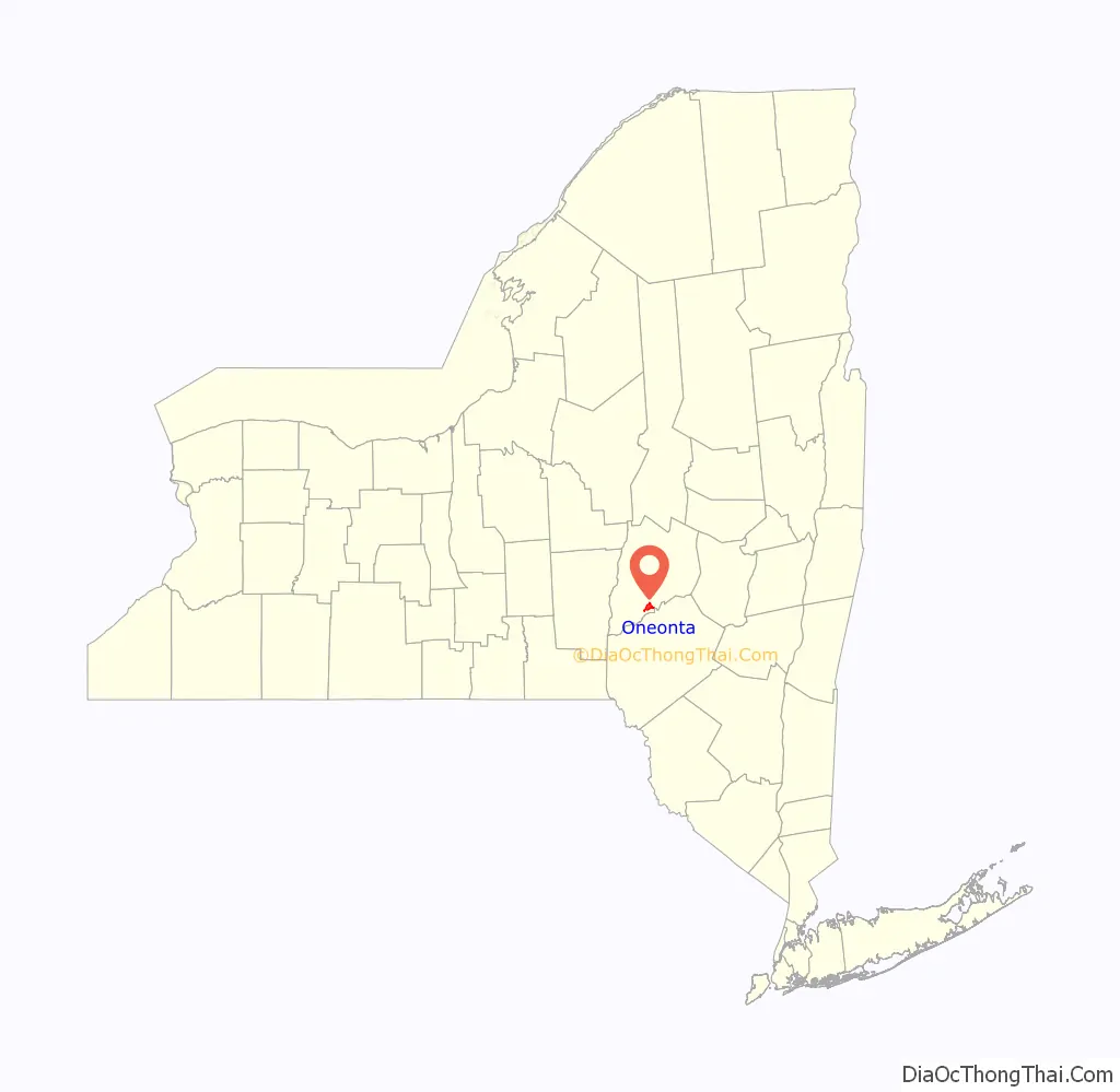
Map of New York State and its subdivision:- Albany
- Allegany
- Bronx
- Broome
- Cattaraugus
- Cayuga
- Chautauqua
- Chemung
- Chenango
- Clinton
- Columbia
- Cortland
- Delaware
- Dutchess
- Erie
- Essex
- Franklin
- Fulton
- Genesee
- Greene
- Hamilton
- Herkimer
- Jefferson
- Kings
- Lake Ontario
- Lewis
- Livingston
- Madison
- Monroe
- Montgomery
- Nassau
- New York
- Niagara
- Oneida
- Onondaga
- Ontario
- Orange
- Orleans
- Oswego
- Otsego
- Putnam
- Queens
- Rensselaer
- Richmond
- Rockland
- Saint Lawrence
- Saratoga
- Schenectady
- Schoharie
- Schuyler
- Seneca
- Steuben
- Suffolk
- Sullivan
- Tioga
- Tompkins
- Ulster
- Warren
- Washington
- Wayne
- Westchester
- Wyoming
- Yates
- Alabama
- Alaska
- Arizona
- Arkansas
- California
- Colorado
- Connecticut
- Delaware
- District of Columbia
- Florida
- Georgia
- Hawaii
- Idaho
- Illinois
- Indiana
- Iowa
- Kansas
- Kentucky
- Louisiana
- Maine
- Maryland
- Massachusetts
- Michigan
- Minnesota
- Mississippi
- Missouri
- Montana
- Nebraska
- Nevada
- New Hampshire
- New Jersey
- New Mexico
- New York
- North Carolina
- North Dakota
- Ohio
- Oklahoma
- Oregon
- Pennsylvania
- Rhode Island
- South Carolina
- South Dakota
- Tennessee
- Texas
- Utah
- Vermont
- Virginia
- Washington
- West Virginia
- Wisconsin
- Wyoming