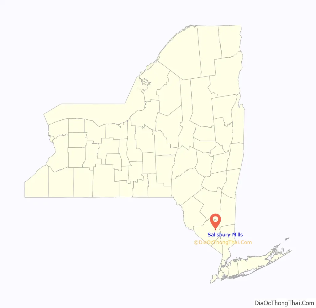
Salisbury Mills is a hamlet and census-designated place (CDP) in the towns of Blooming Grove and Cornwall in Orange County, New York, United States. As of the 2020 census, it had a population of 580.
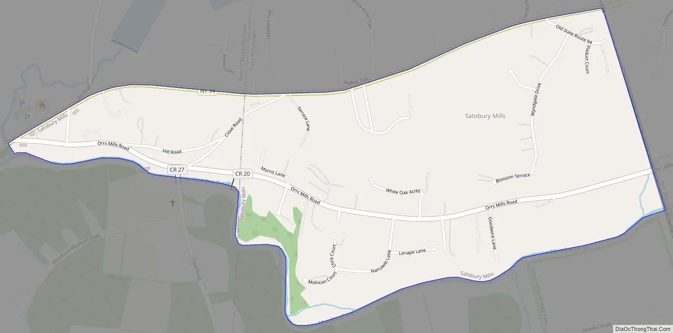
The CDP is in eastern Orange County and is bordered to the north by Beaver Dam Lake. Salisbury Mills is built along Moodna Creek, which flows east into the Hudson River between New Windsor and Cornwall-on-Hudson. The Moodna Viaduct, the longest actively used rail trestle in the eastern United States, crosses Moodna Creek at the eastern edge of the CDP.
New York State Route 94 forms the northern edge of the CDP. It leads northeast 6 miles (10 km) to New Windsor and southwest 10 miles (16 km) to Chester. Newburgh is 8 miles (13 km) to the northeast, and Middletown is 19 miles (31 km) to the west.
| Name: | Salisbury Mills CDP |
|---|---|
| LSAD Code: | 57 |
| LSAD Description: | CDP (suffix) |
| State: | New York |
| County: | Orange County |
| Elevation: | 280 ft (90 m) |
| Total Area: | 0.50 sq mi (1.30 km²) |
| Land Area: | 0.50 sq mi (1.29 km²) |
| Water Area: | 0.01 sq mi (0.01 km²) |
| Total Population: | 580 |
| Population Density: | 1,162.32/sq mi (449.00/km²) |
| ZIP code: | 12577 |
| Area code: | 845 |
| FIPS code: | 3664859 |
| GNISfeature ID: | 2584289 |
Online Interactive Map
Click on ![]() to view map in "full screen" mode.
to view map in "full screen" mode.
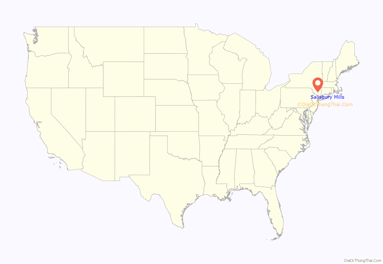
Salisbury Mills location map. Where is Salisbury Mills CDP?
Salisbury Mills Road Map
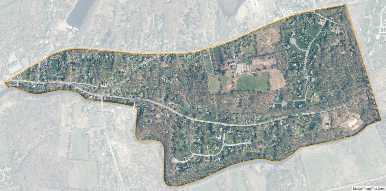
Salisbury Mills city Satellite Map
See also
Map of New York State and its subdivision:- Albany
- Allegany
- Bronx
- Broome
- Cattaraugus
- Cayuga
- Chautauqua
- Chemung
- Chenango
- Clinton
- Columbia
- Cortland
- Delaware
- Dutchess
- Erie
- Essex
- Franklin
- Fulton
- Genesee
- Greene
- Hamilton
- Herkimer
- Jefferson
- Kings
- Lake Ontario
- Lewis
- Livingston
- Madison
- Monroe
- Montgomery
- Nassau
- New York
- Niagara
- Oneida
- Onondaga
- Ontario
- Orange
- Orleans
- Oswego
- Otsego
- Putnam
- Queens
- Rensselaer
- Richmond
- Rockland
- Saint Lawrence
- Saratoga
- Schenectady
- Schoharie
- Schuyler
- Seneca
- Steuben
- Suffolk
- Sullivan
- Tioga
- Tompkins
- Ulster
- Warren
- Washington
- Wayne
- Westchester
- Wyoming
- Yates
- Alabama
- Alaska
- Arizona
- Arkansas
- California
- Colorado
- Connecticut
- Delaware
- District of Columbia
- Florida
- Georgia
- Hawaii
- Idaho
- Illinois
- Indiana
- Iowa
- Kansas
- Kentucky
- Louisiana
- Maine
- Maryland
- Massachusetts
- Michigan
- Minnesota
- Mississippi
- Missouri
- Montana
- Nebraska
- Nevada
- New Hampshire
- New Jersey
- New Mexico
- New York
- North Carolina
- North Dakota
- Ohio
- Oklahoma
- Oregon
- Pennsylvania
- Rhode Island
- South Carolina
- South Dakota
- Tennessee
- Texas
- Utah
- Vermont
- Virginia
- Washington
- West Virginia
- Wisconsin
- Wyoming


