Schroon Lake (/ˈskruːn/ SKROON) is a hamlet and census-designated place (CDP) in the town of Schroon in Essex County, New York, United States. The population was 833 at the 2010 census, or just over half of the total population of the town of Schroon.
| Name: | Schroon Lake CDP |
|---|---|
| LSAD Code: | 57 |
| LSAD Description: | CDP (suffix) |
| State: | New York |
| County: | Essex County |
| Elevation: | 866 ft (264 m) |
| Total Area: | 3.69 sq mi (9.54 km²) |
| Land Area: | 2.89 sq mi (7.48 km²) |
| Water Area: | 0.80 sq mi (2.07 km²) |
| Total Population: | 921 |
| Population Density: | 319.13/sq mi (123.21/km²) |
| ZIP code: | 12870 |
| FIPS code: | 3665640 |
Online Interactive Map
Click on ![]() to view map in "full screen" mode.
to view map in "full screen" mode.
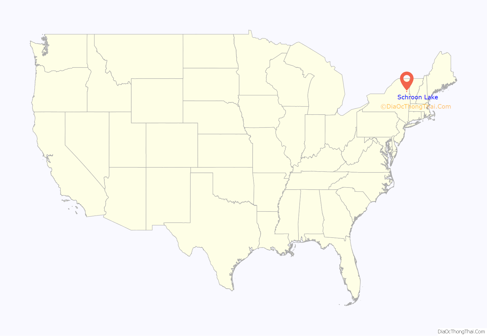
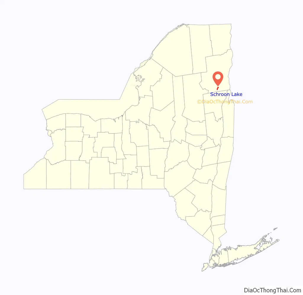
Schroon Lake location map. Where is Schroon Lake CDP?
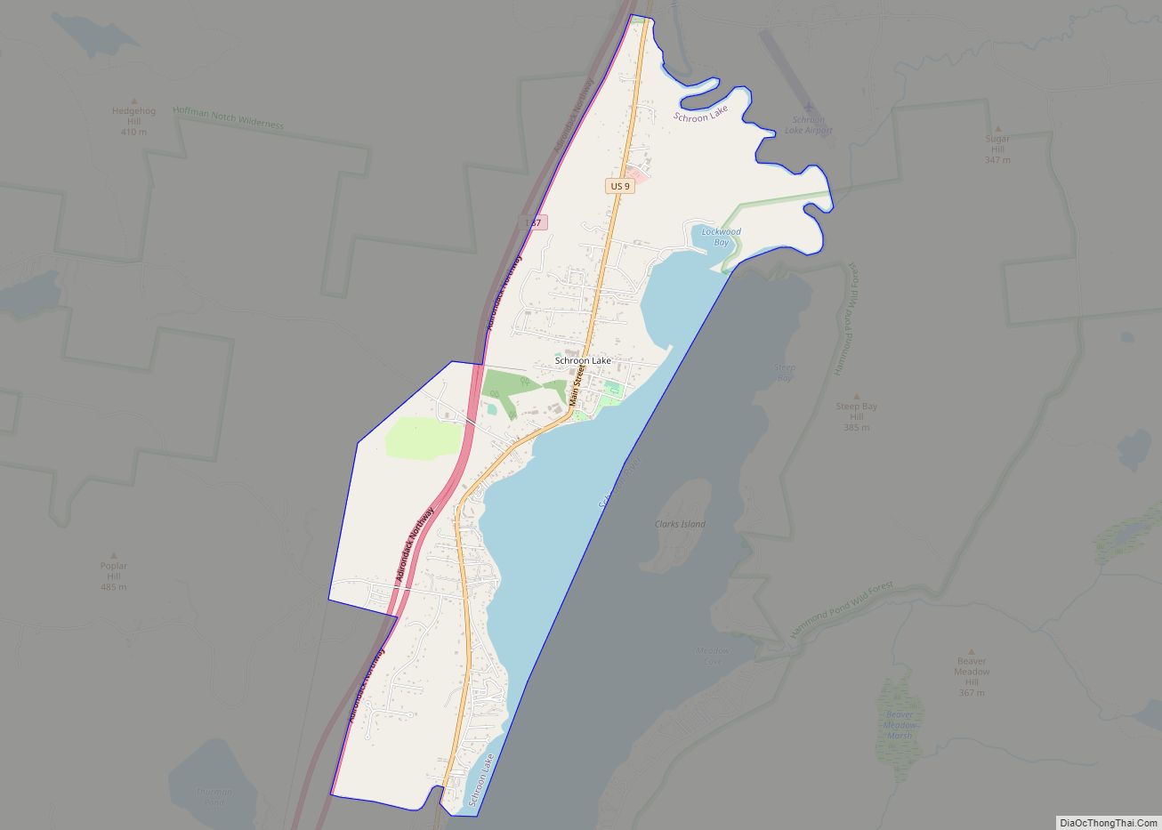
Schroon Lake Road Map
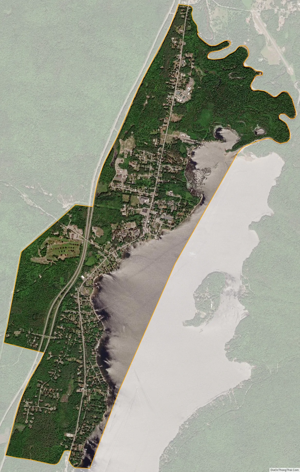
Schroon Lake city Satellite Map
Geography
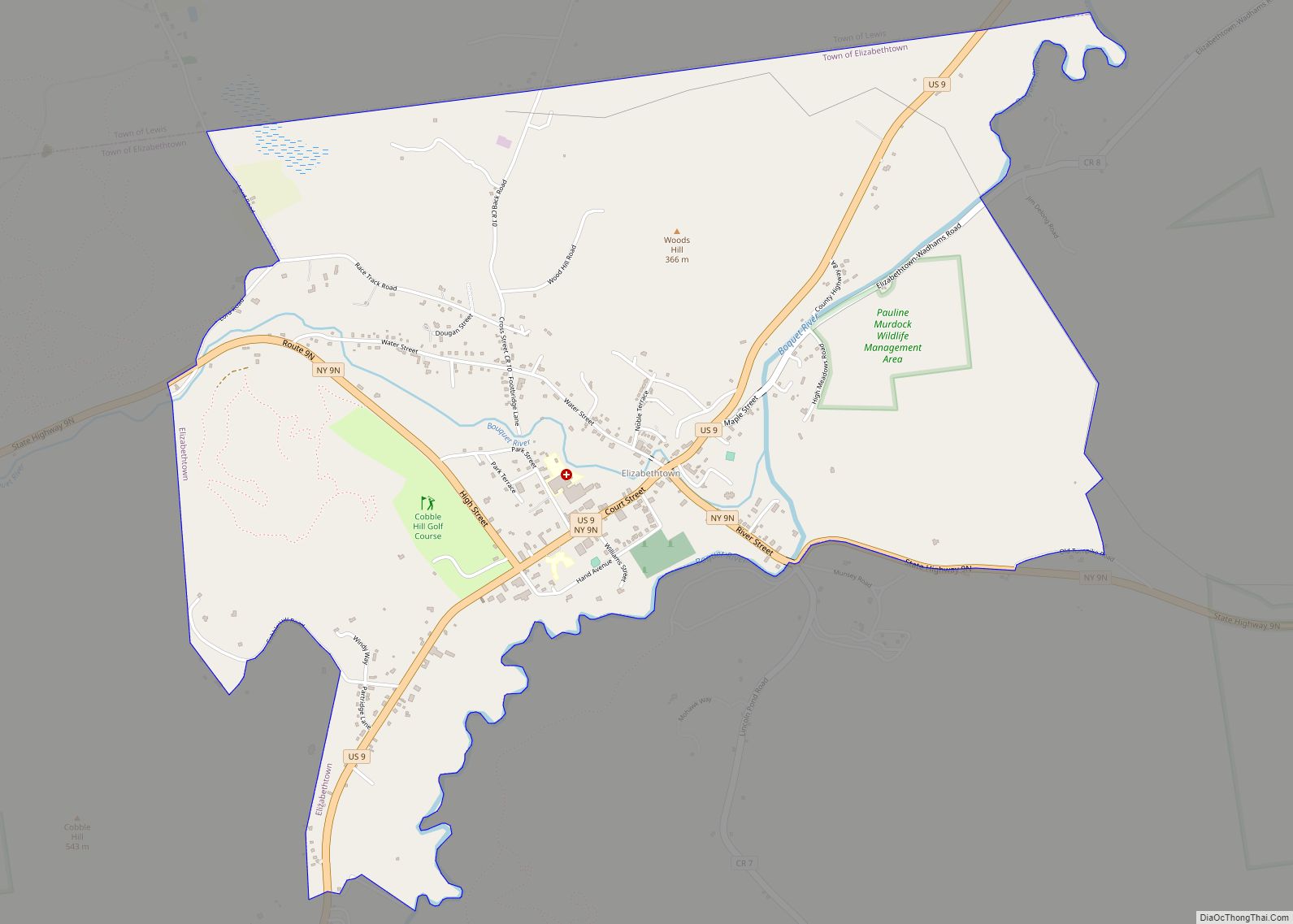
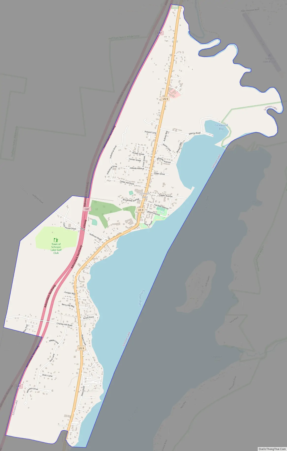
Schroon Lake CDP is located in the center of the town of Schroon, at the northern end of Schroon Lake, the water body. U.S. Route 9 is the main road through the community, while Interstate 87 passes through the western part of the CDP. The CDP extends north along US 9 to Alder Meadow Road and south to Kates Way. The closest I-87 access is from Exit 28 (NY-74), north of the hamlet or Exit 27 (South Schroon Road) to the south. US 9 leads north 8 miles (13 km) to North Hudson and south the same distance to Pottersville, while I-87 leads north 70 miles (110 km) to Plattsburgh and south 92 miles (148 km) to Albany.
According to the United States Census Bureau, the Schroon Lake CDP has a total area of 3.68 square miles (9.54 km), of which 2.89 square miles (7.48 km) is land and 0.80 square miles (2.07 km), or 27.34%, is water.
See also
Map of New York State and its subdivision:- Albany
- Allegany
- Bronx
- Broome
- Cattaraugus
- Cayuga
- Chautauqua
- Chemung
- Chenango
- Clinton
- Columbia
- Cortland
- Delaware
- Dutchess
- Erie
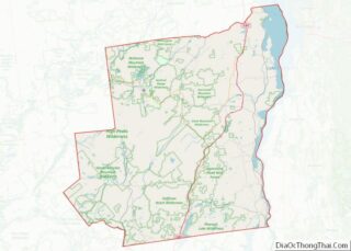
- Essex
- Franklin
- Fulton
- Genesee
- Greene
- Hamilton
- Herkimer
- Jefferson
- Kings
- Lake Ontario
- Lewis
- Livingston
- Madison
- Monroe
- Montgomery
- Nassau
- New York
- Niagara
- Oneida
- Onondaga
- Ontario
- Orange
- Orleans
- Oswego
- Otsego
- Putnam
- Queens
- Rensselaer
- Richmond
- Rockland
- Saint Lawrence
- Saratoga
- Schenectady
- Schoharie
- Schuyler
- Seneca
- Steuben
- Suffolk
- Sullivan
- Tioga
- Tompkins
- Ulster
- Warren
- Washington
- Wayne
- Westchester
- Wyoming
- Yates
- Alabama
- Alaska
- Arizona
- Arkansas
- California
- Colorado
- Connecticut
- Delaware
- District of Columbia
- Florida
- Georgia
- Hawaii
- Idaho
- Illinois
- Indiana
- Iowa
- Kansas
- Kentucky
- Louisiana
- Maine
- Maryland
- Massachusetts
- Michigan
- Minnesota
- Mississippi
- Missouri
- Montana
- Nebraska
- Nevada
- New Hampshire
- New Jersey
- New Mexico
- New York
- North Carolina
- North Dakota
- Ohio
- Oklahoma
- Oregon
- Pennsylvania
- Rhode Island
- South Carolina
- South Dakota
- Tennessee
- Texas
- Utah
- Vermont
- Virginia
- Washington
- West Virginia
- Wisconsin
- Wyoming