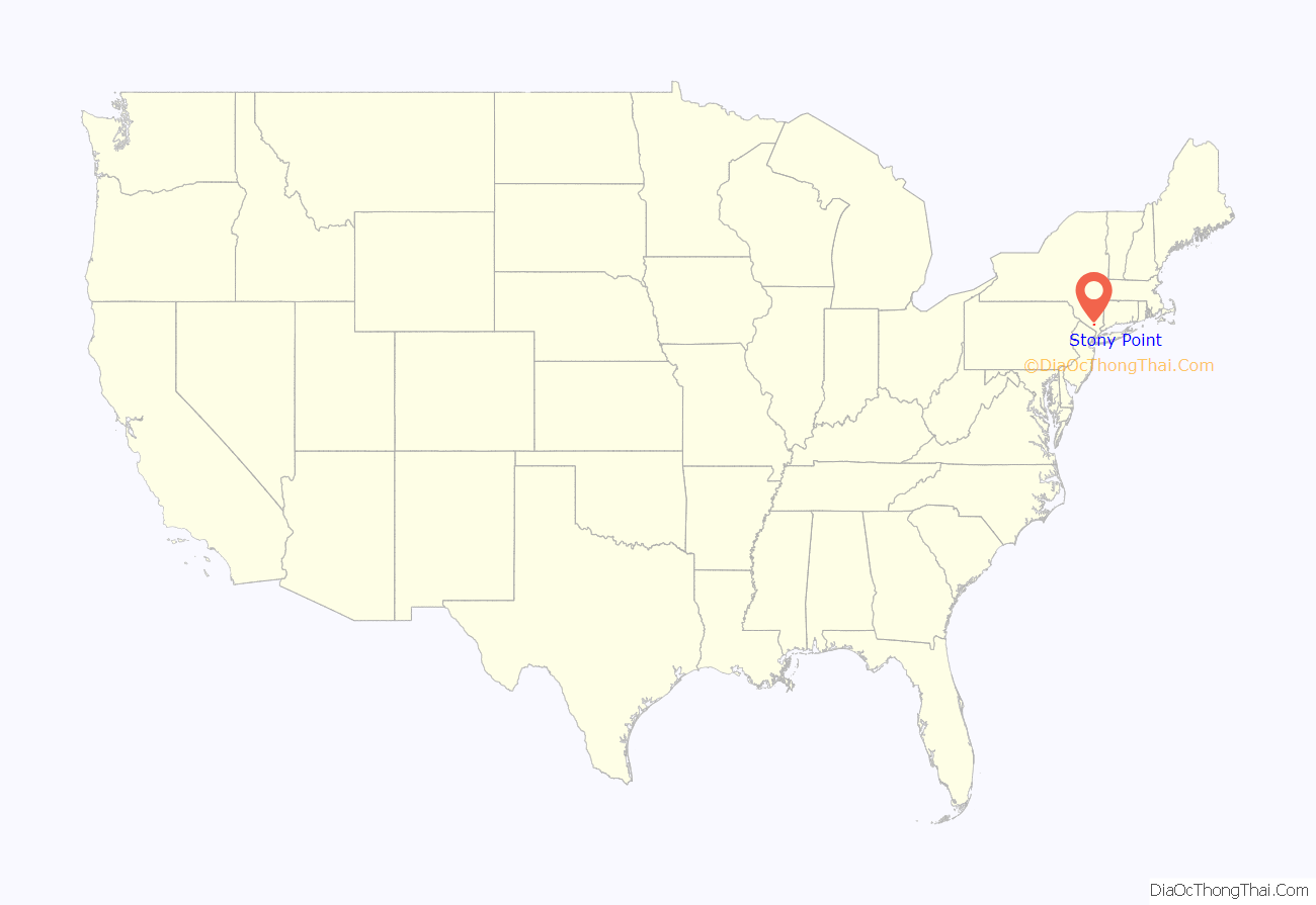
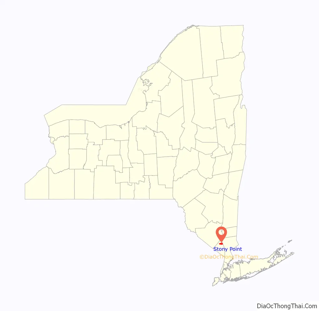
Stony Point is a hamlet and census-designated place in the town of Stony Point, Rockland County, New York, United States. It is located north of West Haverstraw, east of Harriman State Park, south of Tomkins Cove, and west of the Hudson River. The population was 12,147 at the 2010 census.
The community is in the eastern part of the town of Stony Point.
| Name: | Stony Point CDP |
|---|---|
| LSAD Code: | 57 |
| LSAD Description: | CDP (suffix) |
| State: | New York |
| County: | Rockland County |
| Elevation: | 118 ft (36 m) |
| Total Area: | 7.19 sq mi (18.62 km²) |
| Land Area: | 5.89 sq mi (15.25 km²) |
| Water Area: | 1.30 sq mi (3.37 km²) |
| Total Population: | 12,126 |
| Population Density: | 2,059.79/sq mi (795.26/km²) |
| ZIP code: | 10980 |
| Area code: | 845 |
| FIPS code: | 3671663 |
| GNISfeature ID: | 0966589 |
Online Interactive Map
Click on ![]() to view map in "full screen" mode.
to view map in "full screen" mode.
Stony Point location map. Where is Stony Point CDP?
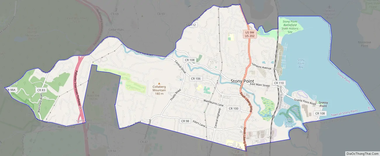
Stony Point Road Map
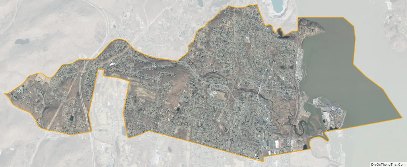
Stony Point city Satellite Map
Geography
Stony Point is located at 41°13′34″N 73°59′34″W / 41.22611°N 73.99278°W / 41.22611; -73.99278 (41.226361, -73.99293).
According to the United States Census Bureau, the CDP has a total area of 6.8 square miles (18 km), of which 5.5 square miles (14 km) is land and 1.3 square miles (3.4 km), or 18.64%, is water.
Stony Point is home to Camp Bullowa, a 316.7-acre (1.282 km) Boy Scout camp.
See also
Map of New York State and its subdivision:- Albany
- Allegany
- Bronx
- Broome
- Cattaraugus
- Cayuga
- Chautauqua
- Chemung
- Chenango
- Clinton
- Columbia
- Cortland
- Delaware
- Dutchess
- Erie
- Essex
- Franklin
- Fulton
- Genesee
- Greene
- Hamilton
- Herkimer
- Jefferson
- Kings
- Lake Ontario
- Lewis
- Livingston
- Madison
- Monroe
- Montgomery
- Nassau
- New York
- Niagara
- Oneida
- Onondaga
- Ontario
- Orange
- Orleans
- Oswego
- Otsego
- Putnam
- Queens
- Rensselaer
- Richmond
- Rockland
- Saint Lawrence
- Saratoga
- Schenectady
- Schoharie
- Schuyler
- Seneca
- Steuben
- Suffolk
- Sullivan
- Tioga
- Tompkins
- Ulster
- Warren
- Washington
- Wayne
- Westchester
- Wyoming
- Yates
- Alabama
- Alaska
- Arizona
- Arkansas
- California
- Colorado
- Connecticut
- Delaware
- District of Columbia
- Florida
- Georgia
- Hawaii
- Idaho
- Illinois
- Indiana
- Iowa
- Kansas
- Kentucky
- Louisiana
- Maine
- Maryland
- Massachusetts
- Michigan
- Minnesota
- Mississippi
- Missouri
- Montana
- Nebraska
- Nevada
- New Hampshire
- New Jersey
- New Mexico
- New York
- North Carolina
- North Dakota
- Ohio
- Oklahoma
- Oregon
- Pennsylvania
- Rhode Island
- South Carolina
- South Dakota
- Tennessee
- Texas
- Utah
- Vermont
- Virginia
- Washington
- West Virginia
- Wisconsin
- Wyoming


