West Point is the oldest continuously occupied military post in the United States. Located on the Hudson River in New York, West Point was identified by General George Washington as the most important strategic position in America during the American Revolution. Until January 1778, West Point was not occupied by the military. On January 27, 1778, Brigadier General Samuel Holden Parsons and his brigade crossed the ice on the Hudson River and climbed to the plain on West Point and from that day to the present, West Point has been occupied by the United States Army. It comprises approximately 16,000 acres (6,500 ha) including the campus of the United States Military Academy, which is commonly called “West Point”.
West Point is a census-designated place (CDP) located in the town of Highlands in Orange County, located on the western bank of the Hudson River. The population was 7,341 at the 2020 census. It is part of the New York–Newark–Jersey City, NY–NJ–PA Metropolitan Statistical Area as well as the larger New York–Newark, NY–NJ–CT–PA Combined Statistical Area.
| Name: | West Point CDP |
|---|---|
| LSAD Code: | 57 |
| LSAD Description: | CDP (suffix) |
| State: | New York |
| County: | Orange County |
| Total Area: | 19.34 sq mi (50.08 km²) |
| Land Area: | 18.43 sq mi (47.75 km²) |
| Water Area: | 0.90 sq mi (2.33 km²) |
| Total Population: | 7,341 |
| Population Density: | 398.21/sq mi (153.75/km²) |
| ZIP code: | 10996–10997 |
| Area code: | 845 |
| FIPS code: | 3680747 |
Online Interactive Map
Click on ![]() to view map in "full screen" mode.
to view map in "full screen" mode.
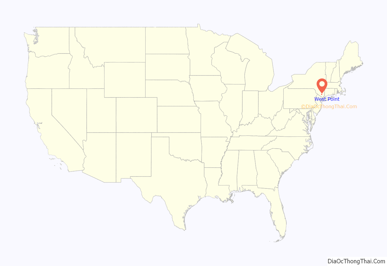
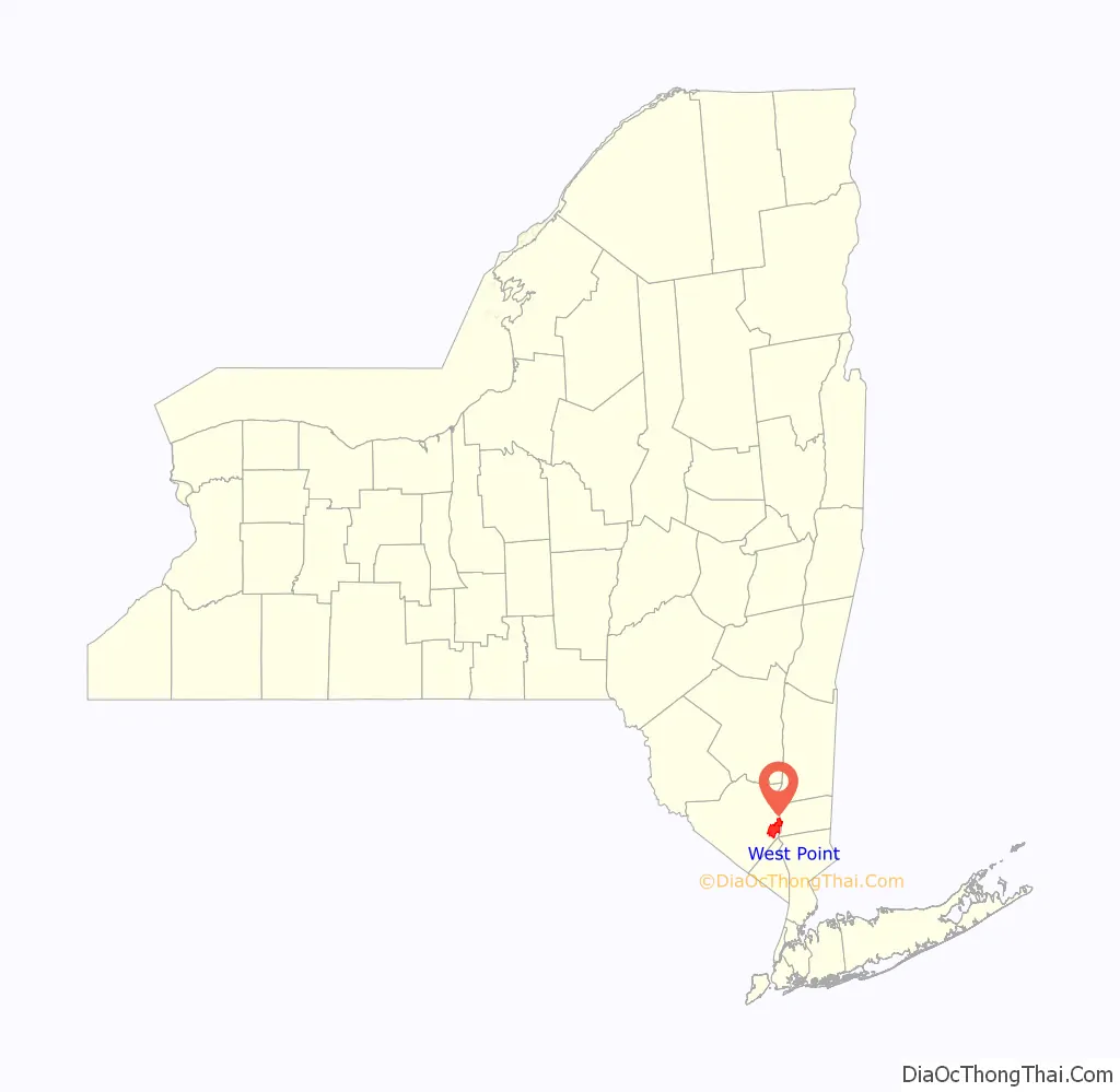
West Point location map. Where is West Point CDP?
History
West Point (then known as Fort Clinton), was a fortified site during the American Revolutionary War. Originally picked because of the abnormal S-curve in the Hudson River at this point, the defenses of West Point were designed by Polish military engineer Tadeusz Kościuszko, who served as a brigadier general in the Continental Army.
It was staffed by a small garrison of Continental Army Soldiers from early in 1776 through the end of the war. A great iron chain was laid across the Hudson at this point in 1778 in order to prevent British Navy vessels from sailing further up the Hudson River, which was never tested by the British.
The site comprised multiple redoubts, as well as Fort Putnam, situated on a high hill overlooking the river. Named after its builder, Revolutionary War General and engineer Rufus Putnam, the fort is still preserved in its original design.
In perhaps the most infamous act of treason in American history, General Benedict Arnold attempted to turn the site over to the British Army in 1780 for a bribe consisting of a commission as a brigadier general in the British Army and a cash reward of £20,000 (about $1.3M in 2009 dollars). Arnold’s plot failed when British Major John André was captured as a spy by the Americans. Arnold received a decreased cash reward of £6,000 (roughly $350,000) but was commissioned as a brigadier general in the British Army.
After the conclusion of the American Revolution, West Point was used as a storage facility for cannon and other military property used by the Continental Army. For two months in 1784, the United States Army consisted of only about 80 soldiers under the command of Brevet Major John Doughty at West Point.
In 1790, New York merchant and American Revolution patriot Stephen Moore sold his estate (known as “Moore’s Folly”) to the United States, following an Act of Congress that solidified the sale. At that point, the home on site (known as “Red House”) had suffered damages from the American Revolution and had been occupied repeatedly, including as temporary headquarters to George Washington. The United States Military Academy was established at West Point in 1802 and is the nation’s oldest service academy. West Point has the distinction of being the longest continuously occupied United States military installation.
In 1937, the West Point Bullion Depository was constructed; in 1988, it became the West Point Mint, as a branch of the United States Mint.
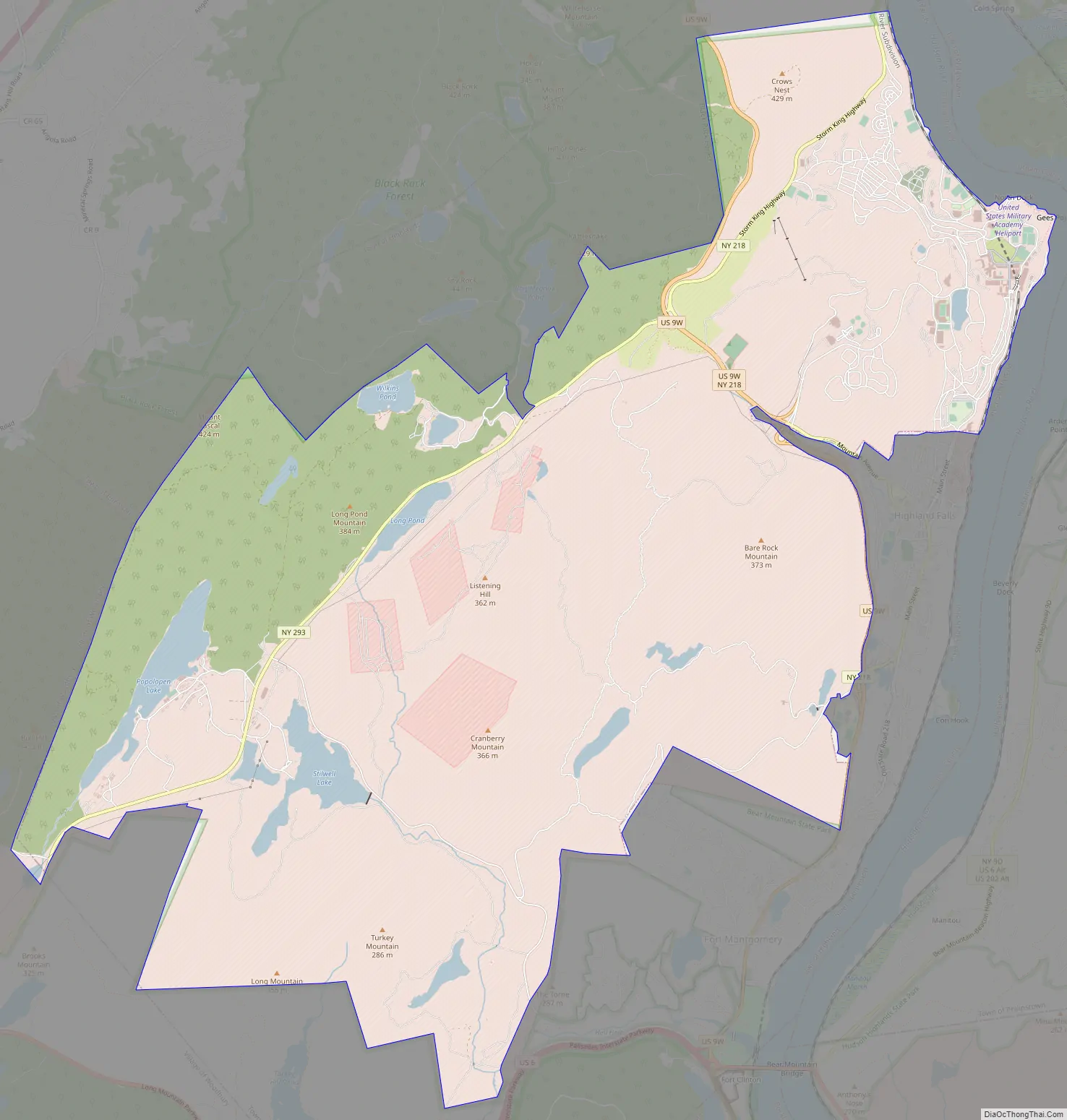
West Point Road Map
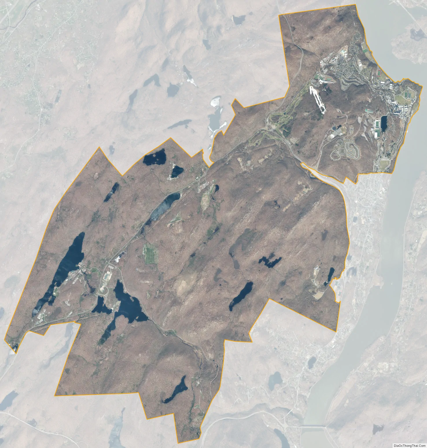
West Point city Satellite Map
Geography
West Point is located at 41° 23′ 42″ N 73° 57′ 18″ W (41.395° N 73.955° W). According to the United States Census Bureau, the CDP has a total area of 25.1 sq mi (65 km); 24.3 sq mi (63 km) land and 0.7 sq mi (1.8 km) water. West Point and the contiguous village of Highland Falls are on the west bank of the Hudson River.
West Point has a humid continental climate (Köppen Dfa), with four distinct seasons. Summers are hot and humid, while winters are cold with moderate snowfall. The monthly daily average temperature ranges from 27.5 °F (−2.5 °C) in January to 74.1 °F (23.4 °C) in July; on average, temperatures reaching 90 °F (32 °C) or 0 °F (−18 °C) occur on 17 and 1.4 days of the year, respectively. The average annual precipitation is approximately 50.5 in (1,280 mm), which is distributed fairly evenly throughout the year; snow averages 35 in (89 cm) per season, although this total may vary considerably from year to year. Extremes in temperature range from 106 °F (41 °C) on July 22, 1926, down to −17 °F (−27 °C) on February 9, 1934.
See also
Map of New York State and its subdivision:- Albany
- Allegany
- Bronx
- Broome
- Cattaraugus
- Cayuga
- Chautauqua
- Chemung
- Chenango
- Clinton
- Columbia
- Cortland
- Delaware
- Dutchess
- Erie
- Essex
- Franklin
- Fulton
- Genesee
- Greene
- Hamilton
- Herkimer
- Jefferson
- Kings
- Lake Ontario
- Lewis
- Livingston
- Madison
- Monroe
- Montgomery
- Nassau
- New York
- Niagara
- Oneida
- Onondaga
- Ontario
- Orange
- Orleans
- Oswego
- Otsego
- Putnam
- Queens
- Rensselaer
- Richmond
- Rockland
- Saint Lawrence
- Saratoga
- Schenectady
- Schoharie
- Schuyler
- Seneca
- Steuben
- Suffolk
- Sullivan
- Tioga
- Tompkins
- Ulster
- Warren
- Washington
- Wayne
- Westchester
- Wyoming
- Yates
- Alabama
- Alaska
- Arizona
- Arkansas
- California
- Colorado
- Connecticut
- Delaware
- District of Columbia
- Florida
- Georgia
- Hawaii
- Idaho
- Illinois
- Indiana
- Iowa
- Kansas
- Kentucky
- Louisiana
- Maine
- Maryland
- Massachusetts
- Michigan
- Minnesota
- Mississippi
- Missouri
- Montana
- Nebraska
- Nevada
- New Hampshire
- New Jersey
- New Mexico
- New York
- North Carolina
- North Dakota
- Ohio
- Oklahoma
- Oregon
- Pennsylvania
- Rhode Island
- South Carolina
- South Dakota
- Tennessee
- Texas
- Utah
- Vermont
- Virginia
- Washington
- West Virginia
- Wisconsin
- Wyoming


