Westmere is a hamlet in the town of Guilderland, Albany County, New York, United States. Since the 1970 Census, a census-designated place (CDP) has been established with the name of Westmere for tabulating the population of what the census has defined as the boundaries for Westmere. The population was 7,284 at the 2010 census. It is a suburb of the neighboring city of Albany. U.S. Route 20 (Western Avenue) bisects the community and is the major thoroughfare and main street. Along Western Avenue are numerous strip malls, shopping plazas, and commercial buildings, with residential use on the side streets to the north and south. Crossgates Mall, the Capital District’s largest shopping mall, is in Westmere’s northeastern corner.
| Name: | Westmere CDP |
|---|---|
| LSAD Code: | 57 |
| LSAD Description: | CDP (suffix) |
| State: | New York |
| County: | Albany County |
| Elevation: | 292 ft (89 m) |
| Total Area: | 3.18 sq mi (8.23 km²) |
| Land Area: | 3.17 sq mi (8.21 km²) |
| Water Area: | 0.01 sq mi (0.03 km²) |
| Total Population: | 7,560 |
| Population Density: | 2,385.61/sq mi (921.03/km²) |
| ZIP code: | 12203, 12084, 12159 |
| Area code: | 518 |
| FIPS code: | 3680423 |
| GNISfeature ID: | 0970925 |
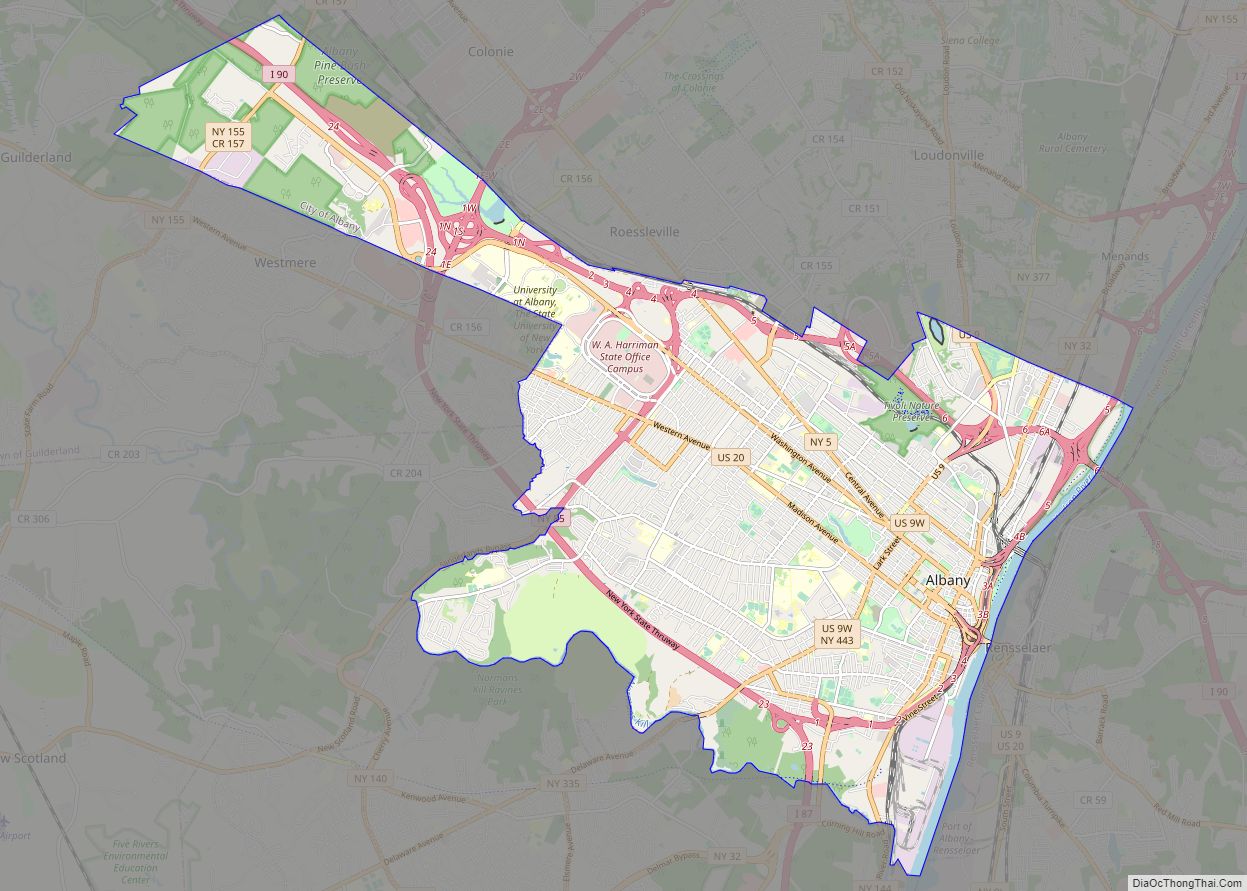
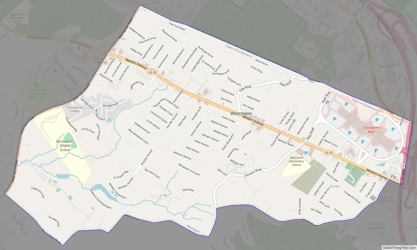
Online Interactive Map
Click on ![]() to view map in "full screen" mode.
to view map in "full screen" mode.
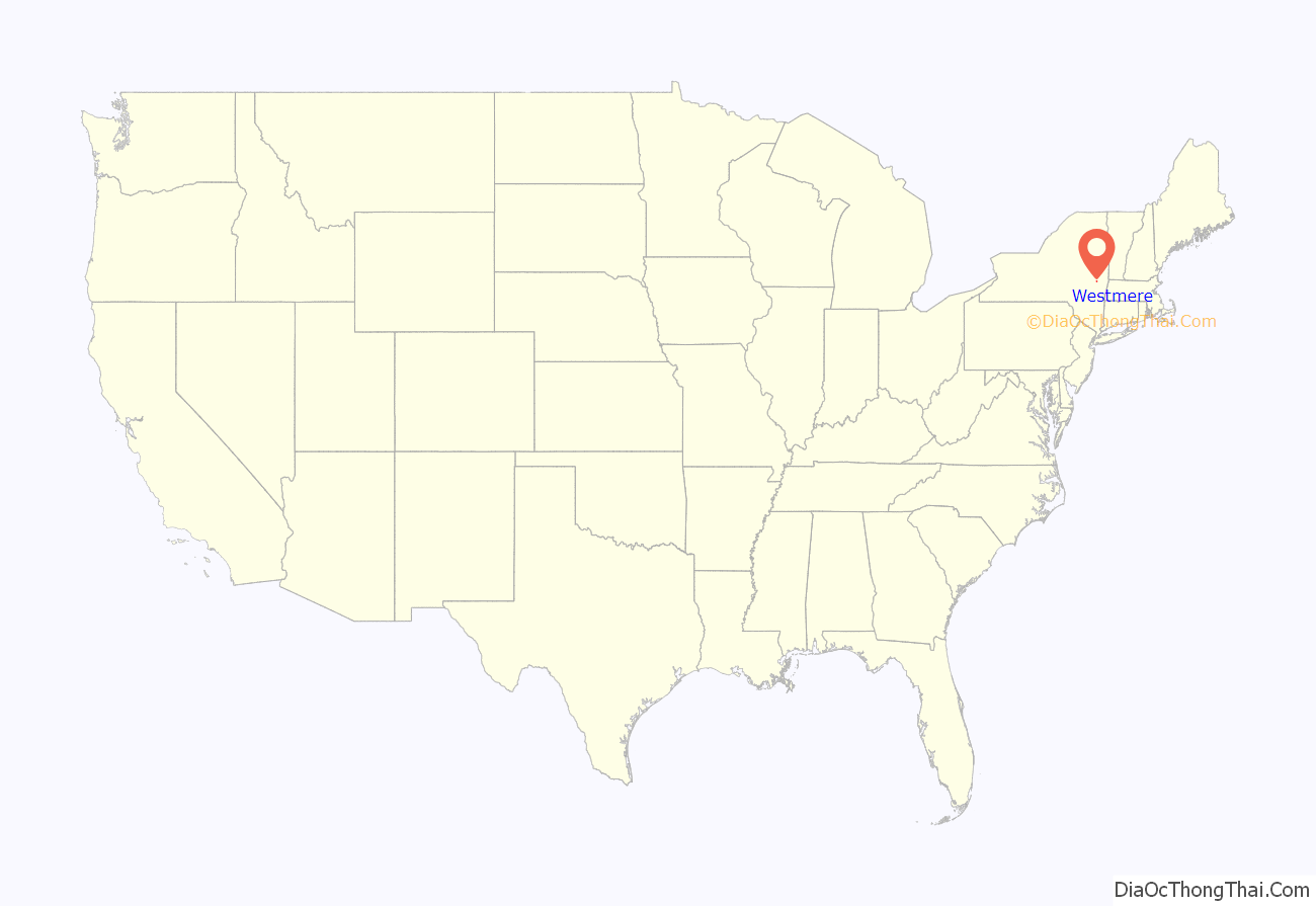
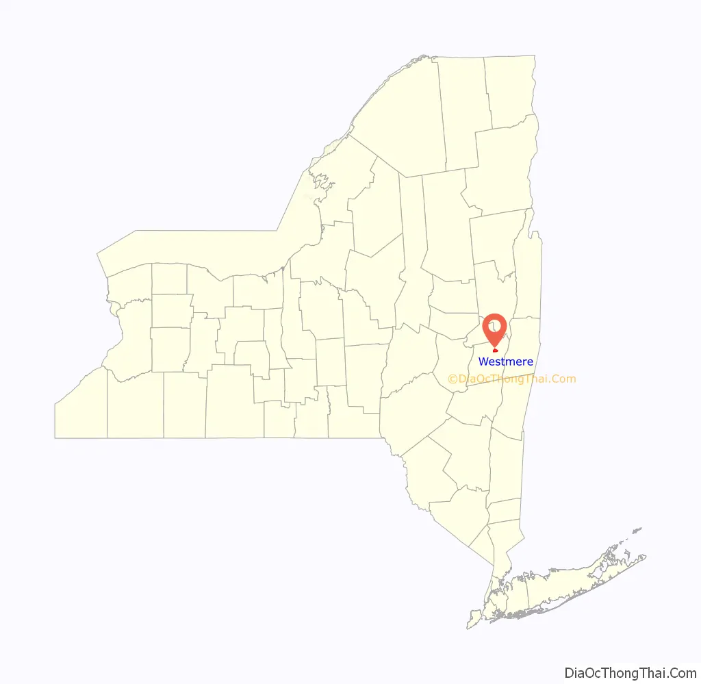
Westmere location map. Where is Westmere CDP?
History
Westmere as a settled place is of recent origin, though being along the Great Western Turnpike, built in 1799, it was always a place migrants passed through on their way from Albany and New England to the western frontier. A toll gate existed on the turnpike roughly where Highland Estates is located. Even before the turnpike was built, 300 wagons (and sleighs in the winter) passed through in 1796 what would later become Westmere. After World War I, development began to encroach on the rural wooded area with mostly bungalows and cottages. This would accelerate in the post-war era after World War II, and in the 1940s is when the name Westmere would be given to this area. Westmere was the fastest growing section of the town of Guilderland in this period.
Westmere Road Map
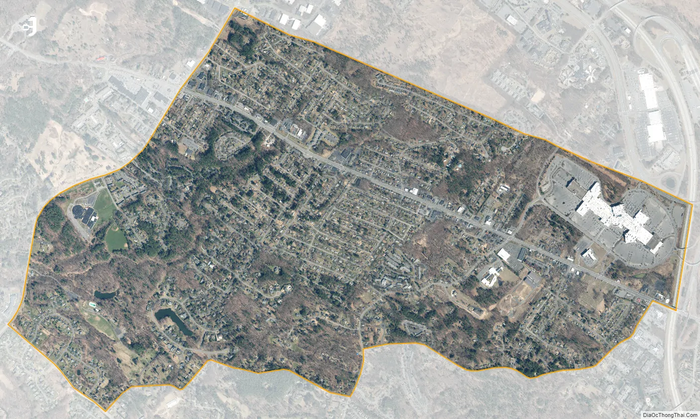
Westmere city Satellite Map
Geography
As a hamlet, the borders of Westmere are only loosely defined. As a census-designated place (CDP) however, the borders (as of the 2010 census) are exactly defined as the city of Albany to the north, then following New York Route 155 (State Farm Road/New Karner Road) as the western border. The southern border follows Doctor Shaw Road from its intersection with NY 155, then turns northeast onto Veeder Road until its termination with Johnston Road. At Johnston Road, the border turns north and follows it until it takes a right onto Church Road and follows it to the intersection with U.S. Route 20 (Western Avenue). The border then takes a right on Western Avenue to the Governor Thomas E. Dewey Thruway (Interstate 87) and goes north to the Albany city line. These borders can change from census to census. According to the United States Census Bureau in 2000, the CDP has a total area of 3.2 square miles (8.3 km), all land.
Location
See also
Map of New York State and its subdivision:- Albany
- Allegany
- Bronx
- Broome
- Cattaraugus
- Cayuga
- Chautauqua
- Chemung
- Chenango
- Clinton
- Columbia
- Cortland
- Delaware
- Dutchess
- Erie
- Essex
- Franklin
- Fulton
- Genesee
- Greene
- Hamilton
- Herkimer
- Jefferson
- Kings
- Lake Ontario
- Lewis
- Livingston
- Madison
- Monroe
- Montgomery
- Nassau
- New York
- Niagara
- Oneida
- Onondaga
- Ontario
- Orange
- Orleans
- Oswego
- Otsego
- Putnam
- Queens
- Rensselaer
- Richmond
- Rockland
- Saint Lawrence
- Saratoga
- Schenectady
- Schoharie
- Schuyler
- Seneca
- Steuben
- Suffolk
- Sullivan
- Tioga
- Tompkins
- Ulster
- Warren
- Washington
- Wayne
- Westchester
- Wyoming
- Yates
- Alabama
- Alaska
- Arizona
- Arkansas
- California
- Colorado
- Connecticut
- Delaware
- District of Columbia
- Florida
- Georgia
- Hawaii
- Idaho
- Illinois
- Indiana
- Iowa
- Kansas
- Kentucky
- Louisiana
- Maine
- Maryland
- Massachusetts
- Michigan
- Minnesota
- Mississippi
- Missouri
- Montana
- Nebraska
- Nevada
- New Hampshire
- New Jersey
- New Mexico
- New York
- North Carolina
- North Dakota
- Ohio
- Oklahoma
- Oregon
- Pennsylvania
- Rhode Island
- South Carolina
- South Dakota
- Tennessee
- Texas
- Utah
- Vermont
- Virginia
- Washington
- West Virginia
- Wisconsin
- Wyoming