Whitney Point is a village in Broome County, New York, United States. The population was 964 at the 2010 census. It is part of the Binghamton Metropolitan Statistical Area. The name comes from Thomas and William Whitney, early developers.
The village is in the southwestern corner of the town of Triangle and is north of Binghamton.
| Name: | Whitney Point village |
|---|---|
| LSAD Code: | 47 |
| LSAD Description: | village (suffix) |
| State: | New York |
| County: | Broome County |
| Elevation: | 958 ft (292 m) |
| Total Area: | 1.11 sq mi (2.88 km²) |
| Land Area: | 1.04 sq mi (2.70 km²) |
| Water Area: | 0.07 sq mi (0.18 km²) |
| Total Population: | 960 |
| Population Density: | 920.42/sq mi (355.54/km²) |
| ZIP code: | 13862 |
| Area code: | 607 |
| FIPS code: | 3681831 |
| GNISfeature ID: | 0971191 |
| Website: | www.whitneypoint.org |
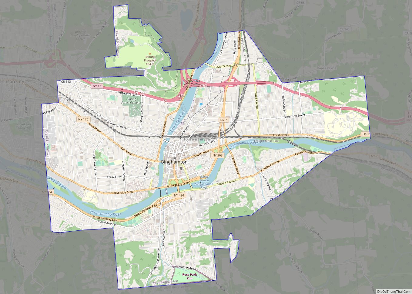
Online Interactive Map
Click on ![]() to view map in "full screen" mode.
to view map in "full screen" mode.
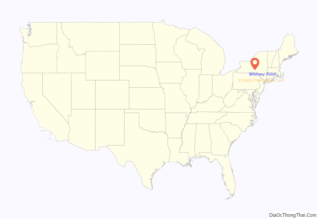
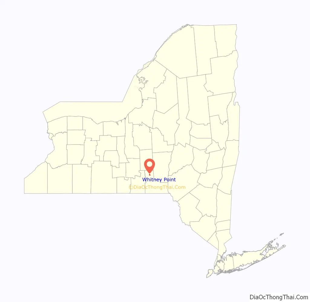
Whitney Point location map. Where is Whitney Point village?
History
The village area was first settled around 1791 and began to flourish after the arrival of the Whitney family around 1800.
The Village of Whitney Point (originally called “Whitney’s Point”) was incorporated in 1871. A catastrophic fire almost destroyed the village in 1897. After serious flooding in 1935 and 1936, work began on a dam north of the village on the Otselic River. It was completed in 1942 and — after decisions were later made to impound water on a year-round basis for recreational purposes — formed the Whitney Point Lake (Reservoir).
The village has been the site of the Broome County Fair since 1874.
The Whitney Automobile was briefly manufactured in this village around 1902.
Grace Episcopal Church was listed on the National Register of Historic Places in 1998.
The town slogan is “Best Town by a Dam Site” in reference to the Whitney Point Reservoir Dam in Dorchester Park.
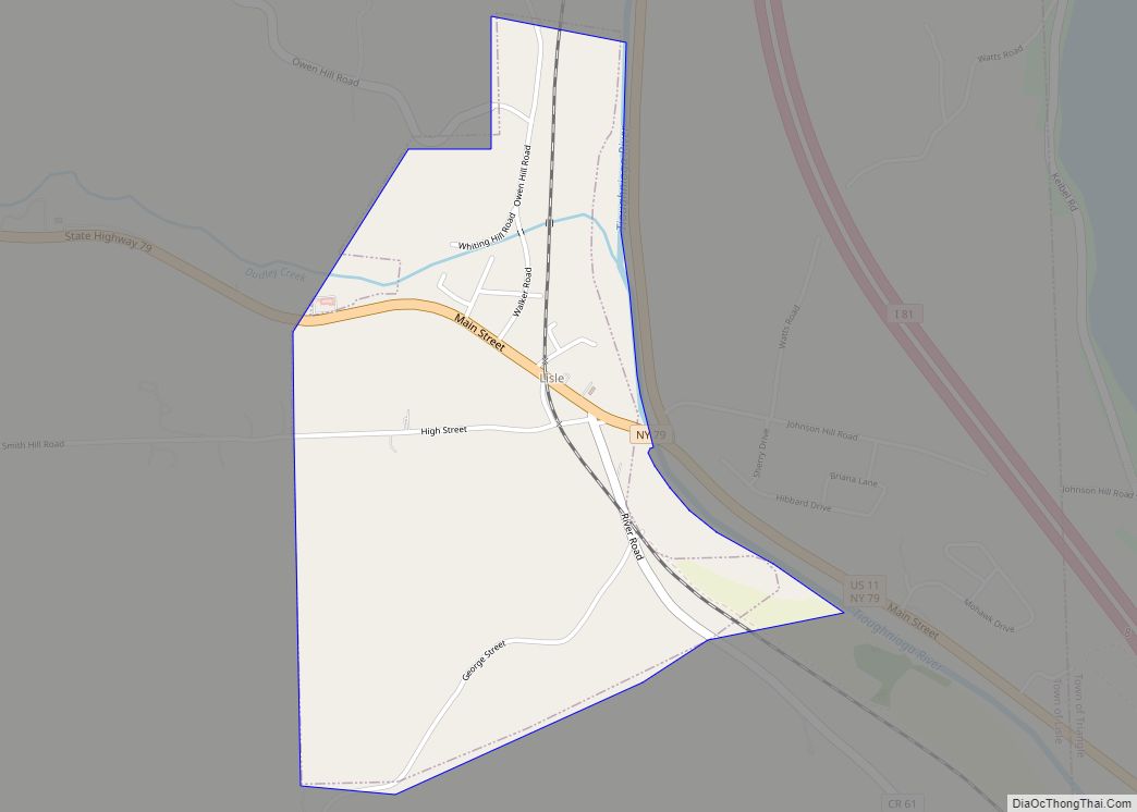
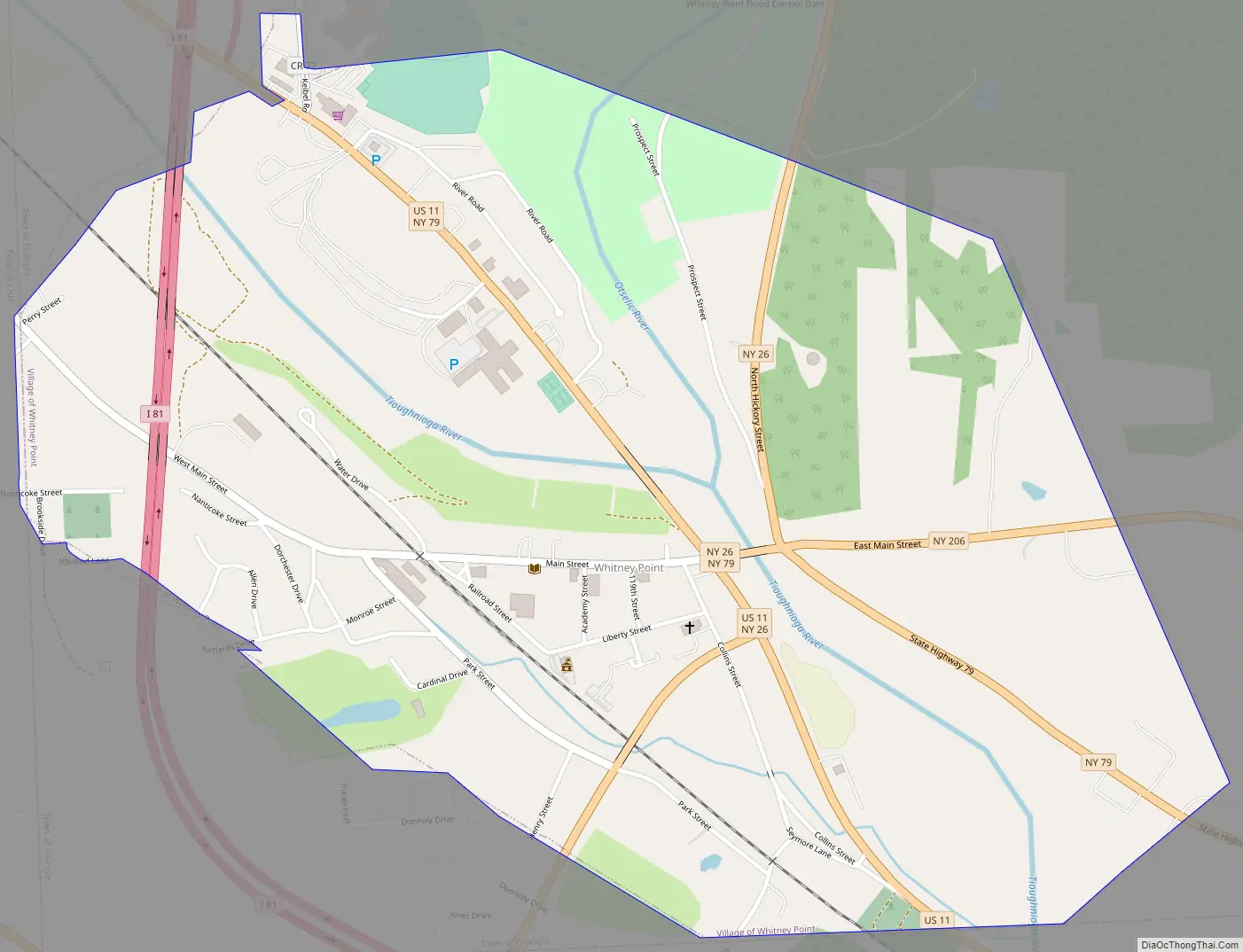
Whitney Point Road Map
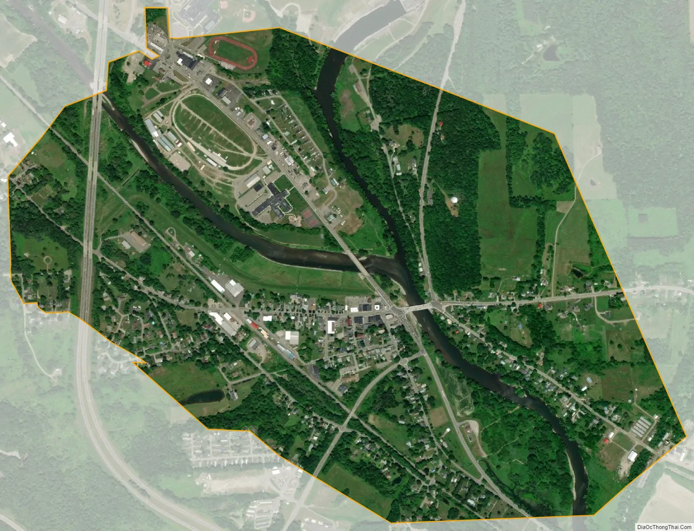
Whitney Point city Satellite Map
Geography
Whitney Point is located at 42°19′48″N 75°58′12″W / 42.33000°N 75.97000°W / 42.33000; -75.97000 (42.330084, -75.970091).
According to the United States Census Bureau, the village has a total area of 1.1 square miles (2.9 km), of which 1.0 square mile (2.7 km) is land and 0.077 square miles (0.2 km), or 6.31%, is water.
The village is located on the Tioughnioga River, by its junction with the Otselic River.
The village is located at the junction of NY 26, NY 79, NY 206, and US 11. Interstate 81 passes through the western side of the village, with access from Exit 8.
See also
Map of New York State and its subdivision:- Albany
- Allegany
- Bronx
- Broome
- Cattaraugus
- Cayuga
- Chautauqua
- Chemung
- Chenango
- Clinton
- Columbia
- Cortland
- Delaware
- Dutchess
- Erie
- Essex
- Franklin
- Fulton
- Genesee
- Greene
- Hamilton
- Herkimer
- Jefferson
- Kings
- Lake Ontario
- Lewis
- Livingston
- Madison
- Monroe
- Montgomery
- Nassau
- New York
- Niagara
- Oneida
- Onondaga
- Ontario
- Orange
- Orleans
- Oswego
- Otsego
- Putnam
- Queens
- Rensselaer
- Richmond
- Rockland
- Saint Lawrence
- Saratoga
- Schenectady
- Schoharie
- Schuyler
- Seneca
- Steuben
- Suffolk
- Sullivan
- Tioga
- Tompkins
- Ulster
- Warren
- Washington
- Wayne
- Westchester
- Wyoming
- Yates
- Alabama
- Alaska
- Arizona
- Arkansas
- California
- Colorado
- Connecticut
- Delaware
- District of Columbia
- Florida
- Georgia
- Hawaii
- Idaho
- Illinois
- Indiana
- Iowa
- Kansas
- Kentucky
- Louisiana
- Maine
- Maryland
- Massachusetts
- Michigan
- Minnesota
- Mississippi
- Missouri
- Montana
- Nebraska
- Nevada
- New Hampshire
- New Jersey
- New Mexico
- New York
- North Carolina
- North Dakota
- Ohio
- Oklahoma
- Oregon
- Pennsylvania
- Rhode Island
- South Carolina
- South Dakota
- Tennessee
- Texas
- Utah
- Vermont
- Virginia
- Washington
- West Virginia
- Wisconsin
- Wyoming