Windsor is a village in Broome County, New York, United States. The population was 916 at the 2010 census. It is part of the Binghamton Metropolitan Statistical Area.
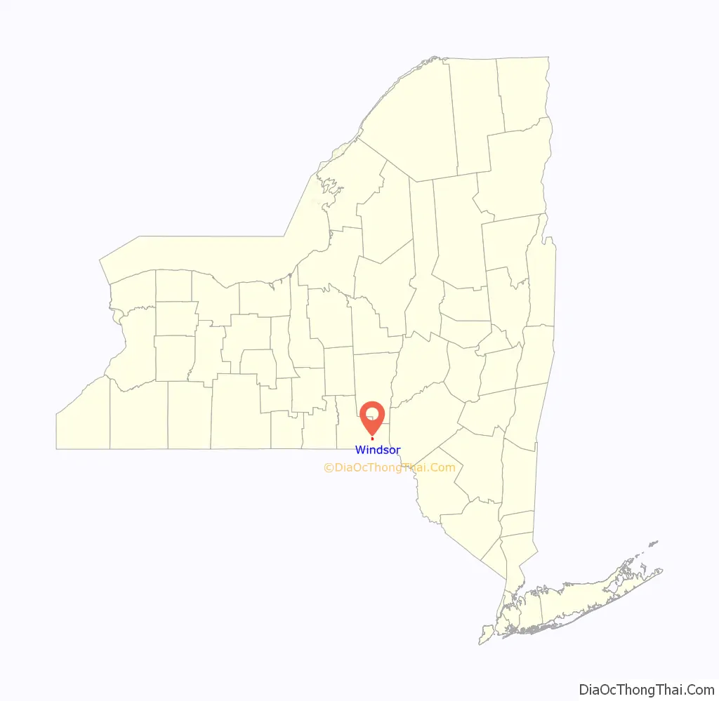
The Incorporated Village of Windsor is located near the middle of the Town of Windsor and is the principal settlement in the town. The village is east of Binghamton.
| Name: | Windsor village |
|---|---|
| LSAD Code: | 47 |
| LSAD Description: | village (suffix) |
| State: | New York |
| County: | Broome County |
| Elevation: | 951 ft (290 m) |
| Total Area: | 1.17 sq mi (3.02 km²) |
| Land Area: | 1.10 sq mi (2.85 km²) |
| Water Area: | 0.07 sq mi (0.17 km²) |
| Total Population: | 907 |
| Population Density: | 825.30/sq mi (318.53/km²) |
| ZIP code: | 13865 |
| Area code: | 607 |
| FIPS code: | 3682524 |
| GNISfeature ID: | 0971474 |
| Website: | www.villageofwindsor.org |
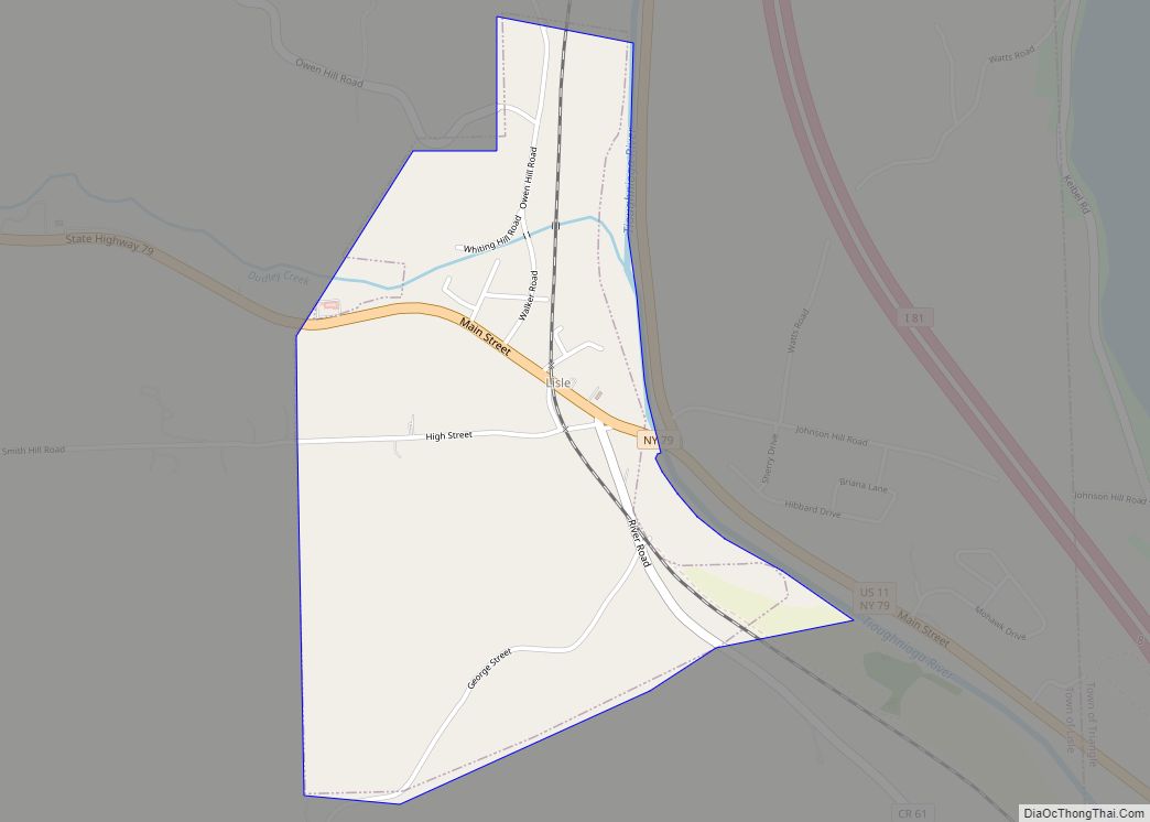
Online Interactive Map
Click on ![]() to view map in "full screen" mode.
to view map in "full screen" mode.
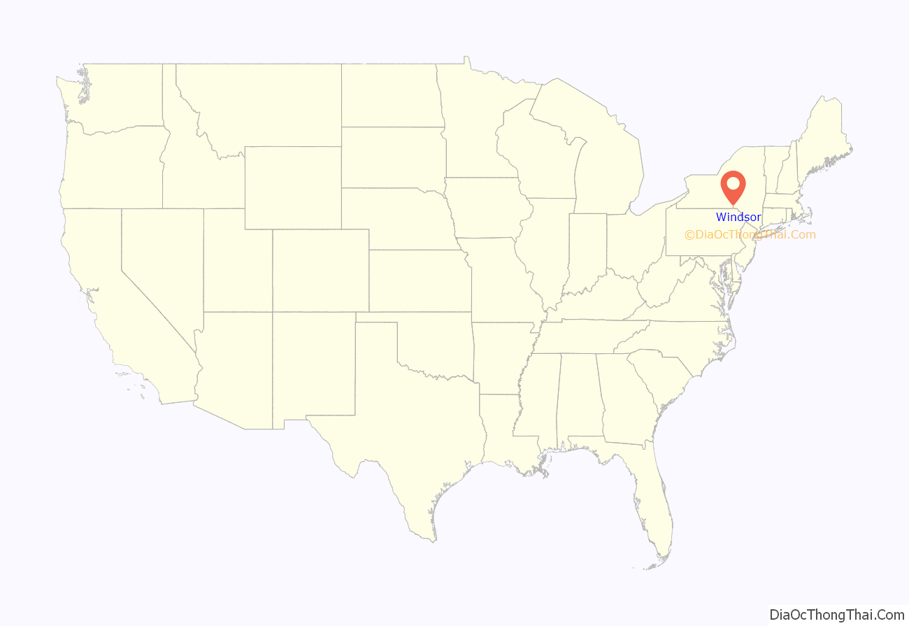
Windsor location map. Where is Windsor village?
History
Windsor is the site of the historic Seneca village of Onaquaga, which was one of 40 destroyed by the Continental Army in October 1778 during Sullivan’s Expedition.
In 1830, the new village was founded as a commercial settlement, and it soon outstripped its rival to the north, Ouaquaga. The village was incorporated in 1896.
The Windsor Village Historic District was listed on the National Register of Historic Places in 1980. The Jedediah Hotchkiss House was listed in 1982.
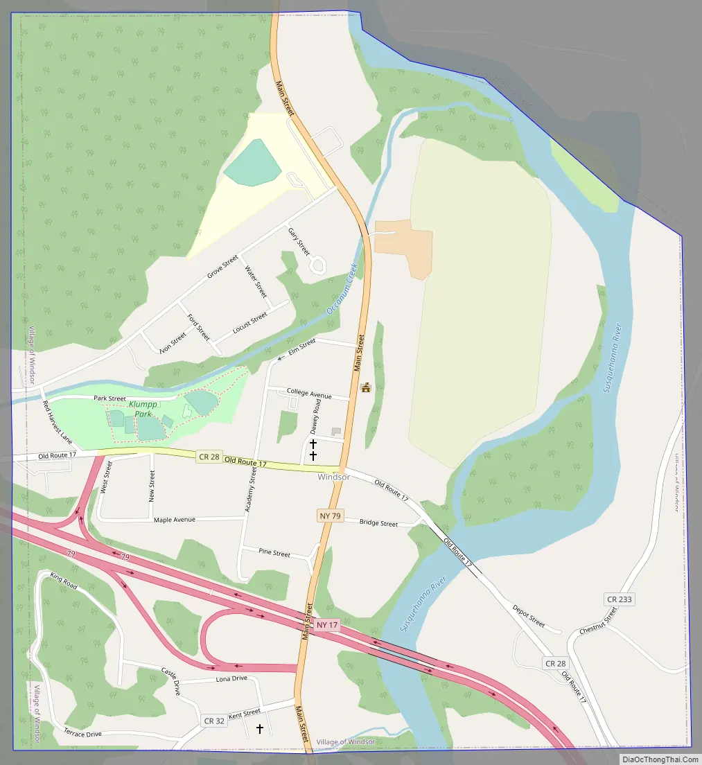
Windsor Road Map
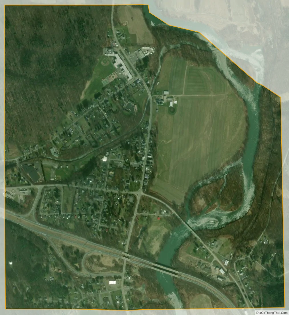
Windsor city Satellite Map
Geography
According to the United States Census Bureau, the village has a total area of 1.2 square miles (3.0 km), of which 1.1 square miles (2.8 km) is land and 0.077 square miles (0.2 km), or 6.15%, is water.
Windsor is on the west bank of the Susquehanna River and is located on Interstate 86/New York State Route 17 at the junction of New York State Route 79.
See also
Map of New York State and its subdivision:- Albany
- Allegany
- Bronx
- Broome
- Cattaraugus
- Cayuga
- Chautauqua
- Chemung
- Chenango
- Clinton
- Columbia
- Cortland
- Delaware
- Dutchess
- Erie
- Essex
- Franklin
- Fulton
- Genesee
- Greene
- Hamilton
- Herkimer
- Jefferson
- Kings
- Lake Ontario
- Lewis
- Livingston
- Madison
- Monroe
- Montgomery
- Nassau
- New York
- Niagara
- Oneida
- Onondaga
- Ontario
- Orange
- Orleans
- Oswego
- Otsego
- Putnam
- Queens
- Rensselaer
- Richmond
- Rockland
- Saint Lawrence
- Saratoga
- Schenectady
- Schoharie
- Schuyler
- Seneca
- Steuben
- Suffolk
- Sullivan
- Tioga
- Tompkins
- Ulster
- Warren
- Washington
- Wayne
- Westchester
- Wyoming
- Yates
- Alabama
- Alaska
- Arizona
- Arkansas
- California
- Colorado
- Connecticut
- Delaware
- District of Columbia
- Florida
- Georgia
- Hawaii
- Idaho
- Illinois
- Indiana
- Iowa
- Kansas
- Kentucky
- Louisiana
- Maine
- Maryland
- Massachusetts
- Michigan
- Minnesota
- Mississippi
- Missouri
- Montana
- Nebraska
- Nevada
- New Hampshire
- New Jersey
- New Mexico
- New York
- North Carolina
- North Dakota
- Ohio
- Oklahoma
- Oregon
- Pennsylvania
- Rhode Island
- South Carolina
- South Dakota
- Tennessee
- Texas
- Utah
- Vermont
- Virginia
- Washington
- West Virginia
- Wisconsin
- Wyoming