Austintown is an unincorporated community and census-designated place within Austintown Township, Mahoning County, Ohio, United States. The population was 29,594 at the 2020 census. Located directly west of Youngstown, it is a suburb of the Youngstown–Warren metropolitan area.
| Name: | Austintown CDP |
|---|---|
| LSAD Code: | 57 |
| LSAD Description: | CDP (suffix) |
| State: | Ohio |
| County: | Mahoning County |
| Elevation: | 1,129 ft (344 m) |
| Total Area: | 11.65 sq mi (30.18 km²) |
| Land Area: | 11.62 sq mi (30.09 km²) |
| Water Area: | 0.03 sq mi (0.09 km²) |
| Total Population: | 29,594 |
| Population Density: | 2,547.47/sq mi (983.56/km²) |
| ZIP code: | 44515, 44511 |
| FIPS code: | 3903184 |
| GNISfeature ID: | 1064362 |
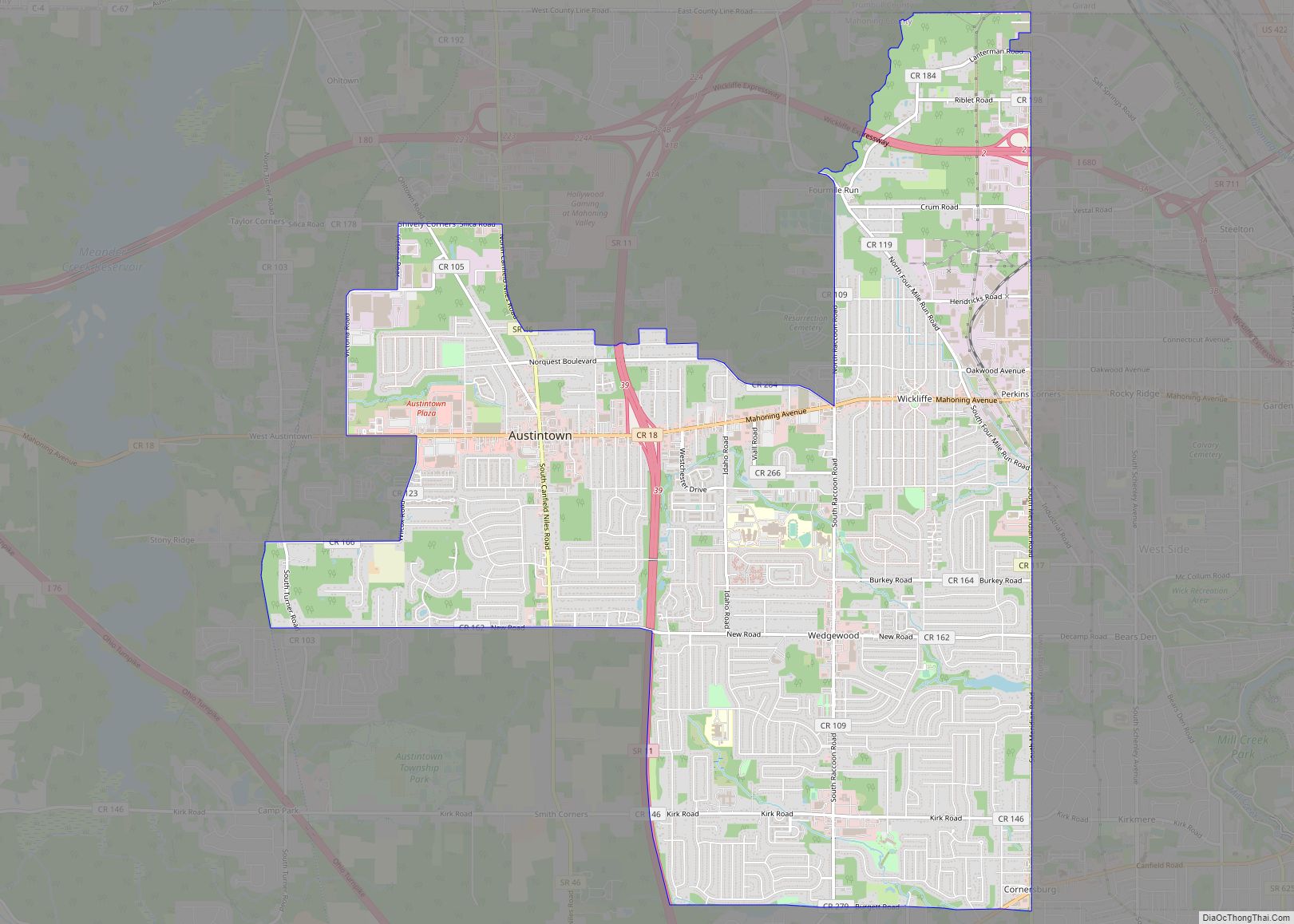
Online Interactive Map
Click on ![]() to view map in "full screen" mode.
to view map in "full screen" mode.
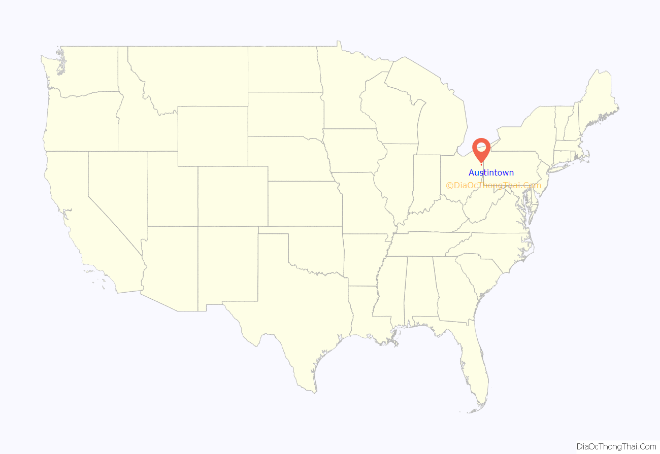
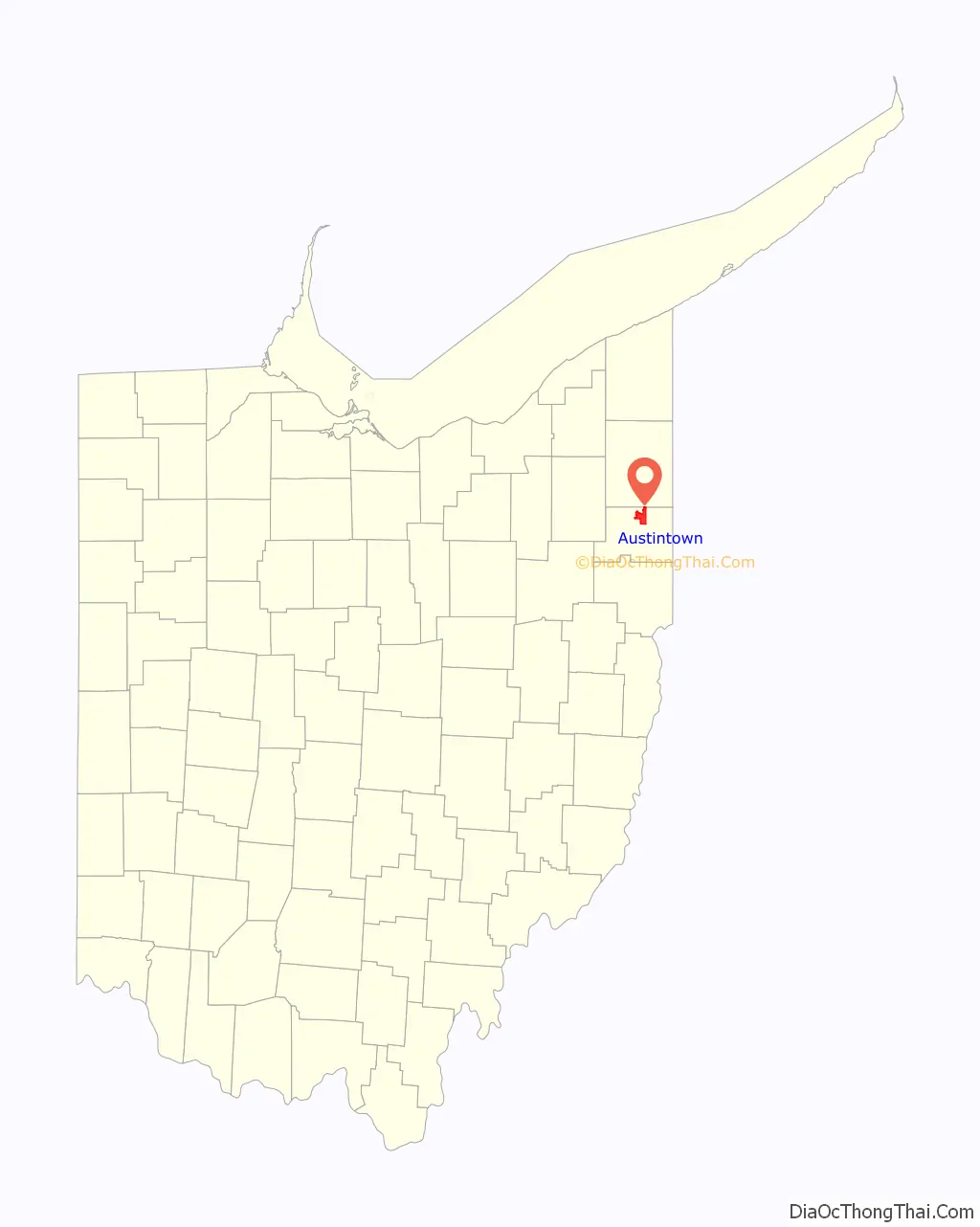
Austintown location map. Where is Austintown CDP?
History
Austintown Township was founded in 1793 as township 2, range 3 of the Connecticut Western Reserve by purchase from the Connecticut Land Company. It was surveyed as a parcel of land 5 miles (8 km) on each side, as were other townships of the Connecticut Western Reserve. Austintown was named for Warren resident and Western Reserve judge Calvin Austin. In 1794, John McCollum of New Jersey became the first settler. Throughout the 19th century, the township slowly grew; by 1880, coal miners and their families increased the population to 2,502. A post office called Orange was established on November 15, 1815, and its name was changed to Austintown on May 6, 1872. It ceased operation on May 15, 1917, forwarding mail to West Austintown, Ohio. After World War II, Austintown experienced a population boom as suburban spillover from Youngstown crept into the eastern part of the township, whilst the central Austintown community grew along Ohio State Route 46. The census-designated place of Austintown was formally established by the U.S. Census Bureau in 1980, consisting of the urban portions of the township.
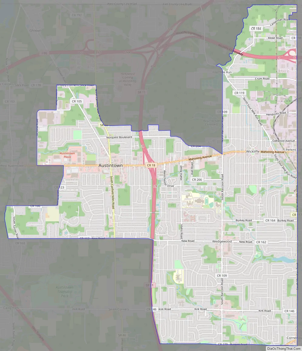
Austintown Road Map
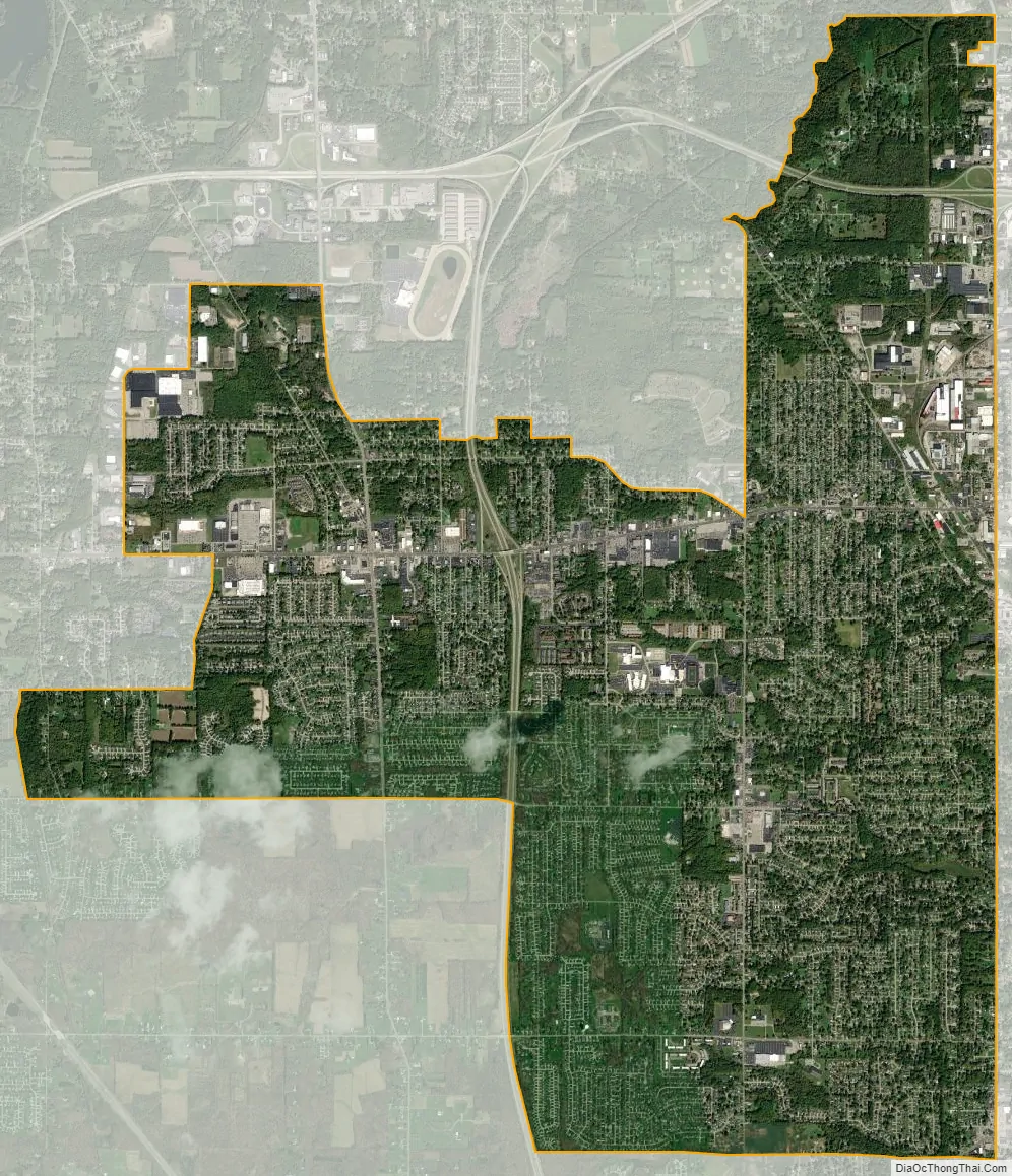
Austintown city Satellite Map
Geography
Austintown is located at 41°5′30″N 80°44′17″W / 41.09167°N 80.73806°W / 41.09167; -80.73806 (41.091743, -80.738103). The Austintown CDP takes up slightly less than half of the area of Austintown Township, largely on the eastern side of the township, where it abuts the western border of the city of Youngstown.
According to the United States Census Bureau, the CDP has a total area of 11.7 square miles (30.2 km), of which 11.6 square miles (30.1 km) is land and 0.04 square miles (0.1 km), or 0.29%, is water.
Ohio State Route 11 is a north-south freeway which passes through the CDP, with access from Exit 39. Interstate 680 passes east-to-west through the northern part of the CDP but provides no access. Interstate 80 passes to the north of the CDP, with access from Exit 223.
See also
Map of Ohio State and its subdivision:- Adams
- Allen
- Ashland
- Ashtabula
- Athens
- Auglaize
- Belmont
- Brown
- Butler
- Carroll
- Champaign
- Clark
- Clermont
- Clinton
- Columbiana
- Coshocton
- Crawford
- Cuyahoga
- Darke
- Defiance
- Delaware
- Erie
- Fairfield
- Fayette
- Franklin
- Fulton
- Gallia
- Geauga
- Greene
- Guernsey
- Hamilton
- Hancock
- Hardin
- Harrison
- Henry
- Highland
- Hocking
- Holmes
- Huron
- Jackson
- Jefferson
- Knox
- Lake
- Lake Erie
- Lawrence
- Licking
- Logan
- Lorain
- Lucas
- Madison
- Mahoning
- Marion
- Medina
- Meigs
- Mercer
- Miami
- Monroe
- Montgomery
- Morgan
- Morrow
- Muskingum
- Noble
- Ottawa
- Paulding
- Perry
- Pickaway
- Pike
- Portage
- Preble
- Putnam
- Richland
- Ross
- Sandusky
- Scioto
- Seneca
- Shelby
- Stark
- Summit
- Trumbull
- Tuscarawas
- Union
- Van Wert
- Vinton
- Warren
- Washington
- Wayne
- Williams
- Wood
- Wyandot
- Alabama
- Alaska
- Arizona
- Arkansas
- California
- Colorado
- Connecticut
- Delaware
- District of Columbia
- Florida
- Georgia
- Hawaii
- Idaho
- Illinois
- Indiana
- Iowa
- Kansas
- Kentucky
- Louisiana
- Maine
- Maryland
- Massachusetts
- Michigan
- Minnesota
- Mississippi
- Missouri
- Montana
- Nebraska
- Nevada
- New Hampshire
- New Jersey
- New Mexico
- New York
- North Carolina
- North Dakota
- Ohio
- Oklahoma
- Oregon
- Pennsylvania
- Rhode Island
- South Carolina
- South Dakota
- Tennessee
- Texas
- Utah
- Vermont
- Virginia
- Washington
- West Virginia
- Wisconsin
- Wyoming