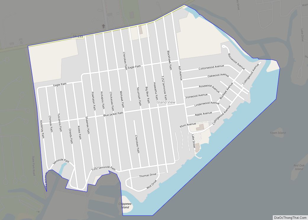
Chippewa Park is a census-designated place in Stokes Township, Logan County, Ohio, United States. As of the 2010 census, the population was 891.
| Name: | Chippewa Park CDP |
|---|---|
| LSAD Code: | 57 |
| LSAD Description: | CDP (suffix) |
| State: | Ohio |
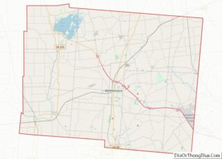
| County: | Logan County |
| Elevation: | 1,015 ft (309 m) |
| Total Area: | 0.49 sq mi (1.28 km²) |
| Land Area: | 0.44 sq mi (1.14 km²) |
| Water Area: | 0.05 sq mi (0.14 km²) |
| Total Population: | 819 |
| Population Density: | 1,861.36/sq mi (718.32/km²) |
| ZIP code: | 43331 (Lakeview) |
| FIPS code: | 3914280 |
| GNISfeature ID: | 2628906 |
Online Interactive Map
Click on ![]() to view map in "full screen" mode.
to view map in "full screen" mode.
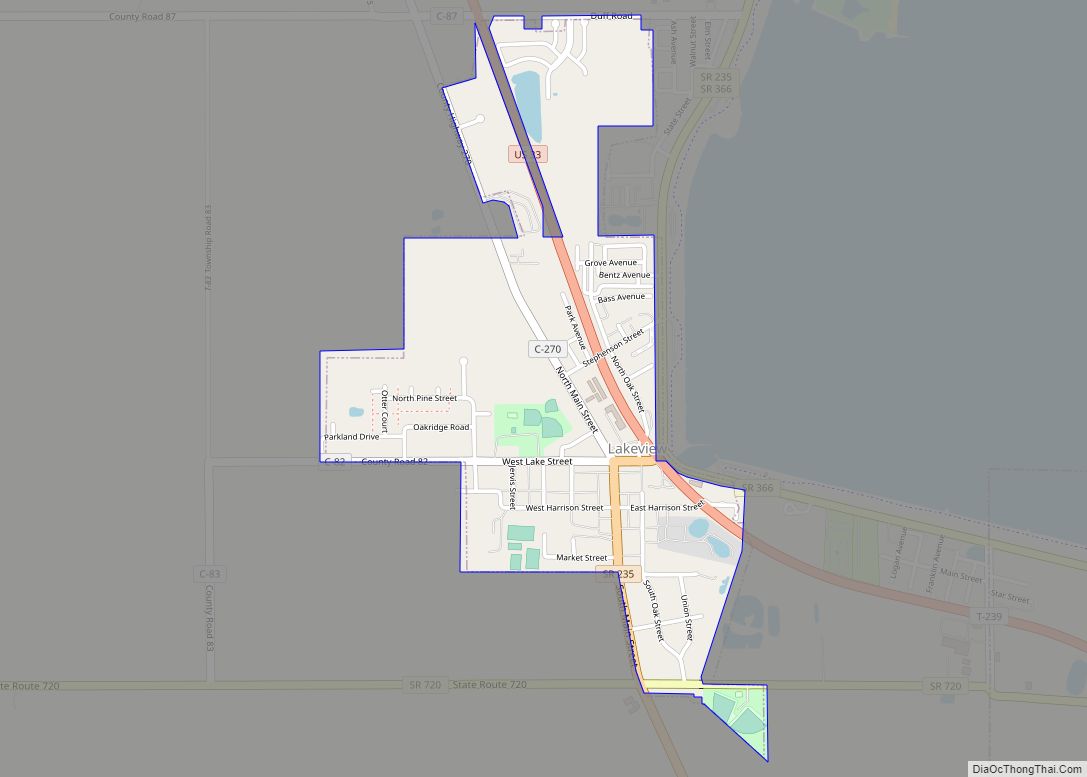
Chippewa Park location map. Where is Chippewa Park CDP?
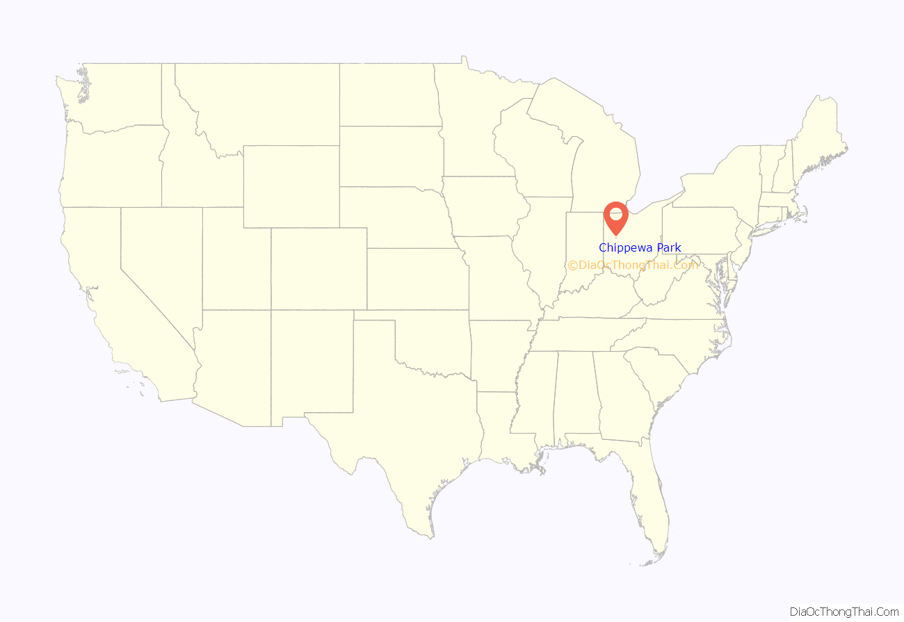
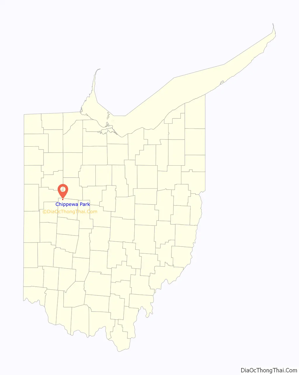
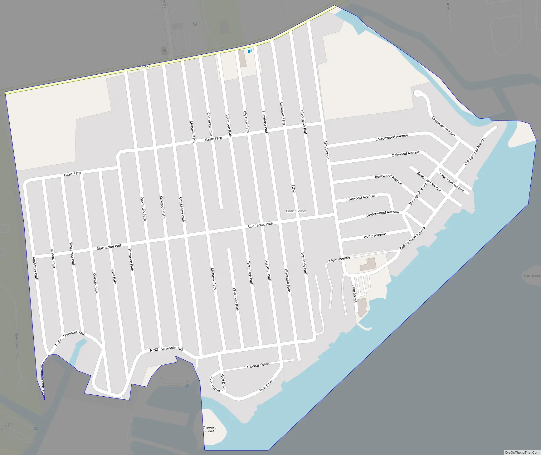
Chippewa Park Road Map
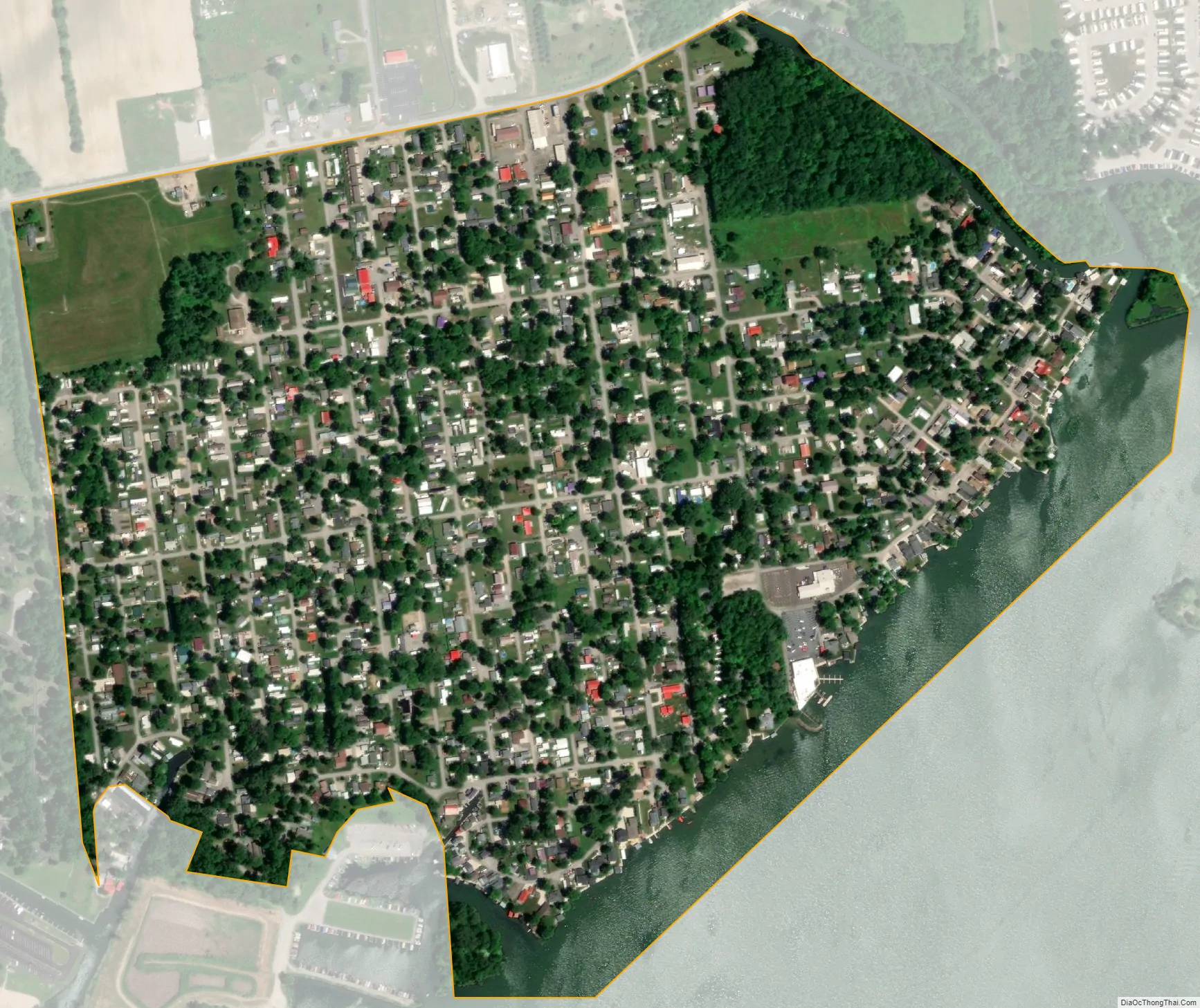
Chippewa Park city Satellite Map
Geography
Chippewa Park is in northwestern Logan County, in the northeast part of Stokes Township. The CDP is located along the northern shore of Indian Lake and includes the neighborhood known as Island View. The northern edge of the CDP follows Ohio State Route 235, the eastern edge follows Blackhawk Run, the southern edge is the shore of Indian Lake, and the western edge is the border of Indian Lake State Park.
The community is 4 miles (6 km) northeast of the village of Lakeview, 20 miles (32 km) southwest of Kenton, and 23 miles (37 km) southeast of Lima. According to the U.S. Census Bureau, the CDP has a total area of 0.50 square miles (1.3 km), of which 0.04 square miles (0.1 km), or 10.77%, are water.
See also
Map of Ohio State and its subdivision:- Adams
- Allen
- Ashland
- Ashtabula
- Athens
- Auglaize
- Belmont
- Brown
- Butler
- Carroll
- Champaign
- Clark
- Clermont
- Clinton
- Columbiana
- Coshocton
- Crawford
- Cuyahoga
- Darke
- Defiance
- Delaware
- Erie
- Fairfield
- Fayette
- Franklin
- Fulton
- Gallia
- Geauga
- Greene
- Guernsey
- Hamilton
- Hancock
- Hardin
- Harrison
- Henry
- Highland
- Hocking
- Holmes
- Huron
- Jackson
- Jefferson
- Knox
- Lake
- Lake Erie
- Lawrence
- Licking
- Logan
- Lorain
- Lucas
- Madison
- Mahoning
- Marion
- Medina
- Meigs
- Mercer
- Miami
- Monroe
- Montgomery
- Morgan
- Morrow
- Muskingum
- Noble
- Ottawa
- Paulding
- Perry
- Pickaway
- Pike
- Portage
- Preble
- Putnam
- Richland
- Ross
- Sandusky
- Scioto
- Seneca
- Shelby
- Stark
- Summit
- Trumbull
- Tuscarawas
- Union
- Van Wert
- Vinton
- Warren
- Washington
- Wayne
- Williams
- Wood
- Wyandot
- Alabama
- Alaska
- Arizona
- Arkansas
- California
- Colorado
- Connecticut
- Delaware
- District of Columbia
- Florida
- Georgia
- Hawaii
- Idaho
- Illinois
- Indiana
- Iowa
- Kansas
- Kentucky
- Louisiana
- Maine
- Maryland
- Massachusetts
- Michigan
- Minnesota
- Mississippi
- Missouri
- Montana
- Nebraska
- Nevada
- New Hampshire
- New Jersey
- New Mexico
- New York
- North Carolina
- North Dakota
- Ohio
- Oklahoma
- Oregon
- Pennsylvania
- Rhode Island
- South Carolina
- South Dakota
- Tennessee
- Texas
- Utah
- Vermont
- Virginia
- Washington
- West Virginia
- Wisconsin
- Wyoming