Loveland is a city in Hamilton, Clermont, and Warren counties in the southwestern part of the U.S. state of Ohio. The population was 13,307 at the 2020 census. Considered part of the Cincinnati metropolitan area, Loveland is located near exit 52 off Interstate 275, about 15 miles (24 km) northeast of the Cincinnati city limits. It borders Symmes, Miami and Hamilton townships and straddles the Little Miami River. Once a busy railroad town, Loveland is now a major stop along the Little Miami Scenic Trail.
| Name: | Loveland city |
|---|---|
| LSAD Code: | 25 |
| LSAD Description: | city (suffix) |
| State: | Ohio |
| County: | Clermont County, Hamilton County, Warren County |
| Elevation: | 597 ft (182 m) |
| Total Area: | 5.08 sq mi (13.14 km²) |
| Land Area: | 5.00 sq mi (12.94 km²) |
| Water Area: | 0.08 sq mi (0.20 km²) 1.40% |
| Total Population: | 13,307 |
| Population Density: | 2,663.00/sq mi (1,028.18/km²) |
| ZIP code: | 45140, 45249 |
| Area code: | 513 |
| FIPS code: | 3945108 |
| GNISfeature ID: | 1085672 |
| Website: | www.lovelandoh.gov |
Online Interactive Map
Click on ![]() to view map in "full screen" mode.
to view map in "full screen" mode.
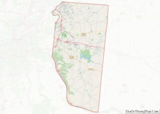
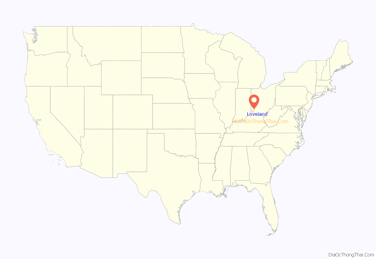
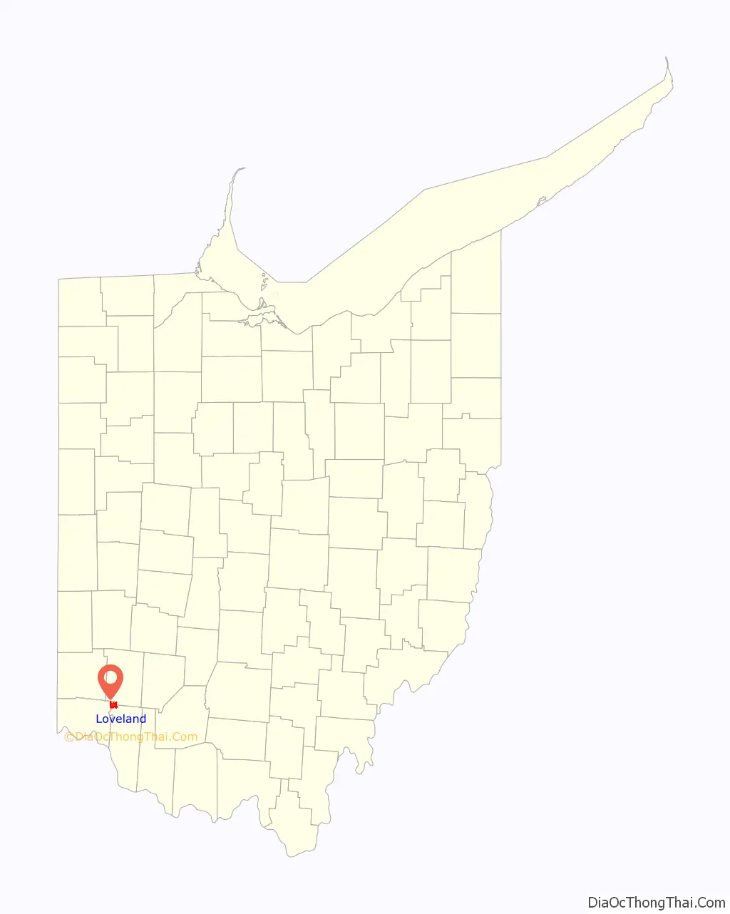
Loveland location map. Where is Loveland city?
History
The city is named after James Loveland, who operated a general store and post office near the railroad tracks downtown. It was incorporated as a village on May 12 or 16, 1876, and incorporated as a chartered city in 1961.
Settlement
Present-day Loveland originally lay at the edges of the Symmes Purchase and Virginia Military District, in what was then the Northwest Territory. The area was first settled in 1795 by Col. Thomas Paxton:
Paxton named the settlement after himself in 1849, but it was renamed Loveland the following year.
Village getaway
In its early days, Loveland was known as a resort town, with its summer homes for the wealthy, earning it the nickname “Little Switzerland of the Miami Valley.” Future Chief Justice Salmon P. Chase maintained a country home near Loveland, while the Cincinnati YWCA maintained a summer cottage there. The area was also home to Ohio’s first paper mill, built in 1810 by John Smith. A local road retains the mill’s eventual name, Kugler Mill. The area surrounding Loveland in Clermont County was well known for its peaches and strawberries. The Obionsville Post Office began operations on October 24, 1831, then changed its name to the Loveland Post Office on January 14, 1848.
The Hillsboro and Cincinnati Railroad was chartered in 1846 to run a line between Hillsboro and O’Bannon Creek in Loveland on the Little Miami Railroad’s route. By 1850, the H&C had completed the 37 miles (60 km) to Hillsboro, Ohio. The H&C would lease its line in perpetuity to the Marietta and Cincinnati Railroad and ultimately became the mainline of the Baltimore and Ohio Railroad. Loveland’s location at the junction of the Little Miami Railroad (now converted into the Loveland Bike Trail) and the Marietta and Cincinnati Railroad fueled the city’s growth, bringing “40 passenger trains per day, and 12 scheduled freight trains between Loveland and Cincinnati.”
Another railroad ran through antebellum Loveland: the Underground Railroad’s Eastern Route from Cincinnati included a stop at the village and continued northward to Waynesville and Lebanon. During the Civil War, Confederate Brig. Gen. John Hunt Morgan and his troops passed through Loveland, seizing possessions of northern and southern sympathizers alike (see Morgan’s Raid).
Until wagon bridges were built across the Little Miami River, settlement of Loveland was mostly confined to the Clermont County side, which had access to a railroad station. A wooden bridge spanned the river at Symmestown and Branch Hill from 1850 until it washed out six years later. For years, residents on both sides pushed for a bridge at Loveland, to avoid the long trip to Foster’s Crossing or Miamiville, and by 1868 threatened to have Miami Township annexed to Hamilton County if Clermont County officials continued to obstruct the project. A $75,000 suspension bridge was finally built at Symmestown and Branch Hill and dedicated on July 4, 1871. It was anchored by four 7,000-pound (3,200 kg) wrought iron columns, at that time the heaviest ever made in the United States. A second bridge, connecting East and West Loveland, was completed between 1872 and 1876.
Loveland incorporated as a village on May 16, 1876. John H. Law was elected the village’s first mayor. That year, the Cincinnati Campground at Loveland was the site of the holiness movement’s tenth annual National Camp Meeting.
In 1886, the skeleton of a mastodon and prehistoric stone tools were found in a Loveland gravel pit.
In 1903, Loveland voted to become a dry village, prohibiting the sale of alcohol within the village limits 17 years before a national ban. Loveland was a center of the Temperance movement in Ohio.
Downtown Loveland’s proximity to the Little Miami River has made it vulnerable to flooding. The worst such event, the Ohio Flood of March 1913, destroyed a corn mill and washed out the Loveland Bridge, which was replaced with an iron bridge the next year.
In the 1920s, The Cincinnati Enquirer ran a promotion that offered a free plot of land in Loveland, along the Little Miami River, after paying for a one-year subscription to the daily. The Loveland Castle was built on multiple plots obtained through this promotion.
Growing city
After a population spike during the 1950s, Loveland reincorporated as a chartered city – the first of only two in Clermont County – on July 25, 1961, with George Anderson as its first mayor. The city absorbed smaller settlements, such as Paxton, Obanionsville, and Symmestown. German architect Rudolf Fränkel developed a master plan for Loveland.
Another major flood in 1959 led to the construction of a dike along the Little Miami River in 1962–1963.
In 1969, Loveland elected Viola Phillips as mayor; she was the first woman to serve as a city official.
In 1972 and 1973, Loveland was the site of multiple Ku Klux Klan rallies that drew members from multiple states.
The long-abandoned Little Miami Railroad corridor was converted into a bike trail in the 1980s and became part of the Little Miami Scenic Trail in 1984.
Loveland has periodically sought to expand its borders by annexing surrounding areas, primarily to the more commercially active west. In 1993, the city attempted to annex parts of Deerfield Township, prompting petitions to instead merge the township with the City of Mason. Moves to merge Symmes Township with Loveland began the next year but ultimately failed. In 1996, Loveland moved its eastern border by purchasing Col. Paxton’s original White Pillars homestead, which had remained unincorporated, despite being the first settlement in the Loveland area.
In the late 1990s, Loveland was designated a Tree City by the National Arbor Day Foundation, as it began a number of efforts to promote its Historic Downtown neighborhood, in part to celebrate the city’s bicentennial. The programs included a renovation of Historic Downtown itself to sport a more “gentrified” look, for example replacing concrete sidewalks with brick ones, installing park benches throughout, and providing incentives to businesses willing to improve their façades. Major roads such as South Lebanon Road (County Road 298) were expanded and given landscaped medians.
The front lawn of Loveland City Hall was decorated with a nativity scene annually from 1973 until 1993, when a representative of the Ku Klux Klan asked the city for permission to erect a cross beside the display. Since then, the nativity scene has been placed on privately owned property.
The Loveland Beautification Committee was established to sponsor various programs and events that aim to improve landscapes and other buildings around town. Under the mayorship of Lee Skierkiewicz, Loveland heavily promoted itself as a cycling destination. The Tour de Loveland, an annual cycling race, was started in order to promote the Loveland Bike Trail as the centerpiece of Historic Downtown Loveland. The city’s efforts culminated with USA Cycling Elite National Championship criteriums in June 1998. On January 24, 2005, Loveland City Council voted to cancel the Tour, due to declining attendance and a lack of sponsors.
On April 9, 1999, Loveland found itself in the path of an F4 tornado (see Fujita scale). The tornado claimed four fatalities, including a Loveland resident, before reaching the city.
With “four blooms”, Loveland won the 2005 America in Bloom competition for cities with 10,001 to 15,000 residents. Loveland lost to St. Ives/Carbis Bay in the 2006 Communities in Bloom International Challenge, medium category, but won the “Communities in Bloom Youth Involvement Project Award.”
In 2004, CSX Transportation leased the former Baltimore and Ohio railroad to RailAmerica’s Indiana and Ohio Railway system. On May 4, 2007, Ohio’s first four-quadrant gate was installed at the Second Street railroad crossing in Loveland, as part of a coordinated three-crossing system.
In 2013, Loveland was named a “Best Hometown” by Ohio Magazine.
Loveland went without a mayor from August to December 2017, after Mayor Mark Fitzgerald resigned under pressure from a recall effort and a move to replace him was declared invalid.
Zoning controversies
Loveland has seen several controversies over zoning regulation. After the city acquired the White Pillars property in 1996, it began plans to develop the land, which is situated on State Route 48. Prior to being elected councilman, Paul Elliot participated in a lawsuit against the city over attempting to rezone the property for commercial use without voter approval. In 2003, Mike Showler led a successful referendum to block the rezoning. An earlier attempt to develop a YMCA location on a section of Phillips Park also failed, when a group of residents protested the city’s development plans, prompting the YMCA to abandon the location. In December 2006, Loveland announced a plan to build a Loveland Recreation Center on land adjacent to Phillips Park. The city planned to enter into an operating agreement with the YMCA once the center was built; however, the Recreation Center tax referendum was defeated in May 2007. The Recreation Center plan was later revised, but Loveland residents again rejected an income tax levy to fund the center on November 6, 2007.
Shooter’s Supply, a local gun store, proposed building an indoor shooting range at the former location of the Matthew 25: Ministries humanitarian aid agency. Nearby residents attempted to block the shooting range, which would be built near several apartment complexes and residential neighborhoods, as well as a church. In May 2007, the building was instead converted into a luxury boarding facility for dogs.
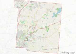
Loveland Road Map
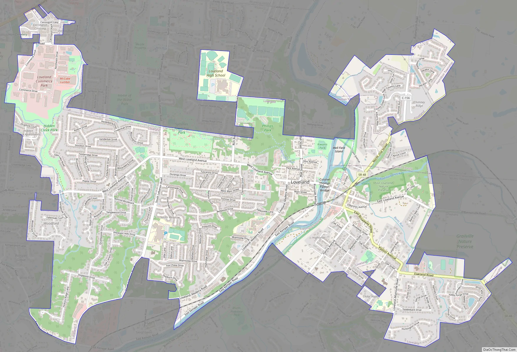
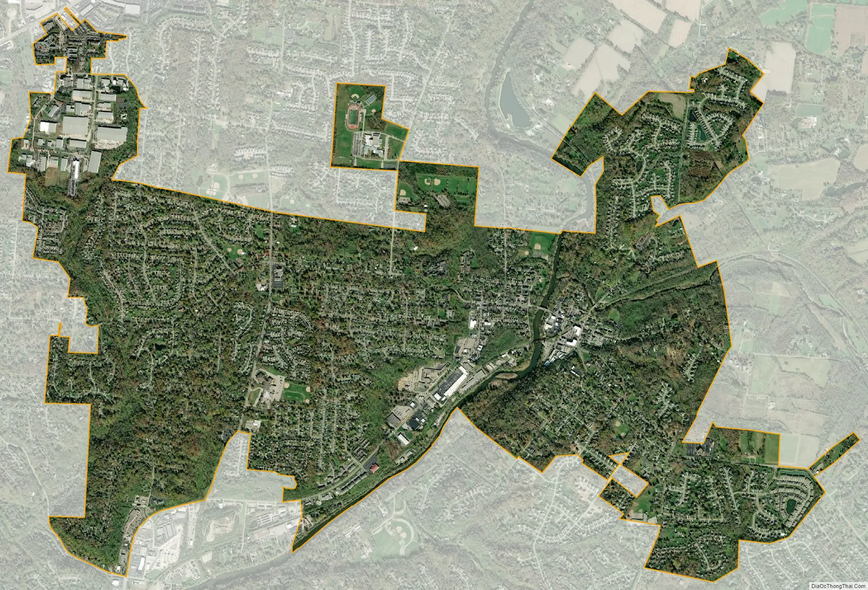
Loveland city Satellite Map
Geography
According to the United States Census Bureau, the city has a total area of 5.00 square miles (12.95 km), of which 4.93 square miles (12.77 km) is land and 0.07 square miles (0.18 km) is water. The city is situated at an elevation of 597 ft (182 m) above sea level.
Loveland can be reached by car most easily via Interstate 275, but State Route 48 also serves the city. State Route 3 / U.S. Route 22 touches the northwestern corner of Loveland, and State Route 126 passes through Remington and Miamiville to the south.
Loveland is located within three counties: Hamilton, Clermont and Warren. At least 61 Ohio cities cross county lines. Loveland has withdrawn from Symmes, Miami, and Hamilton Townships to form a coextensive set of paper townships each named Loveland Township. Historic Downtown Loveland and the central business district lie in a small valley on opposite sides of the Little Miami Scenic River, the boundary between Hamilton and Clermont counties, whereas most of Loveland’s residential areas are located on the hills surrounding the valley on either side. Loveland City Hall is located in Clermont County, whereas most of the population resides in Hamilton County.
These areas include some neighborhoods from the 1950s and earlier, as well as a number of newer subdivisions built as part of the urban sprawl that saw nearby Mason grow tremendously. Unlike Mason and other suburbs closer to Interstate 71 and Interstate 75, Loveland is considered somewhat of a “bedroom community”, where residential neighborhoods (and churches) seemingly outnumber businesses, and many residents make the half-hour commute to Downtown Cincinnati for work each day.
The 513 area code includes the entirety of Loveland. The 45140 ZIP code also includes the entire city, with the exception of a few recently annexed businesses that belong to the 45249 ZIP code (Symmes). The United States Postal Service lists a number of place names as unacceptable for this ZIP code, including “Murdock” and “Twenty Mile Stand”; however, “Loveland, Ohio” is acceptable for Camp Dennison‘s 45111 ZIP code. The 45108 FIPS55 code and US XHT LOCODE both correspond to the city proper.
See also
Map of Ohio State and its subdivision:- Adams
- Allen
- Ashland
- Ashtabula
- Athens
- Auglaize
- Belmont
- Brown
- Butler
- Carroll
- Champaign
- Clark
- Clermont
- Clinton
- Columbiana
- Coshocton
- Crawford
- Cuyahoga
- Darke
- Defiance
- Delaware
- Erie
- Fairfield
- Fayette
- Franklin
- Fulton
- Gallia
- Geauga
- Greene
- Guernsey
- Hamilton
- Hancock
- Hardin
- Harrison
- Henry
- Highland
- Hocking
- Holmes
- Huron
- Jackson
- Jefferson
- Knox
- Lake
- Lake Erie
- Lawrence
- Licking
- Logan
- Lorain
- Lucas
- Madison
- Mahoning
- Marion
- Medina
- Meigs
- Mercer
- Miami
- Monroe
- Montgomery
- Morgan
- Morrow
- Muskingum
- Noble
- Ottawa
- Paulding
- Perry
- Pickaway
- Pike
- Portage
- Preble
- Putnam
- Richland
- Ross
- Sandusky
- Scioto
- Seneca
- Shelby
- Stark
- Summit
- Trumbull
- Tuscarawas
- Union
- Van Wert
- Vinton
- Warren
- Washington
- Wayne
- Williams
- Wood
- Wyandot
- Alabama
- Alaska
- Arizona
- Arkansas
- California
- Colorado
- Connecticut
- Delaware
- District of Columbia
- Florida
- Georgia
- Hawaii
- Idaho
- Illinois
- Indiana
- Iowa
- Kansas
- Kentucky
- Louisiana
- Maine
- Maryland
- Massachusetts
- Michigan
- Minnesota
- Mississippi
- Missouri
- Montana
- Nebraska
- Nevada
- New Hampshire
- New Jersey
- New Mexico
- New York
- North Carolina
- North Dakota
- Ohio
- Oklahoma
- Oregon
- Pennsylvania
- Rhode Island
- South Carolina
- South Dakota
- Tennessee
- Texas
- Utah
- Vermont
- Virginia
- Washington
- West Virginia
- Wisconsin
- Wyoming