Wapakoneta, (/ˌwɔːpəkəˈnɛtə/, local pronunciation: [wɒpəkəˈnɛɾə]) is a city in and the county seat of Auglaize County, Ohio, United States, about 56 miles (90 km) north of Dayton and 83 miles (134 km) south of Toledo. The population was 9,957 at the 2020 census. It is the principal city of and is included in the Wapakoneta, Ohio Micropolitan Area, which is included in the Lima–Van Wert–Wapakoneta, OH, Combined Statistical Area.
| Name: | Wapakoneta city |
|---|---|
| LSAD Code: | 25 |
| LSAD Description: | city (suffix) |
| State: | Ohio |
| County: | Auglaize County |
| Founded: | 1782 |
| Incorporated: | March 2, 1849 |
| Elevation: | 895 ft (272 m) |
| Total Area: | 6.61 sq mi (17.13 km²) |
| Land Area: | 6.56 sq mi (17.00 km²) |
| Water Area: | 0.05 sq mi (0.13 km²) |
| Total Population: | 9,957 |
| Population Density: | 1,517.14/sq mi (585.79/km²) |
| ZIP code: | 45895 |
| Area code: | 419, 567 |
| FIPS code: | 3980766 |
| GNISfeature ID: | 1070980 |
| Website: | http://www.wapakoneta.net |
Online Interactive Map
Click on ![]() to view map in "full screen" mode.
to view map in "full screen" mode.
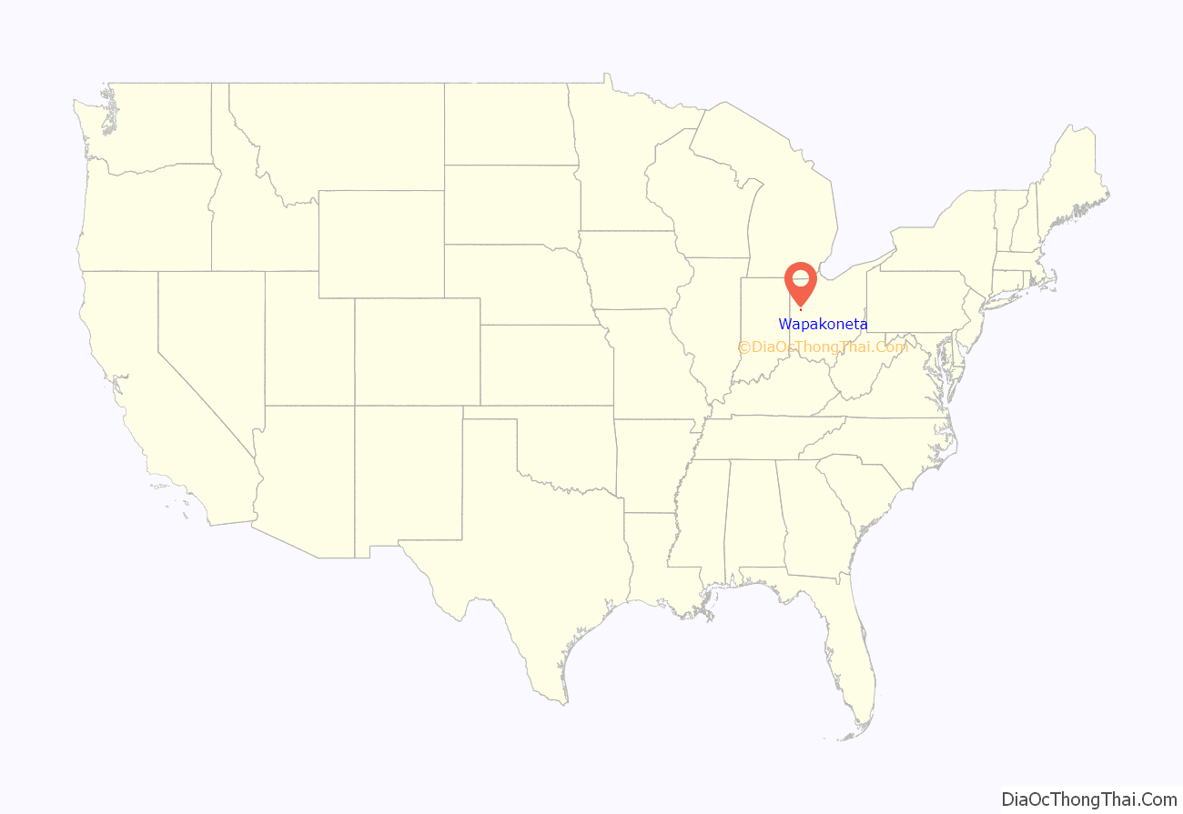
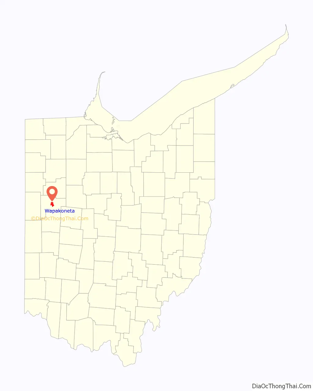
Wapakoneta location map. Where is Wapakoneta city?
History
In 1748, the French built a trading post (Fort au Glaize, also known as “Wapakoneta Trading Post” or “AuGlaize Trading Post”) about a half-mile northeast of the future site of Wapakoneta. After being re-established in 1760 as “Francis Duchouquet’s Trading Post,” the British later took over this territory after the French ceded it following defeat in the Seven Years’ War. Neither they nor the later Americans (after independence) built a succeeding fort here. French-Canadian traders later reestablished a trading post at the site in 1784, which was abandoned after the Battle of Fallen Timbers in 1794.
The city itself was established in the 1780s as a Shawnee settlement called “Waughpaughkonnetta” (possibly derived from the Shawnee word “Wa-po’kanite,” meaning “the place of white bones”). After the Shawnee tribe was removed to Kansas in 1831, Wapakoneta was platted in 1833 and later named as the seat of Auglaize County in 1848.
The Armstrong Air & Space Museum opened in Wapakoneta in 1972.
Wapakoneta Road Map
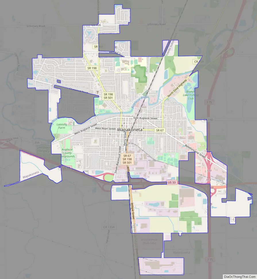
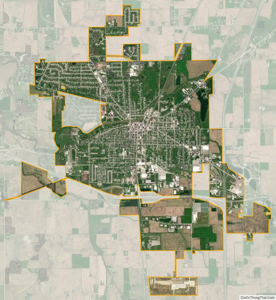
Wapakoneta city Satellite Map
Geography
According to the United States Census Bureau, the city has an area of 6.26 square miles (16.21 km), of which 6.21 square miles (16.08 km) is land and 0.05 square miles (0.13 km) is water.
Wapakoneta is on the Auglaize River and includes parts of Duchouquet, Pusheta, and Moulton Townships.
See also
Map of Ohio State and its subdivision:- Adams
- Allen
- Ashland
- Ashtabula
- Athens
- Auglaize
- Belmont
- Brown
- Butler
- Carroll
- Champaign
- Clark
- Clermont
- Clinton
- Columbiana
- Coshocton
- Crawford
- Cuyahoga
- Darke
- Defiance
- Delaware
- Erie
- Fairfield
- Fayette
- Franklin
- Fulton
- Gallia
- Geauga
- Greene
- Guernsey
- Hamilton
- Hancock
- Hardin
- Harrison
- Henry
- Highland
- Hocking
- Holmes
- Huron
- Jackson
- Jefferson
- Knox
- Lake
- Lake Erie
- Lawrence
- Licking
- Logan
- Lorain
- Lucas
- Madison
- Mahoning
- Marion
- Medina
- Meigs
- Mercer
- Miami
- Monroe
- Montgomery
- Morgan
- Morrow
- Muskingum
- Noble
- Ottawa
- Paulding
- Perry
- Pickaway
- Pike
- Portage
- Preble
- Putnam
- Richland
- Ross
- Sandusky
- Scioto
- Seneca
- Shelby
- Stark
- Summit
- Trumbull
- Tuscarawas
- Union
- Van Wert
- Vinton
- Warren
- Washington
- Wayne
- Williams
- Wood
- Wyandot
- Alabama
- Alaska
- Arizona
- Arkansas
- California
- Colorado
- Connecticut
- Delaware
- District of Columbia
- Florida
- Georgia
- Hawaii
- Idaho
- Illinois
- Indiana
- Iowa
- Kansas
- Kentucky
- Louisiana
- Maine
- Maryland
- Massachusetts
- Michigan
- Minnesota
- Mississippi
- Missouri
- Montana
- Nebraska
- Nevada
- New Hampshire
- New Jersey
- New Mexico
- New York
- North Carolina
- North Dakota
- Ohio
- Oklahoma
- Oregon
- Pennsylvania
- Rhode Island
- South Carolina
- South Dakota
- Tennessee
- Texas
- Utah
- Vermont
- Virginia
- Washington
- West Virginia
- Wisconsin
- Wyoming