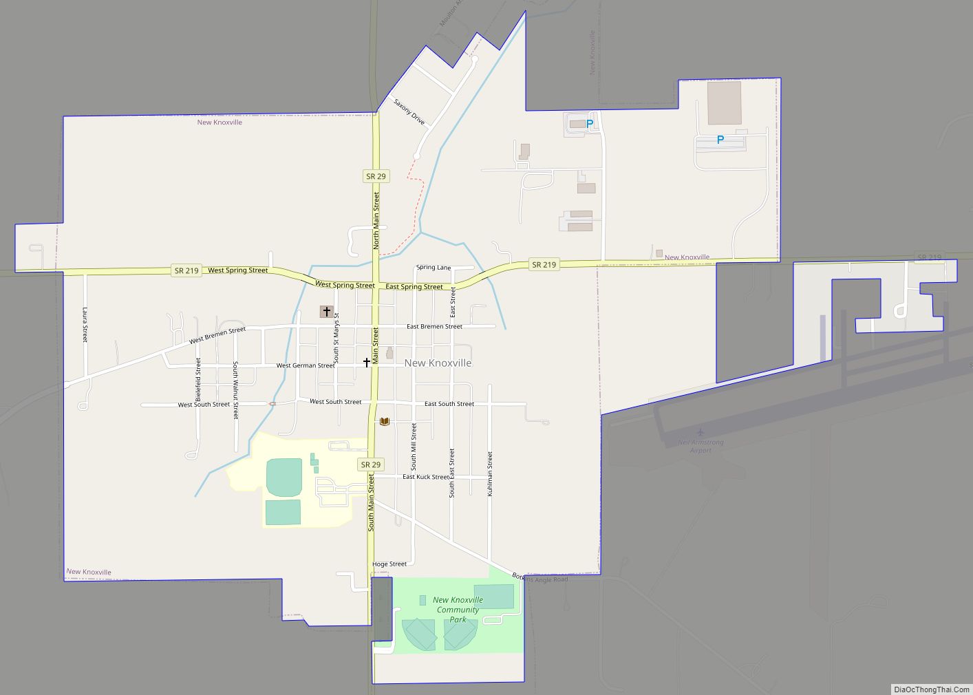
New Knoxville is a village in Auglaize County, Ohio, United States. It was established in 1836. The population was 946 at the 2020 census. It is included in the Wapakoneta, Ohio Micropolitan Statistical Area.
| Name: | New Knoxville village |
|---|---|
| LSAD Code: | 47 |
| LSAD Description: | village (suffix) |
| State: | Ohio |
| County: | Auglaize County |
| Elevation: | 902 ft (275 m) |
| Total Area: | 0.97 sq mi (2.51 km²) |
| Land Area: | 0.97 sq mi (2.51 km²) |
| Water Area: | 0.00 sq mi (0.00 km²) |
| Total Population: | 946 |
| Population Density: | 977.27/sq mi (377.36/km²) |
| ZIP code: | 45871 |
| Area code: | 419 |
| FIPS code: | 3954838 |
| GNISfeature ID: | 1065123 |
| Website: | http://www.newknoxville.com/ |
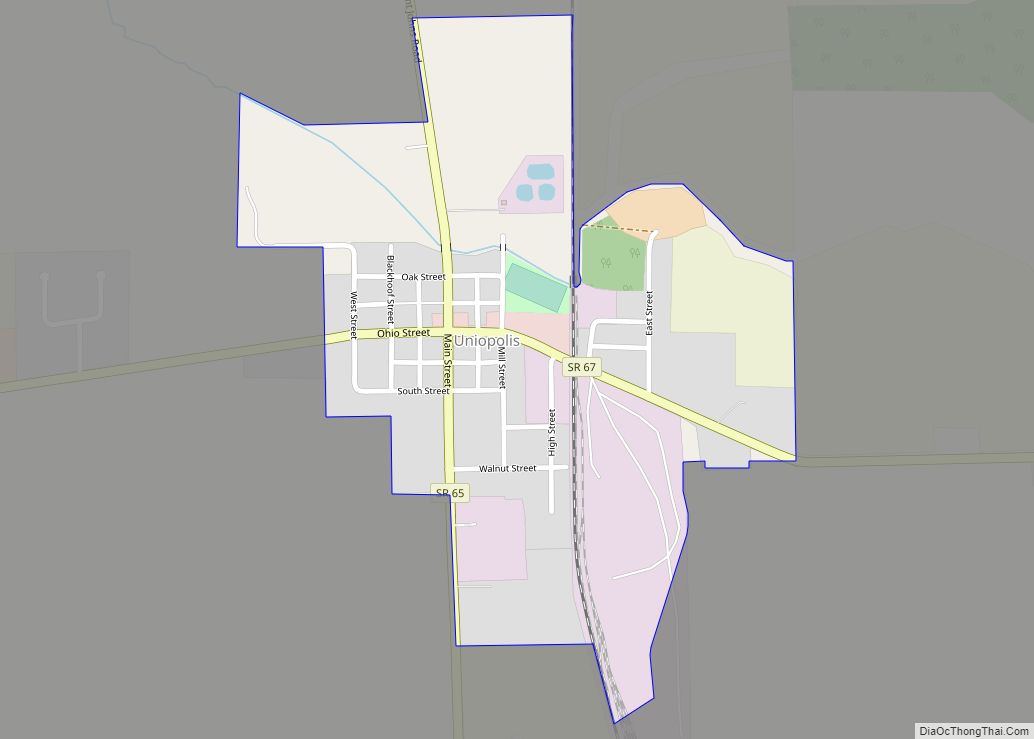
Online Interactive Map
Click on ![]() to view map in "full screen" mode.
to view map in "full screen" mode.
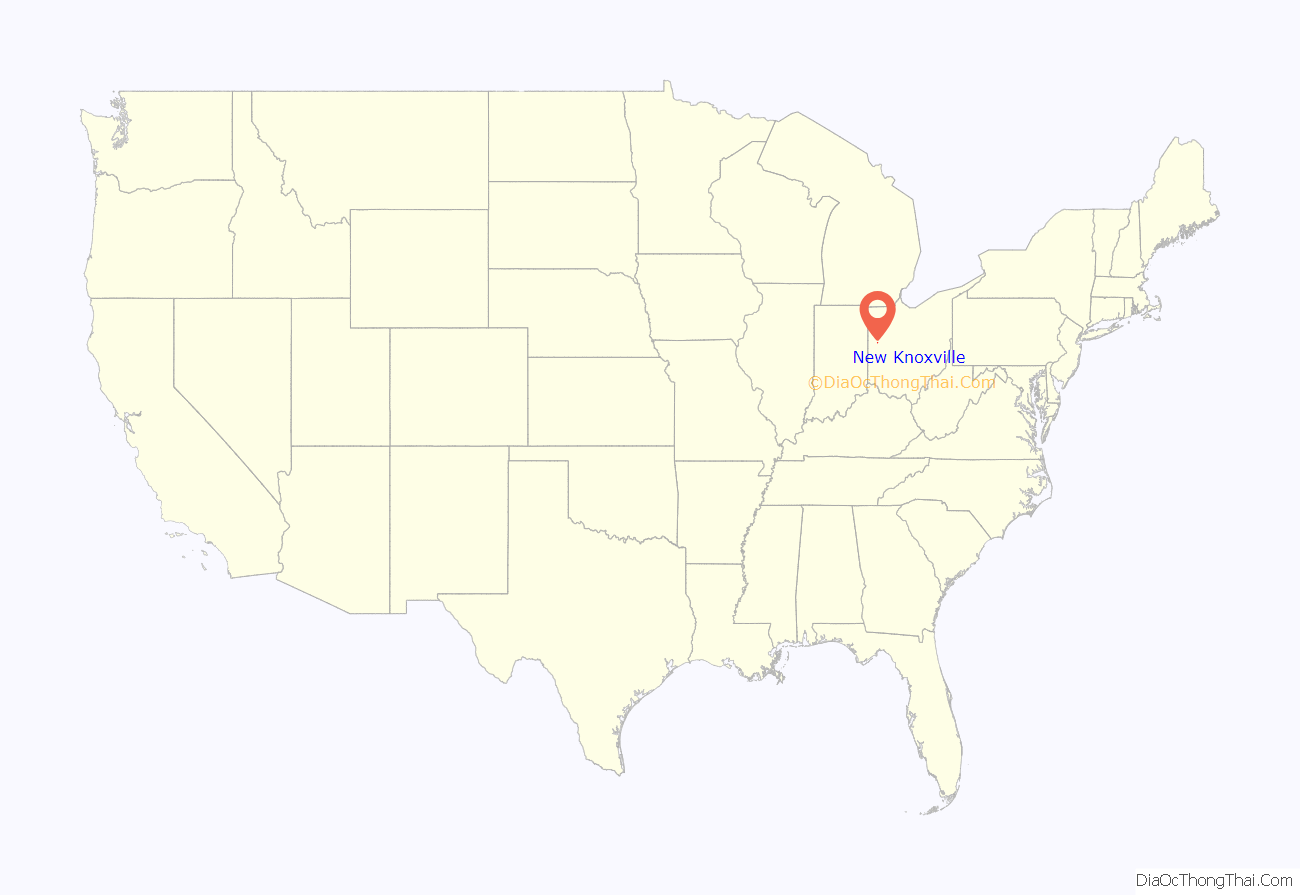
New Knoxville location map. Where is New Knoxville village?
History
New Knoxville was platted in 1836. A post office called New Knoxville has been in operation since 1858.
New Knoxville’s community historical society maintains a historical museum in the village consisting of six buildings. Three of the buildings in the “Heritage Center Complex” are listed on the National Register of Historic Places because of their place as the home and office of Dr. H.E. Fledderjohann, a leading member of the community at the turn of the twentieth century.
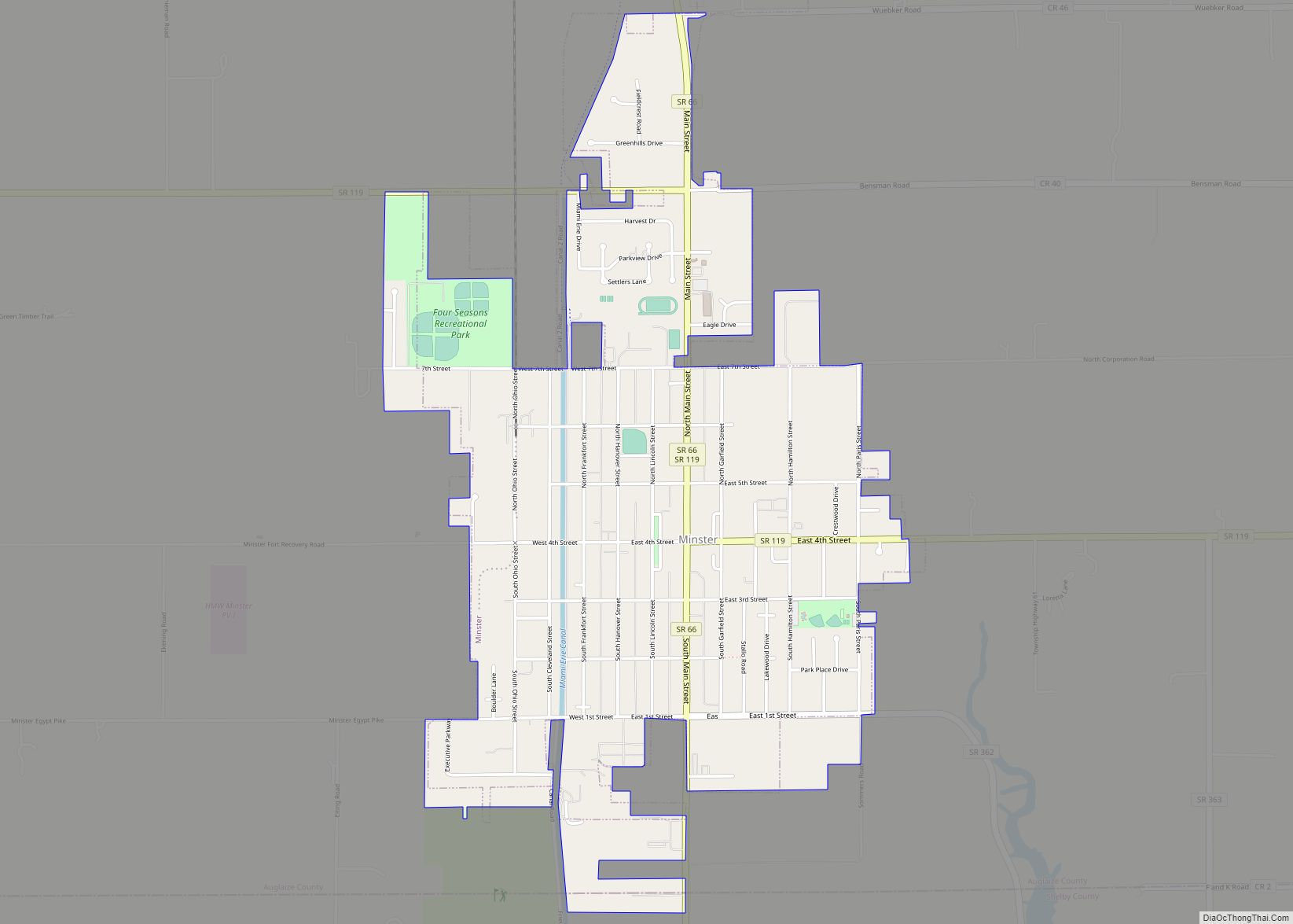
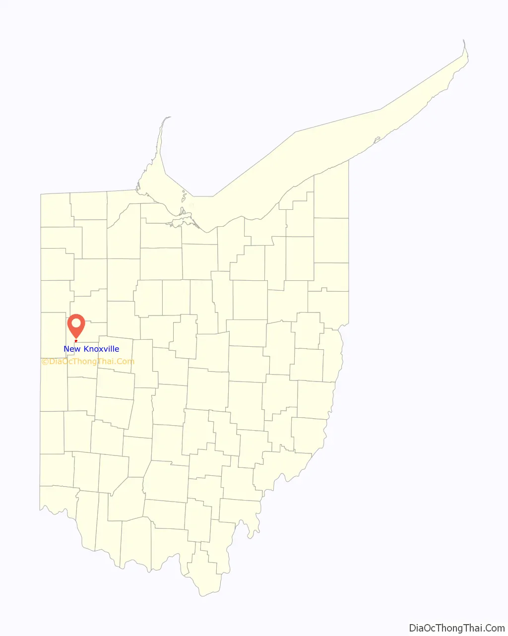
New Knoxville Road Map

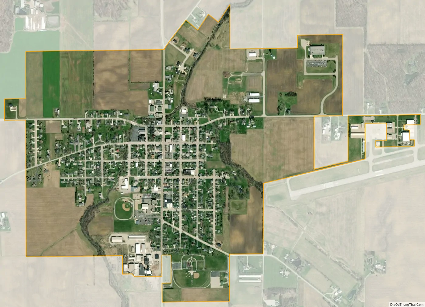
New Knoxville city Satellite Map
Geography
New Knoxville is located at 40°29′39″N 84°19′2″W / 40.49417°N 84.31722°W / 40.49417; -84.31722 (40.494233, -84.317260). According to the United States Census Bureau, the village has a total area of 0.89 square miles (2.31 km), all land.
See also
Map of Ohio State and its subdivision:- Adams
- Allen
- Ashland
- Ashtabula
- Athens
- Auglaize
- Belmont
- Brown
- Butler
- Carroll
- Champaign
- Clark
- Clermont
- Clinton
- Columbiana
- Coshocton
- Crawford
- Cuyahoga
- Darke
- Defiance
- Delaware
- Erie
- Fairfield
- Fayette
- Franklin
- Fulton
- Gallia
- Geauga
- Greene
- Guernsey
- Hamilton
- Hancock
- Hardin
- Harrison
- Henry
- Highland
- Hocking
- Holmes
- Huron
- Jackson
- Jefferson
- Knox
- Lake
- Lake Erie
- Lawrence
- Licking
- Logan
- Lorain
- Lucas
- Madison
- Mahoning
- Marion
- Medina
- Meigs
- Mercer
- Miami
- Monroe
- Montgomery
- Morgan
- Morrow
- Muskingum
- Noble
- Ottawa
- Paulding
- Perry
- Pickaway
- Pike
- Portage
- Preble
- Putnam
- Richland
- Ross
- Sandusky
- Scioto
- Seneca
- Shelby
- Stark
- Summit
- Trumbull
- Tuscarawas
- Union
- Van Wert
- Vinton
- Warren
- Washington
- Wayne
- Williams
- Wood
- Wyandot
- Alabama
- Alaska
- Arizona
- Arkansas
- California
- Colorado
- Connecticut
- Delaware
- District of Columbia
- Florida
- Georgia
- Hawaii
- Idaho
- Illinois
- Indiana
- Iowa
- Kansas
- Kentucky
- Louisiana
- Maine
- Maryland
- Massachusetts
- Michigan
- Minnesota
- Mississippi
- Missouri
- Montana
- Nebraska
- Nevada
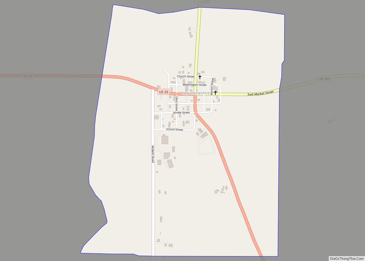
- New Hampshire
- New Jersey
- New Mexico
- New York
- North Carolina
- North Dakota
- Ohio
- Oklahoma
- Oregon
- Pennsylvania
- Rhode Island
- South Carolina
- South Dakota
- Tennessee
- Texas
- Utah
- Vermont
- Virginia
- Washington
- West Virginia
- Wisconsin
- Wyoming