New Paris is a village in Preble County, Ohio, United States. The population was 1,629 at the 2010 census. It is part of the Dayton Metropolitan Statistical Area.
| Name: | New Paris village |
|---|---|
| LSAD Code: | 47 |
| LSAD Description: | village (suffix) |
| State: | Ohio |
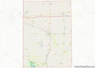
| County: | Preble County |
| Elevation: | 1,037 ft (316 m) |
| Total Area: | 0.76 sq mi (1.96 km²) |
| Land Area: | 0.73 sq mi (1.90 km²) |
| Water Area: | 0.02 sq mi (0.06 km²) |
| Total Population: | 1,494 |
| Population Density: | 2,032.65/sq mi (784.48/km²) |
| ZIP code: | 45347 |
| Area code: | 937, 326 |
| FIPS code: | 3955188 |
| GNISfeature ID: | 1065129 |
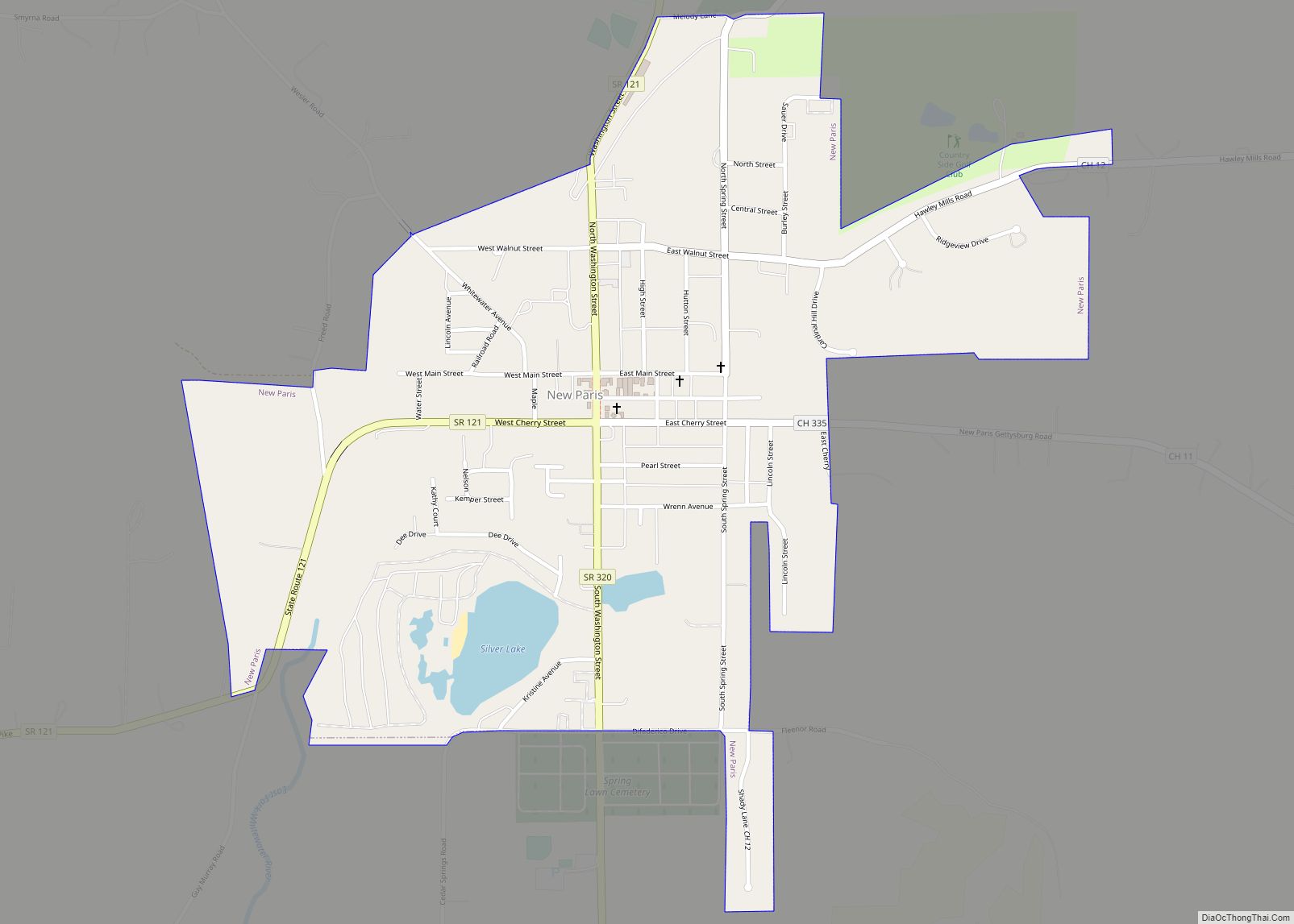
Online Interactive Map
Click on ![]() to view map in "full screen" mode.
to view map in "full screen" mode.
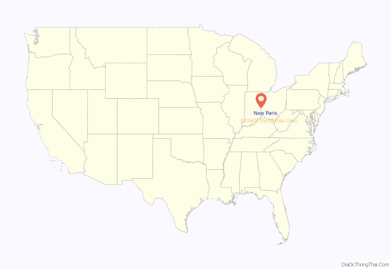
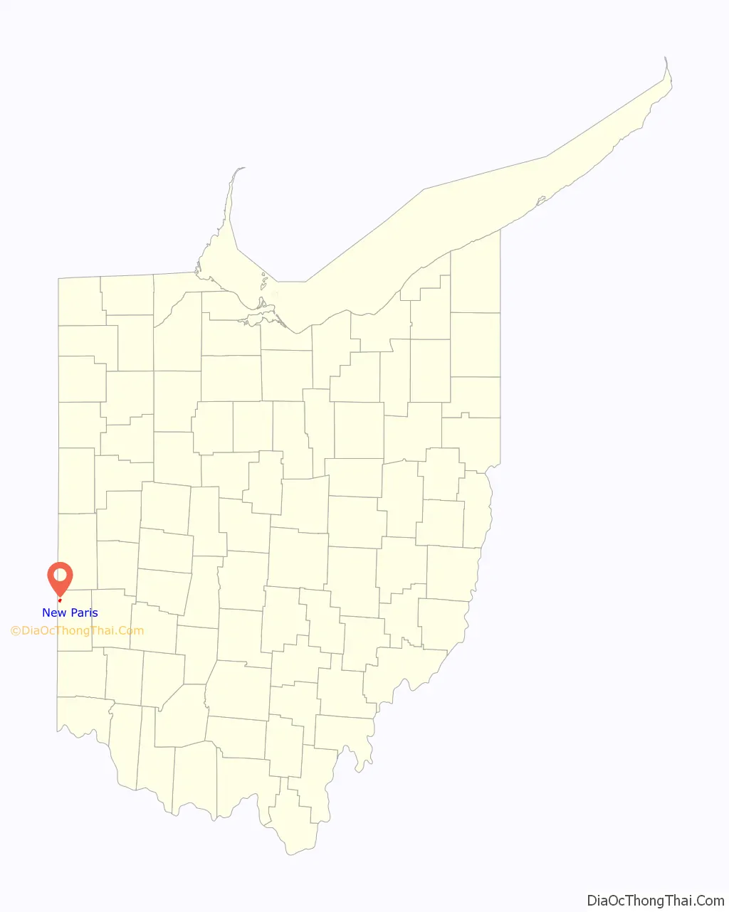
New Paris location map. Where is New Paris village?
History
New Paris was platted in 1817, and named after Paris, Kentucky, the former home of a share of the first settlers. A post office called New Paris has been in operation since 1820.
New Paris Road Map
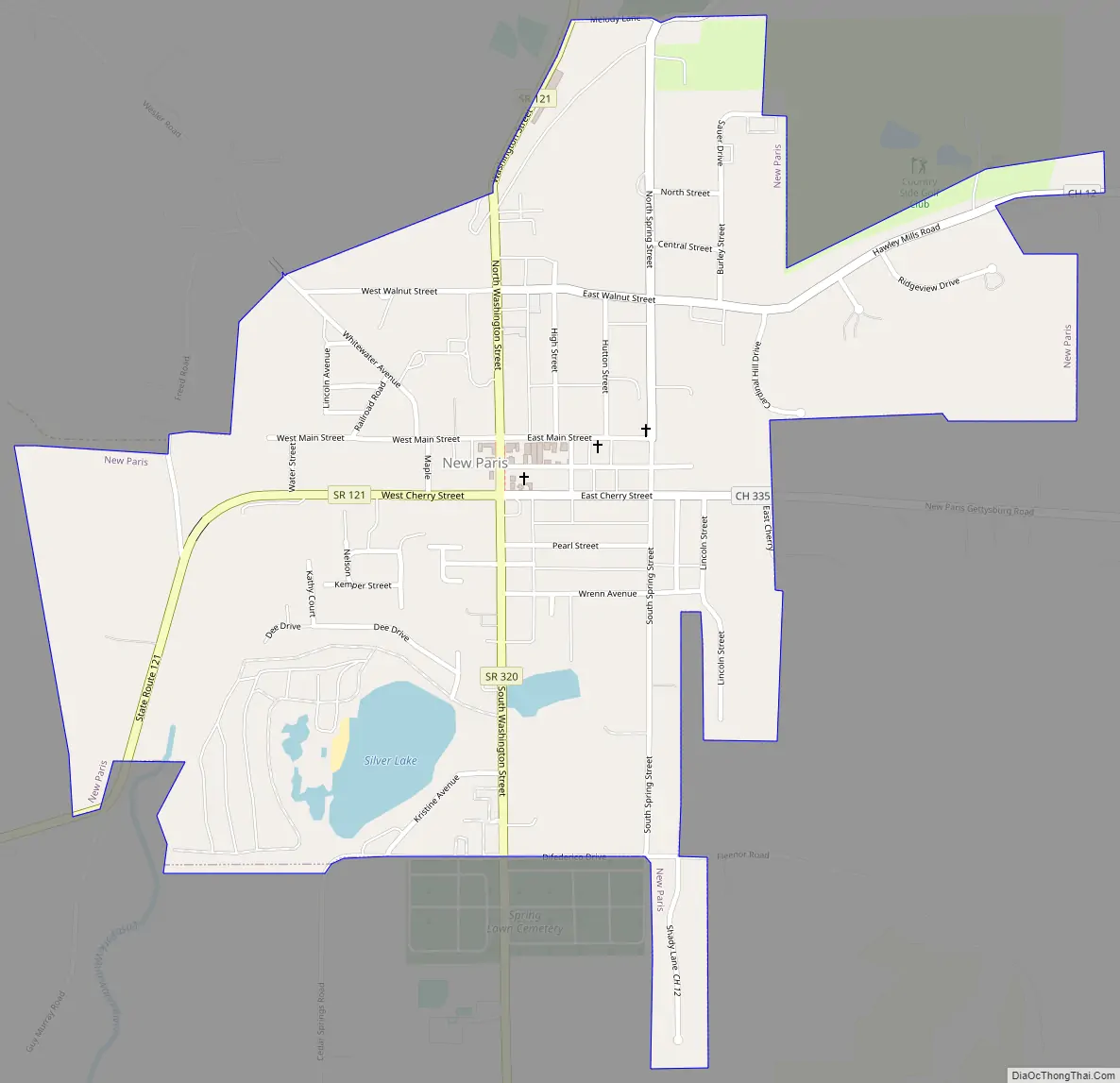
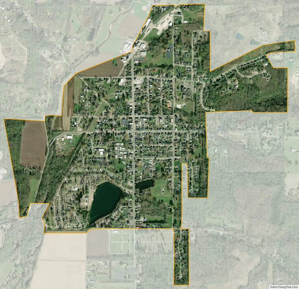
New Paris city Satellite Map
Geography
New Paris is located at 39°51′21″N 84°47′39″W / 39.85583°N 84.79417°W / 39.85583; -84.79417 (39.855952, -84.794170).
According to the United States Census Bureau, the village has a total area of 0.76 square miles (1.97 km), of which, 0.74 square miles (1.92 km) is land and 0.02 square miles (0.05 km) is water.
The village is at the intersection of State Routes 121 and 320, north of Interstate 70.
New Paris is just east of the Indiana state line.
The village is heavily dominated by cornfields, a staple of this area of Ohio.
See also
Map of Ohio State and its subdivision:- Adams
- Allen
- Ashland
- Ashtabula
- Athens
- Auglaize
- Belmont
- Brown
- Butler
- Carroll
- Champaign
- Clark
- Clermont
- Clinton
- Columbiana
- Coshocton
- Crawford
- Cuyahoga
- Darke
- Defiance
- Delaware
- Erie
- Fairfield
- Fayette
- Franklin
- Fulton
- Gallia
- Geauga
- Greene
- Guernsey
- Hamilton
- Hancock
- Hardin
- Harrison
- Henry
- Highland
- Hocking
- Holmes
- Huron
- Jackson
- Jefferson
- Knox
- Lake
- Lake Erie
- Lawrence
- Licking
- Logan
- Lorain
- Lucas
- Madison
- Mahoning
- Marion
- Medina
- Meigs
- Mercer
- Miami
- Monroe
- Montgomery
- Morgan
- Morrow
- Muskingum
- Noble
- Ottawa
- Paulding
- Perry
- Pickaway
- Pike
- Portage
- Preble
- Putnam
- Richland
- Ross
- Sandusky
- Scioto
- Seneca
- Shelby
- Stark
- Summit
- Trumbull
- Tuscarawas
- Union
- Van Wert
- Vinton
- Warren
- Washington
- Wayne
- Williams
- Wood
- Wyandot
- Alabama
- Alaska
- Arizona
- Arkansas
- California
- Colorado
- Connecticut
- Delaware
- District of Columbia
- Florida
- Georgia
- Hawaii
- Idaho
- Illinois
- Indiana
- Iowa
- Kansas
- Kentucky
- Louisiana
- Maine
- Maryland
- Massachusetts
- Michigan
- Minnesota
- Mississippi
- Missouri
- Montana
- Nebraska
- Nevada
- New Hampshire
- New Jersey
- New Mexico
- New York
- North Carolina
- North Dakota
- Ohio
- Oklahoma
- Oregon
- Pennsylvania
- Rhode Island
- South Carolina
- South Dakota
- Tennessee
- Texas
- Utah
- Vermont
- Virginia
- Washington
- West Virginia
- Wisconsin
- Wyoming