Peninsula is a village in Summit County, Ohio, United States. The population was 565 at the 2010 census. It is part of the Akron Metropolitan Statistical Area.
Peninsula is in the middle of the Cuyahoga Valley National Park, which provides a source of tourism to the village. Blossom Music Center is located on its outskirts. The Ohio and Erie Canal Towpath Trail runs through just west of downtown, and many bikers and hikers stop for refreshments because it is one of the few towns between Akron and Cleveland.
Peninsula is bordered on the east by Boston Heights. It is a part of Boston Township.
More than 20 places in Peninsula are listed on the National Register of Historic Places.
| Name: | Peninsula village |
|---|---|
| LSAD Code: | 47 |
| LSAD Description: | village (suffix) |
| State: | Ohio |
| County: | Summit County |
| Elevation: | 755 ft (230 m) |
| Total Area: | 4.42 sq mi (11.44 km²) |
| Land Area: | 4.41 sq mi (11.41 km²) |
| Water Area: | 0.01 sq mi (0.02 km²) |
| Total Population: | 536 |
| Population Density: | 121.62/sq mi (46.96/km²) |
| ZIP code: | 44264 |
| Area code: | 330 |
| FIPS code: | 3961574 |
| GNISfeature ID: | 1049072 |
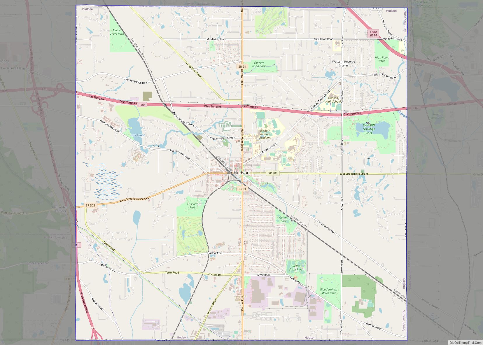
Online Interactive Map
Click on ![]() to view map in "full screen" mode.
to view map in "full screen" mode.
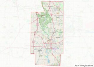
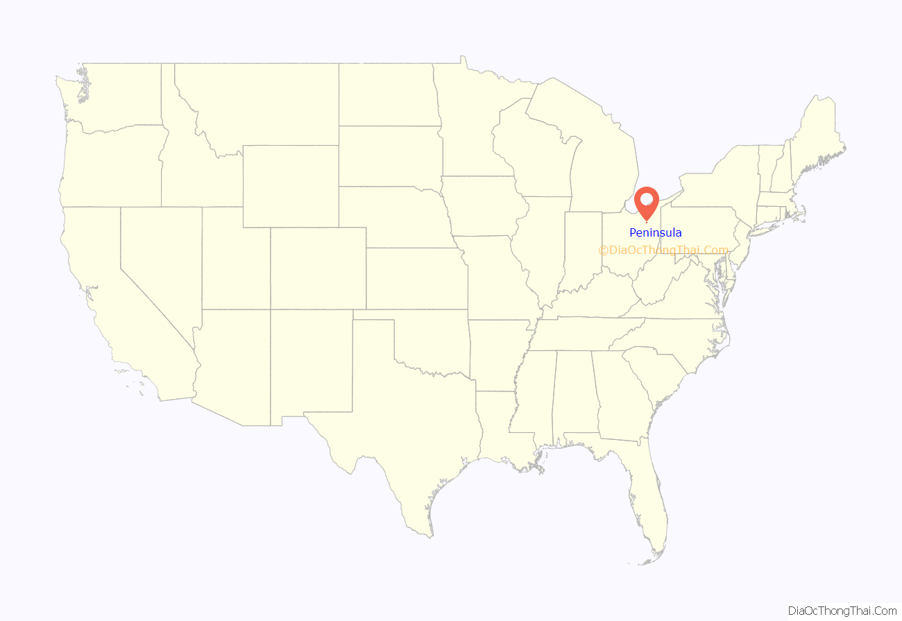
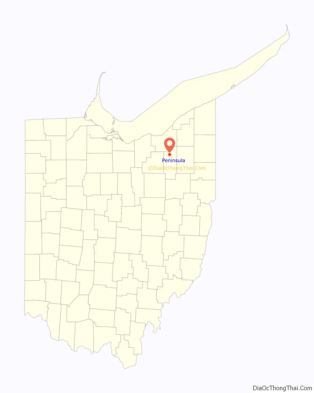
Peninsula location map. Where is Peninsula village?
History
Settled in 1818, Peninsula, on the Cuyahoga River halfway between Cleveland and Akron, is a well-preserved mid-19th-century town that grew and prospered with the establishment of the Ohio and Erie Canal and the Valley Railroad. The village was plotted in 1837 by Herman Bronson. Peninsula was a bustling canal boat stop and home to several mills, stone quarries and boat yards, five hotels and 14 bars until 1887. The Gothic Revival Bronson Memorial Church, originally constructed in 1835 as the Bethel Church, according to William Perrin’s History of Summit County (1881) was an attempt to “introduce moral and religious tactics among the vicious and unlawful practices of the canal boatmen.” In 1889 the church was remodeled in the Gothic Revival style. The historic district extends along Main Street and contains many fine examples of early 19th-century architecture. The dominant Greek Revival style reflects popular architectural tastes at the time the area was settled by New Englanders. A notable high style example of the village’s Greek Revival architecture is the 1824 Bronson House, built of locally quarried sandstone blocks. Several canal-era houses are typical of the popular Western Reserve New England building type called the Upright-and-Wing, particularly suitable for the early 19th-century Ohio frontier. The main gable-front two-story section contained a parlor and bedchambers, while the kitchen was located in a perpendicular one-story eave oriented section. Other architectural styles include Gothic Revival, Italianate, Queen Anne, Stick and Colonial Revival. The 1886 Stick-style Boston Township Hall originally functioned as the village high school. The three-story hip-roofed building contains a pyramidal roof tower with an open belfry. The Township Hall is now the Cuyahoga Valley Historical Museum.
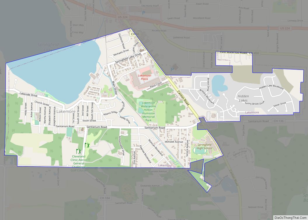
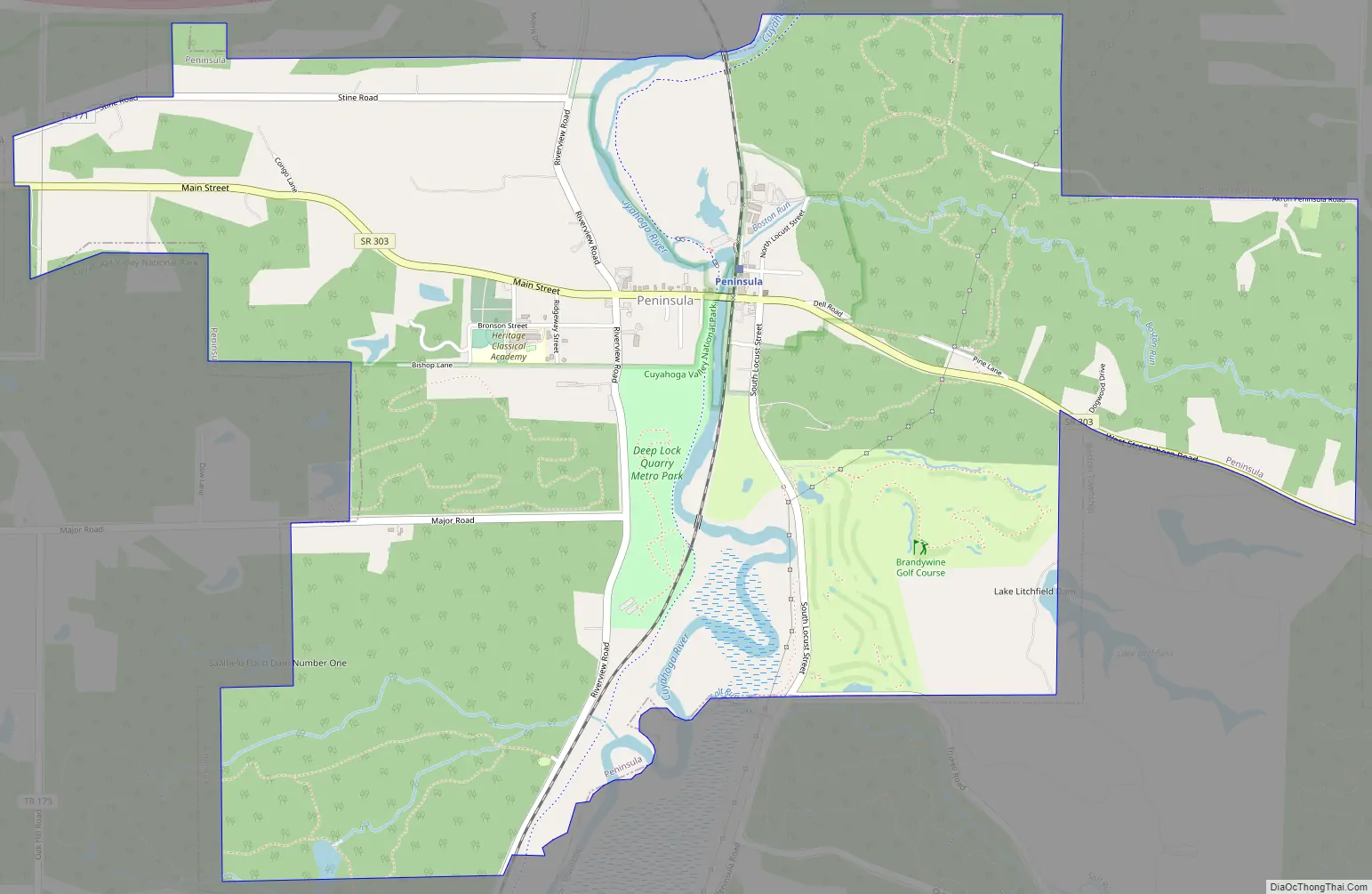
Peninsula Road Map
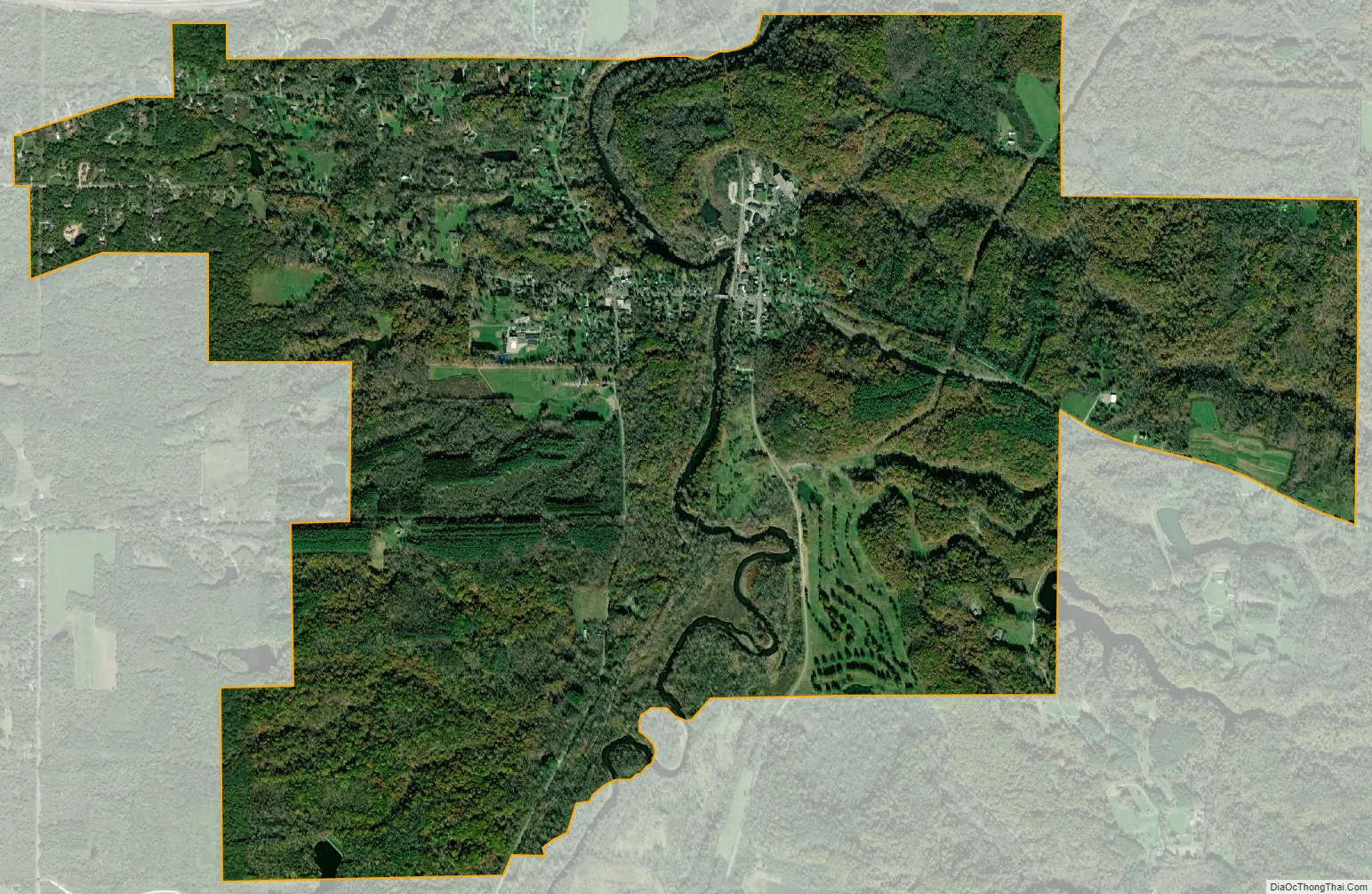
Peninsula city Satellite Map
Geography
Peninsula is located at 41°14′27″N 81°33′23″W / 41.24083°N 81.55639°W / 41.24083; -81.55639 (41.240755, -81.556363).
According to the United States Census Bureau, the village has a total area of 4.68 square miles (12.12 km), of which 4.67 square miles (12.10 km) is land and 0.01 square miles (0.03 km) is water.
Boston Mills/Brandywine Ski Resort just north of Peninsula is one of the few skiing locations in Ohio.
See also
Map of Ohio State and its subdivision:- Adams
- Allen
- Ashland
- Ashtabula
- Athens
- Auglaize
- Belmont
- Brown
- Butler
- Carroll
- Champaign
- Clark
- Clermont
- Clinton
- Columbiana
- Coshocton
- Crawford
- Cuyahoga
- Darke
- Defiance
- Delaware
- Erie
- Fairfield
- Fayette
- Franklin
- Fulton
- Gallia
- Geauga
- Greene
- Guernsey
- Hamilton
- Hancock
- Hardin
- Harrison
- Henry
- Highland
- Hocking
- Holmes
- Huron
- Jackson
- Jefferson
- Knox
- Lake
- Lake Erie
- Lawrence
- Licking
- Logan
- Lorain
- Lucas
- Madison
- Mahoning
- Marion
- Medina
- Meigs
- Mercer
- Miami
- Monroe
- Montgomery
- Morgan
- Morrow
- Muskingum
- Noble
- Ottawa
- Paulding
- Perry
- Pickaway
- Pike
- Portage
- Preble
- Putnam
- Richland
- Ross
- Sandusky
- Scioto
- Seneca
- Shelby
- Stark
- Summit
- Trumbull
- Tuscarawas
- Union
- Van Wert
- Vinton
- Warren
- Washington
- Wayne
- Williams
- Wood
- Wyandot
- Alabama
- Alaska
- Arizona
- Arkansas
- California
- Colorado
- Connecticut
- Delaware
- District of Columbia
- Florida
- Georgia
- Hawaii
- Idaho
- Illinois
- Indiana
- Iowa
- Kansas
- Kentucky
- Louisiana
- Maine
- Maryland
- Massachusetts
- Michigan
- Minnesota
- Mississippi
- Missouri
- Montana
- Nebraska
- Nevada
- New Hampshire
- New Jersey
- New Mexico
- New York
- North Carolina
- North Dakota
- Ohio
- Oklahoma
- Oregon
- Pennsylvania
- Rhode Island
- South Carolina
- South Dakota
- Tennessee
- Texas
- Utah
- Vermont
- Virginia
- Washington
- West Virginia
- Wisconsin
- Wyoming