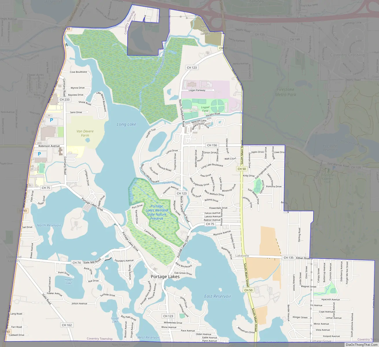
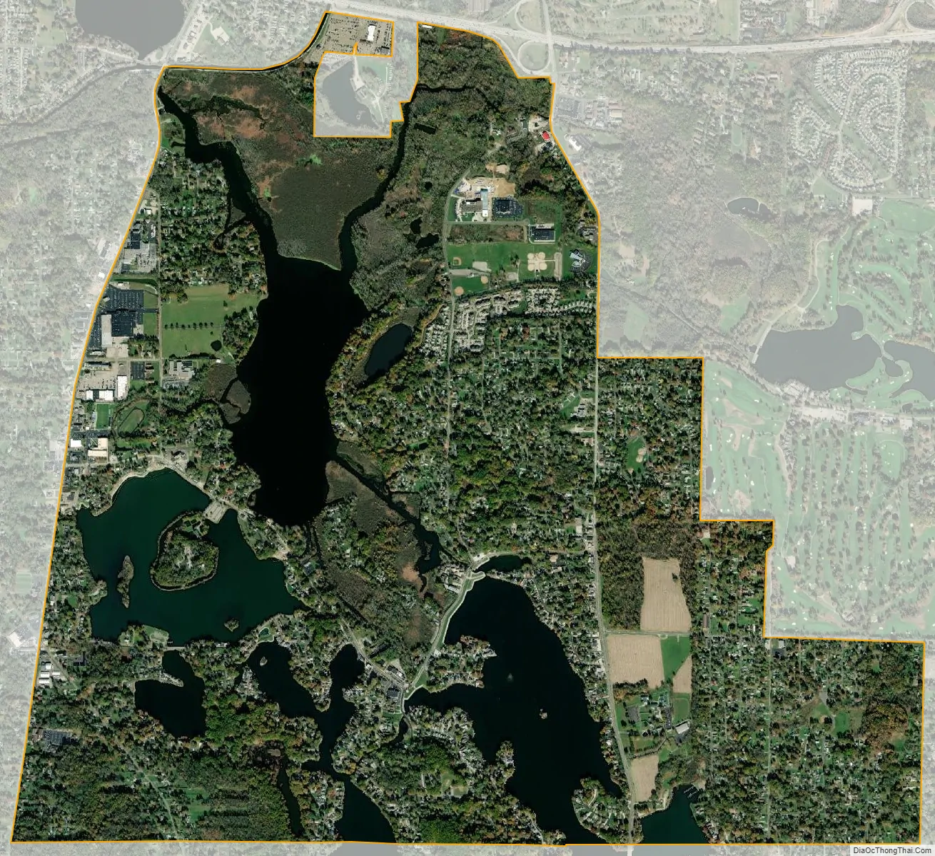
Portage Lakes is a census-designated place (CDP) in Summit County, Ohio, United States. The population was 9,870 at the 2000 census. The city of Green is adjacent to the southeast and Akron on the north. The nearby Portage Lakes of the area include but are not limited to Turkeyfoot Lake, Nimisila Reservoir, Mud Lake, and Long Lake. The lakes are connected by a series of “channels”. There is a Portage Lakes State Park with boat launching ramps and seasonal beach swimming.
Portage Lakes is part of the Akron Metropolitan Statistical Area.
| Name: | Portage Lakes CDP |
|---|---|
| LSAD Code: | 57 |
| LSAD Description: | CDP (suffix) |
| State: | Ohio |
| County: | Summit County |
| Elevation: | 965 ft (294 m) |
| Total Area: | 4.94 sq mi (12.80 km²) |
| Land Area: | 3.96 sq mi (10.25 km²) |
| Water Area: | 0.98 sq mi (2.54 km²) |
| Total Population: | 6,407 |
| Population Density: | 1,618.34/sq mi (624.86/km²) |
| FIPS code: | 3964136 |
| GNISfeature ID: | 2393195 |
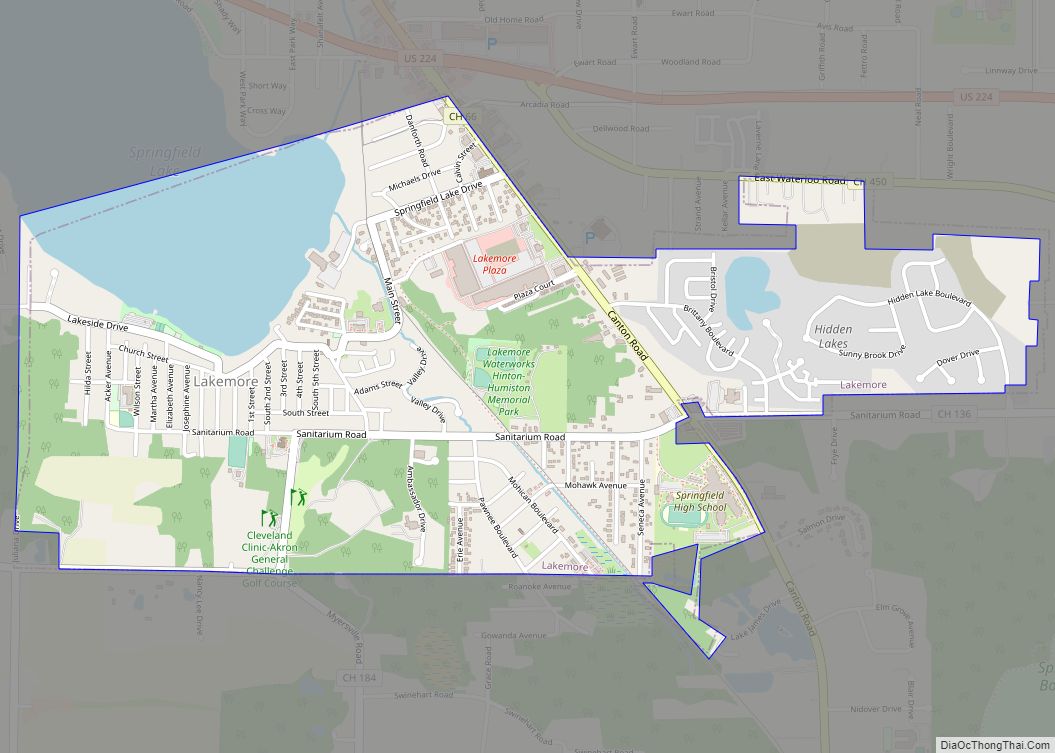
Online Interactive Map
Click on ![]() to view map in "full screen" mode.
to view map in "full screen" mode.
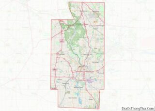
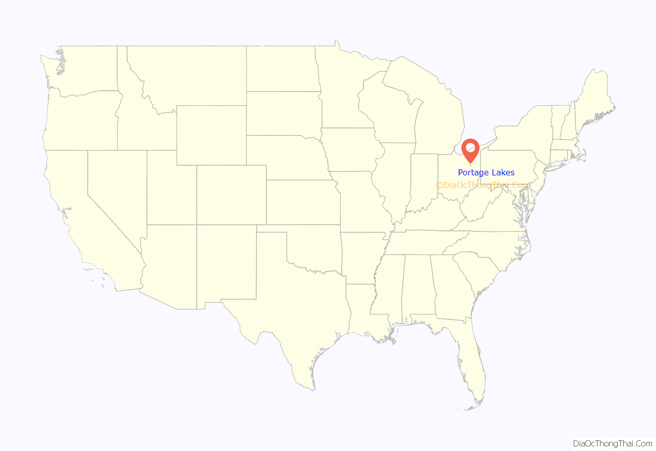
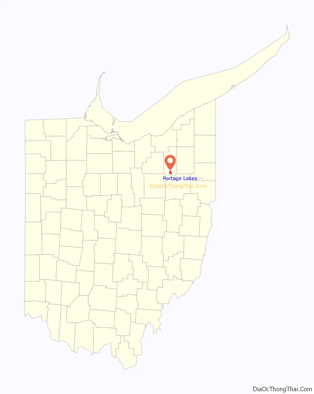
Portage Lakes location map. Where is Portage Lakes CDP?
Portage Lakes Road Map
Portage Lakes city Satellite Map
Geography
Portage Lakes is located at 41°0′13″N 81°32′6″W / 41.00361°N 81.53500°W / 41.00361; -81.53500 (41.0034979, -81.5348850).
According to the United States Census Bureau, the CDP has a total area of 8.2 square miles (21 km), of which 6.6 square miles (17 km) is land and 1.6 square miles (4.1 km) (19.49%) is water.
At the 2000 census, Portage Lakes included portions of Coventry and Franklin townships. On 1 January 2005, all of Franklin Township was merged into the village of New Franklin; as a result, the CDP’s Franklin Township portion is now entirely within New Franklin. Therefore, the CDP today consists of territory only in Coventry Township, as CDPs are located only in unincorporated areas.
See also
Map of Ohio State and its subdivision:- Adams
- Allen
- Ashland
- Ashtabula
- Athens
- Auglaize
- Belmont
- Brown
- Butler
- Carroll
- Champaign
- Clark
- Clermont
- Clinton
- Columbiana
- Coshocton
- Crawford
- Cuyahoga
- Darke
- Defiance
- Delaware
- Erie
- Fairfield
- Fayette
- Franklin
- Fulton
- Gallia
- Geauga
- Greene
- Guernsey
- Hamilton
- Hancock
- Hardin
- Harrison
- Henry
- Highland
- Hocking
- Holmes
- Huron
- Jackson
- Jefferson
- Knox
- Lake
- Lake Erie
- Lawrence
- Licking
- Logan
- Lorain
- Lucas
- Madison
- Mahoning
- Marion
- Medina
- Meigs
- Mercer
- Miami
- Monroe
- Montgomery
- Morgan
- Morrow
- Muskingum
- Noble
- Ottawa
- Paulding
- Perry
- Pickaway
- Pike
- Portage
- Preble
- Putnam
- Richland
- Ross
- Sandusky
- Scioto
- Seneca
- Shelby
- Stark
- Summit
- Trumbull
- Tuscarawas
- Union
- Van Wert
- Vinton
- Warren
- Washington
- Wayne
- Williams
- Wood
- Wyandot
- Alabama
- Alaska
- Arizona
- Arkansas
- California
- Colorado
- Connecticut
- Delaware
- District of Columbia
- Florida
- Georgia
- Hawaii
- Idaho
- Illinois
- Indiana
- Iowa
- Kansas
- Kentucky
- Louisiana
- Maine
- Maryland
- Massachusetts
- Michigan
- Minnesota
- Mississippi
- Missouri
- Montana
- Nebraska
- Nevada
- New Hampshire
- New Jersey
- New Mexico
- New York
- North Carolina
- North Dakota
- Ohio
- Oklahoma
- Oregon
- Pennsylvania
- Rhode Island
- South Carolina
- South Dakota
- Tennessee
- Texas
- Utah
- Vermont
- Virginia
- Washington
- West Virginia
- Wisconsin
- Wyoming