Solon (/ˈsoʊlən/ SOH-lun) is a city in southeastern Cuyahoga County, Ohio, United States. A suburb of Cleveland, it is part of the Cleveland metropolitan area. According to the 2020 census, the population of Solon was 24,262.
The city has been recognized by Money in its list of “Best Places to Live”, placing 23rd in 2009, 3rd in 2011, and 10th in 2015. The city has been rated as one of the safest in Ohio, has a highly rated public school system, and was ranked as one of the “best places to raise kids” by Bloomberg Businessweek. Solon has a strong economy, and in 2013 and 2014, was granted a Google eCity award recognizing it as the city with the strongest online business community in Ohio.
| Name: | Solon city |
|---|---|
| LSAD Code: | 25 |
| LSAD Description: | city (suffix) |
| State: | Ohio |
| County: | Cuyahoga County |
| Elevation: | 1,040 ft (320 m) |
| Total Area: | 20.43 sq mi (52.91 km²) |
| Land Area: | 20.31 sq mi (52.61 km²) |
| Water Area: | 0.11 sq mi (0.30 km²) |
| Total Population: | 24,262 |
| Population Density: | 1,194.35/sq mi (461.15/km²) |
| ZIP code: | 44139 |
| Area code: | 440 |
| FIPS code: | 3972928 |
| GNISfeature ID: | 1046426 |
| Website: | https://www.solonohio.org/ |
Online Interactive Map
Click on ![]() to view map in "full screen" mode.
to view map in "full screen" mode.
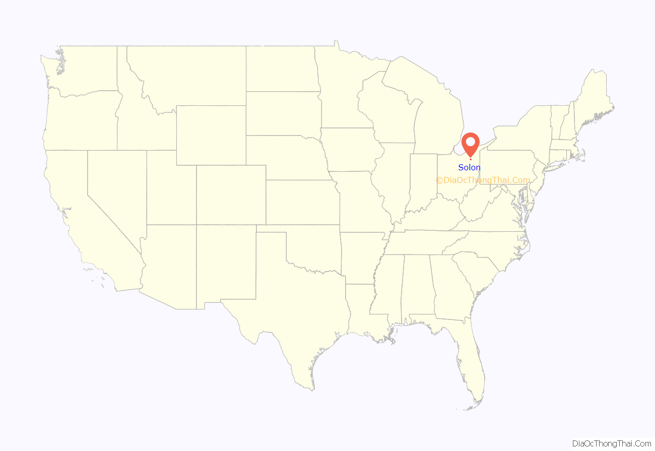
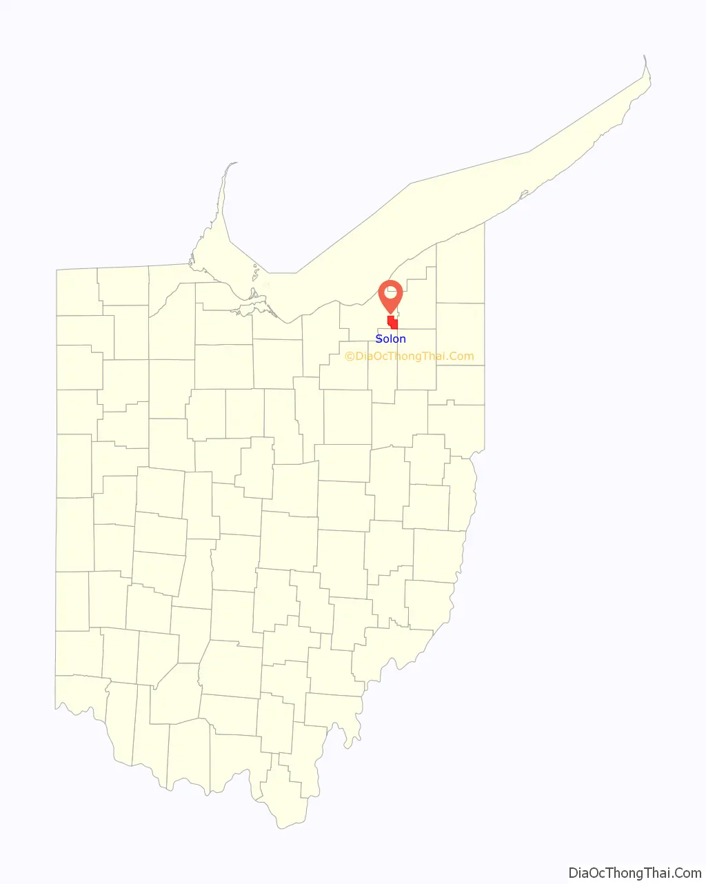
Solon location map. Where is Solon city?
History
In 1820, the first settlers arrived from Connecticut to live in part of the Connecticut Western Reserve. The township was named after Lorenzo Solon Bull, who was the son of Isaac Bull, one of the first settlers. Purportedly, the selection of young Lorenzo’s middle name was due to its derivation from the “father of democracy”, Solon, the famous Athenian lawmaker of Ancient Greece. The early settlers faced challenges common to pioneers, but in Solon, drainage and wetlands issues complicated settlement and agriculture. Overcoming these obstacles, Solon Township became an arable farming area, producing corn and wheat crops and supporting dairy farms (including five cheese factories). By 1850, the population of Solon Township reached 1,034.
Because of nearby Cleveland’s position as a national hub of the railroad industry, rail also contributed greatly to Solon’s growth. In 1857, the Cleveland-Youngstown section of the Cleveland and Mahoning Railroad established a line running through Solon.
Laid out in a traditional New England plan, Solon, like many of the neighboring townships, established a public square in its town center. In conjunction with townships to the north, a north–south corridor was established through the town centers of Solon, Orange, and Mayfield townships (from south to north, respectively) and, accordingly, was named SOM Center Road (now Ohio 91). Solon Township included the current municipalities of the City of Solon and the villages of Bentleyville and Glenwillow. In 1927, Solon was incorporated as a village and later became a city in 1961, operated under the mayor-council form of government.
Solon was one of the first cities to use a comprehensive zoning plan and has been able to achieve a strong industrial base, while insulating its bedroom communities from industrial activities. Further, the city has primarily concentrated its commercial and retail districts in the town center, making them convenient to all residents. In addition to its planned use for corporate and residential areas, Solon has 687 acres (2.78 km) of city parks and recreational area, 360 acres (1.5 km) of Cleveland Metroparks (the South Chagrin Reservation) and three golf courses within its borders.
In 1991, the extension of a divided highway, US 422, was completed as an east–west corridor just north of its town center. US 422 enables easy access to many points throughout Northeast Ohio, providing a corridor extending from Cleveland through Solon and beyond Warren into Pennsylvania.
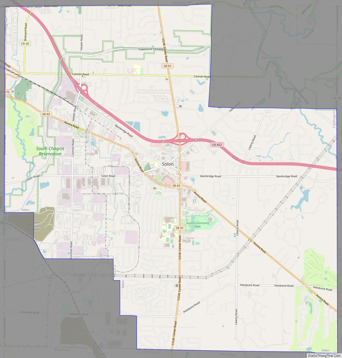
Solon Road Map
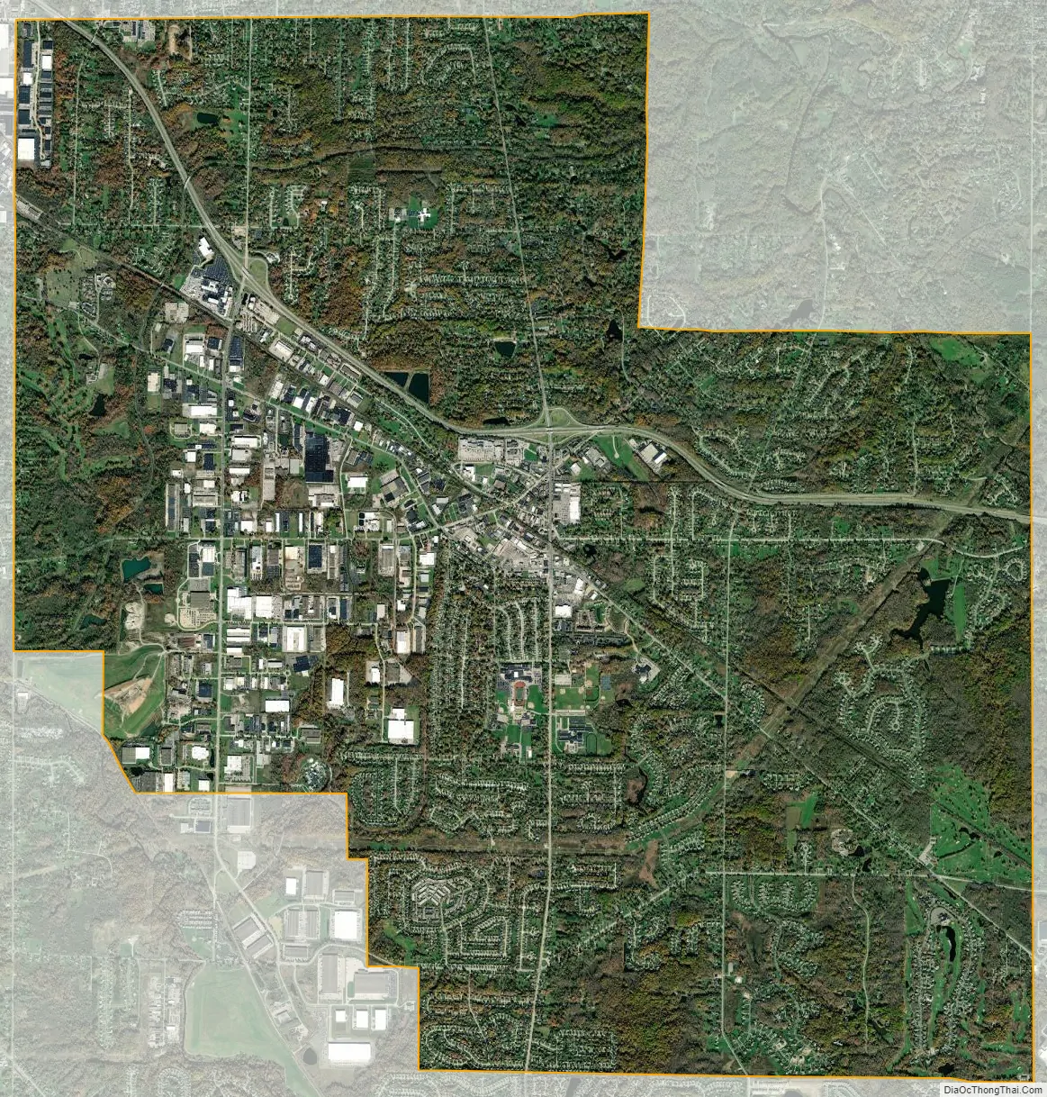
Solon city Satellite Map
Geography
Solon is at 41°23′24″N 81°26′32″W / 41.39000°N 81.44222°W / 41.39000; -81.44222 (41.389871, −81.442330).
According to the United States Census Bureau, the city has a total area of 20.49 square miles (53.07 km), of which 20.36 square miles (52.73 km) is land and 0.13 square miles (0.34 km) is water.
Climate
Like other Great Lakes region cities, Solon lies in a humid continental climate zone (Köppen Dfa) and has four distinct seasons, from hot summers to cold and snowy winters. The highest recorded temperature in the city was 101 °F (38 °C) in 1918, and the lowest was −25 °F (−32 °C) in 1994.
Solon experiences relatively high precipitation (an average of 42.78 inches (1,087 mm) annually) due to lake effect and its presence on the western end of the North American snowbelt.
Surrounding communities
Solon is 18 miles (29 km) from Cleveland in the southeastern corner of Cuyahoga County, adjacent to three other counties: Geauga, Portage and Summit (listed here clockwise from east to south). The city is bordered by Moreland Hills, Chagrin Falls, Bainbridge, Reminderville, Twinsburg, Glenwillow, Bedford Heights, and Orange (as shown in the graphic below).
Despite their similar names, Solon is not adjacent to South Solon, Ohio, a village located in Madison County in Central Ohio, approximately 35 miles (56 km) west of Columbus. The two “Solons” are approximately 170 miles (270 km) apart.
See also
Map of Ohio State and its subdivision:- Adams
- Allen
- Ashland
- Ashtabula
- Athens
- Auglaize
- Belmont
- Brown
- Butler
- Carroll
- Champaign
- Clark
- Clermont
- Clinton
- Columbiana
- Coshocton
- Crawford
- Cuyahoga
- Darke
- Defiance
- Delaware
- Erie
- Fairfield
- Fayette
- Franklin
- Fulton
- Gallia
- Geauga
- Greene
- Guernsey
- Hamilton
- Hancock
- Hardin
- Harrison
- Henry
- Highland
- Hocking
- Holmes
- Huron
- Jackson
- Jefferson
- Knox
- Lake
- Lake Erie
- Lawrence
- Licking
- Logan
- Lorain
- Lucas
- Madison
- Mahoning
- Marion
- Medina
- Meigs
- Mercer
- Miami
- Monroe
- Montgomery
- Morgan
- Morrow
- Muskingum
- Noble
- Ottawa
- Paulding
- Perry
- Pickaway
- Pike
- Portage
- Preble
- Putnam
- Richland
- Ross
- Sandusky
- Scioto
- Seneca
- Shelby
- Stark
- Summit
- Trumbull
- Tuscarawas
- Union
- Van Wert
- Vinton
- Warren
- Washington
- Wayne
- Williams
- Wood
- Wyandot
- Alabama
- Alaska
- Arizona
- Arkansas
- California
- Colorado
- Connecticut
- Delaware
- District of Columbia
- Florida
- Georgia
- Hawaii
- Idaho
- Illinois
- Indiana
- Iowa
- Kansas
- Kentucky
- Louisiana
- Maine
- Maryland
- Massachusetts
- Michigan
- Minnesota
- Mississippi
- Missouri
- Montana
- Nebraska
- Nevada
- New Hampshire
- New Jersey
- New Mexico
- New York
- North Carolina
- North Dakota
- Ohio
- Oklahoma
- Oregon
- Pennsylvania
- Rhode Island
- South Carolina
- South Dakota
- Tennessee
- Texas
- Utah
- Vermont
- Virginia
- Washington
- West Virginia
- Wisconsin
- Wyoming


