Upper Arlington (often known by its initials U.A.) is a city in Franklin County, Ohio, United States, on the northwest side of the Columbus metropolitan area. As of the 2020 census, the population was 36,800. The Old Arlington neighborhood is listed on the National Register of Historic Places.
| Name: | Upper Arlington city |
|---|---|
| LSAD Code: | 25 |
| LSAD Description: | city (suffix) |
| State: | Ohio |
| County: | Franklin County |
| Elevation: | 814 ft (248 m) |
| Total Area: | 9.82 sq mi (25.45 km²) |
| Land Area: | 9.79 sq mi (25.37 km²) |
| Water Area: | 0.03 sq mi (0.08 km²) |
| Total Population: | 36,800 |
| Population Density: | 3,757.02/sq mi (1,450.53/km²) |
| Area code: | 614 and 380 |
| FIPS code: | 3979002 |
| GNISfeature ID: | 1075125 |
| Website: | https://upperarlingtonoh.gov/ |
Online Interactive Map
Click on ![]() to view map in "full screen" mode.
to view map in "full screen" mode.
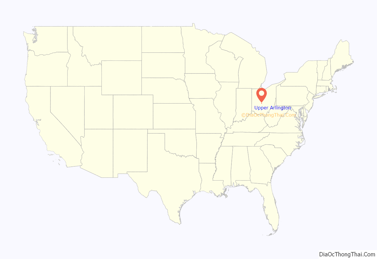
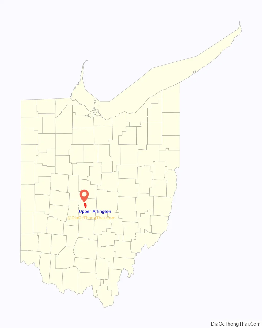
Upper Arlington location map. Where is Upper Arlington city?
History
The land on which present-day Upper Arlington sits was first known to be inhabited by the Adena people, renowned for building conical mounds for burial sites. Centuries later the Wyandot lived there, eventually being expelled after the U.S. Government gave land grants to Revolutionary War soldiers in lieu of pay. Property originally bestowed in this area to Elijah Backus, Jonathan Dayton and Andrew Marker was sold as farm property to a number of different families in the 1800s.
Brothers and real estate developers King and Ben Thompson founded Upper Arlington. They purchased the original 840 acres of land, south of present-day Lane Avenue, from James T. Miller in 1913. It was directly adjacent to the Marble Cliff Quarry Co. They first referred to the area as the “Country Club District” modeled after the Country Club development in Kansas City, but by 1917 the community had become known as “Upper Arlington” in reference to its southern neighbor of Arlington (now known as Marble Cliff). The Upper Arlington Company was incorporated that year and by 1920 operated out of a field office built in Miller Park; that building also served as a streetcar shelter house and is presently the Miller Park branch of the Upper Arlington Library.
The development proceeded according to the Garden City–inspired plan by landscape architect William Pitkin, Jr., which called for following the contours of the land to form curving streets copiously lined with trees rather than a gridded street layout. This design style gave the oldest district in Upper Arlington (at its southernmost end) its distinctively pleasant, park-like feel, featuring numerous small green spaces.
In 1916, the development was interrupted when the National Guard used the area as a temporary training camp called Camp Willis after Ohio’s governor at the time, Frank B. Willis. Thousands of servicemen were trained at Camp Willis and then dispatched against Pancho Villa on the Mexican border. The camp was dismantled by September 1916. Development resumed shortly afterwards, and on March 20, 1918, Upper Arlington incorporated as a village with a population of 200. James T. Miller, the original landowner, served as the first mayor. The Mallway business district, which was constructed in the 1920s, was the first commercial district in Upper Arlington.
Many restrictions existed as Upper Arlington developed. Some of these involved creating open, green spaces, maintenance of parks, generous setbacks ensuring large front and corner lawns, and carefully controlled development of separate areas for businesses and multi-family housing. From 1920 to 1945, the city enforced racially restrictive covenants in property deeds. In 1948, the Supreme Court ruled that racially restrictive covenants were unenforceable, and in 1968, they became illegal.
Upper Arlington became a city on February 8, 1941 and annexed surrounding land as its population grew. Most annexation occurred in the late 1940s through 1960. The two largest annexations occurred in 1954 and 1955, by which the city nearly doubled its surface area. Henderson Road has been Upper Arlington’s northern border since 1969.
The annexed property was part of Perry Township, which had been home to numerous farm residents and their families in the 1800s. One such resident was Pleasant Litchford, a former slave who migrated north after buying his freedom, and who became a notable citizen in the African-American community. The current high school sits on property owned by Pleasant Litchford until his death in 1879. The property was annexed into Upper Arlington in the 1950s.
Other Perry Township farming family names from the 1800s include Kennedy, Kenny, Legg, and Trapp. The McCoy, Richards, Lakin, Matthews, Delashmutt, Phenegar, Slyh, Zollinger, Bickett, Wills and Walcutt families were connected in some way by marriage and have descendants living in Upper Arlington. Richards and McCoy family reunions were held for decades; their first was in 1895, with 109 in attendance.
The post–World War II housing boom led to the development of many new housing tracts north of Lane Avenue. The newer developments took on a much different character from the older core of the city, being mostly organized along normal street grids and with classic ranch-style houses like those found in the area called River Ridge. By the 1960s, as the city grew north, the houses were larger and the neighborhoods more consistent with the intent, if not style, of the original section south of Lane Avenue. The southern half of the city, designated as the “Upper Arlington Historic District” (or colloquially “Old Arlington” or “South of Lane”), was listed on the National Register of Historic Places in 1985.
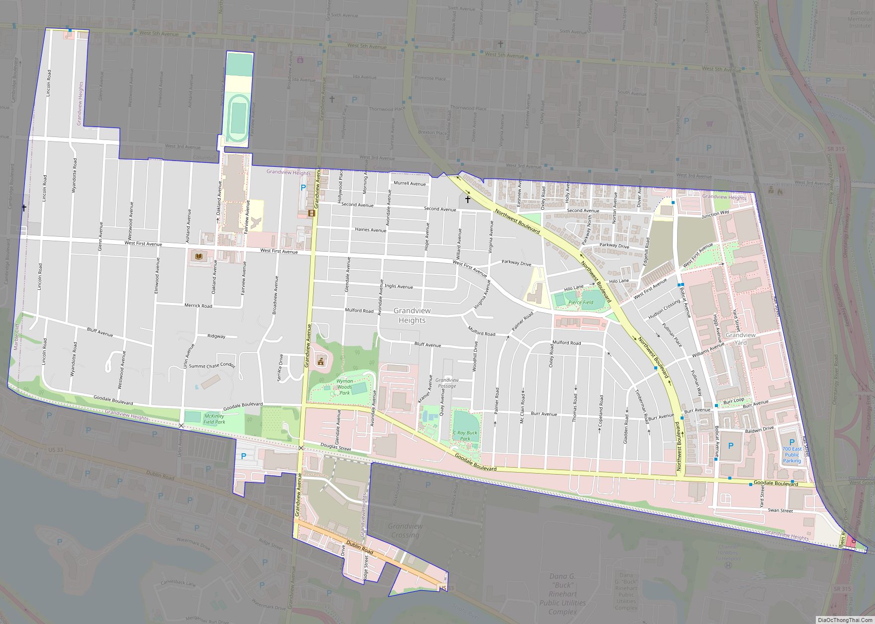
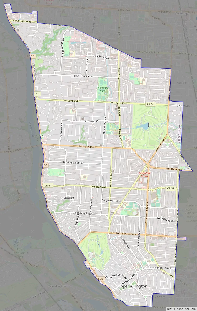
Upper Arlington Road Map
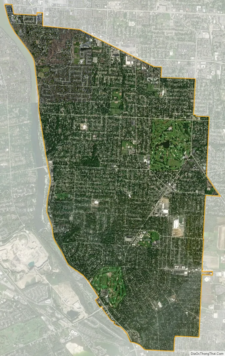
Upper Arlington city Satellite Map
Geography
Upper Arlington is bordered on the west by the Scioto River, on the north and east by Columbus, and on the south by Marble Cliff and Grandview Heights. The Olentangy River and the main campus of the Ohio State University are a short distance to the east of Upper Arlington. Downtown Columbus lies to the southeast, its skyline visible across the OSU farmland research facilities extending along Upper Arlington’s eastern border.
The city is around 800 ft elevation located between the Olentangy and Scioto rivers. Two ravines cut through the city. The Slate Run in the northwest corner flows into the Scioto River. However, the Turkey Run is longer. It originates in the north then runs southwards until it makes an eastward bend around Reed Rd. Then, it flows eastwards through the OSU Golf Course. The run is used as a storm drain at points, has been dammed in the Ohio State course and runs through concrete pipes at two points. The soil is glacial till and is suitable for agriculture, supporting a research farm operated by Ohio State University.
According to the United States Census Bureau, the city has a total area of 9.87 square miles (25.56 km), of which 9.84 square miles (25.49 km) is land and 0.03 square miles (0.08 km) is water.
See also
Map of Ohio State and its subdivision:- Adams
- Allen
- Ashland
- Ashtabula
- Athens
- Auglaize
- Belmont
- Brown
- Butler
- Carroll
- Champaign
- Clark
- Clermont
- Clinton
- Columbiana
- Coshocton
- Crawford
- Cuyahoga
- Darke
- Defiance
- Delaware
- Erie
- Fairfield
- Fayette
- Franklin
- Fulton
- Gallia
- Geauga
- Greene
- Guernsey
- Hamilton
- Hancock
- Hardin
- Harrison
- Henry
- Highland
- Hocking
- Holmes
- Huron
- Jackson
- Jefferson
- Knox
- Lake
- Lake Erie
- Lawrence
- Licking
- Logan
- Lorain
- Lucas
- Madison
- Mahoning
- Marion
- Medina
- Meigs
- Mercer
- Miami
- Monroe
- Montgomery
- Morgan
- Morrow
- Muskingum
- Noble
- Ottawa
- Paulding
- Perry
- Pickaway
- Pike
- Portage
- Preble
- Putnam
- Richland
- Ross
- Sandusky
- Scioto
- Seneca
- Shelby
- Stark
- Summit
- Trumbull
- Tuscarawas
- Union
- Van Wert
- Vinton
- Warren
- Washington
- Wayne
- Williams
- Wood
- Wyandot
- Alabama
- Alaska
- Arizona
- Arkansas
- California
- Colorado
- Connecticut
- Delaware
- District of Columbia
- Florida
- Georgia
- Hawaii
- Idaho
- Illinois
- Indiana
- Iowa
- Kansas
- Kentucky
- Louisiana
- Maine
- Maryland
- Massachusetts
- Michigan
- Minnesota
- Mississippi
- Missouri
- Montana
- Nebraska
- Nevada
- New Hampshire
- New Jersey
- New Mexico
- New York
- North Carolina
- North Dakota
- Ohio
- Oklahoma
- Oregon
- Pennsylvania
- Rhode Island
- South Carolina
- South Dakota
- Tennessee
- Texas
- Utah
- Vermont
- Virginia
- Washington
- West Virginia
- Wisconsin
- Wyoming